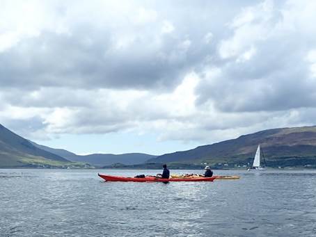
|
|
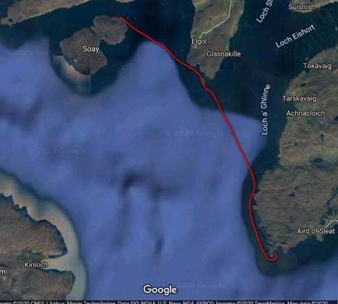
Club Expedition to
Skye 2020 |
|
|
News items or reports on club activities
should be sent to website@liverpoolcanoeclub.co.uk |
||

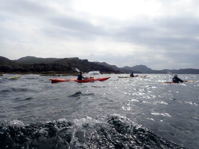
Covid-19
might have led to a change of plan as this year’s Alaska trip was cancelled but
we couldn’t have asked for a better alternative.
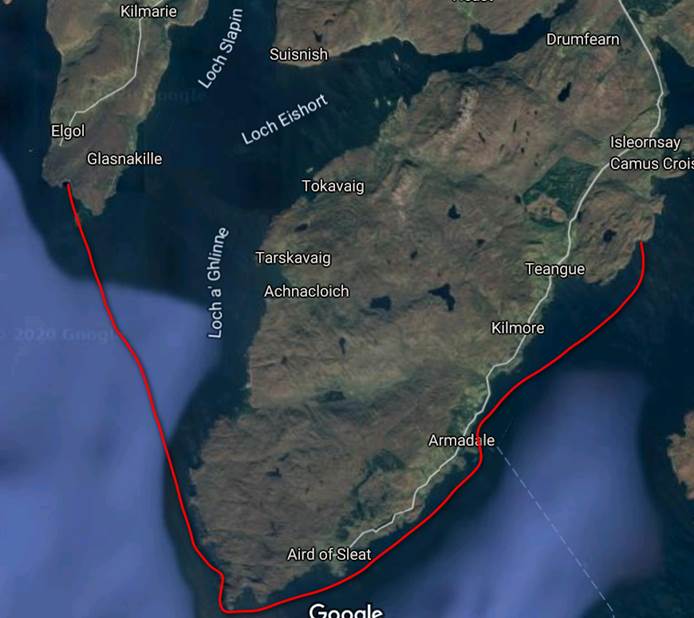
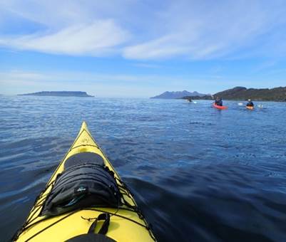
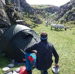
Keith, Ian, Victor, Chris and Jenny headed off for 12
days paddling and wild camping around the Skye coastline and surrounding islands.
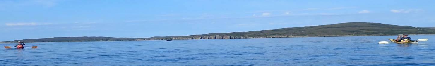
A total of 192 miles covered allowing us to see: whales, otters, dear, dolphin,
eagles (+ other birds I can’t name), seals, over friendly midges, porpoise,
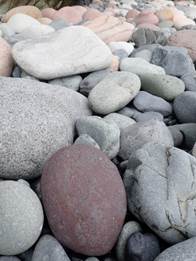
jellyfish, crabs, sea urchins, extinct volcanoes, mountains covered in purple
heather, spectacular rock formations and colourful rocks galore! The trip got
Keith’s “seal of approval” and Jenny had a “whale of a time”!
|
|
|
|
|
|
|
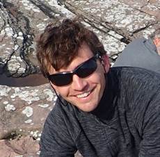
Jenny Brown |
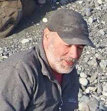
Chris
Thompson |
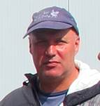
Ian Bell |
|
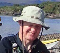
Victor
Leather |
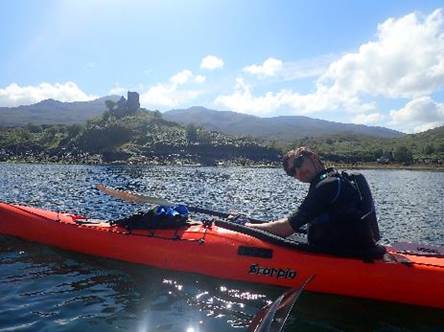
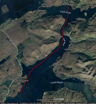
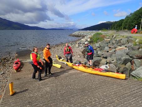
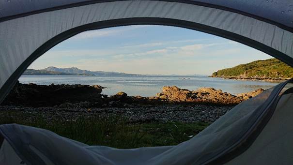
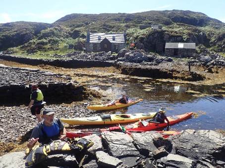
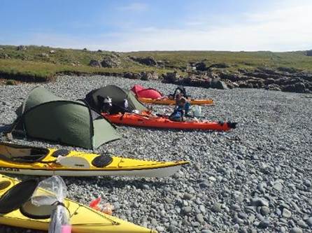
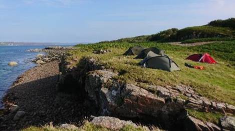
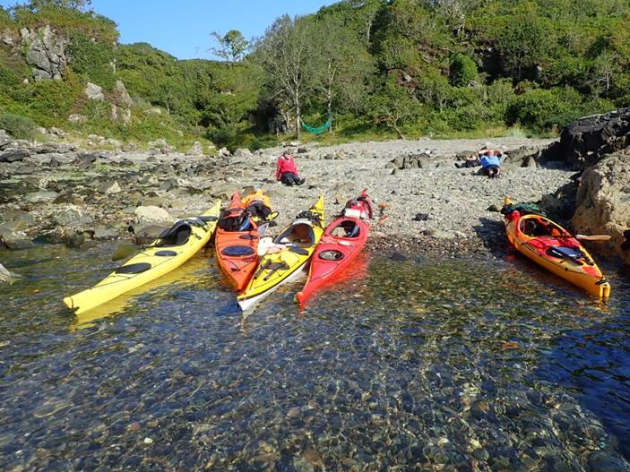
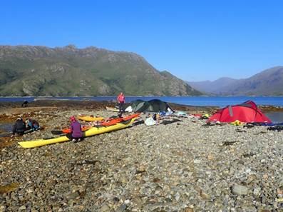
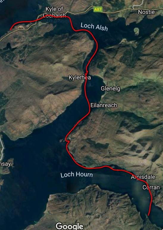
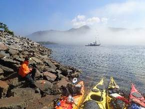
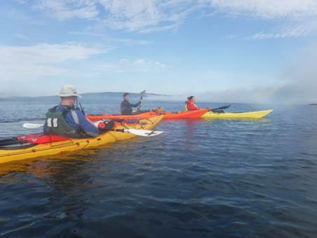
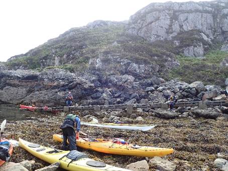
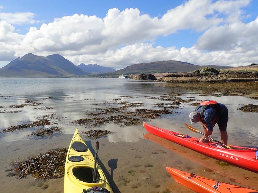
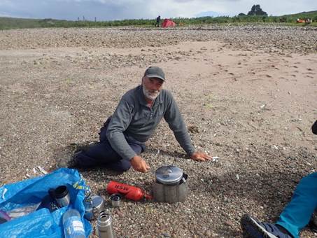
Day 1
(Saturday) 8th August – Balmacara to Camas Barabhaig
Off
we went at 11:15am from Balmacara, after a few of us
finished the long drive north. It was a lovely sunny day as we set off. The
tide was with us through the narrows and overfalls
so we whizzed along covering 17 miles before finding a campsite later that
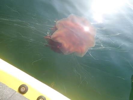
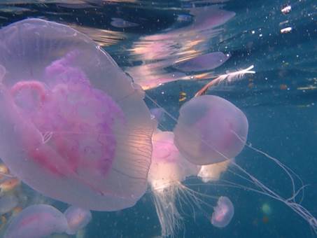
evening. The water was clear and there were plenty of porpoise and massive red
jellyfish with tentacles like cobwebs.
There were loads of seals along the rocky shore and a variety of sea
birds as we paddled along.
We
enjoyed lunch in the sun and some of us checked our boats for leaks as it was
the first time we had packed a sea kayak for an
overnight paddle. However, it turned out to be Ian’s front hatch that had been
slightly caught on a deck line so had a slightly soggy inside. The dry bags did
their job and the seal was double checked during the afternoon paddle – all
dry, phew!
Then
started the “seal of approval” jokes for the rest of the trip. It was finally
time to find camp. We slightly doubled back on ourselves to find a beach after
deciding the promising bay around the headland looked a bit of a boggy midge risk
and had too many rocks to land safely.
Jenny Brown More
Photos……….
|
|
|
|
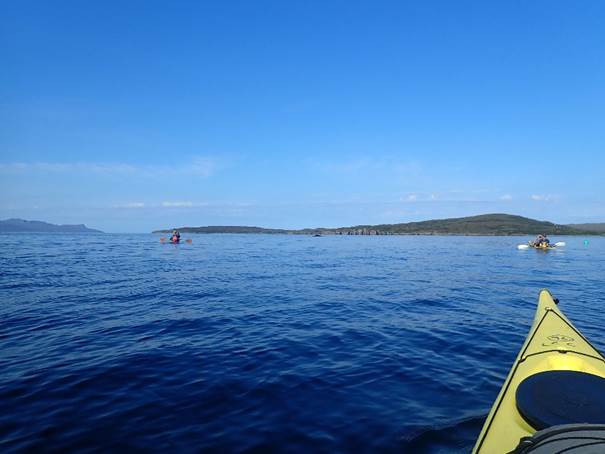
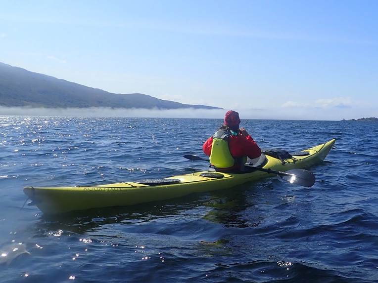
Day 2
(Sunday) 9th August – Camas Barabhaig to
Port an Luig Mhoit
We left at 9am - the water was like a
millpond and we completed 20.7 miles round the Point of Sleat,
crossing Loch Eishort and Loch Slapin.
A few guided
groups were out paddling for the day from near the Armadale ferry terminal (South Skye Sea
Kayaking). There was a bit more “ocean motion” round
the headland as the sea had a slight surge up the rocks. We enjoyed super views
of the Cuillin Range with the black and red colouring
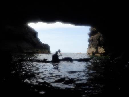
clear to see. More porpoise, shoals of fish ![Text Box: Prince Charlie's Cave
There are many Prince Charlies Caves in the Highlands, caves where Charles Edward Stuart was said to have sheltered when on the run from the Duke of Cumberland, after the defeat at the Battle of Culloden.[1] There is one such cave supposedly located at Elgol.](2020%20%20Team%20Alaska%20go%20on%20a%20Skye%20%23staycation!_files/image028.png) splashing, and sea eagles were spotted as we
paddled along. Plus, those big jellyfish - a bit off-putting for a swim!
splashing, and sea eagles were spotted as we
paddled along. Plus, those big jellyfish - a bit off-putting for a swim!
There had also
been a sea otter swimming about that day. We had lunch in a rocky cove just
around the Point of Sleat. The water was clear and
green with loads of different seaweeds below us. Eigg and Rum appeared on the
horizon.
While crossing
Lochs Slapin and Eishort we
realised there were loads of tiny, tiny (size of my little fingernail) crabs
floating about in the water and swarms of smaller pinkie purple and blue
jellyfish. Turns out jellyfish are surprisingly dense when your paddle stoke
swipes one. Plenty of whale food here as we had our first Minke Whale sighting
- good spot Chris!
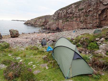
On to campsite on
the headland (next to Prince Charles`s Cave).
This needed a bit of a rocky carry to where we pitched and fell asleep
before waking up to the sound of sheep walking about on the beach and me
wondering if I’d put my boots in the porch or if a sheep could be wondering off
chewing them.
Jenny
Brown More Photos……….
|
|
|
|
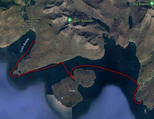
 Day 3
(Monday) 10th August – Port an Luig Mhoit to Loch Brittle
Day 3
(Monday) 10th August – Port an Luig Mhoit to Loch Brittle
We got up to
leave at 8am to try and reduce the midge breakfast. A few of us had been
playing space invaders the night before on the tent ceilings - squishing them
after they descended on us as we landed. It turns out Victor and Jenny were the
tastiest (according to the midges) of the group and had plenty of red pimples
to prove it.
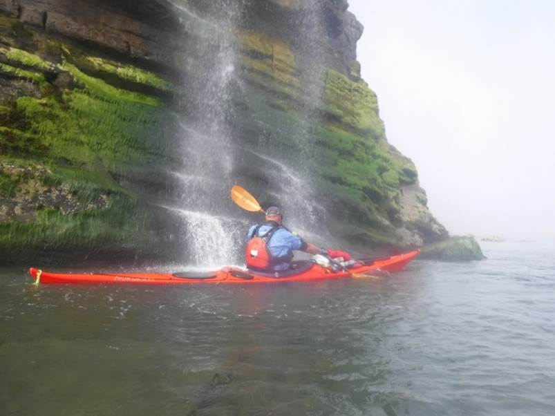
 After going
afloat in our head nets, a gentle breeze soon got rid of the midges so we could
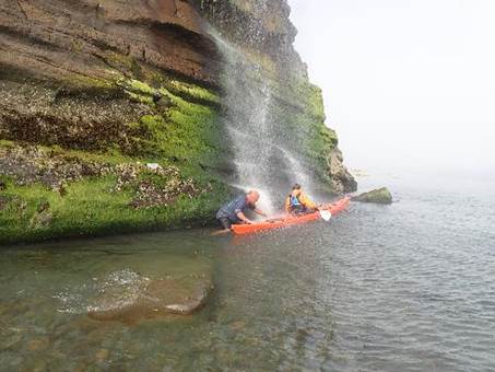
enjoy elevenses and lunch in our shorts and t-shirts. We went to Elgol and then along the Soay
coast and were welcomed by another whale sighting followed by an otter sitting
on a rock, but it didn’t hang about for its photo to
be taken – drat! We had a perfect lunch break beside a waterfall to restock the
water bottles and have a freshen up. There were quite a few butterflies about
in that cove.
After going
afloat in our head nets, a gentle breeze soon got rid of the midges so we could
enjoy elevenses and lunch in our shorts and t-shirts. We went to Elgol and then along the Soay
coast and were welcomed by another whale sighting followed by an otter sitting
on a rock, but it didn’t hang about for its photo to
be taken – drat! We had a perfect lunch break beside a waterfall to restock the
water bottles and have a freshen up. There were quite a few butterflies about
in that cove.
The cliffs slowly
grew higher and while watching for wildlife Keith missed that rock in front of
him – bonk, he, he, he! We did a gentle
14 miles as the next location for a potential camp would have been quite an
epic paddle for a day. Ian was offering
round wine gums, but Keith was adamant he wanted “Rum” as he commented that we
“Canna see the next island”. It turns
out he was talking about the islands of Rhum and Canna. Annoyingly he kept saying “I Canna hear you”
to our questions. There was a good sun
set over the island of Canna as we camped on a 5-star Alaskan stone beach with
an ensuite waterfall with plunge pools, deep enough
to swim in. Our water was restocked, laundry completed, and baths taken.
Jenny Brown More Photos……….
|
|
|
|
 Day 4 (Tuesday) 11th August –
Loch Brittle to Soay
Day 4 (Tuesday) 11th August –
Loch Brittle to Soay
Up
we got sticking to our 8am start. Not many midges, until boat loading then it
was full attack! A cool fresh rain shower soon sorted them out resulting in a
“who can put their cag on at sea unassisted challenge?” Jenny nearly got to
test her hood – she was already in it as it was the best resistance against
bites as Scottish midges seem to treat Deet like
ice-cream (human) sauce.
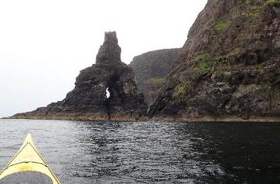
The
rain drops fell on the calm sea surface, which again was like a millpond. Over
5 miles the cliffs built up and so did the wind and waves, which were
reflecting off the cliffs. 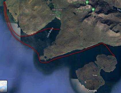 We stopped at a
sea arch before deciding a circumnavigation might not be the best idea as
thunderstorms were on the forecast and we were about to be exposed on the
northwest headlands with limited landing options. Plan B – play in the caves
and head to Soay to camp hopefully going to Knoydart
and the small islands around the east coast. The swell caused the cracks and
caves to gurgle and thump as we paddled along. Ian did some unplanned rock
hopping – oops, I don’t think he was expecting that
wave to suck away so quickly!
We stopped at a
sea arch before deciding a circumnavigation might not be the best idea as
thunderstorms were on the forecast and we were about to be exposed on the
northwest headlands with limited landing options. Plan B – play in the caves
and head to Soay to camp hopefully going to Knoydart
and the small islands around the east coast. The swell caused the cracks and
caves to gurgle and thump as we paddled along. Ian did some unplanned rock
hopping – oops, I don’t think he was expecting that
wave to suck away so quickly!
We
stopped at another waterfall to fill up our bottles and a deer was on the
beach. Sadly, an emergency wee break meant Chris and Jenny were a little behind
and missed it – “oh dear!” The pebbles
on this beach were amazing pinks and purples and we were sheltered from the
weather and waves. Three other groups of paddlers were also about on the
headland, but all paddled off to other destinations. It was a brilliant sunny,
breezy evening so we sat out and enjoyed the views and watched the ropey Soay sheep. When we went to bed, we could hear loads of sea
birds which were still out and about. Another 14.3 miles complete!
Jenny
Brown More
Photos……….
|
|
|
|
 Day 5
(Wednesday) 12th August – Soay to Point of Sleat
Day 5
(Wednesday) 12th August – Soay to Point of Sleat
 Not a bad morning
for midges this morning! Or so we thought, but then they descended just as we
started to pack the boats. That sped us up and we were on the water for 7:40am.
The weather was overcast, but the clouds over the Cuillins
and Rhum looked spectacular while we paddled along on glassy water. There was a
mist on the horizon as we made our crossing back to the Point of Sleat. Ian took the bearing as SSE just in case the mist
came in. Mid-way the wind started to pick up and the waves grew. The spray on
the rocky shore made a nice change in sea state, but we were all pleased not to
be under the high cliffs exposed to the growing waves.
Not a bad morning
for midges this morning! Or so we thought, but then they descended just as we
started to pack the boats. That sped us up and we were on the water for 7:40am.
The weather was overcast, but the clouds over the Cuillins
and Rhum looked spectacular while we paddled along on glassy water. There was a
mist on the horizon as we made our crossing back to the Point of Sleat. Ian took the bearing as SSE just in case the mist
came in. Mid-way the wind started to pick up and the waves grew. The spray on
the rocky shore made a nice change in sea state, but we were all pleased not to
be under the high cliffs exposed to the growing waves.
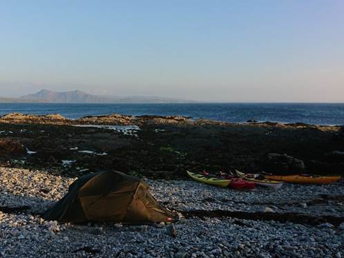
Later
the sun returned, and the mist went. There was another whale sighting and lots
of ferries out crossing to the smaller islands. As we went round the headland
we landed on a white sand and gravel tombolo beach – spectacular! We’d done 12.8 miles, and this was going to be our camp site
for the night. A great view and gentle wind to keep the midges away. A few
sheep came to watch us as we pitched on their grazing area. We spent the
afternoon enjoying the sun and said hello to some other paddlers that had
landed for lunch. Ian and Keith made a driftwood bench, while Vic went out
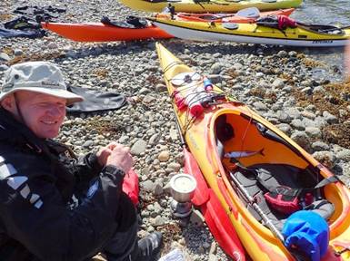
fishing for Mackerel – success! He enjoyed a late fish and limpet lunch. We all
had a walk to the lighthouse to enjoy the views and see where we’d paddled before bed.
Jenny
Brown More
Photos……….
|
|
|
|
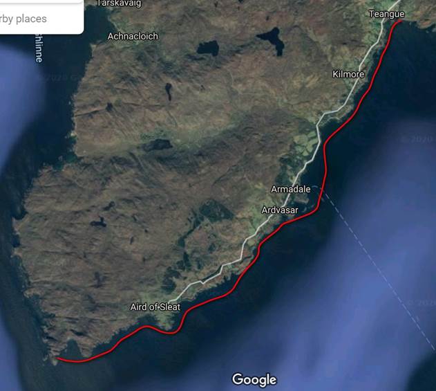
 Day 6 (Thursday) 13th August
–Point of Sleat to Teangus
(Castle Ruin)
Day 6 (Thursday) 13th August
–Point of Sleat to Teangus
(Castle Ruin)
As
we were expert at packing boats by now, we were on the water by 7:40am. There
was nice breeze and no midges. A strong wind was building, so plan A to go to
Knoydart was turned into a plan B to stay safe and camp on Skye again. We hugged
the coastline to stay out of the wind. The Scottish coast looked impressive
with the mountains engulfed in low cloud.
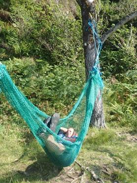
After
an hour or so we found a beach with a stream and hammock for elevenses. Great
to refill water, have a wash and a quick swing/snooze. The rock pools had a
great selection of anemone and shellfish in the crystal-clear water. The beach
had grey and pink stripy cobbles.
 We continued
along the rocky shore where there was a sea Eagle chasing some seagulls. As we
passed the Armadale ferry terminal it was a quick dash against the headwind and
waves to clear the terminal as we realised the boat was coming in.
We continued
along the rocky shore where there was a sea Eagle chasing some seagulls. As we
passed the Armadale ferry terminal it was a quick dash against the headwind and
waves to clear the terminal as we realised the boat was coming in.
White
horses were growing out in the sound as the winds increased to a force 5. The
crossing to Knoydart wouldn’t have been much fun so we
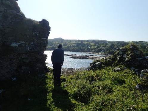
took shelter after 10.5 miles behind a headland where there was a castle
ruin. On arrival, a swordsman practising
his moves against the castle skyline – aka Brave Heart.
There
was a selection of 3 beaches so we picked the one with the easiest carry, but
still decided tomorrow would be a 10am start to let the tide come in over the
rocks and allow the wind to drop if it followed the forecast. An otter was
spotted while we scouted out the beaches before landing and as we pitched, we
were watched by some lambs in the field above.
After
dinner a few of us went to sit on the rocks to watch for the otter again and
saw 2 as they ran round the outcrops and jumped in for an evening fish - which
is just what Vic was doing too. Before we returned to camp, a fish was spotted
jumping, so we wondered if it was being chased. Some walkers turned up that
evening and pitched in the castle ruins, we thought they might get blown away
that night – but they were still there in the morning. A couple also came down
to the beach searching for some pipe they wanted to salvage for a drainage
system they were putting in.
Jenny
Brown More
Photos……….
|
|
|
|
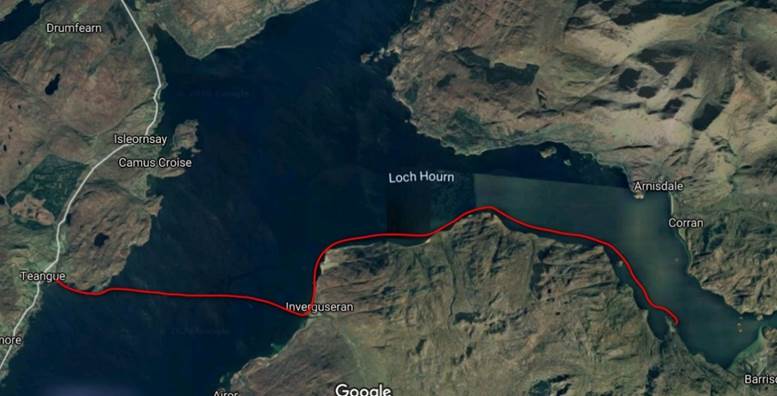
 Day 7 (Friday) 14th August – Teangus (Castle Ruin) to Loch Hourn
A
lazy start as the wind dropped. 10am and we went straight for the crossing over
to the white houses at Airor. The wind was force 3
making a fair chop on the sea. The tide was still low, so it was quite a carry
to get on the water. The team were now so efficient we were on the water before
Keith!
We
stopped for elevenses at Airor as the wind started to
drop then paddled around the coast into Loch Hourn.
As we got to the headland there was a rock covered in seals with their pups.
They all launched into the water on our arrival. Lots more trees along this
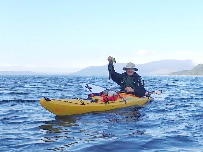
coastline and fish farms with jumping salmon in. Vic got his line out again and
caught dinner while we paddled with the wind now behind us.
After 13.3 miles we found a Tombolo (a beach joining an island to the mainland)
to camp on and enjoyed the afternoon watching the seals and someone flying a
kite further up the loch. There was a lot of mica in the rocks that sparkled in
the sun. Vic hiked off for water from a nearby waterfall and Jenny was pleased
to have got to Knoydart, this had been on her to do list for a few years. Ian
and Vic enjoyed a swim and another paddler stopped to say hello.
Jenny
Brown More
Photos……….
|
|
|
|
 Day 8 (Saturday) 15th August –
Loch Hourn to Kyle of Lochalsh
Day 8 (Saturday) 15th August –
Loch Hourn to Kyle of Lochalsh
With
good weather and the tide with us this was our longest day at 21.7 miles. It
was also the longest day as at 3.10am a few of us were woken by the sound of
the tide getting rather close to the tents. A mini rock pyramid was built at
the waterline as a marker and by 4.10am Jenny was happy the tide was finally
dropping and went back to sleep.
 We packed up in a
midge-free breeze and Chris and Jenny’s tent was caught in a gust and tumble
turned towards the sea where thankfully it was saved. We paddled off at 8am
along the northern shore of Loch Hourn with the wind
behind us, wildlife spotting for birds, otters and
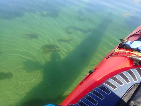
seals. The sea was clear and deep with large shells, urchins
and a variety of seaweeds on the bottom. Small fish flitted about the rocks. We
had elevenses in the shelter of the Sandaig Islands
as the wind dropped and the sun shone. A few boats were moored with snorkelers
splashing about.
We packed up in a
midge-free breeze and Chris and Jenny’s tent was caught in a gust and tumble
turned towards the sea where thankfully it was saved. We paddled off at 8am
along the northern shore of Loch Hourn with the wind
behind us, wildlife spotting for birds, otters and
seals. The sea was clear and deep with large shells, urchins
and a variety of seaweeds on the bottom. Small fish flitted about the rocks. We
had elevenses in the shelter of the Sandaig Islands
as the wind dropped and the sun shone. A few boats were moored with snorkelers
splashing about.
We were thinking about stopping before the narrows, but we had made good time,
the tide was racing along with us so we decided to
push on to the other side of the Bridge of Skye. The heather on the mountains
was starting to come out creating a purple tinge, which then got stronger
through the next week. As we went through the narrows there was some frisky
seals making a good splash and a head wind picked up. We crossed Loch Alsh to go along the north coast to shelter from the wind.
We all had a snigger at someone doing naked yoga on a rock and battled on
against the wind to stop for a quick shop at Kyle of Lochalsh
just as a fog bank started to drift in.
We stopped on the beach behind a rocky outcrop just north of the bridge on Skye
as the fog really came in. Chris and Jenny went to work on fixing a broken tent
pole – success, but as it was foggy outside, they stayed inside with only 1
porch up for the night. Later at 10pm the fog had lifted and there was a lovely
pink sky.
Jenny
Brown More
Photos……….
|
|
|
|
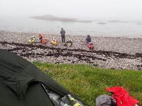
 Day 9 (Sunday) 16th August –
Kyle of Lochalsh to Brochel
Bay (Rassay)
Day 9 (Sunday) 16th August –
Kyle of Lochalsh to Brochel
Bay (Rassay)
We woke up to
find a fog bank bridging the sound. Annoyingly, as Chris and Jenny opened their
tent another tent pole snapped under the tension. It was a mirror image of the 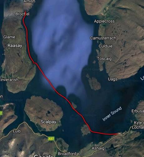 other tent pole
breakage so they remained with only 1 porch for the rest of the trip, but
plenty of spare poles if anything else broke. Off we went to have “nineses” on Pabay the fog coming
in around us from both directions.
other tent pole
breakage so they remained with only 1 porch for the rest of the trip, but
plenty of spare poles if anything else broke. Off we went to have “nineses” on Pabay the fog coming
in around us from both directions.
We saw porpoise as we set off to Longay noting the
compass bearing of 320 degrees. We carried on past the Skerries rocks (Sgeir Dhearg and Sgeir Thraid) and went north up
the east coast of Raasay. There were loads of sea
birds, 2 circling us looking for food. We had elevenses in the fog before
finding a waterfall with a freezing cold down draft for a freshen-up. Jenny got
to test her hood finally!
There were no sign of any submarines training, but Ian was adamant there could
have been. We soon popped out the other side of the fog bank to find sea eagles
and rock climbers on the landslides and cliff falls. After 16.6 miles we
stopped on a gravel beach of purple brown pebbles (Brochel
Bay) to camp with great views towards Appleby and the NW with many seals
watching us.
After dinner, a pod of bottle nosed dolphins were observed in the distance some
jumping fully out of the water as if being chased or playing. Jenny had a swim
while Keith got Ian to refold his maps once again. After dinner, a singing seal
could be heard from around the corner. It was a very starry night with the
Milky Way clearly visible.
Jenny
Brown More
Photos……….
|
|
|
|
 Day 10 (Monday) 17th August –Brochel Bay (Rassay) to Manish
Point (Via Rona)
Day 10 (Monday) 17th August –Brochel Bay (Rassay) to Manish
Point (Via Rona)
Another
long day on the water - 20.4 miles. We were up and packed by 7:40am to find a
toad hiding under the kayaks. Today we were off to Rona with plenty of seals
and sea 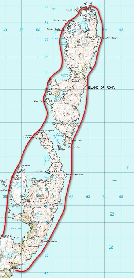 birds on the way. Ian spotted a dear and a
whale.
birds on the way. Ian spotted a dear and a
whale.
We had elevenses at an MOD site on the northern tip of
the island under the lighthouse. There was a nice breeze and a slight swell
behind us as we started to paddle south. There was storm winds on the forecast
later in the week so we were coming up with a Plan A (paddle to the Crowlin Islands, camp at Uags and
head to the cars Thursday morning) and Plan B (head along the Skye coast
sheltering from the SW winds and straight to the cars early afternoon Wed) to
make sure we were in a good position to respond as the forecast updated.
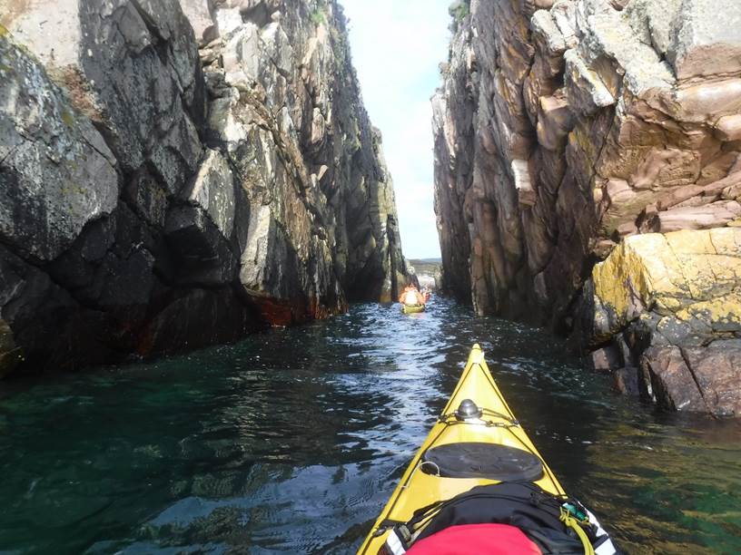
We paddled past the small islands of Eilean Tigh and Eilean Fladday stopping in caves and navigating through cracks in
the cliffs off Raasay. The views of Skye where
fabulous along the Skye cliffs and out to Lewis on the horizon. The breeze
started to die so it was time to find a camp before the midges came out. We
found a cobbled beach at Manish Point with a stream, pitched and made drinks
before quickly taking cover from the midges in our tents. In Jenny’s case head
net and full paddling kit seemed the most effective protection - even if a
little hot! A short rain shower was very welcome, but not quite enough to fully
clear the midges.
As the evening sun returned we snuck out to make dinner and Vic tied the boats
up to a large rock as there wasn’t a huge amount of space above the seaweed
line and we weren’t quite sure where high water would come to. The boats were
packed after dinner in preparation for a speedy departure as we thought it
could be midge-tastic in the morning. There was wood
around and we were tempted to make a fire, but the midges returned so we jumped
back into our tents. We were all content that we’d
managed to cook outside though as that’s always nicer than cold wraps in the
tent for dinner.
Jenny
Brown More
Photos……….
|
|
|
|
Day
11 (Tuesday) 18th August - Manish Point to Camas na
Geadaig (Scalpay)
 We launched at 7:30am
(Keith was still in his tent!), packing the boats the night before knowing we
would be setting off at high water where we’d left the
boats tied up. There was a bit of a swell on the water surging up the rocks and
making a splash. As we came south level with Portree
the wind dropped, and the sea became flat. There was a
We launched at 7:30am
(Keith was still in his tent!), packing the boats the night before knowing we
would be setting off at high water where we’d left the
boats tied up. There was a bit of a swell on the water surging up the rocks and
making a splash. As we came south level with Portree
the wind dropped, and the sea became flat. There was a 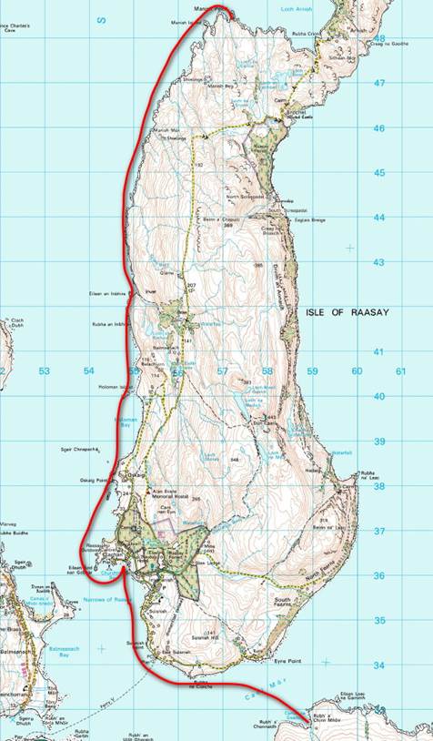 fab “Skye line”
in front of us as we paddled. There were lots of caves and rock formations to
potter around with seals and sea eagles.
fab “Skye line”
in front of us as we paddled. There were lots of caves and rock formations to
potter around with seals and sea eagles.
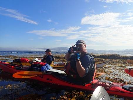
We had had 9’s on a beach with a stream to refill our bottles. We paddled on
through huge swarms of jellyfish – oddly enough no one fancied doing any
rolling practice! Next stop was lunch just round the west side of the Rassay Ferry terminal. We found a perfectly positioned
bench with a grassy verge and watched the ferry come and go. Lots of Urchins
and fish around the jetty.
The breeze returned as we crossed to Scalpay to camp
on a sandy beach with grass backing and 2 streams, one either side of the bay.
The gravel on the upper beach had an orangey purple stripe. It was a slightly
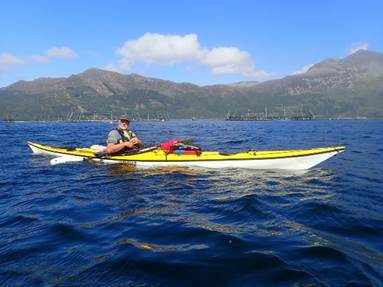
shorter day – covering 13.5 miles. Vic
went out fishing again while Chris estimated that the circumnavigation of Skye
would have been about 150miles - so we’d ended up
doing a greater distance island hopping.
The strong winds were still on the forecast for Thursday evening. Plan A was still an option, but the mornings
forecast would have to be checked to make the final call. We went to bed
listening to the bees buzzing about as the heather was out.
Jenny
Brown More
Photos……….
|
|
|
|
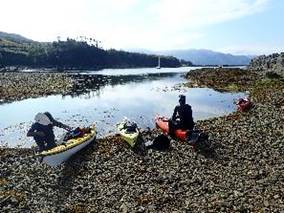
![]()
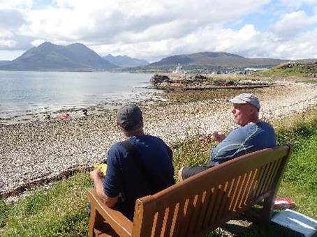
Day 12 (Wednesday) 19th August
- Camas na Geadaig (Scalpay) to Balmacara
We were up and
the forecast was for gale force winds coming in that night slightly ahead of
schedule. It was a midge-tastic morning, so we raced
onto the water in our head nets and quickly paddled offshore in hope of some
wind – nothing! Once we had outpaddled the midges we made a plan.
There was a fog bank over the Crowlin Islands, it wasn’t that thick but with no wind it might not have been
moving soon.
We went with plan B to make sure we were safely off the water and not caught
out crossing the sound in fog or high winds if they came in early. Getting
storm bound for a couple of days only an hour from the cars wouldn’t
have been much fun. We did 17.6 miles round the tree lined west and south of Scalpay and over to Pabay for a
bite to eat before heading through the bridge back to the cars.
The heat of the day increased, the fog
lifted and atmospheric clouds were left hanging round the mountain tops. As we
went under Skye bridge Jenny was melting in her midge safety suit (cool weather
paddling kit). Just passed the jetty on
the Skye side was a massive sand crab and another castle. We crossed back to
the Scottish mainland - no naked Yoga man this time - then got to the cars at
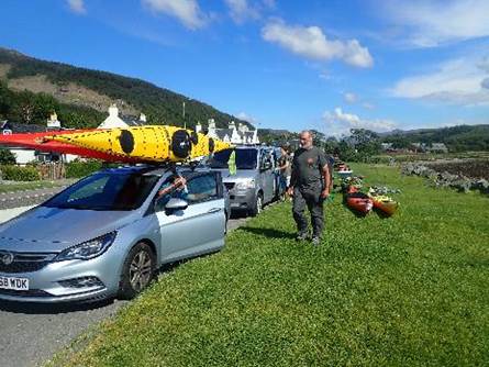
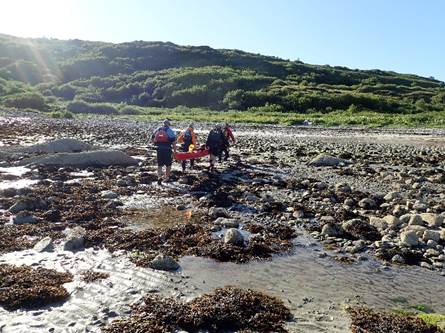
low water. Vic went for 10 victory rolls and we started to carry the kit over the
![]() seaweeds and
rocks to the cars.
seaweeds and
rocks to the cars.
Ian and Keith set off for home ahead of the wind while Vic, Chris and Jenny
stopped for lunch by the sea in the sun. They were going to stop overnight
rather than heading straight home. Vic headed to Dalwhinnie
to consider paddling Loch Ericht if the weather wasn’t
too bad. Chris and Jen went to the north coast of Skye. That night the wind
picked up at 1:30am and howled all the next day – it was definitely
a good decision to get off the water when we did and finish as we
started, paddling in perfect conditions! All got home with no news of roof
racks flying off cars in the strong wind. Now to look forward to the next
adventure.
Jenny Brown More Photos……….
|
|
|
|