|
|
2021
Scottish Sea Kayaking Trip to the Summer Isles |
|
|
News items or reports on club
activities should be sent to website@liverpoolcanoeclub.co.uk |
||

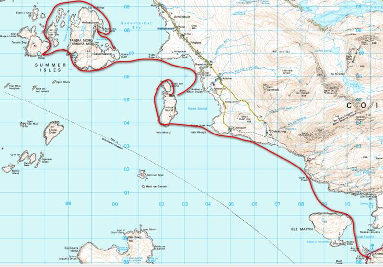
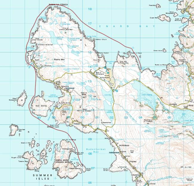
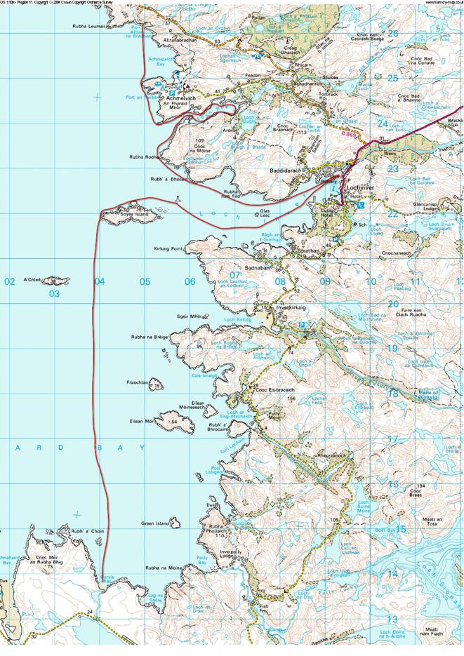
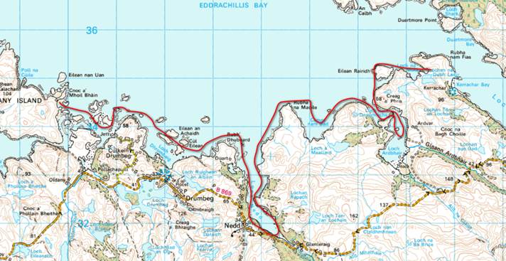
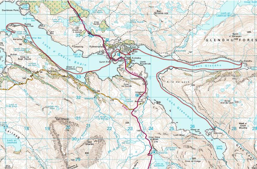
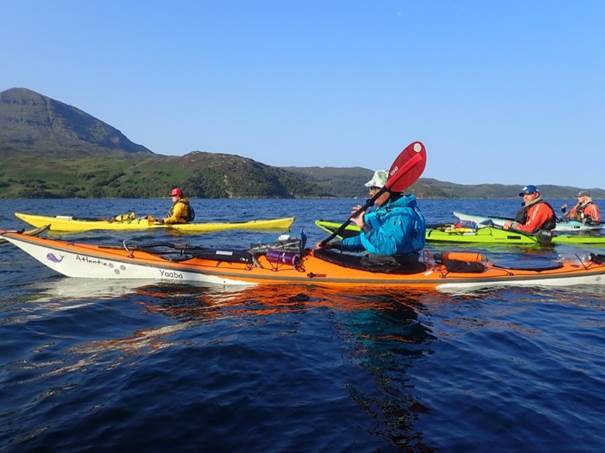
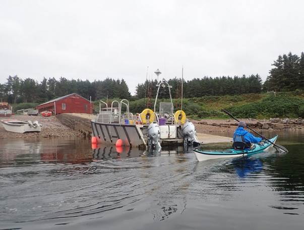
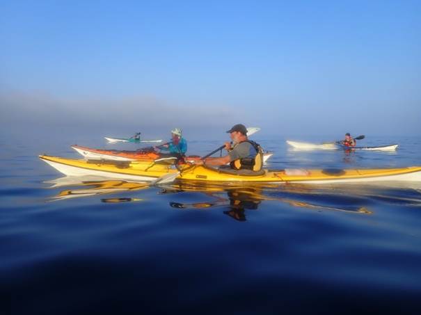
This year’s trip was organised as two separate
weeks but both starting from the same campsite at Ardmair
Point. This would enable people to
paddle for either or both of the weeks and allowed for greater
flexibility. Week 1 headed North around
the Point of Stoer to Kylesku
Bridge. Week 2 saw us head South around
Rua Reidh to Gairloch and Charlestown.
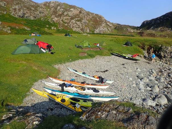
We enjoyed fantastic summer conditions again. On both occasions we were self-sufficient and
camped out of our boats.
The Paddlers
Alan P, Andy G, Catriona H, Debbie H, Frankie
A, Ian B, Mark B, Keith S, Roger M, David G
Ardmair Point Holiday Park
|
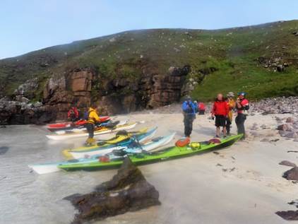
 Day 01 Sunday Ardmair point to Tanera More (island) via Horse Island & Tanera Beg island by Frankie Annan
Or alternately the day of car shuttles and 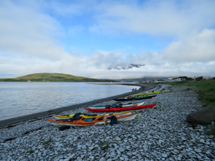 buffalo girls……
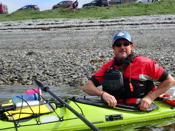
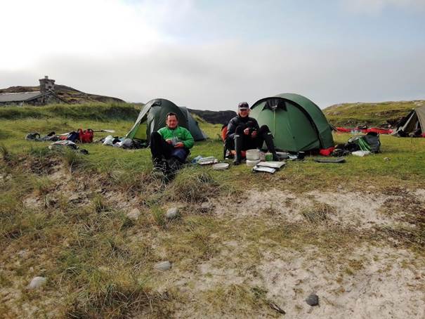
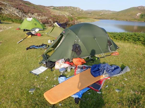
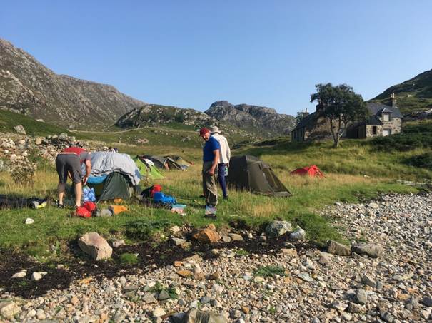
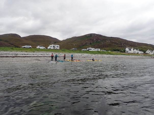
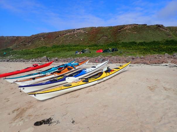
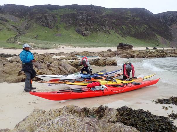
Waking to a midgy misty morning we quickly loaded (threw) gear into the cars to transfer boats and all the paraphernalia involved in a week’s sea paddling to the beach right by the campsite to get packed and sorted. It has been suggested I refused to move on the beach until I had coffee. Moi?
The car shuttle organised those not driving to Kylesku to leave cars had time to drink more coffee and pack in a more leisurely fashion. In true LCC expedition fashion elevenses arrived before we could depart – chocolate brownie anyone?
We headed out onto the water and set out for somewhere, the
sun 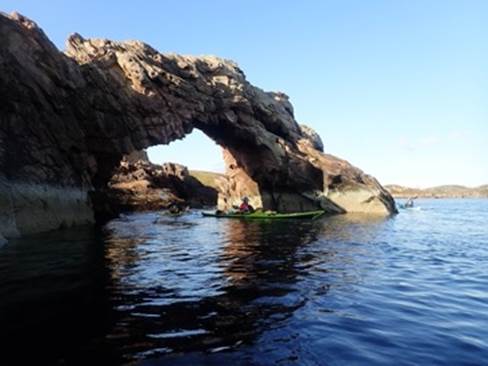 came out and we paddled towards the
summer isles, at some point Keith said he wanted to go round the outside of an
island, that is a song said Andy G – so the Buffalo Girls became the phrase for
any circumnavigation of
came out and we paddled towards the
summer isles, at some point Keith said he wanted to go round the outside of an
island, that is a song said Andy G – so the Buffalo Girls became the phrase for
any circumnavigation of 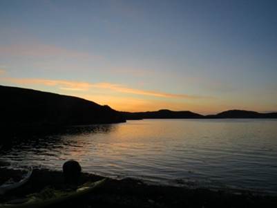 anything for the rest of the week.
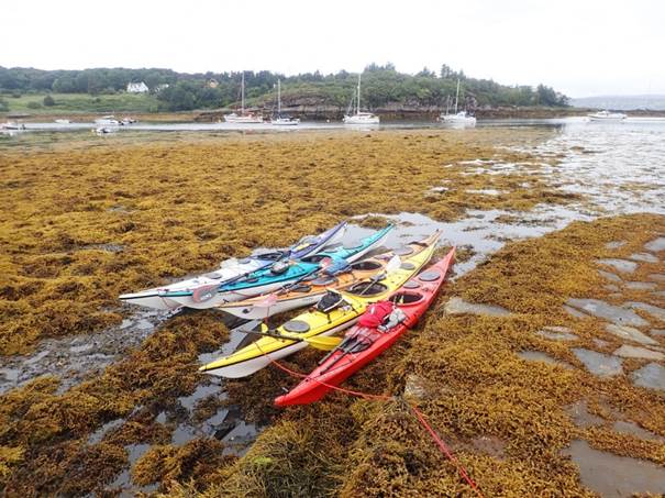
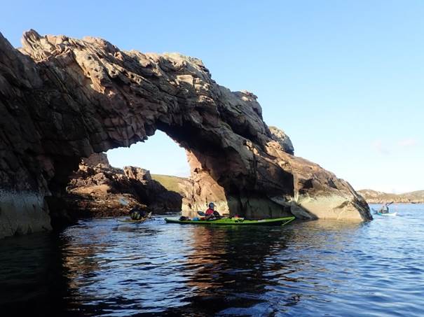
The map tells me we went around Horse Island and Tanera Beg, there is a great arch on the way to Tanera Beg, but let’s be honest after lunch on the beach by the burial ground with the solitary windmill, everything we did that day has been wiped from the memory by the realisation that I was looking at the windmill from lunchtime and we had paddled around in a big circle after paddling around the outside of an island or two, looking for a campsite, and continuing on in our search when the 5* campsites didn’t materialise.
On landing at Some local knowledge was provided to Keith and we settled into our first campsite on Tanmera Mor to eat and watch the sunset.
|
|
|
|
Day 02
Monday Tanera More
Island to Garvie Bay via Isle Ristol and Rubha Na Coigeach (headland) by Ian Bell
With the weather looking good, the majority of us were ready
around the target time of 9:00am. One or
two were a little slower than this, as they faced the challenges of getting
everything back into the boat after the first night’s camp. After the usual cursing and swearing, we were
all eventually packed and ready on the water.
In reality, it did not really matter this day, as there were no tide
windows that needed to be met. We all
set off from Anchorage Bay on Tanera More, heading on
a course north, that would take us 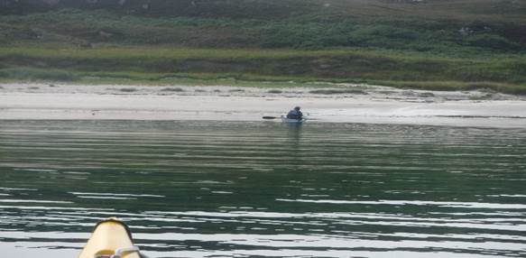 around Isle of Ristol.
Keith had identified a beach here which was a possible campsite, so we used it
as our elevenses stop.
around Isle of Ristol.
Keith had identified a beach here which was a possible campsite, so we used it
as our elevenses stop.
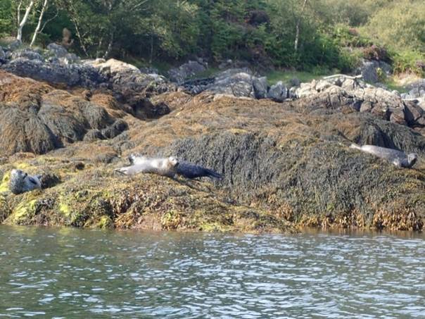
We then continued North around the Rubha Na Coigeach headland, exploring as we went and keeping an eye on the open sea to our left for any possible sightings of wildlife. Although there were a couple of possibilities, we did not have any confirmed sightings of any big mammals. We did see seals and plenty of seagulls.
Once around Ruba Na Coigean, we stated to think about a camping option for the evening. We knew of the commercial caravan site at Achnahaird and that the beach here would be a very long carry, landing and lunching at low water. Being on spring tides we would need to camp high on the beach that night.
We identified Garvie Bay as a
better option. This is a small sandy bay just round the next small
headland. On arrival, we found that
there were several day-trippers enjoying this idyllic beach and the excellent
sunshine. At low water the beach was sandy 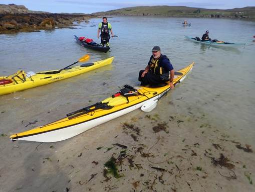 with a rock terrace at the back and above that
a grassy area behind which there was a small loch. This feed a stream that ran
into the sea on the left-hand side of the beach providing an ideal supply of
drinking water, as well as opportunity to wash and freshen up. On the righthand
side of the beach was a rock platform which made ideal hard camping for some of
us.
with a rock terrace at the back and above that
a grassy area behind which there was a small loch. This feed a stream that ran
into the sea on the left-hand side of the beach providing an ideal supply of
drinking water, as well as opportunity to wash and freshen up. On the righthand
side of the beach was a rock platform which made ideal hard camping for some of
us.
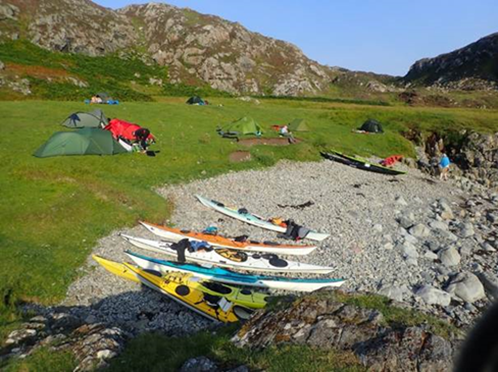
No sooner had we landed, people started to look for and claim their tent pitch. Andy used his paddle to mark his territory, but this was reallocated by someone, who shall remain nameless. Alan was just as quick and found a space on the grass that was flat but was currently being used by a couple, who were sunbathing there. Apparently, he did ask but started to set up next to them. They left shorty after.
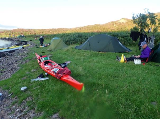
Others found spots but soon started to find midges in the grass. Some of us had experience from previous trips in Canada where we camped on rock platforms, so chose this as our preferred option. Once the tents were set up and with some of the weight of our kit out of the boats, they were carried up to top of rocks, so they would be safe for the night. By now, most of the day trippers had left, so we began to cook the evening meal.
As evening closed in, some retreated to their tents. Catriona and I when a short wark to explore the river and view the loch that feed them. It was about 1km of muddy path that took us up from beach, around the small loch to the road, where we got a view across a much larger loch which fed the river. We tried to get to see the waterfalls which we could hear in the distance but as the path tended to go away from river, we could not get very close to get any good pictures only glimpsing them from a distance. Arriving back as dark fell, we retreated to are tent for the night and to see what the next day would bring.
|
|
|
|
 Day 03 Tuesday Garvie Bay to Port
Allan na Bradhan via Lochinver by Andy Garland
Day 03 Tuesday Garvie Bay to Port
Allan na Bradhan via Lochinver by Andy Garland
 I awoke, peered out of my tent, and started
counting the midges. When I got to
twenty million gadzillion I decided that an ample
dosing of Deet and a midge net was a good way to start the day. The tent was un-erected (is that a word?) and
gear packed in the boat before all my new midgy mates
had had a chance to fully introduce themselves.
I sought solace on the water and watched bemused as Roger of Wales
assembled his 3-piece kayak (does the pointy section go in the middle or at the
end?).
I awoke, peered out of my tent, and started
counting the midges. When I got to
twenty million gadzillion I decided that an ample
dosing of Deet and a midge net was a good way to start the day. The tent was un-erected (is that a word?) and
gear packed in the boat before all my new midgy mates
had had a chance to fully introduce themselves.
I sought solace on the water and watched bemused as Roger of Wales
assembled his 3-piece kayak (does the pointy section go in the middle or at the
end?).
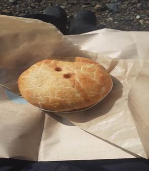
Once all the group were in their boats we paddled north – the sun shone, the scent of heather drifted over the water and the towering monoliths of the Sutherland mountains provided a stunning backdrop. What more could anyone want? Well, the answer to that question is simple…we wanted pies, lots of pies. By an amazing coincidence the best pie shop in the known universe lay only a few kilometres away – The Lochinver Larder (AKA Lochinver Pie Shop). We landed right outside the Pie Shop (I mean right outside – within 4 meters of the entrance) and availed ourselves of their delicious pastry wrapped offerings.
While scoffing pies, we got chatting to a local fella who divulged some local knowledge about a good bay for seal watching and a hidden gem of a campsite. Once again, we set off to paddle north, accompanied only by the odd crumb of pastry on our lips and the occasional belch of Steak and Ale pie.
 After
around 5km we entered the narrow entrance of Loch Roe – the seal watching
location that had been recommended. It
was a very tranquil spot. The numerous
seals seemed only mildly interested in our presence and lazed idly under the
warm September sun. After a while we
continued north to find the hidden gem of a campsite (Port Allan na Bradhan). Well, it certainly was hidden! It took a
while for us to find the narrow entrance that was almost invisible from the
sea.
After
around 5km we entered the narrow entrance of Loch Roe – the seal watching
location that had been recommended. It
was a very tranquil spot. The numerous
seals seemed only mildly interested in our presence and lazed idly under the
warm September sun. After a while we
continued north to find the hidden gem of a campsite (Port Allan na Bradhan). Well, it certainly was hidden! It took a
while for us to find the narrow entrance that was almost invisible from the
sea.
However, once ashore we soon pitched camp and some of the more deranged members of the party went for a swim (without drysuits!) in the frigid and terribly wet water. Frankie and I were much more sensible and sat beside the tents shaking our heads at their childish exploits. It had been a fantastic day, but I must admit to having a gnawing sense of unease about what we had planned for tomorrow.
|
|
|
|
 Day 04 Wednesday Port Allan na Bradhan to Oldany Island camp at Cnoc a Mhoil Bhain
via the point of Stoer and old man by Debbie Hughes
Day 04 Wednesday Port Allan na Bradhan to Oldany Island camp at Cnoc a Mhoil Bhain
via the point of Stoer and old man by Debbie Hughes
 Setting off from Port Allan na Bradhan it was quite overcast
but good paddling conditions again. As
we left Achmelvich Bay we could see Stoer Head Lighthouse in the distance. It had been visible for several days, far,
far away but today was the day we would actually reach it. The tidal planning committee had to be spot
on today with tidal direction and timing to get us round Stoer
Head and Point of Stoer, the crux of today’s paddle.
Setting off from Port Allan na Bradhan it was quite overcast
but good paddling conditions again. As
we left Achmelvich Bay we could see Stoer Head Lighthouse in the distance. It had been visible for several days, far,
far away but today was the day we would actually reach it. The tidal planning committee had to be spot
on today with tidal direction and timing to get us round Stoer
Head and Point of Stoer, the crux of today’s paddle.
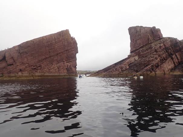
The first point of interest was the split rock near Clachtoll…A’Chlach Thuill in Gaelic, created by the slippage of a massive
section of rock down the Torridonian sandstone base -
spectacular seen from the sea.
We continued on across small Clachtoll
Bay’s sandy beaches where we think we saw the black rib belonging to the guy we
met at Lochinver pie shop who had directed us to the
previous night’s excellent tucked away campsite. Next across the bigger Bay of Stoer and then about four and a half kilometres further on
to Geodh Gainmhich, and a
tiny beach where we stopped to refuel before tackling the committing part of
our day’s paddle. Keith shouting “don’t
get swept round the point” made us all 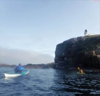 concentrate on staying close in to reach
the landing point. It felt like a very
remote spot, but the road was only a short distance from the top of the
cliff.
concentrate on staying close in to reach
the landing point. It felt like a very
remote spot, but the road was only a short distance from the top of the
cliff.
Back on the water after second breakfast we were out and
round the point with the lighthouse high above us in no time. The water was gently bouncy for the next
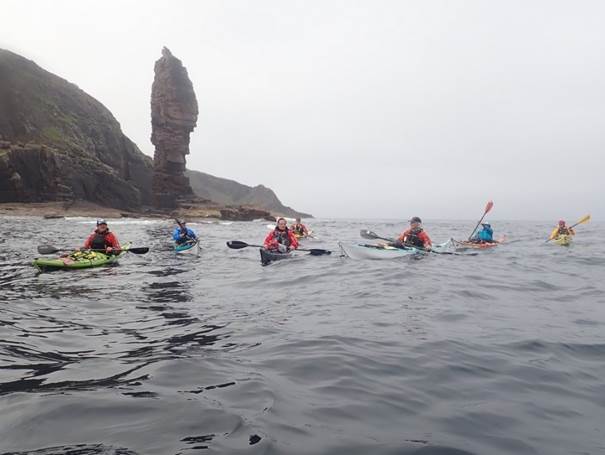
section up towards the Old 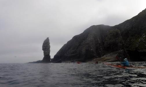 Man of Stoer,
with dramatic cliffs all the way along until the spectacular 60m high sea stack
appeared…no one climbing there today but a popular challenge with
climbers. Keith organised a group photo
right in front of it which took some manoeuvring to get us all in position.
Man of Stoer,
with dramatic cliffs all the way along until the spectacular 60m high sea stack
appeared…no one climbing there today but a popular challenge with
climbers. Keith organised a group photo
right in front of it which took some manoeuvring to get us all in position.
There were lots of rock hopping opportunities for those who dared, and we soon reached Point of Stoer and started heading south easterly towards our lunch spot at the jetty at Culkein where it was rush hour for the local cattle who took priority wandering along the only road holding up the traffic, such as it was.
We set off again to cross to Eilian Chrona, and next to Oldany Island where we were camping that night. I was really looking forward to this as I had camped here once before a long time back and it was definitely one of my all-time favourite camping spots.
We rounded the northern point of Oldany then played “find the beach” amongst all the rocky outcrops exposed at low tide. Even at low tide the white sand of the tombolo beach (Sand either side of an isthmus) did not disappoint – just as I remembered. Plenty of flat grass for camping and the big plus – a midge free night.
|
|
|
|

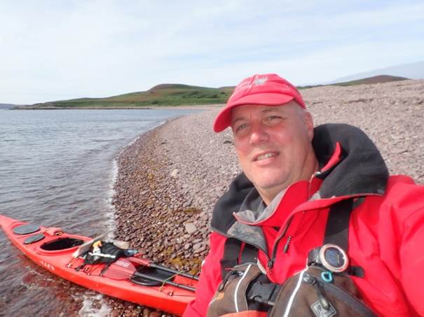
What a way to celebrate my birthday, the third I have spent on a LCC paddling trip. Great company, amazing coastal scenery on a piece of coast I have long wanted to paddle. The blondies I had made to bring as a birthday treat had survived long enough to be still edible and were shared round. (One thing less to stuff in my hatches tomorrow morning – and a wee dram (or several) of whisky to finish the day off. What more could you want from a birthday…..
I had chosen to keep my phone turned off throughout the trip except from taking the odd photo. BUT, seeing as it was my birthday, I turned it on to get birthday messages from my friends and family. Several pinged their way through including one from my daughter Anna. Happy Birthday Mommy – I’ve been trying to call you – I’m in hospital. News you never want to hear. Poor Anna was in Edinburgh Royal Infirmary and had emergency surgery on her lower back. As updates on her recovery came through it became apparent that she would be unable to look after herself for some time when she was discharged so I made the decision to abandon my plans to paddle a second week and leave the group on Sunday after returning to the campsite near Ullapool to go and look after her in Musselburgh...The Gairloch section would be another stretch of coastline to look forward to another time.
|
|
|
|
Day 05
Thursday Oldany Island camp at Cnoc
a Mhoil Bhain to loch na mols (small bay) by Mark Benson
 Overnight winds had lessened when we
awoke to a calmer day. However, the light
breeze was still enough to keep the midges at bay (hurrah!).
Overnight winds had lessened when we
awoke to a calmer day. However, the light
breeze was still enough to keep the midges at bay (hurrah!).
Catriona led us off, heading east along the south coast of Eddrachillis Bay. Initially we threaded between and around
a number of small islands, meeting several seals along the way. We continued
along the coast, passing in and out of the small 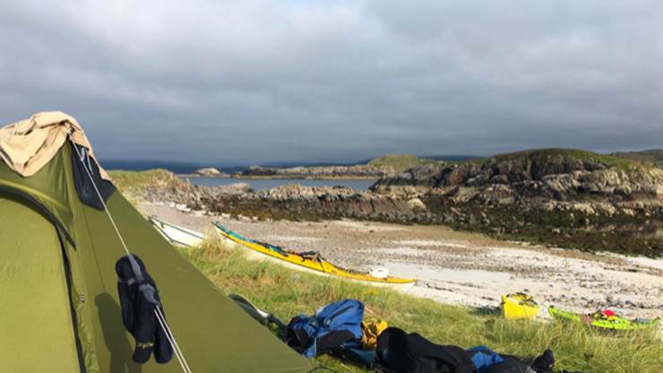 lochs.
Loch Nedd and Loch Ardbhair
gave sheltered diversions and a chance for a rest. We entered Loch Ardbhair against a mild tidal flow of the outgoing
tide. Some ferry glided to the far side
and worked the eddies in the narrows.
lochs.
Loch Nedd and Loch Ardbhair
gave sheltered diversions and a chance for a rest. We entered Loch Ardbhair against a mild tidal flow of the outgoing
tide. Some ferry glided to the far side
and worked the eddies in the narrows.
Finally, we continued around the last section of coast to reach Keith's "5 star" target beach in Loch na Mola. We weren't disappointed, though the picturesque hinterland of Lochan na Dubh Leithi threatened mosquitoes to add to the inevitable midges.
The grassy camping area was not sufficient for all of us, and some camped on the shingle beach, the guy lines of their geodesic tents secured with rocks. The continuing breeze gave us time to relax and enjoy dinner but as it dropped away, so the midges emerged and some of us retreated to our tents.
Frankie observed that the setting sun would make for some good photos; alerted by this, I enjoyed watching the sun set into the sea. As evening drew on the wind began to build up again. We were in for a very noisy night, wondering if our tents would hold. However, it was mainly "sound and fury", everyone's tent was still in place by morning and the wind doubtless lessened the presence of our winged tormentors.
|
|
|
|
 Day 06 Friday loch na mols (small bay)
To beach next to Glencoul bothy by Roger Morgan
Day 06 Friday loch na mols (small bay)
To beach next to Glencoul bothy by Roger Morgan
"My
alarm went off at 6, which I duly ignored, again. Thankfully it was
another day of gorgeous sunshine, marred only by the squadrons of midges flying
in tight aerial formation outside the almost fully zipped flysheet; whilst
they were waiting for me for breakfast, I munched whatever cereal bar I could
find, to make me more nutritious and give me (and them?) energy.
By
now we were all slick with packing our tents sleeping bags etc., moving boats
to the water’s edge, loading, swatting midges, going back for more gear, moving
another boat, swatting more midges, the 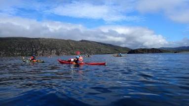 latter being
a continual theme, where do they all come from, and get so much energy
(ah!). Promptly on the water by 8, timed so that we could safely pass
underneath Kylesku Bridge, where if you get it wrong
your battling against 3knots of tide. Leaving our campsite at the small
Loch na Mola we all started the gentle paddle
eastwards up Loch a` Chairn Bhain.
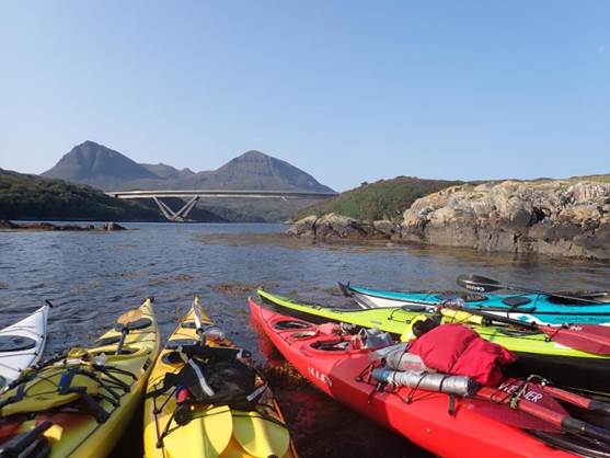
There was hardly any wind, it was a beautiful day to be out on the water. We
gently paddled up the loch, passing under the impressive Kylesku
bridge and the old slipways where the ferry used to land until the bridges
opening in 1984 apparently. We landed on the n slipway where Keith thankfully
boiled water for anyone that needed it, and we had elevenses, at about 9.30. (Note
to self, STOP packing your cooker away where you can’t find it, duh!)
latter being
a continual theme, where do they all come from, and get so much energy
(ah!). Promptly on the water by 8, timed so that we could safely pass
underneath Kylesku Bridge, where if you get it wrong
your battling against 3knots of tide. Leaving our campsite at the small
Loch na Mola we all started the gentle paddle
eastwards up Loch a` Chairn Bhain.
There was hardly any wind, it was a beautiful day to be out on the water. We
gently paddled up the loch, passing under the impressive Kylesku
bridge and the old slipways where the ferry used to land until the bridges
opening in 1984 apparently. We landed on the n slipway where Keith thankfully
boiled water for anyone that needed it, and we had elevenses, at about 9.30. (Note
to self, STOP packing your cooker away where you can’t find it, duh!)
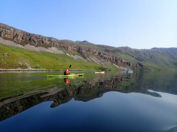
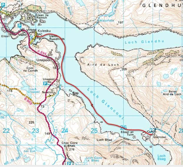
 Our
objectives were to paddle to the head of Loch Glendhu,
then Loch Glencoul both had bothies run by the
Mountain bothies association (see their website for more info) remote huts or
houses which offered (usually) a decent roof and sleeping area where you can
spend the night sheltered from the elements. With Covid, there was uncertainty
whether they would be open. Passing the low-lying buoys holding the fish farm
nets in place we noticed at first what we thought was a boisterous dolphin or
porpoise jumping out of the water, upon closer inspection it turned out to be a
seal, practising it high jump, to get into the fish farms for its ready meal of
corralled fish. Never seen this before, wise seal.
Our
objectives were to paddle to the head of Loch Glendhu,
then Loch Glencoul both had bothies run by the
Mountain bothies association (see their website for more info) remote huts or
houses which offered (usually) a decent roof and sleeping area where you can
spend the night sheltered from the elements. With Covid, there was uncertainty
whether they would be open. Passing the low-lying buoys holding the fish farm
nets in place we noticed at first what we thought was a boisterous dolphin or
porpoise jumping out of the water, upon closer inspection it turned out to be a
seal, practising it high jump, to get into the fish farms for its ready meal of
corralled fish. Never seen this before, wise seal.
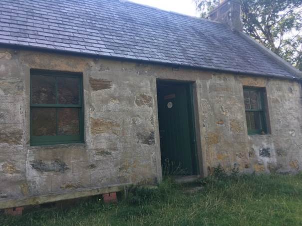
Glendhu bothy
was open, it had two main downstairs rooms, and two upstairs, it would have
been a comfortable albeit basic place to stay, but you would have out of the
elements. Nearby was another house, locked with a lot of bunkbeds in, and two
ponies in a field behind, for  carrying
felled deer from hunting parties from the nearby estate. After second
elevenses, a baste in the sun, or maybe it was dinner, we moved on to paddle
around to loch Glencoul, and again another bothy.
Easy paddling, minimal winds and tide, mountainous scenery all around, good
company, both human and midge like (on the shore), what more could you ask
for.
carrying
felled deer from hunting parties from the nearby estate. After second
elevenses, a baste in the sun, or maybe it was dinner, we moved on to paddle
around to loch Glencoul, and again another bothy.
Easy paddling, minimal winds and tide, mountainous scenery all around, good
company, both human and midge like (on the shore), what more could you ask
for.
Moving
down loch Glencoul in the far distance you could see
the Eas a`Chual Aluinn waterfall, Britain's highest, with a drop of
200metres, that would be tomorrows highlight, in the meantime we landed at Glencoul bothy, again open, with one hiker staying. He
however quickly packed and went up the mountain once he saw that we were
planning to stay the night, albeit camping on the foreshore around the old
walls and farm buildings. Most of us started cooking by our tents, providing
food for ourselves and our guests (yep, midges!!), but quickly reconvened in
turn (to avoid breaking MBA bothy use rules ((Covid 19!!), in the bothy to make
our food, making our way back to the tents and sleeping bags following, or
watching the sunset.
This whole area is fascinating from a geological point of view (Scotland’s first Geopark, an area of significant geological interest) an area of early settlement at the dawn of man (and midge) kind, and more recently in WW2 a site where the midget submariners trained before going to do their thing in Norway or wherever."
|
|
|
|
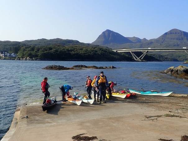
 Day 07 Saturday Glencoul bothy To Kylesku slipway by Alan Peachment
The last day; otherwise known as, the day on which
everyone was on the water before Keith had started to load is boat.
 The last day proved the rule that
there are twice as many midges in the morning as there are in the evening. They definitely know that you are in your
tent and wait by the entrance for you to emerge and then descend en-masse. There were
so many that our clothes shimmered as the light caught their wings.
The last day proved the rule that
there are twice as many midges in the morning as there are in the evening. They definitely know that you are in your
tent and wait by the entrance for you to emerge and then descend en-masse. There were
so many that our clothes shimmered as the light caught their wings.
Because of the number of midges, nobody was bothered about loitering on the beach to have breakfast. It was a case of de-camping as quickly as possible to get on the water and then eat breakfast sufficiently far offshore not to be bothered by the midges.
Maybe it was because it was the last day and the desire for a lay-in, or maybe it was the midges. Whatever it was, Keith didn’t emerge from his tent until all but two of the team were on the water; with everyone on the water before he moved his boat. For those of you who know Keith, this is almost un-heard of. He always, almost without fail, is the first on the water. I am not saying that this was a factor in how quickly everyone got going on this day but…..
The plan was to paddle to the end of the loch and see a magnificent waterfall which cascaded down the side of the mountain. Unfortunately, due to combination of low cloud and the fact that the waterfall didn’t actually cascade into the loch, there was very little to be seen. Still, it was better than a straight paddle to simply paddling to our endpoint at Kylesku.
 The paddle to Kylesku
was straight forward with good sea conditions.
The paddle to Kylesku
was straight forward with good sea conditions.
Having loaded our boats onto the cars which we had shuttled earlier in the week, we then set off back to Ullapool. The ones who need to wait at Kylesku had to slum it in the local hotel eating, what is by all accounts, an excellent cooked breakfast. Some of compensated for missing out on the breakfast by diverting to Lockinver to pay a visit to the pie shop.
Once back in Ullapool it was a case of either setting off back South for the 500-mile journey or convalescing in Ullapool ahead of the second week of paddling.
Some final observations:
- We had awesome weather.
- The paddling in this part of the world is fantastic.
- You can’t beat paddling with a group on a long journey.
- Wild camping has to be experienced.
- Keith has a habit of operating in ‘parent mode’ – “we are nearly there”, “it is just around the corner”. And the best, “there was definitely a beach here on Google Earth!”.
- There is nothing quite like a pie from Lochinver after a long morning’s paddle.
- There are one or two midges in Scotland.
|
|
|
|
|
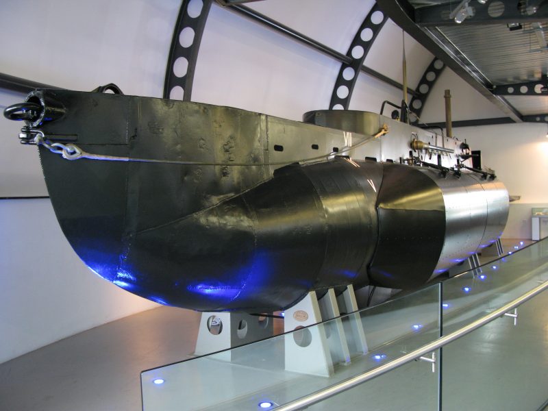
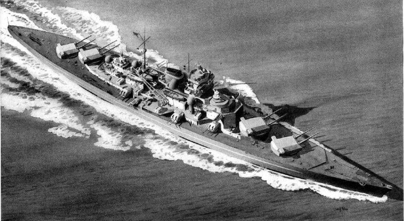
X24 on display at the Royal Navy Submarine Museum
(Photo right) The anniversary of the 1943 mission
of raiding a German battleship using small and dangerous X class midget
submarine or X-craft is being marked. The raid was one of several heroic
attempts against the Germans. Kylesku is a small
remote fishing settlement in Sutherland in the Scottish Highlands. On the
north side of the Kylesku Bridge, a cairn was
erected in 1993 commemorating the 50th anniversary of the
bold and daring feat of the XIIth Submarine
Flotilla, a unit of X-craft. A recognition drawing of Tirpitz prepared by the
US Navy (Photo below)
|
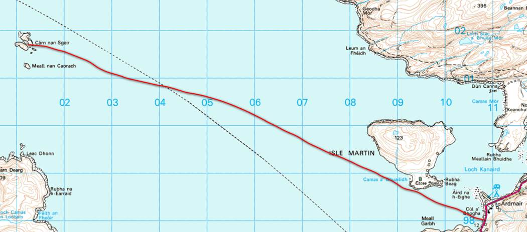 Day 08 Sunday Ardmair
Point to pebble beach on Carn Nan Sgeir
(island). Keith Steer
Day 08 Sunday Ardmair
Point to pebble beach on Carn Nan Sgeir
(island). Keith Steer
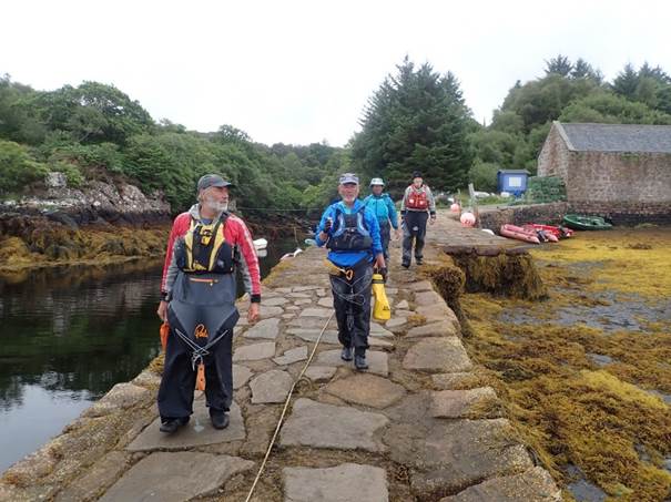
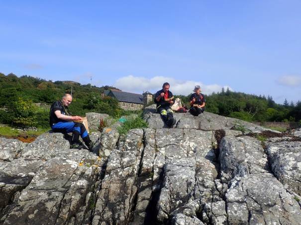
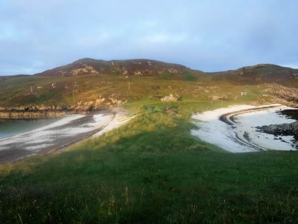
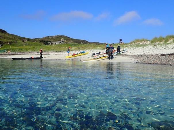
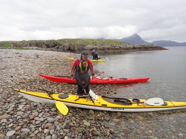
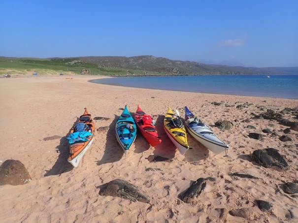
After all enjoying the evening meal arranged by Roger and Catriona most of us were up early in the morning and busy packing our boats for the second week. Around 9:00am and Ian, Catriona and Dave headed off for the car shuttle to leave a vehicle at our two finish points. Catriona could only stay for another 2 days. Frankie, Andy and I enjoyed numerous coffee`s and second breakfasts on the steep shingle point opposite Admair Campsite.
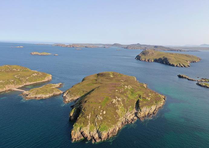
We set off just before midday and headed out past the Isle of Martin and before long saw the same wind turbine that we had spotted on numerous occasions on the first day. After a couple of hours of paddle in saw Carn na Sgeir, a small island with a pebble tombolo (spit) between the two islands. We landed and enjoyed a late lunch and brew on the beach. It really was a stunning place with views all around the Summer Isles.
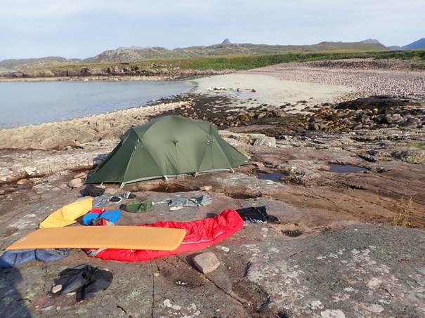
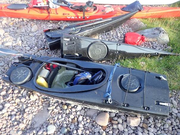
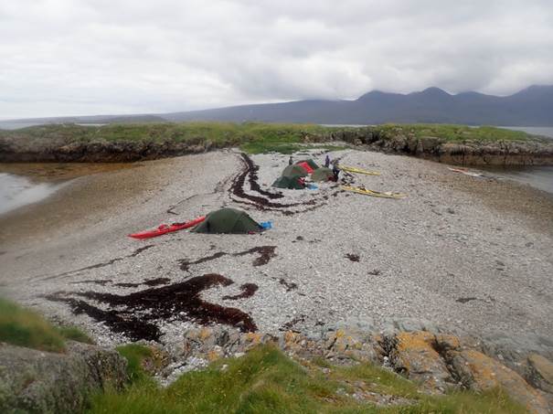
After some discussion and consultation with the tide tables (we were on neaps) this spot proved too good an opportunity given the long shuttles and idyllic location to pass up. We decided to stay the night, having vowed never to bypass a 5-star campsite. We put up our six tends on the flat top of the pebble beach – we had great views over the water to the West and East. It did not take long to explore the small island and chatted and drank coffee until it was time to cook our evening meal. We all slept soundly that night.
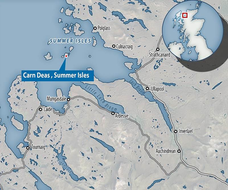
On our return we discovered that the next island over, Càrn Deas, was up for sale - £50,000 would secure its purchase. A little larger than our island but very similar. Part of the Daily Mail article is précised below.
|
|
|
|
|
Day 09
Monday Càrn Nan Sgeir
(island) to Camas a’ Chruthcach via small village
with wind generators and solar panels (Scraig) then
across little loch Broome to Anthrax island by Catriona Hare
Having enjoyed yesterday's long car shuttle (Sunshine and
scenery make all the difference.) and the fantastic sunset on last night's
beach camp ![]() I was looking forward to today’s paddle.
Today I would complete an unexpected two-day bonus extension to the first
week. Keith found somewhere I could pick
up my car at the end of the day.
I was looking forward to today’s paddle.
Today I would complete an unexpected two-day bonus extension to the first
week. Keith found somewhere I could pick
up my car at the end of the day.
We set off promptly at 8:45, 15 minutes before we had agreed
to leave, at the start of week two the packing was getting quicker even without
midges. The midges were kept at bay by
the wind which also meant it was definitely a cag day from the outset, only my
second of the trip. We started off by paddling round the small island we had
camped on the night before, seeing the now infamous wind turbine from day 1 !
After the circumnavigation we paddled across to the mainland near Cailleach
Head. There was a reasonably strong northerly wind so for this part of the trip
we had a following sea. We rounded Caillach Head and
entered ![]() the mouth of Little Loch Broom and
headed down the northern coast to Scoriag, where we
were sheltered from the wind for a time. Scoriag is
an isolated off grid community with no road access, I wondered if it was a
suitable working from home location. We stopped by the jetty at Scoriag for second breakfast or first lunch at about 11:00.
the mouth of Little Loch Broom and
headed down the northern coast to Scoriag, where we
were sheltered from the wind for a time. Scoriag is
an isolated off grid community with no road access, I wondered if it was a
suitable working from home location. We stopped by the jetty at Scoriag for second breakfast or first lunch at about 11:00.
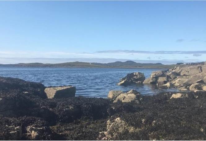
We headed off from Scoriag across the mouth of Little Loch Broom towards the cliffs on the opposite side near Leac an Ime. From here we headed up the coast to the headland and round into Gruinard Bay, with impressive view of the hills on the mainland. By now Keith was mentioning Anthrax at frequent intervals and explaining that Gruinard (Anthrax) Island had been declared safe. Gruinard Island was requisitioned as a remote site for biological warfare experiments in WWII. (I am not sure of their definition of remote, it's only a Km from the mainland.) The island was declared safe in 1990 by the Government, well sheep were no longer dying after the island had been decontaminated by spraying it with formaldehyde diluted with seawater. This was obviously reassuring.
We continue round the headland to a bay near Miotag, where we stopped to decide together if we went to Gruinard Island and for lunch. The tide was going out and the beach was muddy, so a quick decision was made to go round the island but not camp on it, and to leave without lunch.
![]() The circumnavigation of the island
was fun, and I was pleased I didn’t bail out to my car sooner (I wasn’t looking
forward to the long drive to Edinburgh following a day’s paddle.). We paddled
up the east side into a northerly wind, which was quite hard going followed by
a cross wind with side on waves on the north and the following sea down the
west side, which gave us good conditions for rock hopping. Keith was the only person who opted to land
on the island on the tip of the sand spit at Sròn a’ Mhoill. I may have been tempted, but by then I had seen
how” stylishly” Keith had landed and there were likely to be a few more people
with cameras out for anyone else having a go at landing. If Keith doesn’t get anthrax, does that make
him a sheep?
The circumnavigation of the island
was fun, and I was pleased I didn’t bail out to my car sooner (I wasn’t looking
forward to the long drive to Edinburgh following a day’s paddle.). We paddled
up the east side into a northerly wind, which was quite hard going followed by
a cross wind with side on waves on the north and the following sea down the
west side, which gave us good conditions for rock hopping. Keith was the only person who opted to land
on the island on the tip of the sand spit at Sròn a’ Mhoill. I may have been tempted, but by then I had seen
how” stylishly” Keith had landed and there were likely to be a few more people
with cameras out for anyone else having a go at landing. If Keith doesn’t get anthrax, does that make
him a sheep?
We paddled across to the jetty on the mainland near my car. Thankfully Ian shouted at us to paddle due east, so we were not pushed south of the jetty by the northerly wind. We landed near the jetty, and I went to get my car from a nearby layby while Keith, Ian and Andy emptied my boat and moved it and my stuff next to the road from the landing place. I am not entirely sure how my boat got passed the deer gate, I know Ian “shimmied” under the gate to help me load the boat on the car etc.; this made me feel guilty briefly. The rest of the group had a late lunch near the jetty. I wanted to join them, but I didn’t want to stay where I was parked for longer than necessary, so I drove back to civilisation, first layby cleaner clothes, second stop a lovely cup of coffee at the Gale centre in Gairloch.
The rest of the group paddled on to a small bay, Camas a’ Chruthcach, for their evening camp. I was sad to be going but pleased that I had an extra couple of days paddling, and even more pleased when the rock concert I needed to leave early for was excellent. Maybe I don’t want to live in an isolated off grid community after all.
|
|
|
|
Day 10
Tuesday Fraoch Eilean Mor, around greenstone point to Slagan
Bay by Andy Garland
![]()
We had spent the night camped at yet another idyllic spot. It had a backdrop of the Torridon mountains to the east and the Black Cuillin of Skye across the sea to the west. Added to that, a golden beach extended to the south.
This beach was made of several trillion particles of sand -
tiny, tiny grains of silica that did their upmost to invade absolutely
everything. Despite fastidious efforts to keep the tent clean it still got
everywhere...in my socks, sleeping bag, mug, toothbrush and into just about every
bodily orifice that I possess. You might guess correctly that a sandy beach is
not my favourite place to camp. Anyway, as usual we were on the water at a
respectable time, and we continued our journey south. Before long we paddled
past a tiny settlement, called...Sand! (seriously).
After that the coast took on a much rockier character as we passed around Greenstone Point. The winds continued to be light, and we had great paddling conditions.
Our next camp was at Slagan Bay. Now then, after the best part of two weeks on the water the days had begun to blur into one, and I have no recollection of what Slagan Bay actually looked like. However, I can confidently say that I did not camp on sand!
|
|
|
|
![]()
Day 11
Wednesday Slagan Bay to Seana
Chamas Bay via Rubha Reidh
by David Grimes
I woke early to the haunting calls of a pair of loons on the
water (that is, beautiful seabirds, not over-enthusiastic dawn kayakers) piercing
the deafening silence of the bay and the ruined village above it. I had
assumed that the ruins were as a result of the clearances. However, it
seems that the clan chief of the Mackenzies in Gairloch refused to evict his tenants during the clearances
of the 19th century and, as a result, cleared Highlanders from other
communities made their way to settle in the area. However, the population
dwindled because of the decline in the agricultural economy. Reputedly,
there are strangers buried in the village - they came ashore to raid but had
been spotted in advance and the villagers were ready and waiting for them.
The only hostile visitors waiting for us were the inevitable clouds of midgies - however there were times when I felt as though a
swift despatch at the hands of a pitchfork wielding local might have been
preferable to being tormented by a million psychopathic critters.
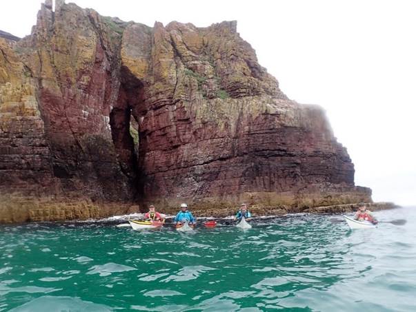
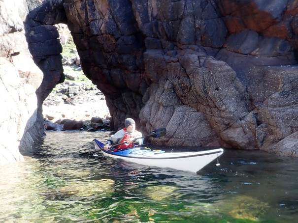
The day started somewhat overcast but calm with very little wind as we made the short crossing to the headland of Rubha Reidh, resisting the temptation of a detour down into Loch Ewe. There were some hugely impressive red rock arches to explore. As we worked our way along the coast to the Rua Reidh lighthouse, the coastal features were like a sea kayakers sweetshop with fantastic rock formations, caves and a very photogenic waterfall. I say photogenic, it was until several of us tried to paddle underneath it and recreate the old Timotei adverts. One particular cave was really memorable - a very narrow and dark 60ish yard long tunnel with a big dark void part way along - very spooky.
As we passed the jetty and lighthouse of Rua Reidh, the grey clouds began to burn away, and it became an impossibly beautiful sunny afternoon. We rounded the headland and a spectacular view of Skye opened up on our horizon. I could see a distant small dark island off the coast of Skye. Hmm, something about that shape…and it was almost imperceptibly moving…the realisation dawned that it was one of Her Majesty’s fleet of nuclear submarines cruising along the surface. There was a tanker just further north, working its way up towards the Western Isles - Keith speculated that the sub might potentially use it for some target practice. Luckily, it was quite a long distance away!
Just past the settlement of Melvaig above the coastline, we arrived at the ridiculously beautiful long, white sand bay of Seana Chamas. This was our campsite for the night, with a panoramic view across the turquoise sea to Skye. A quick google reveals that not much happens in Melvaig other than a long history of producing and smuggling alcohol. Its big moment was in 1805 when Captain John McCallum’s schooner full of herrings was wrecked just offshore with the loss of all hands-on deck except one. A local ne’er do well called John Smith stole the sea boots from one of the bodies washed up on shore. Luckily, the one or two dog walking locals who ventured down onto the beach didn’t seem interested in all the kit spread out to dry in the sun.
The payoff for an early start was that we had arrived at Seana Chamas in the early afternoon. So once our two camps were up (grassy one for sand refusers and sandy one for sheep tick refusers), it was actually like a proper holiday, with plenty of time to relax and chill. A superb and memorable day ended with the customary gourmet cooking, good conversation, a swig (or several) of Bunnahabhainn and the reddening sun sinking into the sea in front of us.
|
|
|
|
Day 12
Thursday Seana Chamas Bay to Eilean
Tloram (Fishing Station) by Frankie Annan
![]()
![]() The 8:00am avoid the midges starts were a
now well-established routine, breakfast at elevenses (which was pretty much
never at 11am) and a coffee without a mouthful of Scottish midge. The gentle
paddle to the Fish Station was yet more of the coast that just keeps giving. More
caves to explore and rocks to hop around in the sunshine once the morning fog
had burned off.
The 8:00am avoid the midges starts were a
now well-established routine, breakfast at elevenses (which was pretty much
never at 11am) and a coffee without a mouthful of Scottish midge. The gentle
paddle to the Fish Station was yet more of the coast that just keeps giving. More
caves to explore and rocks to hop around in the sunshine once the morning fog
had burned off.
The search for the next 5* campsite bypassed some wonderful beaches that were discounted for being too busy (5 people). “Around the corner was a better option”, promised Keith. Redpoint beach did not disappoint. After a debate about which end of the beach to land on, Andy suggested the left end, so of course we went to the right towards the fishing refuge, and abandoned crofts landing on the beach to find yet another wonderful camping spot. We were at the farthest point south of our trip as Friday’s plan was a paddle into Gairloch via the pub – but that is a tale for someone-else’s write up!
With tents pitched, there was time to explore the sand dunes and walk along the beach. A collection of old rusty anchors was explored, along with the fishing shelter and the ruins, before walking along the beach and pondering if aliens had landed.
Another very relaxed day of paddling rounded off with a sunny afternoon on the beach, some strange conversation between Andy and Keith, that had something to do with cricket I believe, and an early night to avoid the midges.
|
|
|
|

![]() Day 13 Friday Eilean Tloram (Fishing Station) to Charlestown via loch Shieldaig and loch Kerry by Ian Bell
Day 13 Friday Eilean Tloram (Fishing Station) to Charlestown via loch Shieldaig and loch Kerry by Ian Bell
The aim today was to have a leisurely paddle to get us to the outskirts of Gairloch by mid-afternoon at latest, set up camp and sort car the ferry and create a very short paddle to the final landing and the journey home on Saturday.
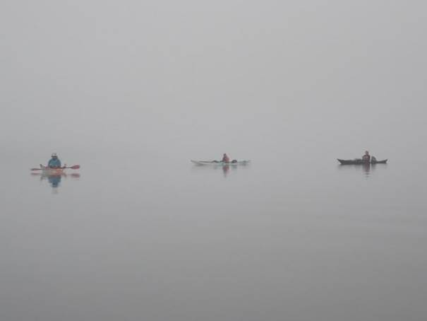
Again, we woke to a misty start but less midges. So, with
boat packed and positioned on the beach so we had circumnavigated Ellean Tioram, our island
camp. We set of at 8:00am, backtracking
on the latter part of previous days route. Stopping for elevenses and 1st
lunch etc at Port Henderson. Still no
sun, just mist and low cloud but conditions were warm and very calm. We noticed a pair of what appeared to be a
set of abandoned ![]() Crocks on the beach. Have decided that they were too big for any
of us but then noticed some activity in water just of the rocks at end the
right-hand end of beach. At first, we
thought it was an otter but soon realised it was the owner of said shoes,
snorkelling and fishing for Scallops.
Crocks on the beach. Have decided that they were too big for any
of us but then noticed some activity in water just of the rocks at end the
right-hand end of beach. At first, we
thought it was an otter but soon realised it was the owner of said shoes,
snorkelling and fishing for Scallops.
The next section of the route took us around the headland into Gairloch. We planned our next stop to be at Badachro, which just so happened to be a Pub with sheltered landing. Unfortunately, we discovered it was not open until midday so rather than hanging around in the rain for an hour or so we paddle on. We explored the sheltered yacht moorings and then on around into Loch Shielding and Loch Kerry where we had another lunch stop and passed several other day kayak groups.
After the second lunch we paddled on past Charlestown
heading to the beach below the golf course which was our intended campsite for
the night. On landing we found an adequate sandy beach but the rough ground to
the edge of the golf course was not to the standard of previous camp
sites. Indeed, far below it. The beach was ok but due to damp we were
going to end up with very wet and sandy kit. After some debate, we agreed to
paddle around to ![]() the car park and while Dave and Myself did
the car ferry the others would explore the options of a commercial campsite for
the final evening. This would give us a
good night rest and good start for the long journey home.
the car park and while Dave and Myself did
the car ferry the others would explore the options of a commercial campsite for
the final evening. This would give us a
good night rest and good start for the long journey home.
While we were doing ferry the others would look after the kayaks and kit and check out the local coffee shop. This proved to be a hard job, but someone’s got to do it to support local economy
Andy had managed to reserve campsite in Gairloch, less than a mile or so away. We loaded up and set up camp on the commercial site. A quick shower, fresh clothes and then to the pub for a very pleasant end of trip meal. The pub hotel was quite busy but made us feel welcome and fitted us in without a reservation. I will certainly call back their next time I visit Gairloch.
A perfect end to two weeks of amazing paddling with excellent company and super weather. In my book, I have been on some excellent trips around the world but Scotland, in good weather offers world class paddling for all abilities. I am looking forward to next year’s trips.
|
|
|
|