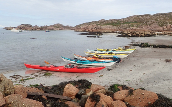
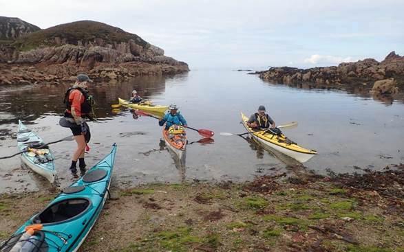
|
|
2022
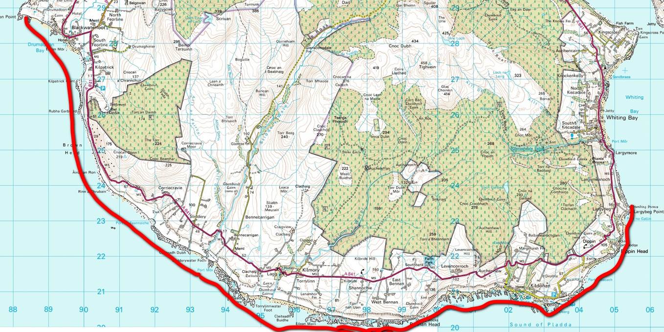
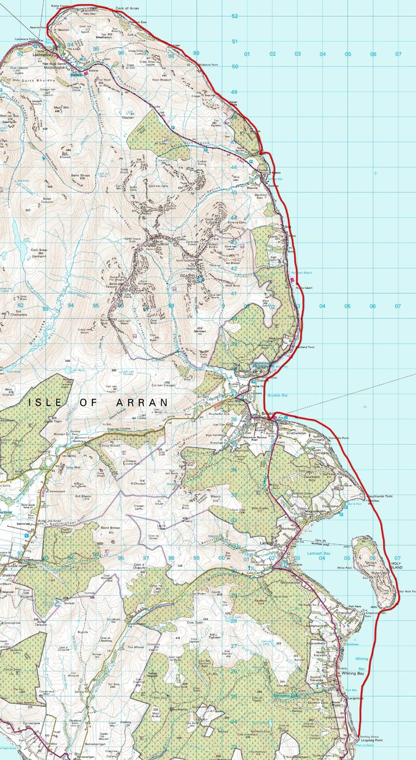
Scottish Sea Kayaking Trip to Arran and Mull |
|
|
News items or reports on club
activities should be sent to website@liverpoolcanoeclub.co.uk |
||

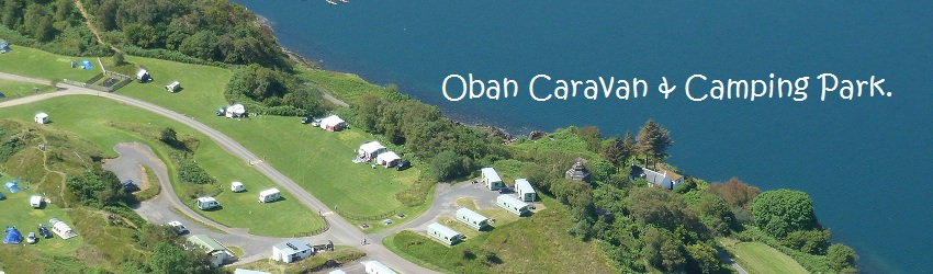
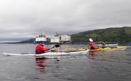
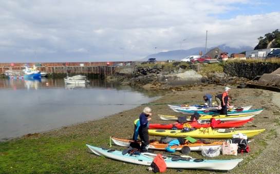
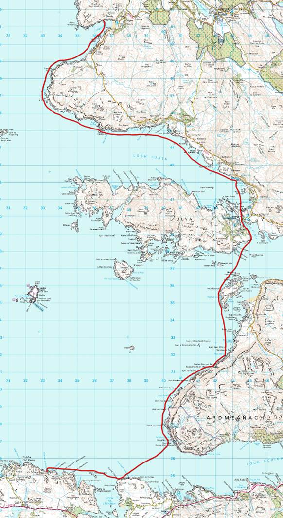
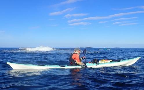
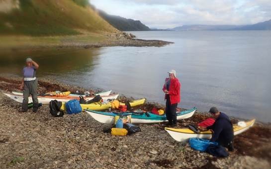
This year’s trip was organised as two separate
weeks but both starting from the same campsite at Oban Caravan & Camping
Park. This would enable people to
paddle for either one or both weeks and would allow for greater flexibility. Week 1 had some unsettled weather, so we
opted to explore Loch Etive and then head over to circumnavigate the Isle of
Arran. Week 2 saw a stable ridge of
high pressure develop over Northern Scotland and would allow us to try to
circumnavigate the Island of Mull. On
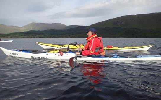
both occasions, we were self-sufficient and camped out of our boats.
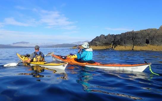
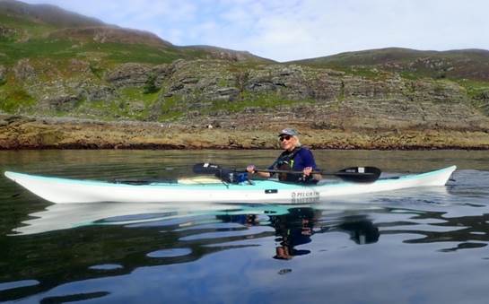
The Paddlers
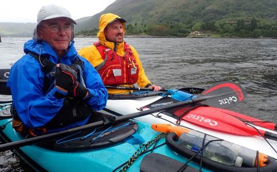
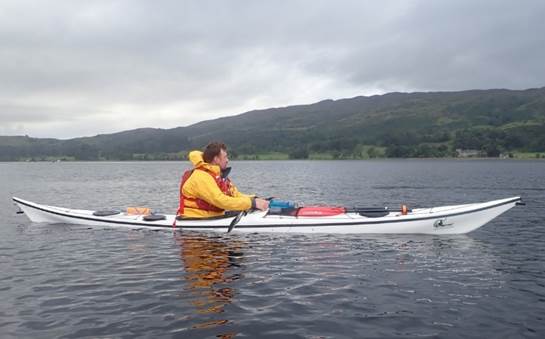
Andy G, Catriona H, Debbie H, Frankie A, Ian
B, Keith S, David B and Gary E.
|
Oban Caravan & Camping Park
|
Day 01
Sunday Loch Etive - Airds Bay (Taynuilt) to the head of Loch Etive by Ian Bell
The Weather forecast was not quite
stable enough to commit to the Mull trip which is open to the Atlantic swells
an on the edge of a line of lows expected to the North of Scotland. Force 5-6 winds required a more sheltered
venue. After breakfast and some time
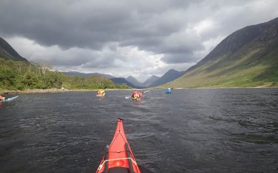
discussing options, we packed up and headed for Loch Etive. This is a beautiful and remote loch with
limited road access for the northern half and had been on several members’
bucket lists for a while.
We drove to the beautiful spit of land that is formed by the River Awe flowing
into the Loch, Bonawe point which has a pier for the old ferry (now not
used). We quickly packed our boats from
the cars – this proved to be an ideal maximum of 5 metres from the cars to the
sea kayaks, it was high tide. After
parking the cars safely out of the way, we headed across the narrows and
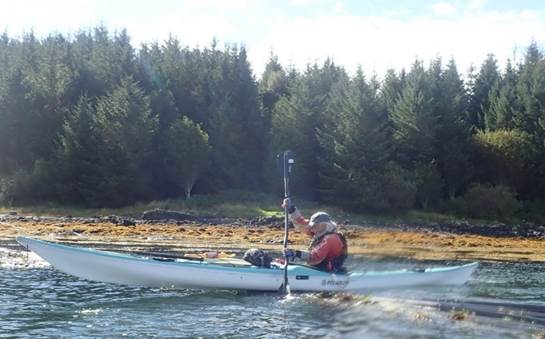
proceeded to paddle along the Northwest shoreline. This was the first time for some with fully
loaded boats, but we quickly glided along.
We paddled past the quarry
(still working with lorries and diggers) and left all signs of habitation. There is a walking footpath along this side
of the loch, but it is not visible for most of the way. Two walkers, a group of sunbathing seals and
occasional fly-bys from the odd heron.
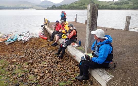
Elevenses were taken at around
12 midday (the first break is always referred to as elevenses no matter the
time of day). I found the first of 3
rope swings on this first trip kindly added by the locals for visiting
paddlers.
We paddled on Northwards with
darkening skies but where the sun broke through it was too warm for a
jacket. As the day went on, we started
to look for options for a campsite. They
were relatively few and far between as the steep loch sides (the loch was in a
steep glaciated U-shaped valley). We
ideally wanted to camp around the loch head where the river Etive flows into
the loch. There is a small road here
which connects with the A82 and Glen Coe.
The wind quickened and whipped up white breaking waves, fortunately, it
was directly behind us and blew us quickly along.
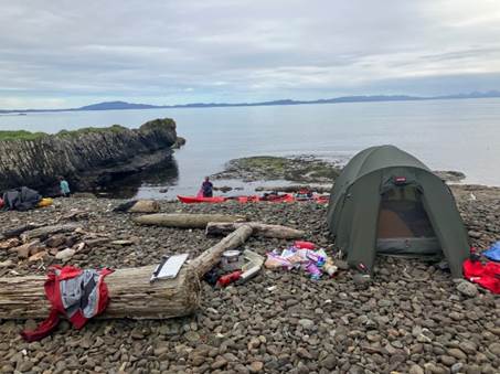
At the head of the Loch, we investigated several options for a suitable
campsite – we needed a nice beach with access at low tide and room enough for 8
tents. Bizarrely there was a Scottish
Wedding at the small car park with gazebos and full kilts. We opted to keep clear of the photos and
headed for the small pier and beach on the northern edge. Tents were put up, stoves fired up and it
proved to be a good little site. Running
water, excellent views but relatively sheltered.
The wind died away later, and
the full moon lit the valley around but most of us were tucked up in our
sleeping bags well before the midges headed out to find their evening
meal. (Nb the midge is the only known
human predator present in the British Isles)
More
photos……… ![]()
|
|
|
|
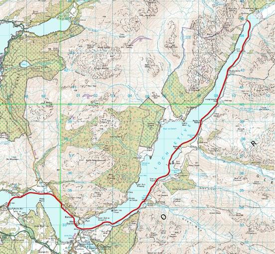 Day 02 Monday Loch Etive - The head of Loch Etive to Rubha Nan
Cairn by Andy Garland
Day 02 Monday Loch Etive - The head of Loch Etive to Rubha Nan
Cairn by Andy Garland
We arose to only a light smattering of midges
and made our usual preparations for departure.
The previous night a wedding party had been holding a reception by the
loch shore, a few hundred meters from our camp, so I checked and double-checked
that no bottles of unused Champagne had been left behind. Alas, there were none.
We all set off and paddled
southwards along the eastern side of the loch, with just a hint of a breeze at
our backs. The mass of Ben Starav loomed
above, and I tried to pick out a route to its summit – reconnaissance for a
future ascent with an approach by canoe perhaps?
We took ‘elevenses’ near
Ardmaddy Bay, and then pushed on to find a suitable spot to camp. We passed our original launching place at the
mouth of the River Awe and carried on for a few kilometres.
Finally, we spied a suitable
beach near the headland of Rubha nan Carn, on the southern shore. Tents were soon pitched, and we settled
down. However, we had unwittingly found
a camp next to a railway line and were soon disturbed by the 16:38 train
service to Oban (and again at 17:41, 18:52, and 19:30…etc.). Fortunately, the trains stopped at around
9:30pm, and we enjoyed a relatively quiet night (apart from the obligatory
snoring from the neighbouring tent).
|
|
|
|

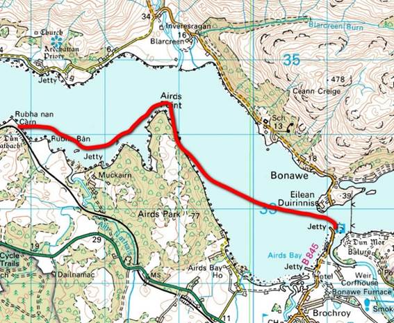 Day 03 Tuesday Loch Etive - Rubha Nan Cairn to Airds Bay by
Frankie Annan
Day 03 Tuesday Loch Etive - Rubha Nan Cairn to Airds Bay by
Frankie Annan
Waking on the wonderful
Alaska-style campsite, it was to be an early start on the water to get back to
the cars. The first train passed at 6.27 am by which time, those of us who need
more packing time, were up and getting sorted, and everyone else was still in
their tents. The short paddle back to the cars, saw us encounter seals, eagles
and otters and possibly some tide against us.
Once back at the cars, there
was the obligatory faffing to get boats empty and loaded before driving back
into Oban and heading for Carradale via Tesco. There was some essential
shopping to be done before getting on the road.
The advantage was taken of Dave’s
van (by me) as I traded the back seat of the car for a front seat. A very good
move in view of the road journey to come.
|
|
|
|

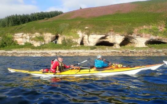
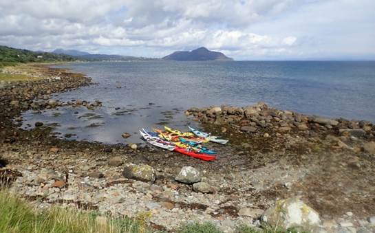
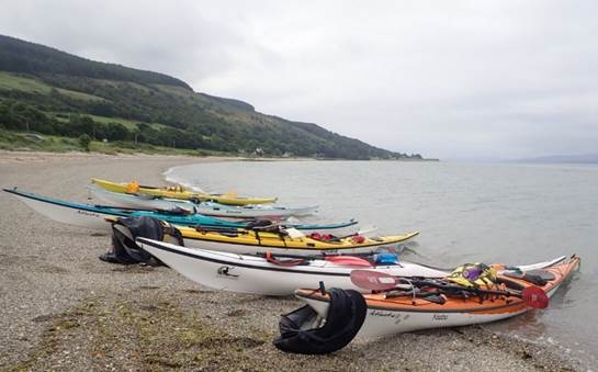
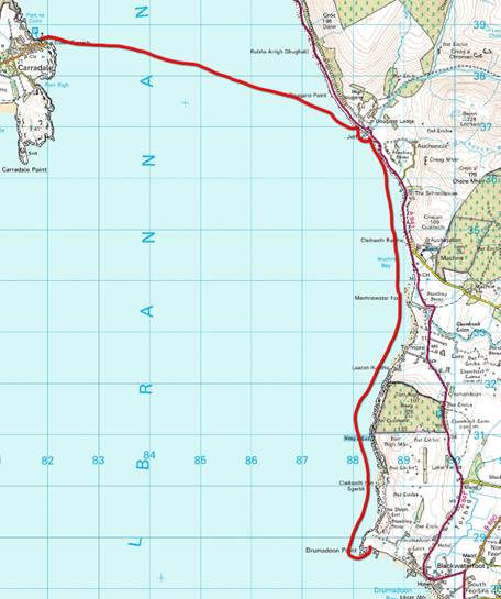 Day 03 Tuesday Arran – Carradale to Drumadoon Point (Golf
Course) by Frankie Annan
Day 03 Tuesday Arran – Carradale to Drumadoon Point (Golf
Course) by Frankie Annan
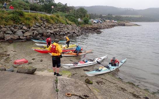
Shopped and fed, the convoy
set off to drive to Carradale to start the next part of the week and dodge the
weather that was headed to Mull. This was the journey down the never-ending
single-track road, or so it seemed. But
eventually, we arrived at the car park by the harbour (with facilities) to
unload boats and repack them for the next leg of the trip. There was a little
rain as we were packing, but then as we launched the sun came out.
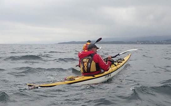
The crossing to Arran was 5
km with a following sea and sunshine. As
I paddled along wondering what the chances of seeing Whales may be for this
trip, I noticed to my right, what looked like a little fin. Yes, it was a group of porpoises that were
just behind us. After watching them for a few minutes, it was back to
concentrating on heading in the right direction towards Arran, where elevenses
waited.
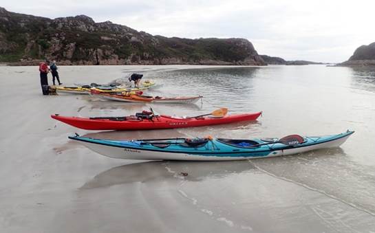
We landed on a beach
somewhere in Machrie Bay, had a short elevenses and then set off again to find
a campsite for the night. There had been
mention of a golf course. The view of Ailsa Craig was wonderful, and the Mull
of Kintyre may have inspired Andy to sing.
As we scouted the shoreline
for landing spots, we passed Drumadoon Point and found the beach next to the
golf course. The temptation of the
greens was resisted as we set up camp on the beach. We were not the only sea
kayakers on the beach, as Dave from the borders who was doing a solo trip
around Arran was at the other end of the beach. Most of the walkers who were
abut were friendly and didn’t object to the obstacle course surrounding the
footpath, though the horse that had come for an evening beach ride, wasn’t too
happy walking past tents.
There were conveniently
situated benches in what was designated the posh end of the beach, which made a
great cooking spot. Others in the group opted for the rocks on the beach. Sadly all areas soon became full of midges,
so one by one everyone disappeared into their tents, as the sun set on the
horizon.
Probably the most paddling we
had done since the start of the trip with the most wildlife of the week so far.
|
|
|
|
Day 04
Wednesday Arran - Drumadoon Point (Golf Course) to Largybeg Point by Gary
Edwards
The initial instructions for
Day Four involved an early 7 am on the water… gladfully, that was delayed an
hour to allow the wind and rain to pass over.
Although any extra sleep I was planning to get was rudely interrupted by
the green keeper from the Shiskine Golf Club, whom no doubt took great pleasure
in loudly sounding the horn on his golf cart whilst whizzing around the course
next to our tents.
Once up, our tents were
quickly packed away whilst dodging the inevitable clouds of midges that had
accompanied the dropping winds. So, it was quickly onto the water to avoid the
worst of them and to get the day started.
Setting off from Drumadoon
Point, as ever, our destination for the day was a mystery… a mystery
accompanied by the promise that it was ‘just around the corner’. The south coast
of Arran, for me, will forever be remembered as the island of a million
corners.
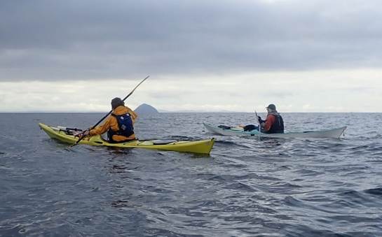
Although the coast of Arran
isn’t as featured as I’d hoped, the views were great. Looking over to Ailsa Craig was a highlight,
several discussions about the origins of curling and the method of creating the
stone were had. The group consensus
though was that the desire to find out was not significant enough to undertake
the 20km crossing to the island.
There was also the option to
paddle around the flat island of Pladda, which despite being a more palatable
1km crossing, was not on people’s minds either.
The previous day’s mixture of packing, paddling, packing, driving,
packing, paddling and finally camping has drained energy levels to the point
that we were all looking forward to an early finish and relaxed evening. As we passed Pladda, we were on the final
straight towards Largybeg Point where we decided to set up camp. It was around
2 pm, it was sunny, the pitch was flat, and the group was happy. The afternoon and evening were spent
relaxing, drying out kit and looking forward to the next day of paddling.
|
|
|
|
Day 05
Thursday Arran - Largybeg Point to Lochranza by Debbie Hughes
Despite having camped on land
evidently occupied by cattle, we got through the night without interference
from large hoofy bovines. Yet another birthday morning for me with LCC, with
card, rosette and birthday banner from the gang – special people and special
places to remember the day, thanks for caring.
It was quite a leisurely
start (as these things go) as we had to wait for the tide to come in enough to
negotiate the bouldery exit. The
“teamwork makes the dreamwork” was essential to get on the water with the fully
laden boats.
We set off across Whiting Bay
towards the channel between the mainland and Holy Island. We took the outside route past the lighthouse
and spotted a large herd of feral goats or maybe sheep. Not easy to tell from
the sea. And sea going swans.
Amazing views towards
Goatfell and then even more jaggedy mountains as we got further north.
Onwards to lunch spot – and
an eagerly anticipated brush with shops at Brodick. Landed on the beach not far
from the ferry terminal (wonderful facilities!) and then went on a water
hunt. Well done to Scottish Water who
provided a brilliant water dispenser halfway along the prom, ideal for filling
up 2 litre pop bottles. Every town
should have one. We had a great lunch
spot with benches at the top of the beach – and Dave produced birthday cake –
not just one but two!!! Carrot cake and
coffee and walnut – cut into eight pieces and scoffed with relish by all. Big thanks Dave – loved it.
The afternoon’s paddle turned
into a bit of a marathon as camping spots were in short supply and we soldiered
on to Lochranza – after a breather near North Sannox where Catriona tried out
Andy’s boat – we’ll never keep up with her if she decides to change for a
composite boat! Then off again.
The PS Waverley paddle
steamer passed us – looked spectacular with its swept-back funnels, the last
sea-going passenger-carrying paddle steamer in the world and built in 1946
according to Mr Google.
Never believe anyone who says
“it’s just round the next corner!” Oh… that afternoon was a long paddle. Eventually, with most of us despairing of
ever getting off the water, we made it to Lochranza and chief scout Keith went
off to suss out the possibility of camping by the castle on the spit at the far
side of the bay.
Phew, if we cooked first and
left putting the tents up until nearly dark, it was decided we could get away
with it. We were right in full view of
houses on either side of the bay but the alternative of paddling on to find
another site was not popular. So, that’s
what we did – a friendly local cheerily told us there was no pub, no hotel, but
there was a pop-up French restaurant near the ferry although no one tried it
out. (The ferry was called Catriona) It
was very midgey – and poor Frankie had a right battle getting her tent up in
the dark with a pole malfunction, the last thing you need after a long paddle -
and the “facilities” were right at the far end of the village, but it was home
for the night and another fantastic place to remember a birthday.
|
|
|
|


Day 06 Friday
Arran - Lochranza to Carradale by Dave Brown
After a great night’s sleep by the side of
Lochranza Castle, where we were pitched on a flat area, with short grass,
chosen by Keith – a 4-star campsite – as there was a long walk to go to the
loos.
The first thing to do was
breakfast in the tent – midges outside, then walk to the loos using my old
man’s brain – I tried the closest loos at the ferry. To my surprise, I found a
hot water tap – ye ha. First wash with hot water for some time!!! This started
my day off with a happy surprise.
After 6 days of paddling, the
routine continued of bags packed, a boat packed, tent down & packed and
afloat in my boat. Well - I seemed to be on the water first – I was in
shock!!!! What did I do right? Still not sure now, but Ian always says don’t
rush it – get it right.
We paddled off down the coast
with the tide with us, wind behind – all good & looking for an elevenses to
stop at. We found a nice slipway called Pirnmill Village – this had a shop, so
Gary was out of his boat first in search of food. I followed & to our
surprise the shop had everything – even a coffee machine, we came back with
coffee & hot chocolate & big smiles on our faces. Off again up the
coast until we decided to head off to the mainland – back to Carradale – which
is where we’d left the cars & my van.
Then I said goodbye to the
team of Keith, Ian, Debbie, Frankie, Katrina & Andy – who were off to do
the Island of Mull for the second week. Gary & I headed home.
This was my first sea kayak trip
of 6 days & I have learnt so much from all of you guys – Thank you &
sorry for asking so many questions.
|
|
|
|
Day 07
Saturday Mull – Oban to Carsaig Bay by Catriona Hare
Depending on our individual interpretations
of the English Language (well fitness levels, existing injury or possibly type
of sea kayak.) today we started on the third part of our holiday or endurance
expedition. We had a 5- or 6-day weather window which would allow us to
circumnavigate round the Island of Mull. A trip long planned by the club but
previously always cancelled due to poor weather. This time we were going.
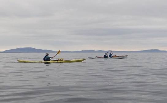
We set off from the mainland
close to the Kerrera Ferry slip at 9:15, with the wind and tide expected to be
with us for most of today’s trip. We passed the southern tip of Kerrera, when
one of the party realised he had forgotten his tow rope. There was some
“debate” between our two “distinguished” leaders about how this could happen,
something about messy car sharing. Other debates would follow during the week.
The rest of us just offered to lend our tow ropes, an offer that was not taken
up.
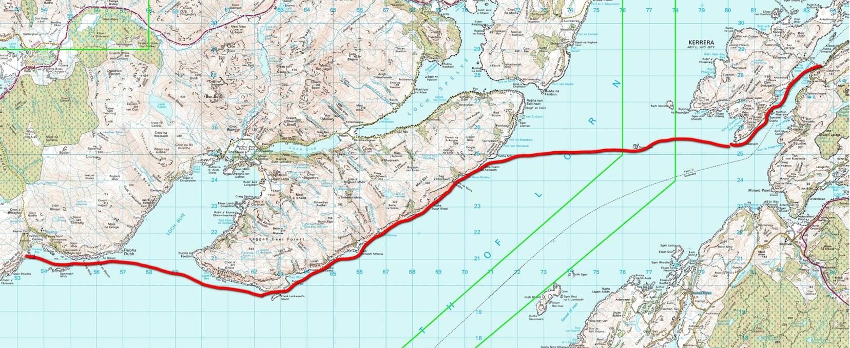
We travelled down to the
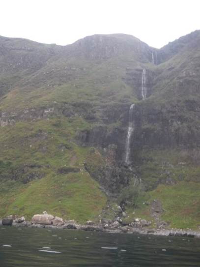
southeast tip of Mull for about 3 hours, our first long crossing of the trip,
admiring the waterfalls that ran down the impressive cliffs on this side of
Mull. However, we were all beginning to wonder if there would ever be anywhere
to land especially those of us who had drunk to much before getting on the
water. Finally, we landed at Port Ohirnie, spray decks were removed and slippy
rocks and seaweed crossed with haste, to find appropriate secluded rocks. The
next long crossing would be better planned. We enjoyed a late elevenses.
We were losing the tide now
as we headed round the unusually named Frank Lockwood Island. As far as I can
make out Lockwood was an English lawyer and politician who spent a lot of time
visiting the tiny island, to relax and recuperate. Something I think many sea
kayakers including me can identify with.
We continued round the coast
spotting deer and goats on the now slightly more gently sloping shoreline to
arrive at Carsaig Bay at low tide. There was some debate about going further
but this bay was fantastic. There were holes in the rock shelf we landed on
containing sea anemones and small crabs, and providing traps for the feet of
boat carriers, interesting cliffs and good small stones to erect our tents at
the top of the beach, on another 5* campsite.
|
|
|
|
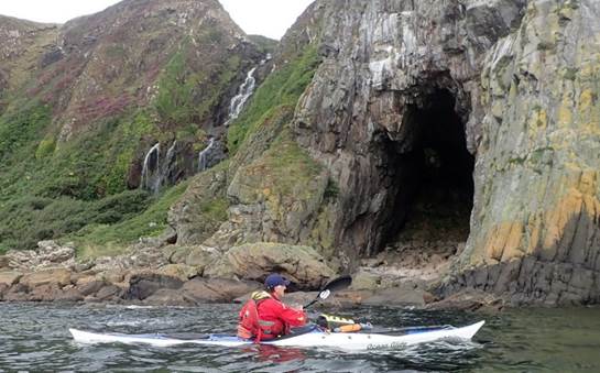
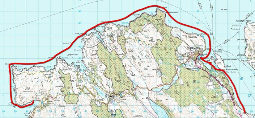
Day 08
Sunday Mull - Carsaig Bay to Port Gart an Fhithrich by Ian Bell
Having had a good night on
the five-star elevated campsite in Carisaig bay we timed are departure to be
close to local high water so there would be little or no carry. This also meant
we would get the best of the tide to assist us along the southern coast of the
Ross of Mull. The aim of the day was to get to the northern end of the sound of
Iona and find camping on the Mull side as camping on Iona is not allowed.
With the tide pushing us
along our way, we made good time. The first part of the day saw us passing high
cliffs with several stepped waterfalls, sea arches and caves. This area is home
to a couple of herds of goats which we saw grazing along the shoreline.
Once we passed Rubba Nam
Braithrean the coast starts to become more broken with lower cliffs bounded by
sandy coves. We stayed slightly offshore as we crossed Ardalanish bay to get
the best of the tide and rounded Rubh’ Ardalanish. We eventually stopped for elevenses on the
beach at Eilean Mor. This was either the
second breakfast or first lunch, depending on your point of view. By this time,
we had already covered in excess of 20k today.
From here the coast changes
again with a number of skerries and off-lying rocks and eyelets. This area is
also the most exposed to Atlantic swells. Even though the conditions on this
day were perfectly calm and flat all morning, as we approached the turn into
the sound of Iona, we did experience a few large rolling swells. By now the tide
was low and approaching slack, so we needed to ensure we did not cut into one
of the drying channels between the rocks as we made our way around the corner.
 As we
paddled up the Sound of Iona we met other kayaks, paddle boarders and a family
just out on the beach. We stayed on the mull side of the sound so had good
views across to the Abby on Iona. We called into Fionnphort, the point at which
the ferry crosses to Iona. This was like returning to civilisation due to the
number of people around. It is a key stopping point for the Mull coach trips.
We took the opportunity to refill our drinking water, get ice cream and use a
proper loo. As we took a second break
here for our second elevenses, the local cat came to befriend us. Unfortunately, he did not get many leftovers
from our lunch but did appreciate the attention.
As we
paddled up the Sound of Iona we met other kayaks, paddle boarders and a family
just out on the beach. We stayed on the mull side of the sound so had good
views across to the Abby on Iona. We called into Fionnphort, the point at which
the ferry crosses to Iona. This was like returning to civilisation due to the
number of people around. It is a key stopping point for the Mull coach trips.
We took the opportunity to refill our drinking water, get ice cream and use a
proper loo. As we took a second break
here for our second elevenses, the local cat came to befriend us. Unfortunately, he did not get many leftovers
from our lunch but did appreciate the attention.
We continued North, up the
sound of Iona and then turned east to find a campsite for the evening. After
the shortest leg of the day, and after about 5km we landed in a sheltered bay
near Rubha na Reiing. This would give us an ideal starting point for the next
section of the trip and several options, depending on the weather the following
day.
|
|
|
|
Day 09
Monday Mull - Port Gart an Fhithrich to Calgary Bay by Andy Garland
Today was going to be a long one! We were camped on the southwestern side of the
large open bay that separated us from Treshnish Point, which was around 25km to
the north. One of our options would be
to make a direct crossing, only briefly making contact with land at the Isle of
Staffa about halfway across (although it was unlikely that we could land
there).
Another option would be to
take the long way around, paddling closer to shore around the eastern rim of
the bay. This would avoid a committing,
open water crossing but would add considerably to the distance.
Our decision of which route
to take was dictated by the updated weather forecast that morning – south
westerly offshore winds, freshening during the day – we would take the long
route. The day’s paddling started with a
relatively short crossing to the Ardmeanach Peninsula, followed by a
coast-hugging journey along its northern shores.
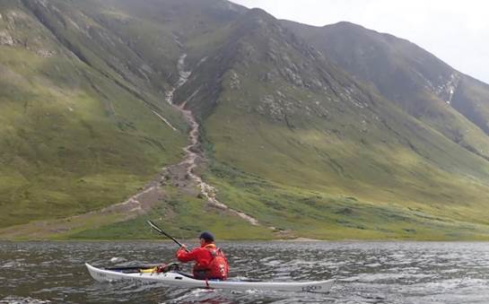
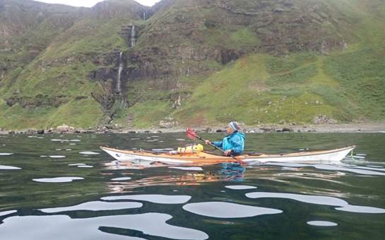
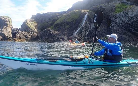
 The coastal scenery along this section is
truly spectacular… Waterfalls plunging down 300m high cliffs into cavernous
bays with vertical walls. It was
other-worldly, like something from Lord of the Rings. This stretch of coast is marked on the map as
‘The Wilderness’ – a very apt description.
The coastal scenery along this section is
truly spectacular… Waterfalls plunging down 300m high cliffs into cavernous
bays with vertical walls. It was
other-worldly, like something from Lord of the Rings. This stretch of coast is marked on the map as
‘The Wilderness’ – a very apt description.
Our journey then led us to
the island of Ulva, which we passed on its western side via a narrow channel
that separates it from the Isle of Mull ‘mainland’. We pressed on and finally passed Treshnis
Point, but we still had a few more kilometres of paddling until we reached our
intended camp for the night at a sandy beach in Calgary Bay.
However, once inside the bay
we could see that the golden sandy beach would involve a long carry of boats to
get them above the high-water mark. The
sight and noise of quad bikes racing up and down the beach didn’t add to its
attractiveness either. We, therefore,
settled on a much quieter camping spot by a disused pier about 1km from the
beach. Yes, it had been a long day –
around 43km – but the scenery and views had been exceptional.
|
|
|
|

Day 10
Tuesday Mull - Calgary Bay to Rubh` an t-Sean Chaisteil by Frankie Annan
 Waking up
early; it was to be a quick departure from the controversial campsite, Keith
rated it 5-stars, Ian 3-stars, the ladies were most disgruntled having been
promised the previous day, that our reward for paddling on was a 5-star
campsite on golden sand in Calgary Bay.
Instead, we had a view of the golden sand from an abandoned pier.
Definitely a zero-star campsite. Just like in Frozen, I need to Let it Go!
Waking up
early; it was to be a quick departure from the controversial campsite, Keith
rated it 5-stars, Ian 3-stars, the ladies were most disgruntled having been
promised the previous day, that our reward for paddling on was a 5-star
campsite on golden sand in Calgary Bay.
Instead, we had a view of the golden sand from an abandoned pier.
Definitely a zero-star campsite. Just like in Frozen, I need to Let it Go!
The plan for the day was on
the water early to make the best use of the tide to get us around into the
sound of Mull. There was slightly more tide against us at points than I had
imagined, but the sun was shining, and the scenery continued to be
wonderful. And for me personally, I was
paddling another part of the coast I hadn’t managed on my previous trip to Mull
when the weather made a circumnavigation impossible.
 To help us
on our way there were Eagles to be spotted, Dolphins to play with and Otters.
It was a long paddle though with no obvious good landing spots there was no
break and elevenses was taken on the water (and oh I think my boat is moving
backwards whilst stopped). The morning became afternoon as we finally
approached Tobermory and navigated into the harbour avoiding the ferry, to land
for a well-deserved break after 5hours on the water, or was it 6, it was
certainly the longest spell in the boats of the trip so far.
To help us
on our way there were Eagles to be spotted, Dolphins to play with and Otters.
It was a long paddle though with no obvious good landing spots there was no
break and elevenses was taken on the water (and oh I think my boat is moving
backwards whilst stopped). The morning became afternoon as we finally
approached Tobermory and navigated into the harbour avoiding the ferry, to land
for a well-deserved break after 5hours on the water, or was it 6, it was
certainly the longest spell in the boats of the trip so far.
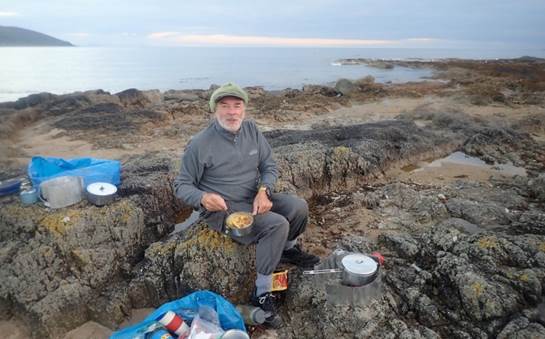
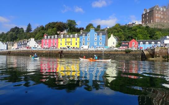
Finally, Tobermory and who
should we meet but the captain of the Molly Roger. Our very own Roger of Wales
who had gone sailing instead of sea kayaking. Amazingly he had spotted Keith
urban foraging ![]() around the
marina for water. It was great to catch up and have a chat. After various bits
of urban foraging by all and lunch (there were pies, doughnuts, sorbet, and
beer) we carried the boats down to the still receding water line for our 7th
hour of paddling (we settled on 6 hours for the morning stint). I’m sure a shorter
day’s paddle had been mentioned the night before!
around the
marina for water. It was great to catch up and have a chat. After various bits
of urban foraging by all and lunch (there were pies, doughnuts, sorbet, and
beer) we carried the boats down to the still receding water line for our 7th
hour of paddling (we settled on 6 hours for the morning stint). I’m sure a shorter
day’s paddle had been mentioned the night before!
Heading from Tobermory out
into the sound there was a moment where we almost ran out of water between
Calve Island and Mull. I told you so, said Andy. Most of us got out of our
boats to drag them across the kelp and minimal water supply. Andy seemed
determined not to get his feet wet. He made it through the shallows with a
couple of helpful shoves from a kind person called Frankie, - who promptly
overbalanced and ended up sitting in the shallow water. It was hot the water
was cool – that was quite an effective cooling strategy!
We slowly made our way along
the coast looking for the first possible campsite, by this point everyone was
ready to stop. Ian thought there was a possible campsite ahead as did Keith. It turns out the 2 completely different
descriptions of the possible campsite were the same place. We were in luck. After about 4km of paddling
the possible campsite turned out to be a true 5-star site and with 6 people on
a boat, we got everything off the water to enjoy a midge-free evening. It included an opportunity to wash in
freshwater thanks, to a stream and an early night.
|
|
|
|
Day 11
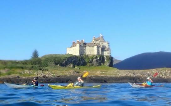
Wednesday Mull - Rubh` an t-Sean Chaisteil to Duart Castle - by Debbie Hughes
Time to leave our 5*
campsite, no midges, running water, superb views, and tackle a long day ![]() – all the
way down the Sound of Mull to the far end.
– all the
way down the Sound of Mull to the far end.
Catriona was in charge of navigation,
and to iron out the dog leg of the sound we set off for the far bank on the
mainland side. There was some tidal
assistance but a bit of a breeze in our faces.
Crossed over and the plan was to cross back over to another” green
knobbly bit” (a technical term used frequently) on the Mull side but that was
delayed a bit due to other shipping to be avoided, ferries etc.
Back on the Mull side, we
headed towards Fishnish Pier where the ferry crosses over to Loch Aline and we
were going to have elevenses – another technical term for any stop regardless
of the time of day! One little problem,
there was a very large fish farm which stretched right out into the sound and
the only way to get to our stopping place was to get across five solid plastic
pipes coming from the farm onto the shore.
Keith, Andy and Ian launched over it with very little trouble – Catriona
and I, however, now have embarrassing photographic evidence of being well and
truly stranded on top of the pipes, having to be hauled off by Andy and
Keith. Relief to get to the food stop……
After refuelling and using
the pier facilities, we set off for the afternoon, and the breeze had dropped
by now, but we would shortly lose the tide.
Another encounter with a very large ship who was moving towards us, very
slowly, near the Glas Eileanan rocks out in the main channel, caused us to
group together to ponder his intentions.
He must have realised our dilemma and turned onto a definite heading
avoiding us. We paddled swiftly past,
and he gave us a cheery toot on the horn as we went by.
The campsite search began
shortly after that and we ventured into Scallcastle Bay to suss out another
golf course site but it didn’t pass muster, then on round the point and past
Craignure where scouts went ashore at an official campsite but that too was
rejected – Astroturf tent site? What is
that all about? There was also a very
unpleasant sewage smell on the beach there…
And you had to pay…
So, we got back on the water
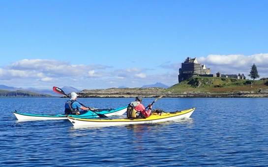
and paddled another 3ish kilometres to Duart Bay and set up camp right
underneath Duart Castle. (The castle was wrapped in scaffolding on the side we
approached from and didn’t look like a castle at all until we saw it in the
morning when we left round the other side) The locals were friendly and we
helped them lift their boat off a trailer and put it into winter storage under
a tarp, thus ensuring we didn’t get shoo-ed away. Another excellent camp spot, with great views
up the Sound. Didn’t see any sea eagles,
but we did see a deer when Catriona and I went for a little explore up to the
castle. Think Andy and Ian saw deer too.
There is nothing to beat a
wee dram on a lonely beach in the wilds of Scotland after a hard day’s
paddling. The whisky supplies have to be
eeked out to last the whole trip. Andy
had saved his last dram for the end of the trip and horror of horrors, managed
to tip it over before he got the chance to drink it – the only thing handy to
mop up the spillage were his socks…..arghhhh….
|
|
|
|
Day 12
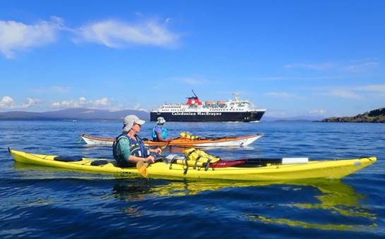
Thursday Mull – Duart Castle to Oban by Catriona Hare
We packed up to leave the
small bay at the base of Duart Castle and were all ready for the relaxed
leaving time of 9:30. This time had been chosen to make sure we hit Lady’s
rocks close to slack water. Three tides meet at Lady’s rock and the water can
be rough and confusing even on calm days. We also had the extra challenge of
missing the shipping channel used by the many ferries out of Oban Port.
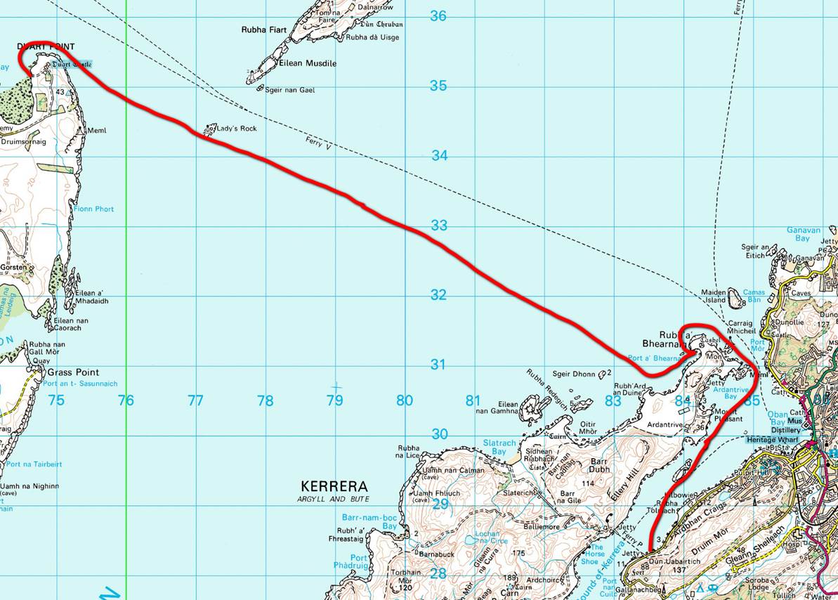
We crossed over and passed
Ladies Rock without mishap; the tidal planning turned out to be correct. The
plan had been to cross over and gently ferry glide northeast to Oban, however,
we noticed quickly that this would not avoid the ferries. We decided to head
directly towards the northern tip of Kerrera to ensure we stayed south of the
shipping lane. Although there were some waves, tide and ship wakes, the
crossing was uneventful. We arrived about 2 hours later at the top of Kerrera
for another elevenses. Interestingly, at the end of nearly two weeks together
we all sat at separate locations on the beach.
We then crept round the top
of Kerrera, staying in deep water to avoid the worst of the ferry wakes and
down the sound of Kerrera and back to the cars for about 12:30 and the end of
the trip, and the long journey south.
|
|
|
|