|
|
2023 LCC Celtic Sea
Kayaking Trip |
|
|
News items or reports
on club activities should be sent to website@liverpoolcanoeclub.co.uk |
||

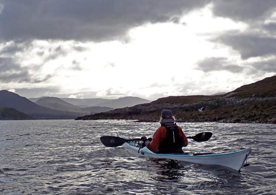
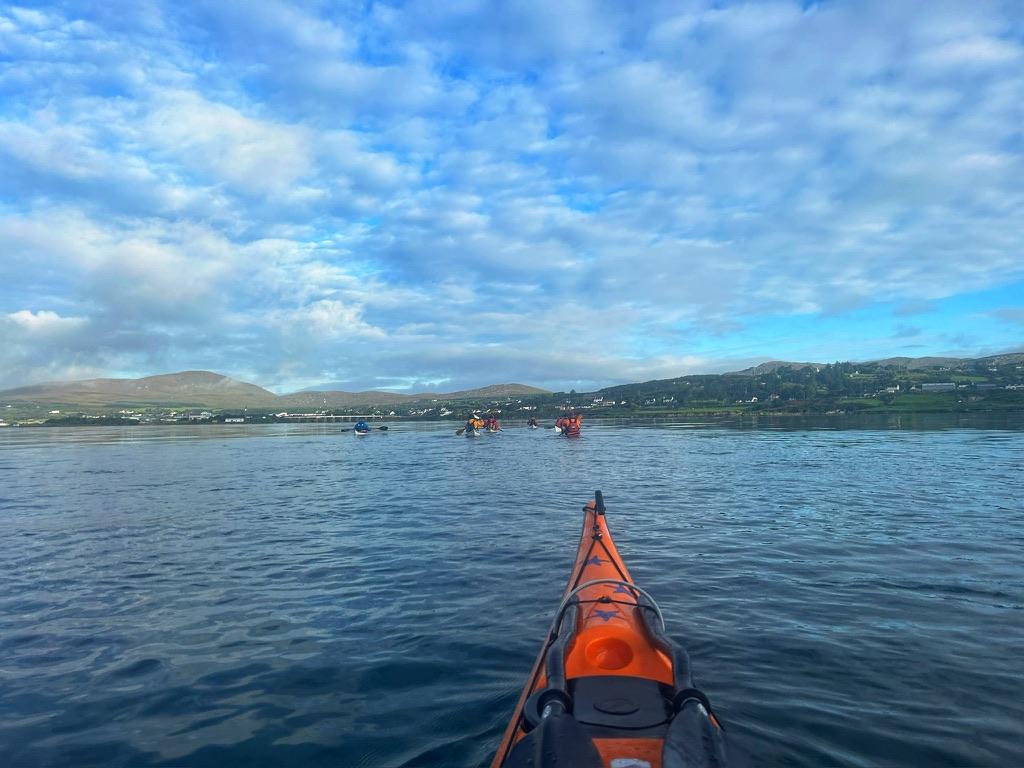
This year
the Celtic Sea Kayaking trip headed for Ireland. We were fairly flexible
and would head to the part of the coast that offered the best conditions for mini
sea trips camping out of our boats for 2,3 and 4 days at a time. The original plan was to head to Galway and
paddle a large section of the Connemara coastline. The conditions proved to be a little more
testing this year compared to the previous 3 summers with large stable
high-pressure systems stationary over most of Scotland during the late summer.
|
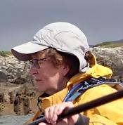
Chris Bolton |
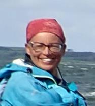
Debbie Hughes |
Frankie Annan |
|
|
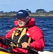
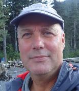
Ian Bell |
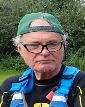
Andrew Garland |
Catriona Hare |
|
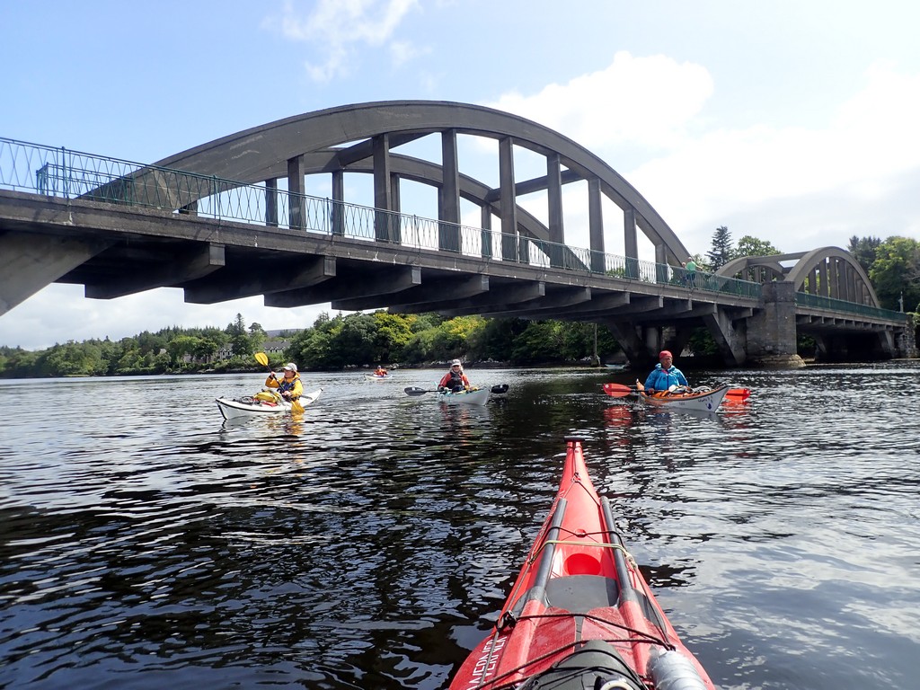
2023 LCC Celtic Sea Kayaking Trip Day 01 Saturday - Keith -
Ferry to Dublin
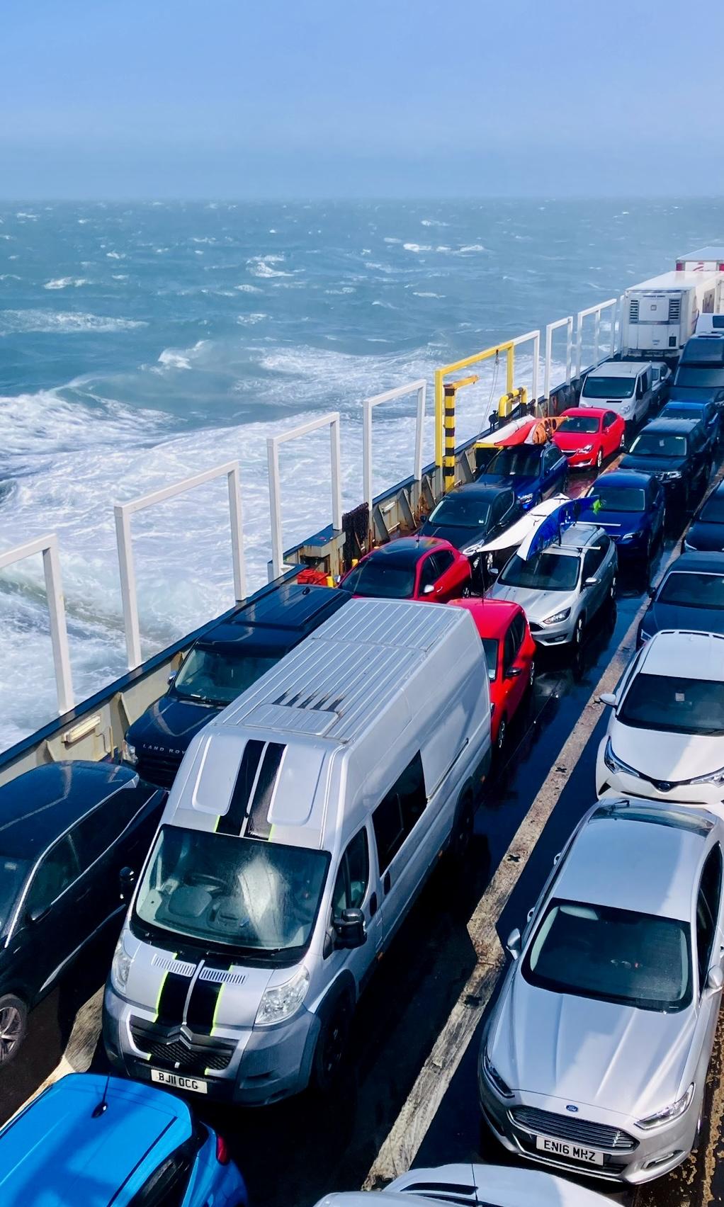
We left Bootle docks on Saturday morning aboard the Norbank. This was a roll-on roll-off ferry that was
designed for commercial lorry traffic and had about 100 cabins with en-suite facilities (which Frankie made good use of).
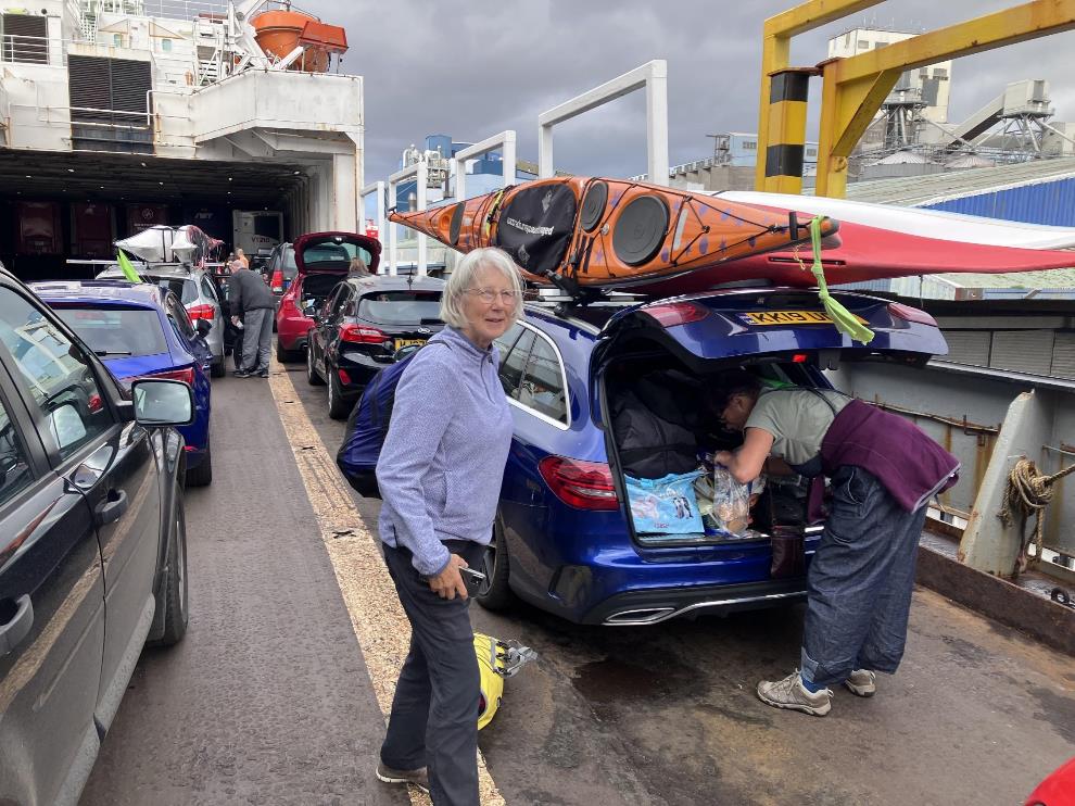
We were dreading the crossing as the forecasted storm Betty was
due to hit Ireland on the Saturday evening.
Storm Betty was due on Saturday, and we were
dreading the 8-hour crossing but it turned
out to be better than we first thought. Three complimentary meals were
provided with the tickets which turned out to be of a very high quality.
Andy was always first to the restaurant and then first to the bar when it
opened after the meal service. The storm waves
even gave the three cars a free wash every time they crashed over the open
car deck.
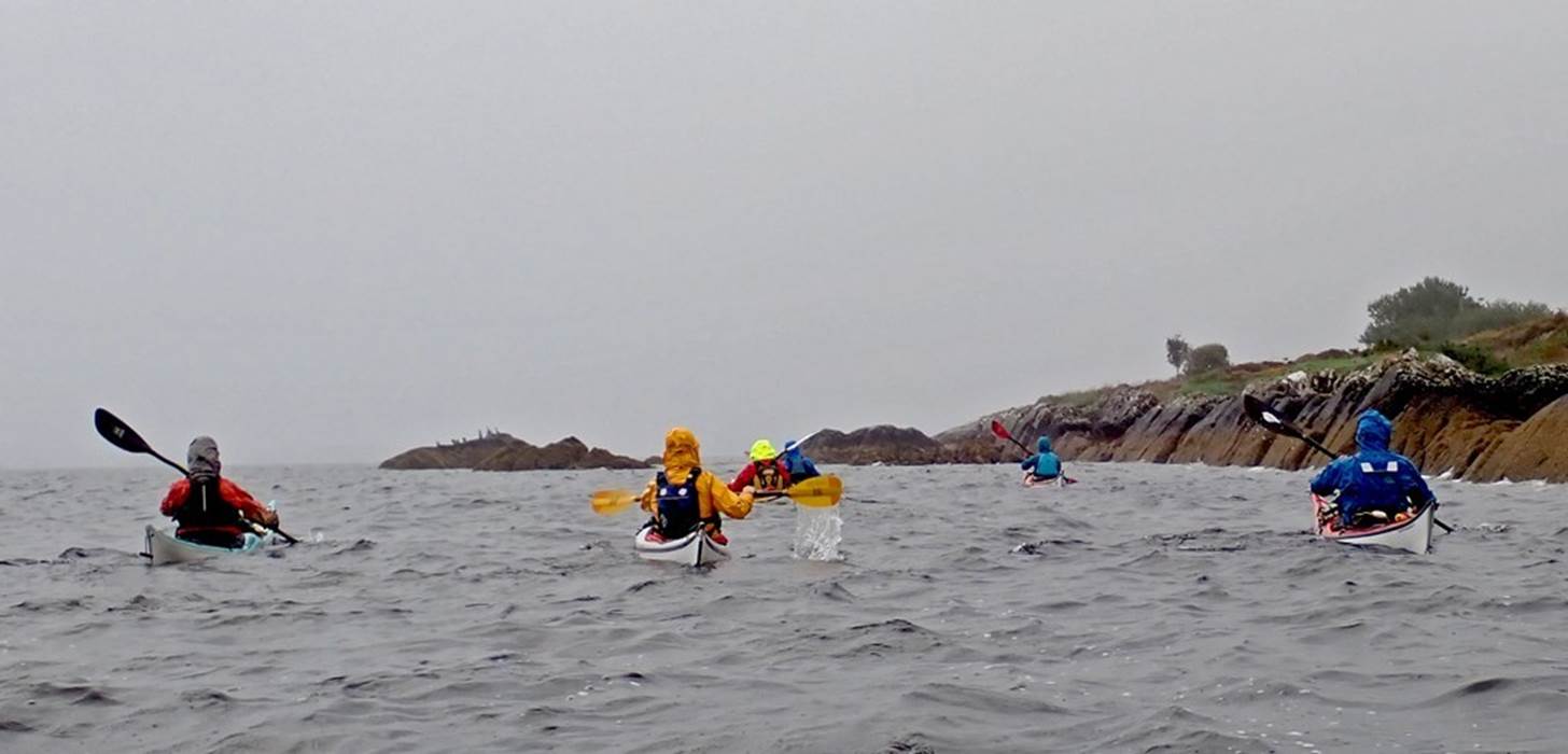
With strong winds from Betty forecast to remain into Sunday we
decided to opt for plan C and headed for a very nice campsite (https://www.camacvalley.com/)
on the edge of Dublin to reformulate our paddling plan in the light of storm
Betty.
Click
or tap for more photos……
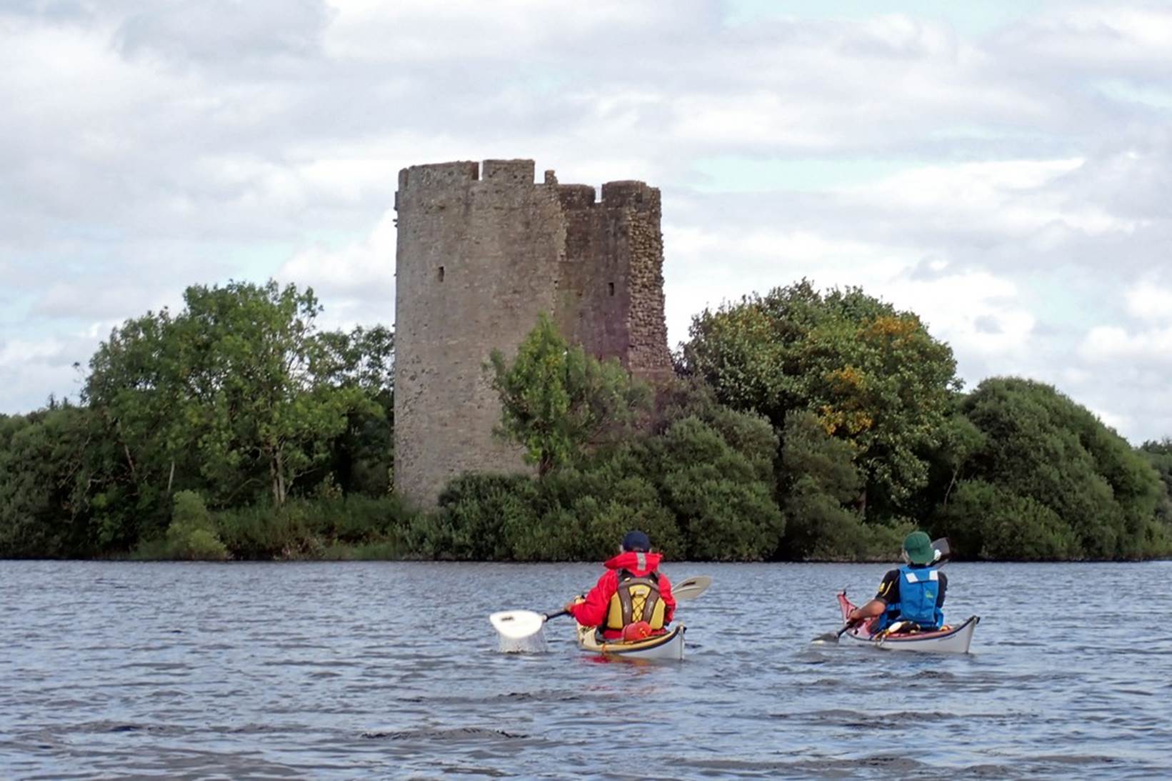
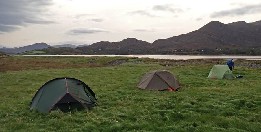
2023 LCC Celtic Sea Kayaking Trip Day 02 Sunday - Lough Oughter, Row Campsite - Lough Oughter
Castle Island - camp opposite Inishmore Island by Frankie A.
The plan made the night before (by Andy as he was
in charge) was for an inland overnight trip on Lough Oughter.
The lough is a complex of lakes in County Cavan covering 22,000 acres, which
have been described as the “best inland example of a flooded drumlin landscape”
in Ireland. The system links to River Erne and Upper Lough Erne. Within the
lough Clough Oughter Castle stands on a tiny island
and dates back to the 13th century. This would be a
destination providing more sheltered paddling compared to heading immediately
to Galway.
The decision was made to leave the Dublin campsite
about 9am to go to the nearest supermarket to stock up on essential food items.
The rules about bringing food into Ireland meant a lack of cheese, corned beef,
chorizo and other essential items amongst the group.
Google informed us there was a Tesco a few minutes away
so we headed there and the LCC equivalent of supermarket sweep then took place,
sadly for some members of the group there was no corned beef to be found.
Shopping done, our destination point was shared by Keith (Row campsite) via
google maps and off we went.
Team blue Mercedes departed from the car park
first, turn left said Google maps, Keith turned right and drove around back
into the car park, much to my amusement.
The other 2 cars followed. Minor driving directions mishap over we
journeyed through beautiful countryside to Row Campsite, where Sean, the
campsite owner, had no problem about us leaving our cars parked overnight and
us making use of his campsite facilities.
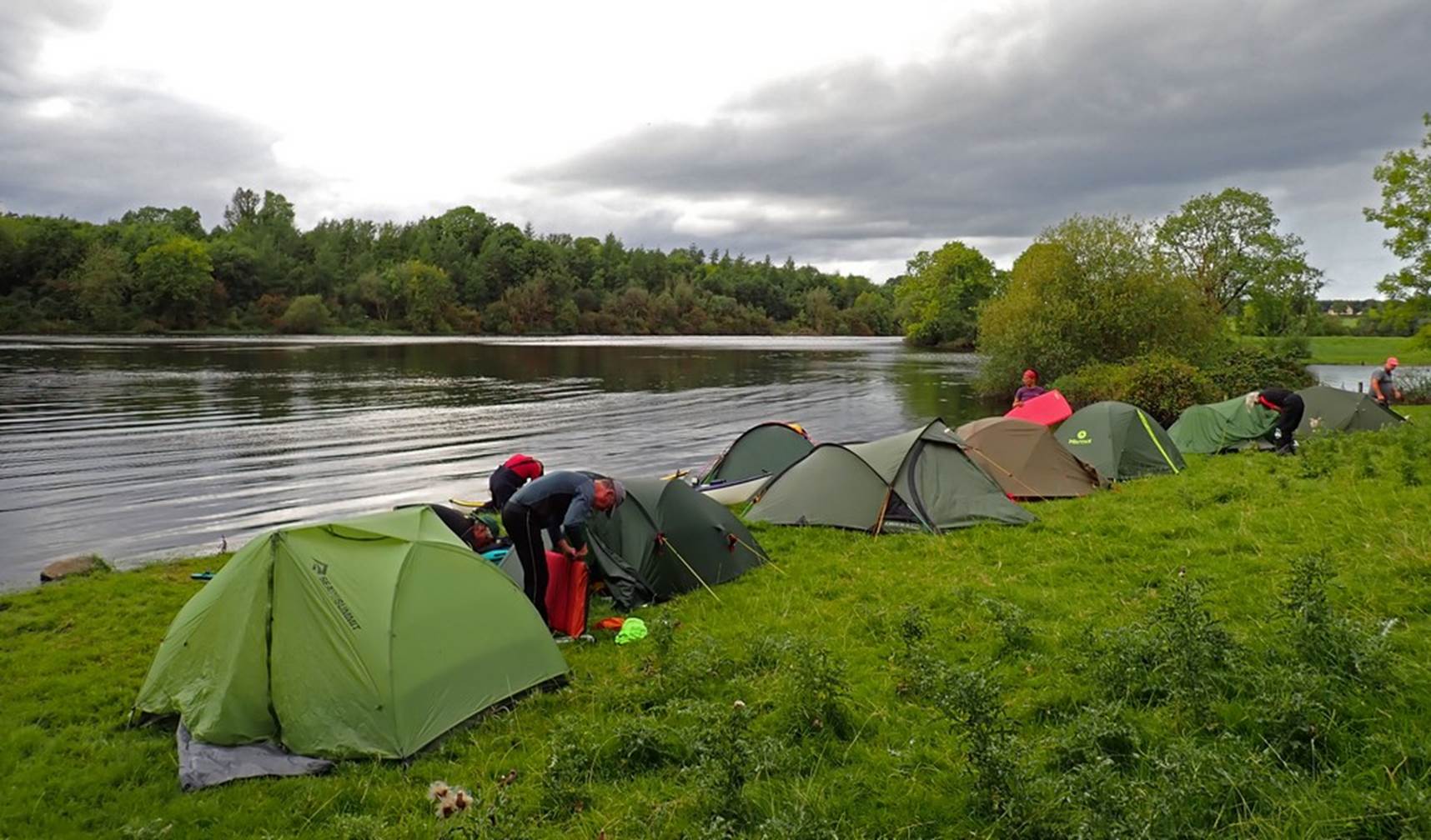
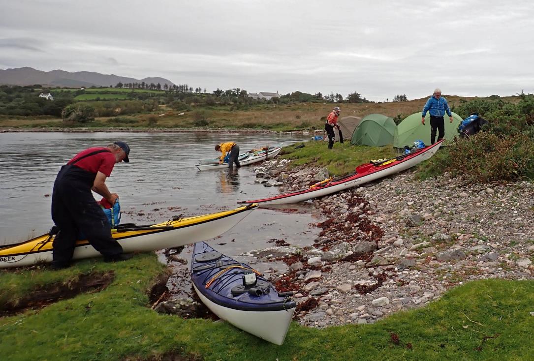
A one-night trip meant plenty of space in the
boats, which were packed in the rain. Our plan was to head
first to the castle on the tiny island and then onto a campsite opposite
Innishmore island. It was windy, we paddled into the
wind, the scenery was possibly not appreciated as much as it could have been
due to the effort of paddling into the wind. Navigation through the lough and
river system was done purely by google maps. At the castle we jumped out of our
boast to explore the ruined castle tower and consult the phones for the maps
for the route to the likely camping spot Keith had identified.
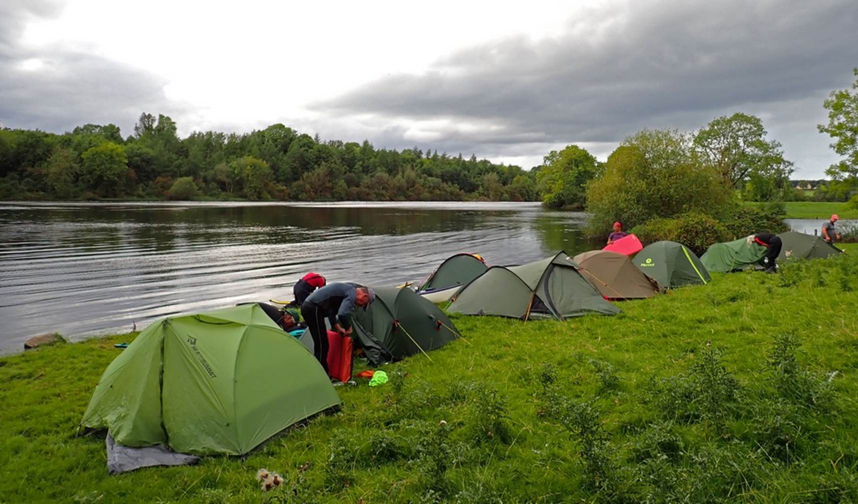
We paddled on through the lake and river system,
there was some moving water and yet more wind. The identified campsite was
reached and examined but due to the proximity of houses it was decided we had
passed a better spot a few 100m back. The grassy bank had just enough area for
8 tents, and Debbie (the expert on all things cows) and Catriona went for a
short walk to check we wouldn’t be invaded by local livestock. The all clear
was given and we settled in for the evening. We all managed to cook and eat before
the evening rain shower sent us all seeking the shelter of our tents. As the
rain stopped, the more hardy lovers of a drop of a
malt gathered for the first evening dram of the trip.
Click
or tap for more photos……
2023 LCC Celtic Sea Kayaking Trip
Day 03 Monday – Last day on Lough Oughter by Andy Garland
The day
dawned clear and bright, but there was still a stiff northerly breeze. This deterred the midges, but it would
provide a tiresome headwind for our journey back to the cars at the Row
campsite. However, despite the headwind,
the planned distance for the day was relatively short, only about 10km. I therefore persuaded the group to extend the
trip slightly by making a circumnavigation of Inishmuck
Island. This would add around an extra
4km to our paddle and provide a bit of variety.
The
first 500m of this bonus excursion went very well on sheltered water in a bay
fringed with pine. The next 500m was
equally pleasant, as was the 500m after that.
However, we then came to the point where we were meant to pass under a
bridge, clearly marked on the map, that linked Inishmuck
Island to the mainland. It immediately
became obvious that at some point in the past, a nincompoop engineer had
misread the design drawings, and instead of building a bridge had constructed a
causeway. Honestly, the incompetence of
some people is astounding. As we
couldn’t paddle over a causeway, and as a portage would be the height of
embarrassment, we had no other option but to retrace our steps (or rather
paddle strokes).
We
were soon back to our starting point (!) and continued south (passing under a
bridge that actually existed at Carratraw!, paddling against the wind to Cloughter
Castle. Shortly afterwards we made a
somewhat awkward landing to access a picnic area to take ‘Elevenses’. While taking a short walk I came across 2
boat ramps which would have made for much easier egress. Unfortunately, we had not seen them from the
water as an inept engineer had obviously put them in the wrong place.
Catriona
and Ian paddling under a bridge that actually existed.
Once we
were fed and watered, we made the short journey to our vehicles parked at the
Row campsite. On the way we once again
passed under a bridge that existed. I
think that the person who had mistakenly built a causeway to Inishmuck Island must have got such a rollicking that they
were very careful not to make the same mistake twice.
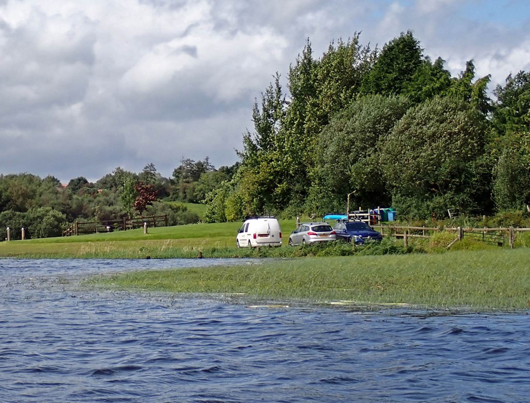
It was
not long before we were reunited with our vehicles. We were somewhat relieved that they were
still on dry ground, as they had been parked close to the water’s edge and we
were slightly apprehensive that the lake level would rise while we were away.
Click or tap for more photos……
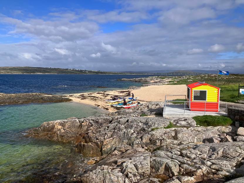
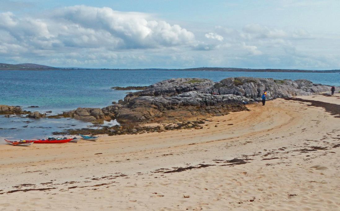
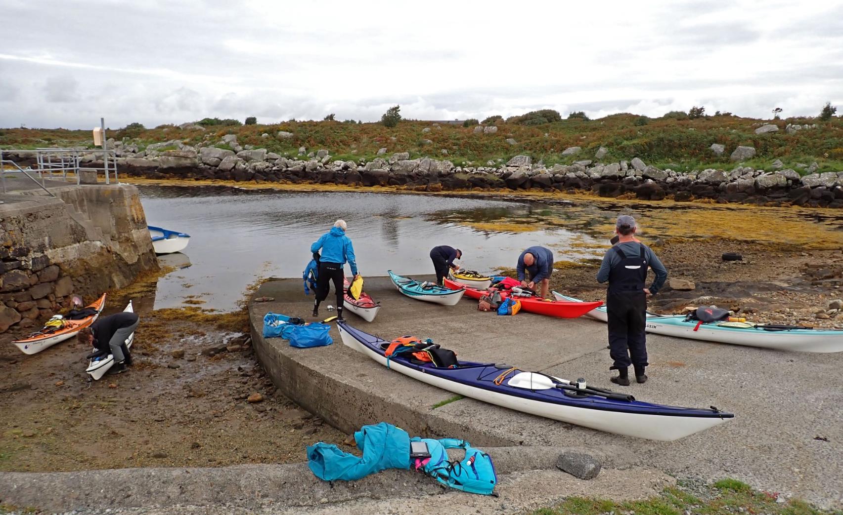
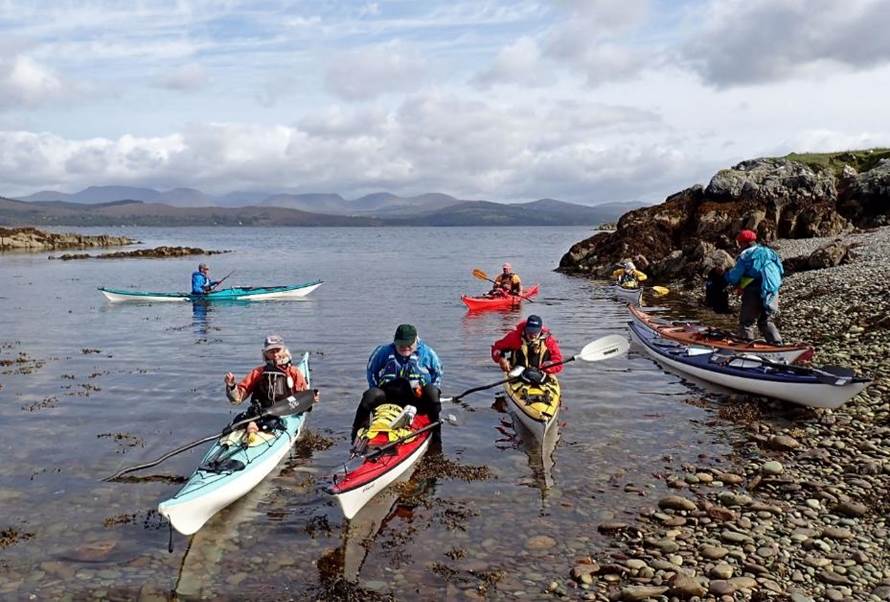
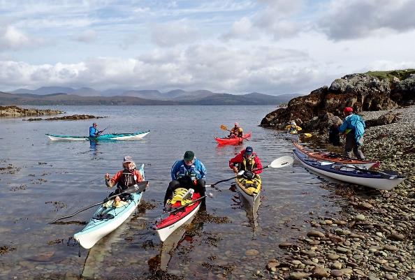
2023
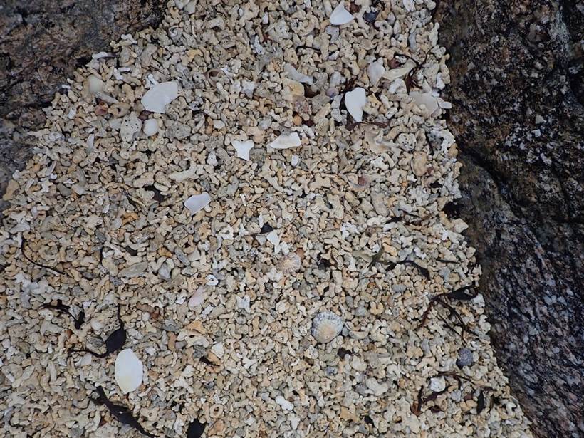
LCC Celtic Sea Kayaking Trip Day 04 Tuesday Connemara Coral Strand - Quay
campsite near Mucklinagh Rd by Gary Bunting
Day 4 started with packing up the tents and a short
drive from Salthills Campsite to the get-in at Coral
Strand. This was a beautiful coral
beach, with public toilets and a lifeguard hut announcing, “for assistance
knock and stand back”. The door opens
outwards!
|
|
The beach was coarse bits of coral washed up by
Atlantic swells |

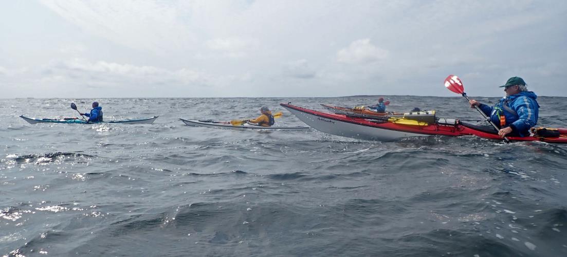
After
loading the boats for 3 (or possibly more nights) we paddled northwards up the
sheltered Greatman’s Bay. Although we had ‘sunny
spells’ it was still moderately breezy, reaffirming the decision to paddle in a
sheltered area. Past another inflated aquatic obstacle course / bouncy castle
and Inchamakinna (island) then across the bay with
some choppy water to pass under Bealadangan Bridge.
Getting under the bridge required a bit of eddy hopping as the tidal flow was
against us, followed by ‘late elevenses’ / early lunch.
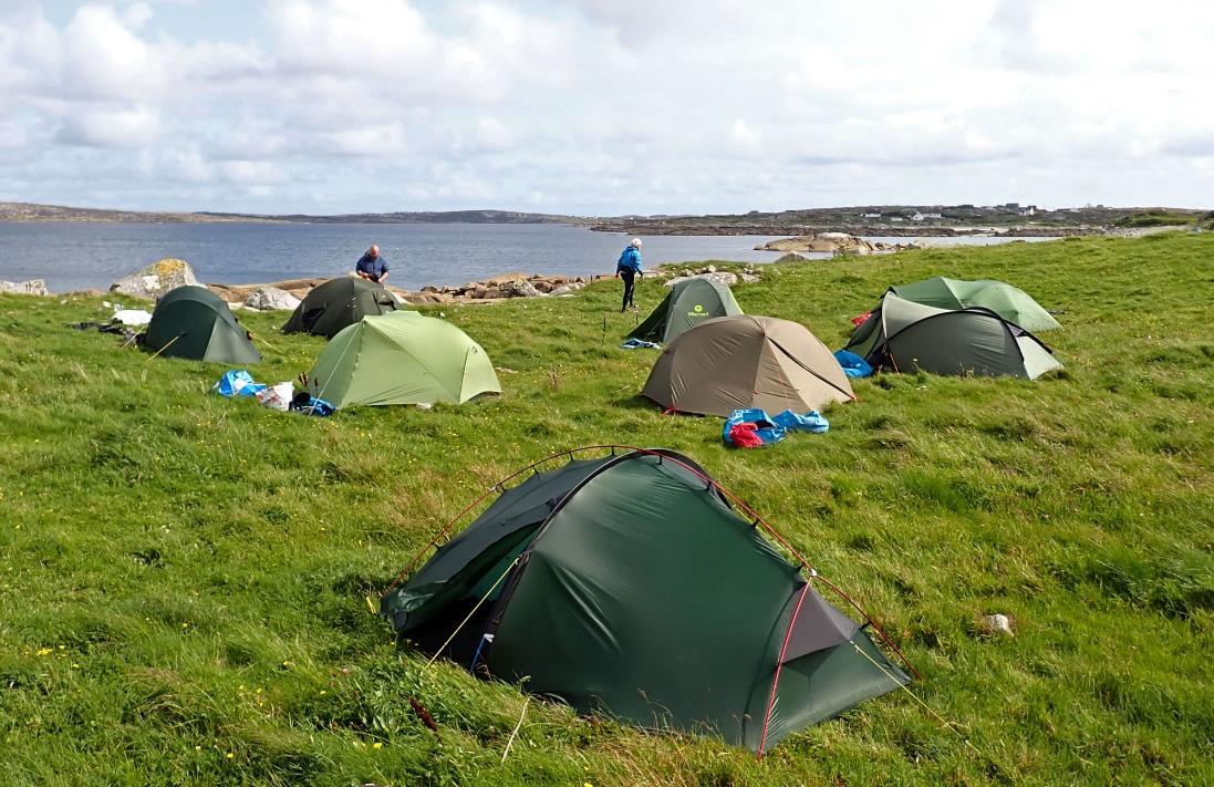
Then
on east into Camus Bay, with spectacle views across the bay and foreshore to
the Connemara hills. After
unsuccessfully exploring a small, and tussock-covered, island as a potential
campsite we moved onto a quay near Mucklinagh Road.
There we set up tents on assorted sloping or flat pitches, one of which proved
to be rather temporary as it was soon covered by the rising tide –
necessitating a rapid move by the occupant.
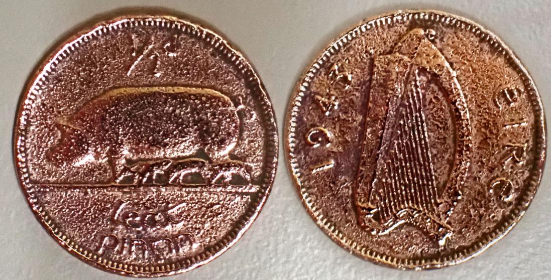
We found
some old coins, corroded to black, by the slipway on the first night away in
Galway. I've cleaned mine up, 1943 Irish Halfpenny
Click or tap for more photos……
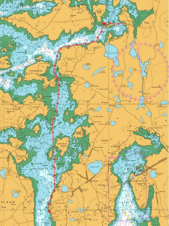
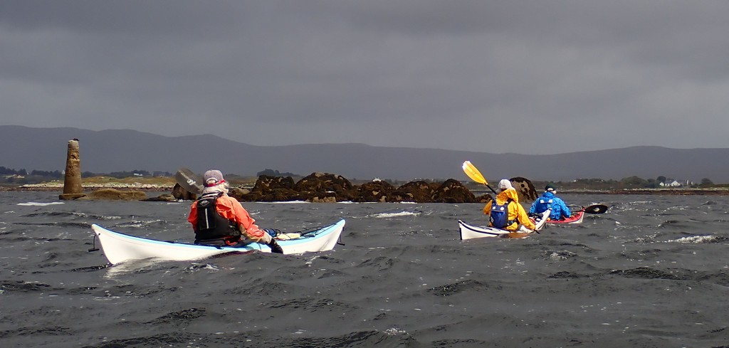
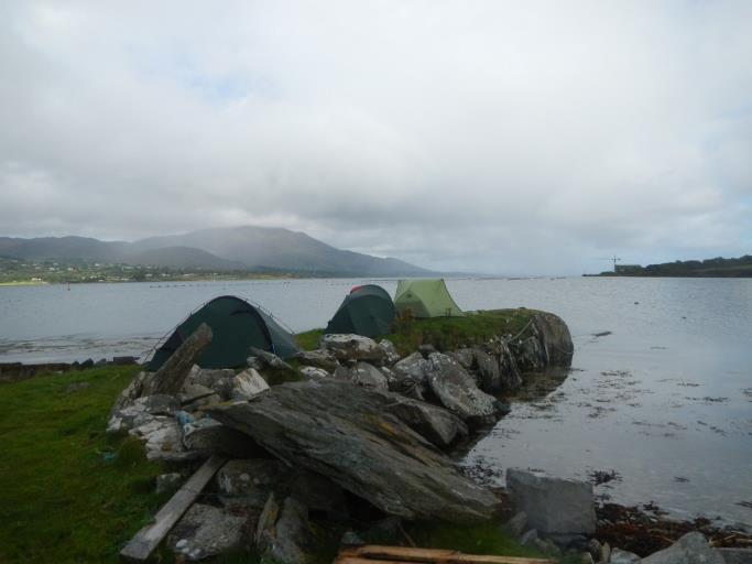
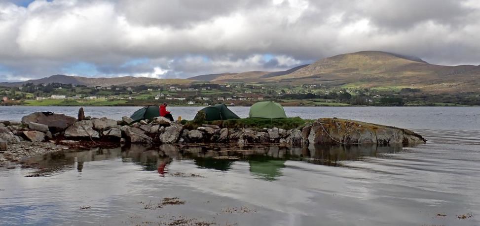
2023 LCC Celtic Sea Kayaking Trip Day 05 Wednesday – Mucklinagh Quay to Dinish Island
by Chris Bolton
The day started with discussions about how far the tide had
reached last night: whether the boats would have floated if they had still been
beside the slipway rather than on it, and how far underwater Chris's tent would
have been if he hadn't moved it (about 0.5m).

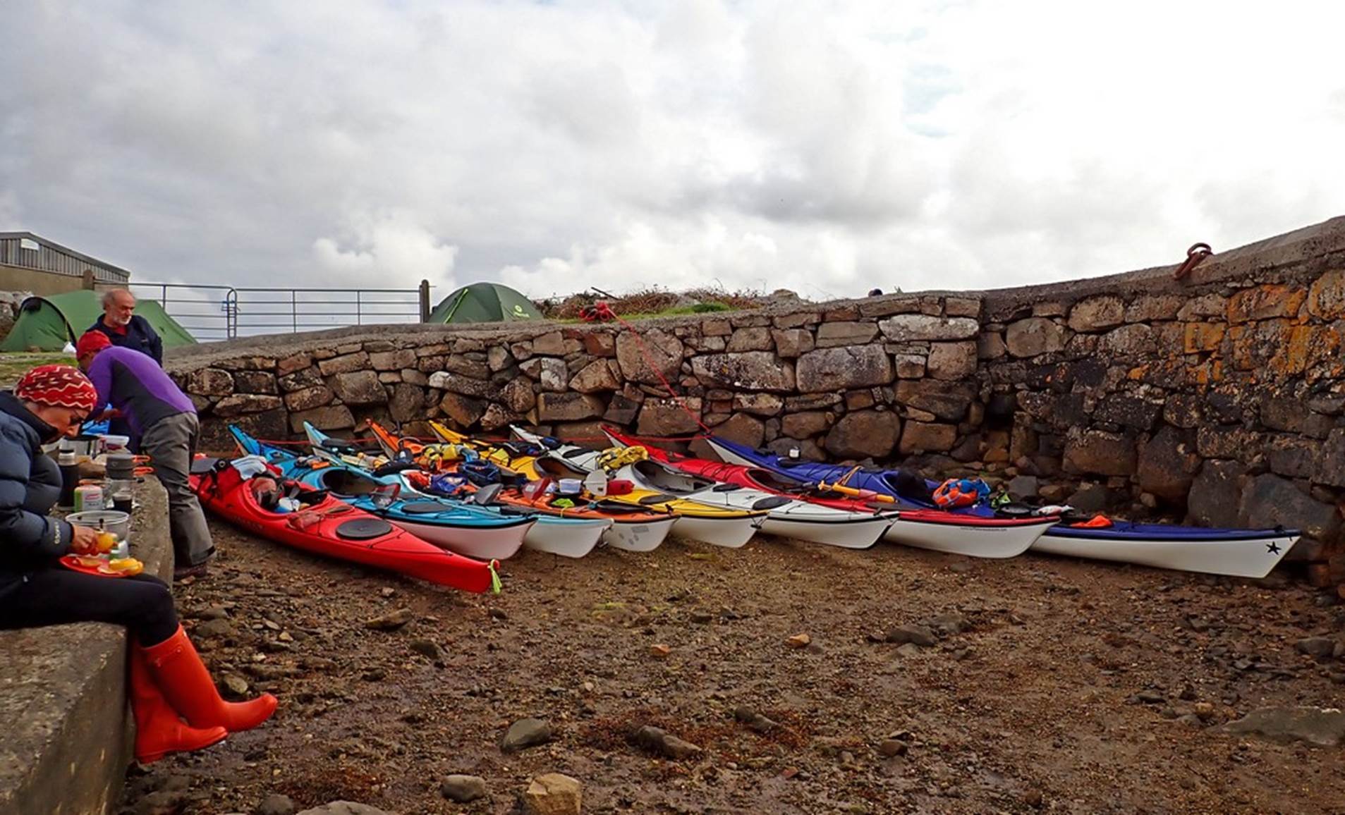
Packing on
the slipway, photo by Chris
Most boats were moved back off the slipway for launching,
as it was very much living up to its name. We were on the water for 8:30, and decided to not to explore the shallow bay to the
North. Apart from it being a somewhat grey and uninspiring morning for
exploring, we didn't know what sea conditions we might find nearer the mouth of
Kilkieran Bay, so the promised 5
star campsite with sandy beach might not be reachable, and time in hand
might be useful.
We chose the wider southern entrance to exit the bay. The
tide still had about 2 hours to flood, so working our way along the eddies at
the gap was interesting, particularly for those less familiar with moving
water. We continued along the North shore, keeping fairly
well in to avoid both the tide and the wind that were running against
us.
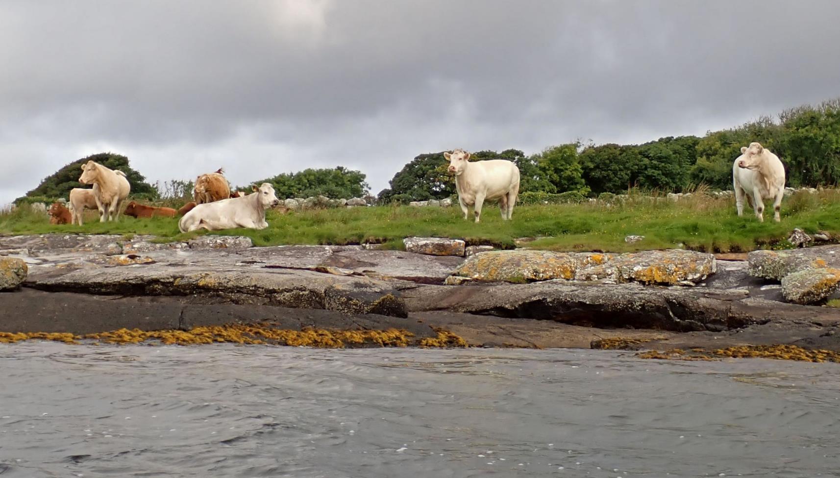
Our first possible stop was Garrivinnagh
Quay, 5km from the start. When we reached it, the harbour itself was only
suitable for larger boats, with high quays and no beach. Just past it, there
were rock slabs, but breaking waves would make landing awkward. More
significant were the cows, which were neither small nor far away. So we continued (at only 9:30, it was a bit early for
elevenses anyway).
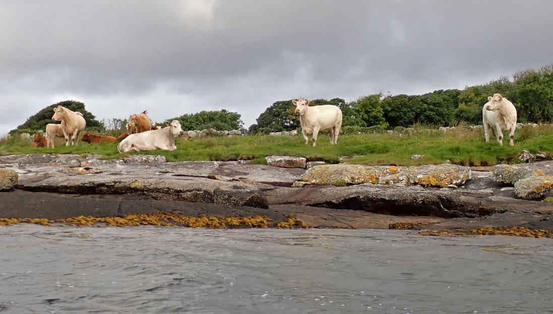
Cows, photo by Chris
Before reaching a suitable stop, we were hit by a very heavy
rain squall, resulting in a pause to put hoods up for those who prefer them,
but was soon past.
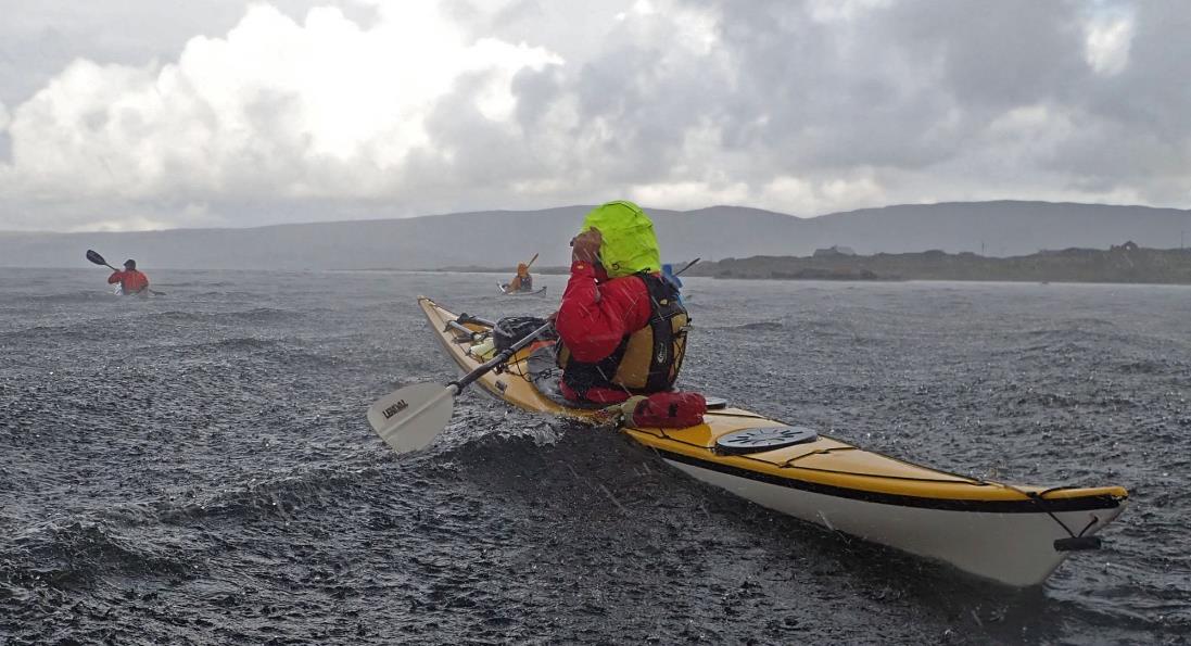
Rain, photo by Keith
There was another quay, and slipway, at the end of the Roskeeda peninsula, but it was tucked in behind Dog Island
and away from our route, so at 10.15 we landed on rock slabs on the lee side of
Greeve Island. We continued West to reach the shore
and followed that South to Kilkieran Quay. This is a
commercial quay with fishing boats and warehouses. Moored off the quay were
half a dozen traditional sailing boats, which we found out were Galway Hookers,
used to carry turf when that was the main fuel.
As we rounded Kilkieran Point we
could see, in the distance, a sandy beach. This was our planned lunch stop. We
could also hear seals singing, although we didn't see them. It was about this
time that some members of the team discovered a common appreciation for the
Hitchhiker's Guide to the Galaxy, to the probable puzzlement and annoyance of
the rest. The comparative lack of wildlife was an oddity, being used to the
West coast of Scotland.
Passing Kilkieran Point, photo by
Keith
The sandy beach was everything we'd hoped for, with rocks
to sit on. The weather had improved, so we took an hour for lunch, watching
some locals with an SOT using a trolley to take it to the top of the beach
then, for some reason, carrying it down to the water.
Lunch beach, photo by Gary
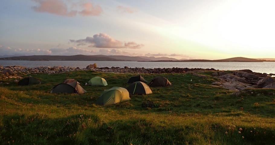
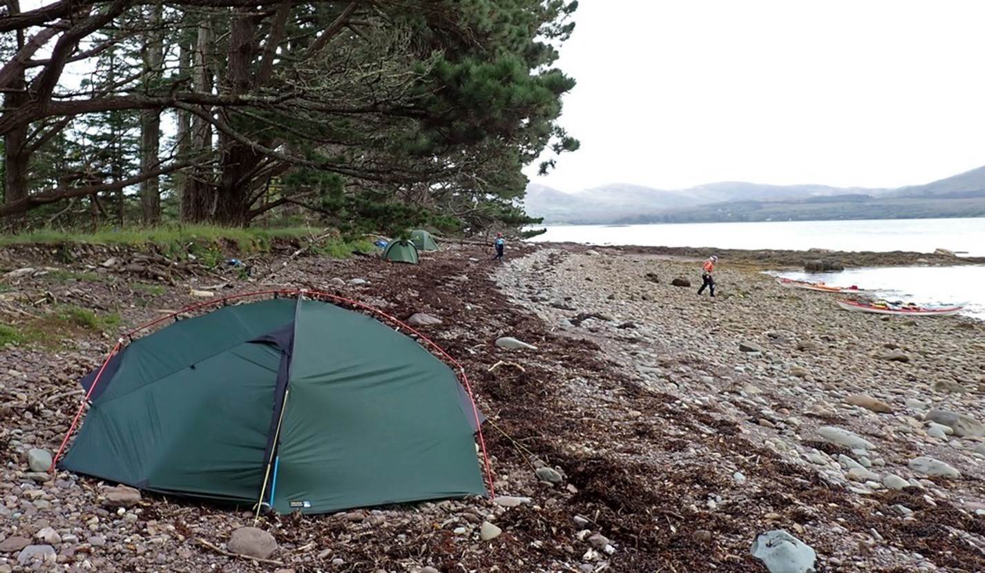
The next stage was the crossing to the island where we
hoped to camp. This was exposed to the wind and swell from the SW, so the plan
was to do it in stages, first to behind the small island of Illaunmaan,
then onwards to Dinish Island.
While the wind was pushing us NE, there was about 1kt of
ebb tide going SW, so getting into the lee of the island required a bit of
planning.
Crossing to Illaunmaan, photo by
Keith
After a short break, we carried on, the getting
progressively further out of the wind and tide, getting a clearer view of the
beach we were heading for and avoiding the fish farm. There were several houses but they didn't look occupied and were at the
opposite end of the beach. There were a few (far away) cows but Debbie having
been a farmer was able to assure they they wouldn't
bother us.
The beach was clean sand and the
campsite was flat grass with plenty of space. On the seaward side there was a
huge wall of cobbles thrown up by the winter storms, providing shelter to the
camping area. Some of the stones must have weighed 200kg, showing the immense
power of the waves. While we were cautious of the exposed coast, it could
clearly get much worse!
Five-star campsite
After a peaceful evening, with only a light shower, we
retired to our tents to contemplate the paddling options for the return to
Coral Beach.
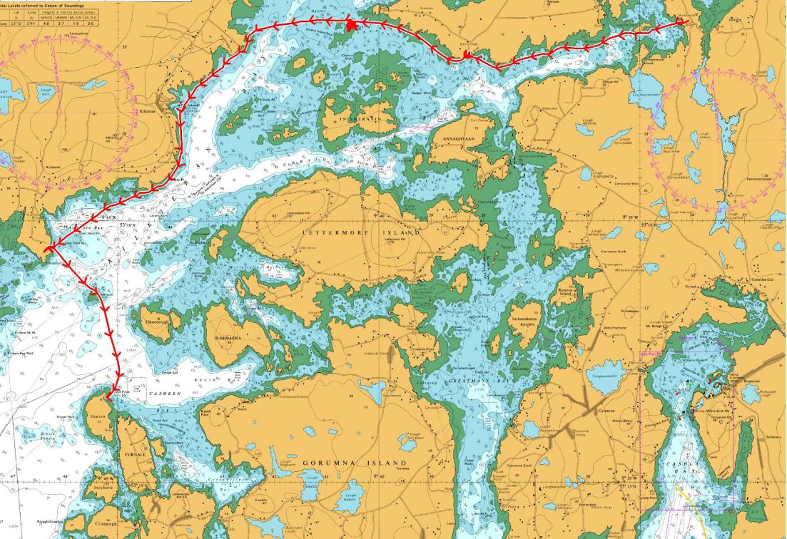
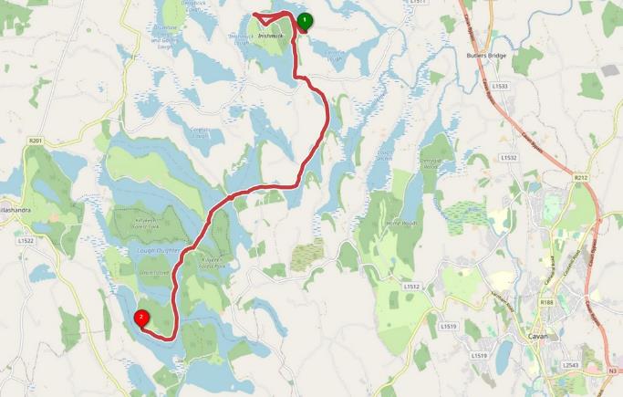
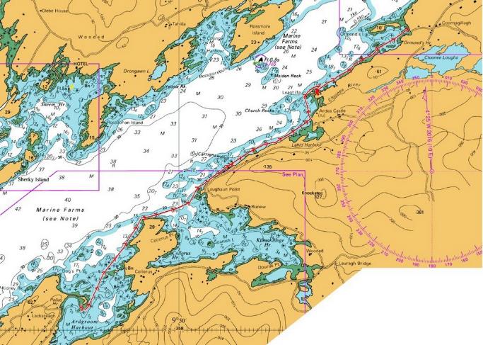
Map of Day 6
Click or tap for more photos……
Day 06 Thursday - Connemara Furnish Island to Coral Strand by
Ian Bell
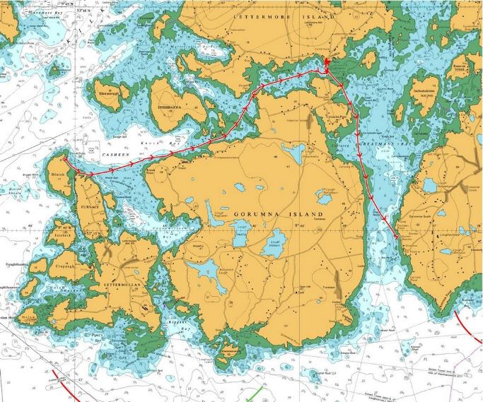
We awoke with a wonderful sunrise and wished Debbie happy
birthday. We had been watching the
forecast for a few days and the winds were due to increase and the swell was
due to build so the group took the safer option of paddling inside Furnace, Lettermullen and Gorumna Islands
to return to Coral Strand and the cars.
Given the weather patterns over the next week we had also decided to
head South and try to miss the series of depressions that were due to track in
and over the North of Ireland and into Western Scotland. In this way we would hopefully get more
paddling.
We carried the boats down the silver sand beach and left
the 5-star campsite at Furnace beach and paddled out across the bay with a
freshening wind. There was a short
discussion on the exact compass bearing to head on before heading out across
the bay. We wound our way past a few
Salmon farms and towards a group of islands and shallows. The tide was flooding into a middle bay (similar to the Inland Sea on Anglesey) and produced a grade
two rapid as it flowed around the rocky eyelets. We had to concentrate for a few minutes until
we made our way safely through the narrows.
Crossing the
sound then presented us with another problem. The tide was now flowing against
us through the connecting causeway bridges and was too strong. We paddled to
the edge to a small beach and took elevenses. Some even walked across to the
local spar shop, others fired up the stoves to have a brew. Before long the
tide had weakened sufficiently for us to continue our paddle back to Coral
Strand. Here we unloaded the boats and packed everything into our waiting cars
efficiently and made preparations for the two and half hour
journey down to the Shannon Estuary and to the lovely Green Acres Caravan & Camping Park
campsite on its shores.
Click or tap for more photos……
![]() Day 07 Friday - Shannon Estuary
Cappa pier around Scattery Island and Hog Island by
Debbie
Day 07 Friday - Shannon Estuary
Cappa pier around Scattery Island and Hog Island by
Debbie
We packed up and left the campsite and headed for Kilrush, a little to the east and today’s launch spot at
Cappagh Pier. Another of Keith`s
excellent choices to stay out of the worst of the wind.
There was a statue on the pier, inscribed ‘Ceapach’, dedicated to the gathering of seaweed along this
coast. Later on,
along the trip we did indeed see a tractor down on the strand line collecting
seaweed.
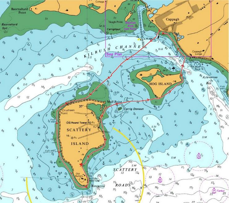
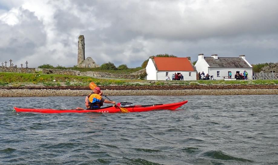
The object of today’s trip was to circumnavigate Scattery Island, (Inish Cathaigh in Gaelic) and then Hog Island. It was quite a
breezy crossing to the end of the island and then we carried on round the far
side. There is a ruined monastery and
the remains of an artillery battery on the island. A ferry from Kilrush
takes tourists across to explore the delights. We passed the lighthouse on the
eastern end and decided it was definitely refuelling
time so stopped for elevenses on the beach not far from the lighthouse.
|
|
|
|
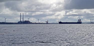
The view was a bit dodgy – towards what looked like a power
station and signs of the industrial estuary. We carried on round the island,
passed under the pier where the ferry had unloaded quite a crowd of visitors,
then regrouped before crossing to Hog Island, again very breezy but we tucked
in by the island and eventually crossed back over to the mainland, and the
final effort back to the pier against a strong head wind. Decided to get off
the water on the very steep slipway rather than battle on round the pier to the
side where we launched.
We packed up and set off for Kenmare Bay, a fair old drive
but with a chippy birthday tea en route, all was
good.
Click or tap for more photos……
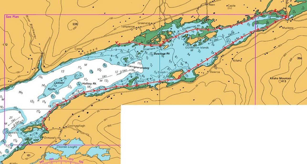
Day 08 Saturday - Kenmore River Coornagillagh
Quay and Beach to Kenmore and Pine Trees at Castle d ChodenTeddi
by Catriona
We woke up to a beautiful morning for the first day of our
next mini adventure, or wind avoidance strategy.
Well, we had no head wind for some of the day. We left the
quay at a respectable 9:00 and paddled with the tide and the wind northeast
towards the head of Kenmare Bay. Kenmare Bay is the site where mythological
Irish ancestor Partholon is said to have landed. This second group of people to colonise
Ireland arrived from Iberia and multiplied to 4000 in number before all dying
of the plague in one week. On our trip to Kenmare we
left with the same number of people as we started with.
At the head of the river was a modern concrete bridge which
we obviously had to go under, before turning round and heading for second
elevenses near the Kenmare Pier, where the kiosk spied from a distance turned
out to be a ticket office not the hoped for bacon butty van.
After elevenses we paddled round and through the numerous
small Islands on the north side of the bay, by now the head wind was back and
we used the islands as respite, before paddling with no break to a possible
campsite. The campsite did not look very
inviting, lots of rocks and trees, but we decided that we didn’t want to go any
further. The high tide line was determined (much more accurately than earlier
in the week) and after some minor civil engineering flat pebble camping
platforms were made and tents erected. This turned out to be a very comfortable
campsite and a lovely night suitable for another intelligent discussion over
whisky.
Click or tap for more photos……
Day 09 Sunday - Kenmore River
Pine Trees at Castle d ChodenTeddi to surprise cove with the swing
by Ian B

Despite
the wind during the night we all enjoyed a relatively
sheltered night thanks to the pines which surrounded our overnight campsite at
Castle d ChodenTeddi.
We were early on the water just as it started to rain. We donned our sea touring hoods and set off
heading West. We passed the Castle and
little harbour heading towards the possible campsites from the evening
before. We definitely
made a good choice to stop where we did as each of the options were
pretty poor.
We
tried to hide from the worst of the weather by ducking between each of the
islands and explored very narrow channels.
The first at Rossmore Island was only just passable at half-tide by
kayaks. Chris managed to pole his way
through the narrows and under the low arched bridge connecting the island to
the mainland.
We
paddles across a bay, Coongar Harbour and had
elevenses (Early lunch) at an idyllic sandy bay on a peninsular of land (Brackross) with a lovely house and pontoon. It would have made a great campsite, but the
beach was obviously man-made and the grass path behind had be mown recently to
produce a lawn / path to the beach.

We
paddled on towards Parknasilla (a large golf and
upmarket holiday resort). We found a
narrow passage and another arched bridge over a channel which saved paddling
around the exposed end of the island.
The castle and hotels were packed (well a handful of people on every
beach). There was a very large sandy /
swampy flooded river valley at Parknasilla which was
best avoided as it probably would have been midge infested.
Sharky
Island was away to our left offshore.
Although attractive it did not seem to have an easy landing or suitable
camping as it looked far too rocky. The
proposed campsite by the Rowing club was looking like a big ask and would
involve at least another 3 hours of paddling.
It was now 4pm and around the next corner we happened across a narrow
cleft between the rocks with what looked like a sheltered beach beyond.
Chirs
was the first to venture in for a look.
It proved to be a very sheltered landing, had water supply and a swing
on the beach! It was awarded 5 stars
immediately and it was clear we were staying the night. Camping was on the flat grass above the
cove. The kayaks were tied up on the top
of the beach, tents erected and cooking stuff
transported to the rocks and evening breeze which kept any midges largely at
bay.
The
view from surprise cove was fantastic, the weather had improved, clouds and
rain departed, and we could see across the sound with Sharky Island in the
distance. Although we had not gone as
far as we liked, we were glad to follow the idiom of “never passing up the
opportunity of a 5-star campsite”, (Unless a known one of better quality is
ahead and a certainty)
Click or tap for more photos……
Day 10 Monday - Kenmore River Surprise Cove with the swing to
Rowing Club and then Ardgroom Harbour (spit) by
Catriona
Luckily, we didn’t have any rain overnight, as some of us
had camped in a bog, indicated by the presence of the carnivorous plant,
butterwort. We woke up to a still day which meant the midges were out in force
and we packed quickly (not necessarily efficiently) to escape to the water and
freedom from the wee beasties. I need a pet bat, apparently, they can eat 2000
midges a night, well ok I need several pet bats, or maybe we needed to cover
bare skin in butterwort plants.
We paddled close to the rocky north shore, which was
getting more impressive as we headed towards the mouth of Kenmare Bay, until we
reached a small sandy beach near Cove Harbour, and we had our first elevenses
of the day.
The next bit was quite exciting, as we made the 6km
crossing to the south side of Kenmare Bay. There was lots of quite big side on
swell and as we approached Bridaun Island near the
end of the crossing there were lots of breaking waves. Ian led us through a gap in the waves I
didn’t think existed, and as we rounded the island, we picked up the following
sea. I would say the waves were huge, but I suspect the editor might decide
trip conditions need some reality.
We paddled down the south side of the Island alongside the
most impressive cliffs, caves, and scenery we had had all week.
It was sometime before we found a suitable
place to stop for second elevenses. Then some irresponsible person put me in
charge for the rest of the day. I got a
lot of advice 😊! The sea
state lessened as we paddle further in land and after lots more caves, arches,
tunnels and cliffs we rounded Dog’s Point to Cus spit, where we ptiched for a
comfortable but dreich night.

Click or tap for more photos……
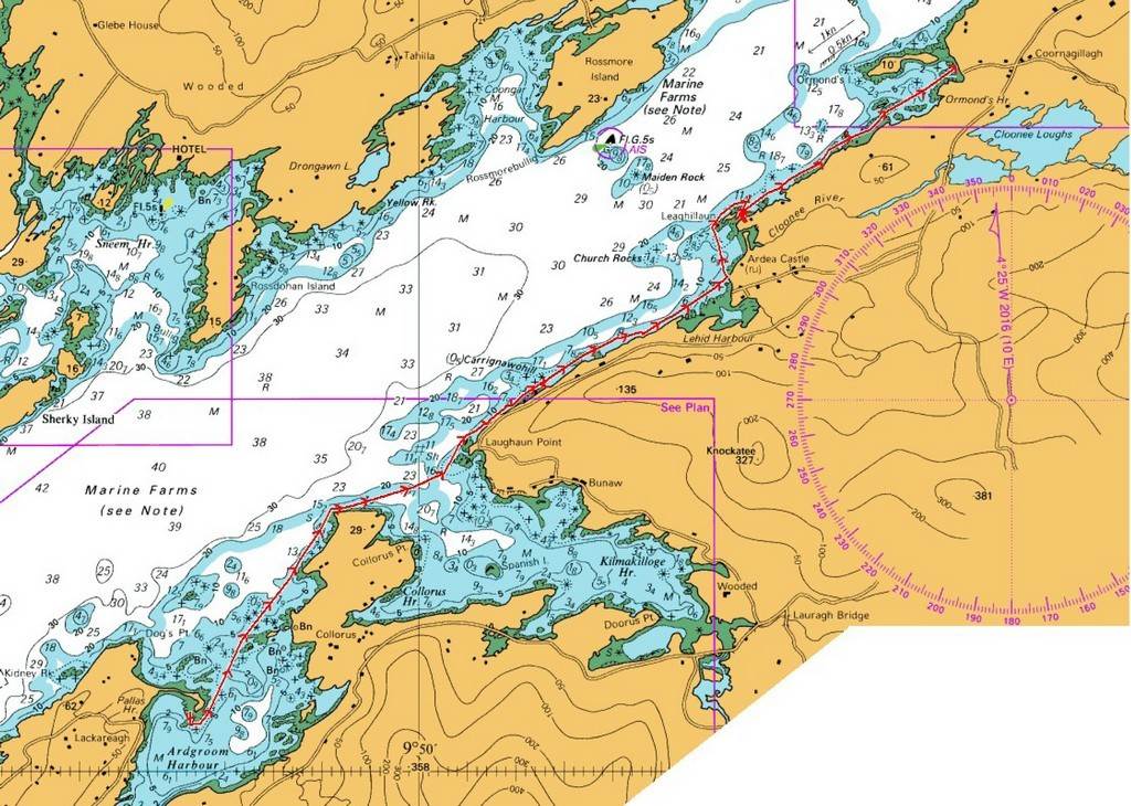
2023 LCC Celtic Sea Kayaking Trip Day 11 Tuesday – Ardgroom Harbour to Coornagillagh
by Andy Garland
We had completed ten days of paddling amongst the wonderfully diverse coast and waterways of Ireland. However, I have to admit that my memory is not as good as it used to be, and each day started to merge into another. The following description might therefore contain some inaccurate recollections. It might also contain some bits that I’ve blatantly made up!
We had
camped for the night on a spit of land that formed a natural breakwater to Ardgroom Harbour.
The day dawned with a bright blue sky (possibly)
and I was soon tucking into a breakfast of scrambled egg and smoked salmon,
washed down with orange juice and freshly ground coffee (or it might have been
a Morrisons Breakfast Bar that had disintegrated in its wrapper, with some
instant coffee – not too sure).

Anyway, we
had soon broken camp and packed everything into our kayaks for the final leg of
our four-day trip in the Kenmare Estuary.
The sun beat down mercilessly as we made our way out of the harbour (or
then again it might have been chilly with a touch of drizzle). Steering a straight course was not easy as we
had to constantly dodge pods of Orca and/or seaweed covered rocks (it was one of the two, but can’t exactly remember).
The views
were superb – to our west lay the Atlantic Ocean, with the Statue of Liberty
clearly visible on the horizon (maybe) while to the north the hills of the
curiously named MacGillycuddy's Reeks rose into the cloud. The MacGillycuddy's
Reeks includes most of the highest peaks and sharpest ridges in Ireland, and
the only peaks on the island over 1,000 metres high (that bit wasn’t made up).

The miles
slipped away easily and the party was in good spirits
because of my endless supply of novel and hilarious jokes (that bit’s
definitely true, probably).
We stopped
for Elevenses at a sheltered beach near Ardea Castle, and the group eventually
allowed me to land as long as I promised not to tell
any more jokes. After a leisurely rest
we carried on to reunite with our vehicles at Coornagillagh Beach.
The boats and kit were quickly loaded onto and into the cars and we set
off on the next part of our Celtic adventure.
Click or tap for more photos……
2023 LCC Celtic Sea Kayaking Trip Day 12 Wednesday – Casteltownbere to Adrigole
Harbour by Chris Bolton
We left the rather good value campsite at Allihies (8 Euros
a night) and drove for half an hour along very narrow lanes
to Casteltownbere. Parking spaces by the harbour were
found, but the slipway was used by the ferry to Bear Island, and we had to get
on the water quickly to be clear of the ramp before it arrived. We managed this
with seconds to spare, despite the distractions of the local pie shops.
We paddled out of the out of harbour, keeping away from the
main channel and looking out for commercial traffic, discussing whether the 'bere' in Casteltownbere and the
'Bear' in Bear Island were pronounced as 'beer' or 'bear'. The consensus was in
favour of 'bear'.
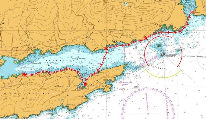
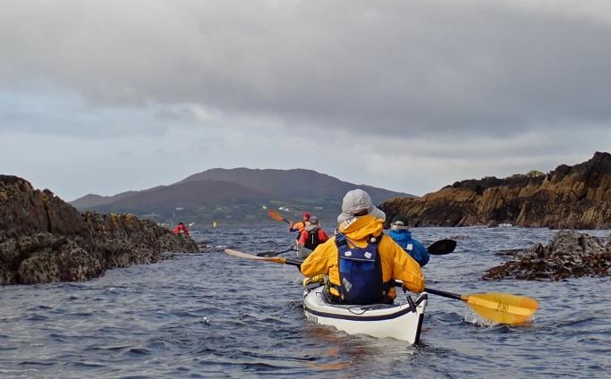
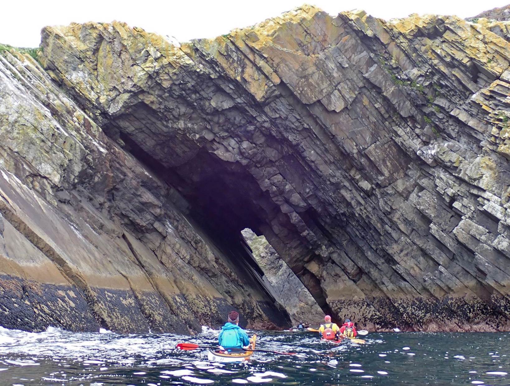
We crossed from Pipers Point to Bear Island and quickly
spotted some interesting-looking cliffs with holes. These turned out to be a
big through cave - and then another back out - and a channel back in. There was
a gap between the last two, with each swell forming a pour-over, sometimes with
a hole on both sides. Keith, in a plastic boat, paddled it neatly from the
outside; Ian in his composite boat considered it from the inside and concluded
that it wasn't really a good risk.

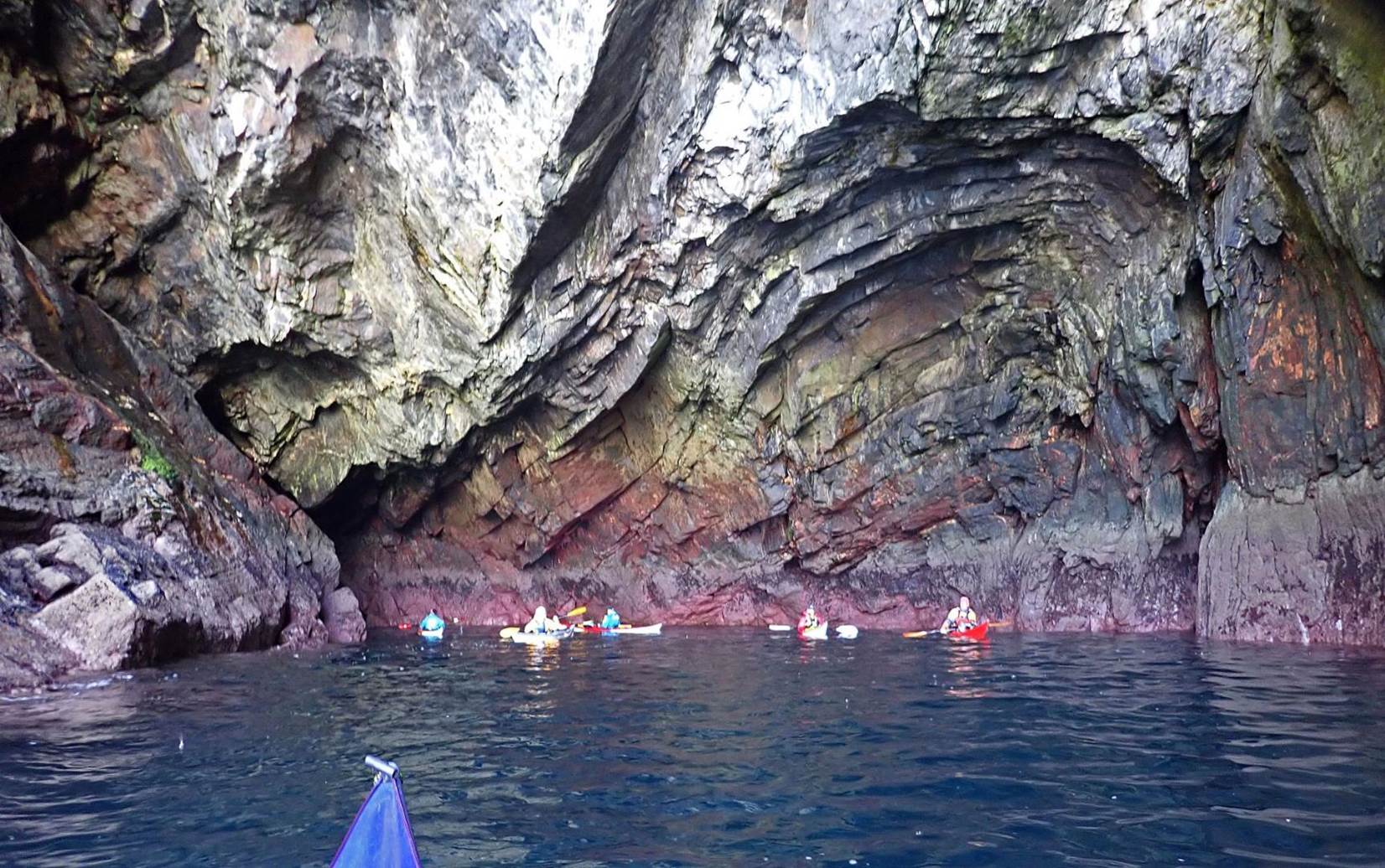
The first through cave on Bear Island
The south side of Bear Island was probably the best
paddling of the trip. We had caves, waterfalls, sunshine
and a favourable tide! There were too many caves to visit - bearing in mind
that we might need to paddle to the far end of the island before landing.
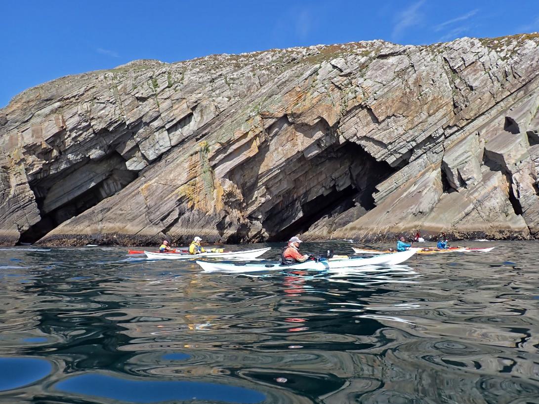
Paddling past more caves on Bear Island
The cliffs were dramatic, and inhabited by some
particularly daring and athletic sheep, one of which appeared to be grazing
while on only 3 legs.
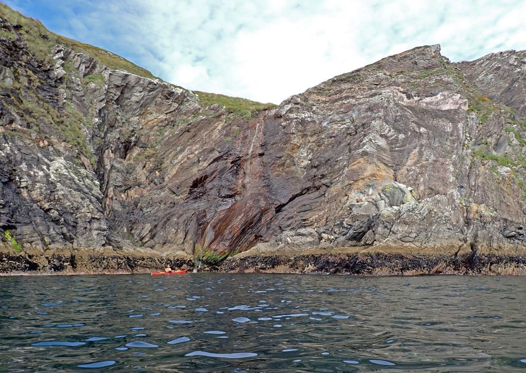
Keith checking out the waterfall on Bear Island
We actually found a sheltered bay,
with narrow entrance, and completely calm pool. Boats were parked in the weed
or moored to boulders, and a late elevenses or lunch was taken.
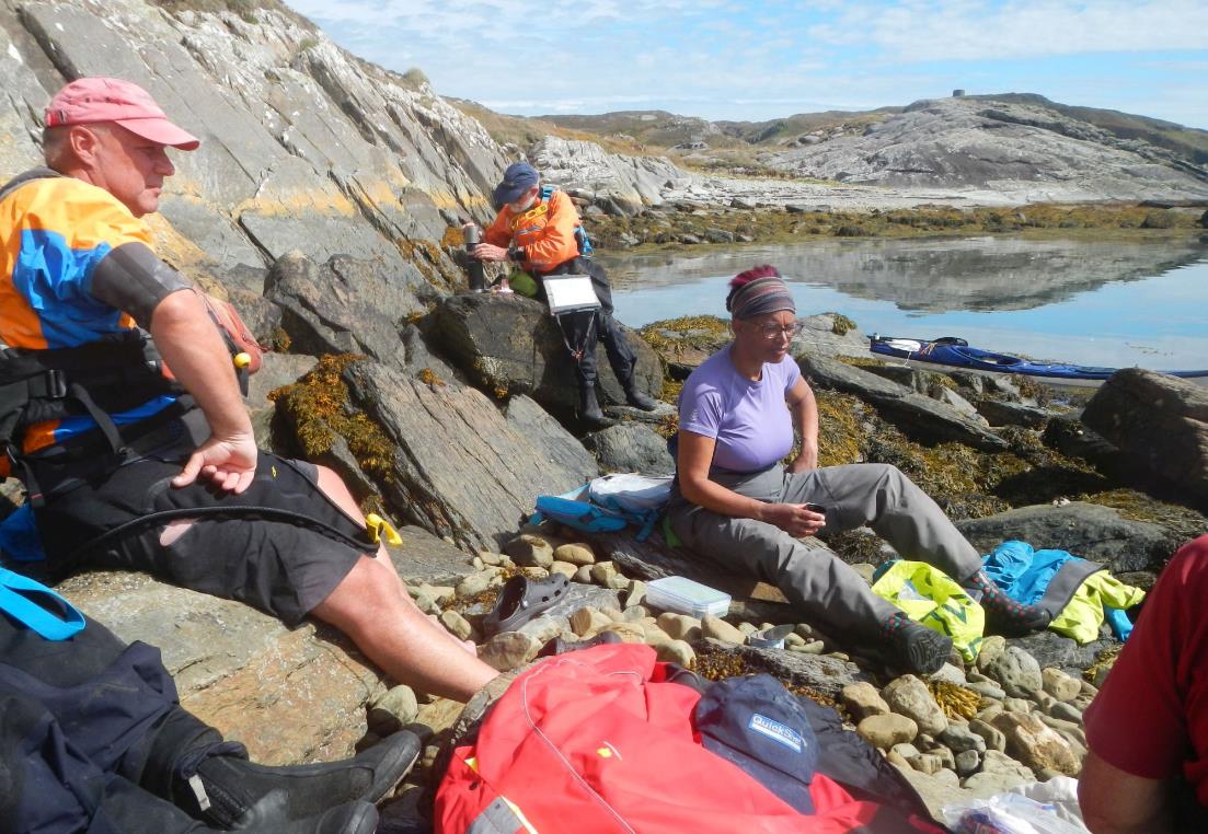
Lunch stop (photo by Gary)
Now that we'd had a break, we could explore more caves, and
they were even more impressive.
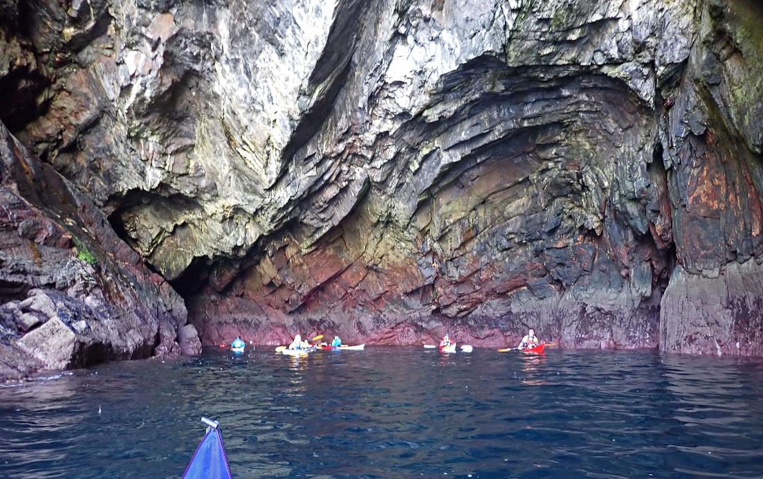
A very large cave on Bear Island
We passed the rifle range which appeared to be out of use,
but decided it wasn't necessarily a useful campsite. Passing the end of the
island, with the tide now pushing us along at 7kph, we reached Perch Rock, with
a South Cardinal top mark, then the Carrigavadra buoy
with an East Cardinal. These were followed by the Roancarrigmore
lighthouse, now disused. Apparently, it's possible to camp in the walled area,
but the landing didn't look inviting, and the camping would have been on a hard
surface.
The entrance to Adrogole Harbour
wasn't obvious from the lighthouse, but we identified a field to head for at Bulliga Point with white dots in it (which Keith correctly
identified and counted as 29 sheep). We did some nice rock hopping along the
coast from there to the bay. It looked possible to camp; Chris landed to check
but the landing was poor and ground was scruffy.
Paddling into the bay, we'd targeted Orthon's
Island as a camp spot. Oilean says it has grass &
ferns, but we found grass and bracken, which is not the same, and rock slabs
which the Alaskan veterans said was like Georgia Bay (tents would be secured by
gravity only). It didn't really have suitable space for eight, so we cut back
across the bay to Pointamore and camped on the grassy
margin at the top of the beach. There was no carry as it was pretty much HW,
and we didn't have to wait long to confirm that the tents were at a safe level.
Evening socialising was curtailed by rain.
Camp at Pointamore, Adrogole Harbour
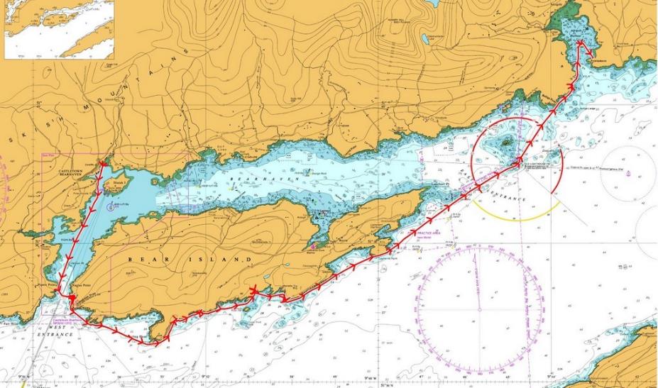
Click or tap for more photos……
Day 13 Thursday - Adrigole Harbour to
Boulder Beach camp on Bere Island by Debbie
Adrigole
Harbour to Boulder Beach camp on Bere Island
After a bit of trickiness getting boats into deep enough
water from the campsite we set off out of the bay and
up the coast. By 10ish Keith was ready for breakfast so we had a quick breather
in a narrow gap in the rocks.
There was little wind at this point
but it soon began to pick up as we headed past the mussel beds for the point
where we were going to cross back to Bere Island and
have lunch at Rerrin, the main village on Bere Island.
We were all ready for a break by the time we got there and
sitting in the sun for a while was great. We watched the ferry leave for the
mainland, and Andy made use of the shop – scone and a cup of coffee/tea while I
had ice cream – only a magnum but better than nothing.
Back on the water we began the search for a suitable wild
camp, supposedly there were a few places we could stop. Several kilometres
later we arrived at a possible campsite.
There was much discussion over whether or not
we would be visited by cows during the night as there was some evidence to
suggest that they had been there recently.
Some of us chose to “chance the cows” and pitch partially on the tarmac
at the road head, while others decided to go for a small promontory sticking
out into the channel.
It turned out that the cattle were the safer bet, they
didn’t appear... However, Chris’s tent on
the promontory came perilously close to being flooded when the high tide crept
closer and closer.
And the bonus of this campsite – four of us made it as far
as the local pub for a pint of Murphy’s after Catriona went on a recce.
Click
or tap for more photos……
Day 14 Friday - Boulder beach camp on Bere
Island to Castletownbere Harbour by Frankie A
I was awake before the alarm I set to ensure I made it
on the water by 8.30am. Camping mostly on the concrete of the road wasn’t
anywhere near as comfortable as pebble/stone beaches. Despite my early start, I
was last on the water at about 8.15 am. A drizzly damp morning turned into a
beautiful calm and sunny morning for the short paddle across into Castletownbere harbour. The plan was to arrive after
the 9 a.m. ferry to Bere Island had left. As we
paddled towards a pink house or 3 on the mainland, we watched the ferry leave Bere Island and realised that we were going to be early and
would have to hang out and wait for the ferry to depart before we could land.
Really, I should have been slower getting on the water and held us up until
8.30.
Still, it
was a very pleasant hop over to the mainland, we gathered
together to decide whether we would try to find an alternate get out or
paddle carefully round into the harbour and wait for the ferry to leave. The
ferry timetable was again consulted at this point to be sure the slipway would
be clear after 9 a.m. To the harbour it was, so we carefully made our way in
through the entrance nearly getting run over by a small fishing boat that was
on the wrong side of the road. We tucked
ourselves away out of the shipping channel and watched for the 9 a.m. departure
to leave.
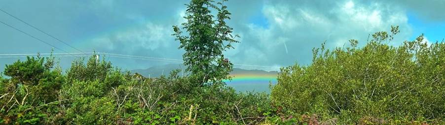
There were showers around so we were once again
treated to a rainbow as we waited to get off the water.
The ferry was spotted departing, so we paddled around
to the get-off point and the straps were used for 4 person
carry of the boats up to the cars. Strangely Andy was first off-the-water but his boat was last to be carried up the slipway,
now why was that I wonder ……….
After unpacking boats and re-packing
cars, there was time for a quick
trip to Supervalu (what a lovely supermarket) for snacks and 2nd breakfast then
it was time to head to Dublin. On the way, we saw the best rainbow yet, with
the most vibrant and stunning colours, if only we had stopped for a proper photograph.

Once back at the Camac campsite, our kit was dried in
the sunshine and plans for an evening meal were made. We headed to an Italian
to enjoy a meal together, great main courses not so-great starters but a lovely
evening to round off our trip.
Click
or tap for more photos……
Day 15 Saturday – The trip home on the Norbay by Gary B
The final day started
with a 5:30 alarm call, a quick final pack up and off by 6:30 to a drive
through Dublin, alongside the Liffey, to the ferry terminal. Early Saturday
morning meant it was quiet, so we arrived with plenty of time to board the Norbay; which was just as well as it sailed 15 minutes
early!
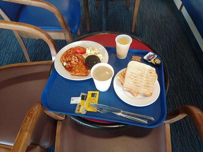
The crossing
started with a ‘complementary’, and welcome, full fry-up breakfast. Lunch and
16:00 ‘evening meal’ were also included, which helped punctuate the 8-hour flat
calm although hazy crossing. This gave us plenty of time to mull over the
fortnight's ‘adventures’ and plan future ones.
Finally, at
5pm we docked in Liverpool, returned to the cars and
said our farewells. We disembarked and
drove off to our assorted homes or ‘lodgings’. An uneventful end to a great
trip. With many thanks to Keith for organizing, Chris, Ian
and Keith for doing all the driving, and everyone for their great company.
Click or tap for more photos……
Click or tap for the full 15 day trip report………