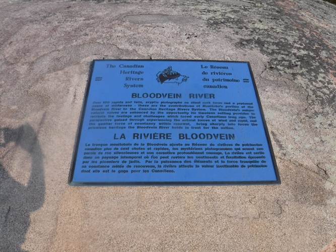
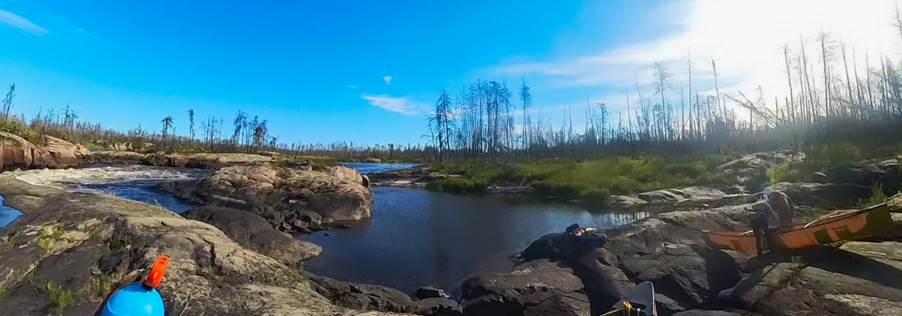
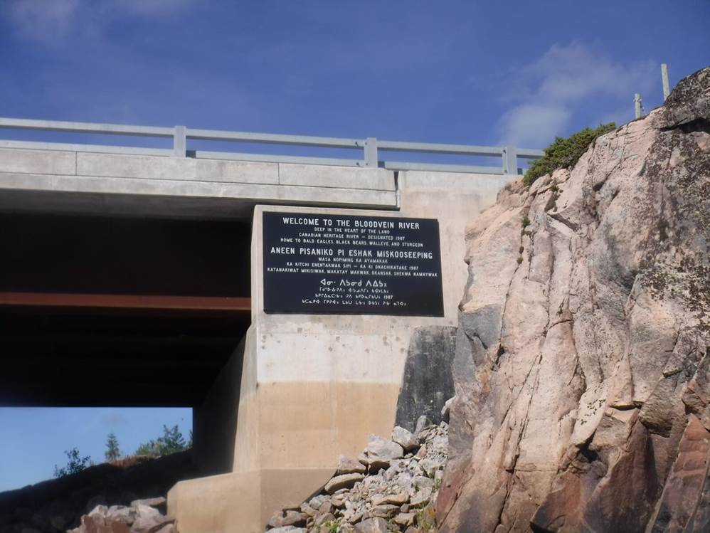
Bloodvein River, Canada
12 day White Water River Expedition by Open Canoe
 https://hapwilson.com/product/wilderness-rivers-of-manitoba/
By Hap Wilson
Let’s be honest, this was largely a personal ambition. I mean, you can have all the qualifications out there, but can you really call yourself a serious canoeist if you haven’t been canoeing in Canada, the birthplace of the open canoe? Well, whether it’s true or not (probably not), it was a good excuse for us to go do it!
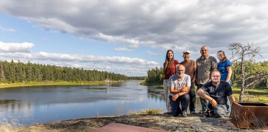
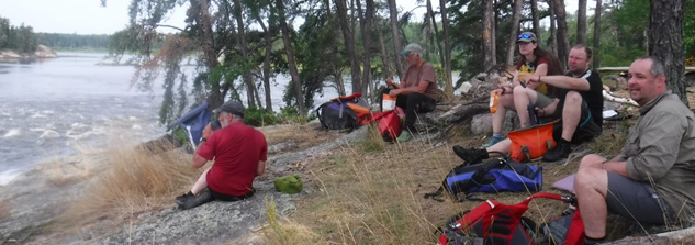
A group of 6 paddlers, Nikki & Martin Aldridge, Mike Alter & Ruth Edwards, Ian Bell and Graham Rowe, made the perfect number for a safe and manageable adventure into the Canadian wilderness… and we weren’t about to do it half-hearted!
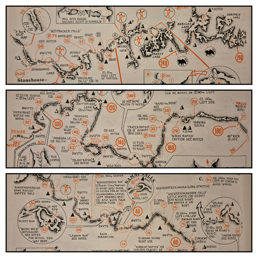
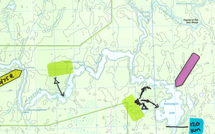
After considering the various Canadian rivers that have been paddled by the likes of Ray Goodwin, we settled on the Bloodvein River, a challenging white water river starting in Ontario and ending at Lake Winnipeg in Manitoba. We chose to paddle a 250km section from Barclay Lake down to Bloodvein Village where the Bloodvein empties into Lake Winnipeg. As it happens, we only paddled 240km because it turns out the get-out bridge is quite a bit sooner than expected! Follow the trip posts to read more on that. We allowed ourselves 12 days on the water to complete the trip.
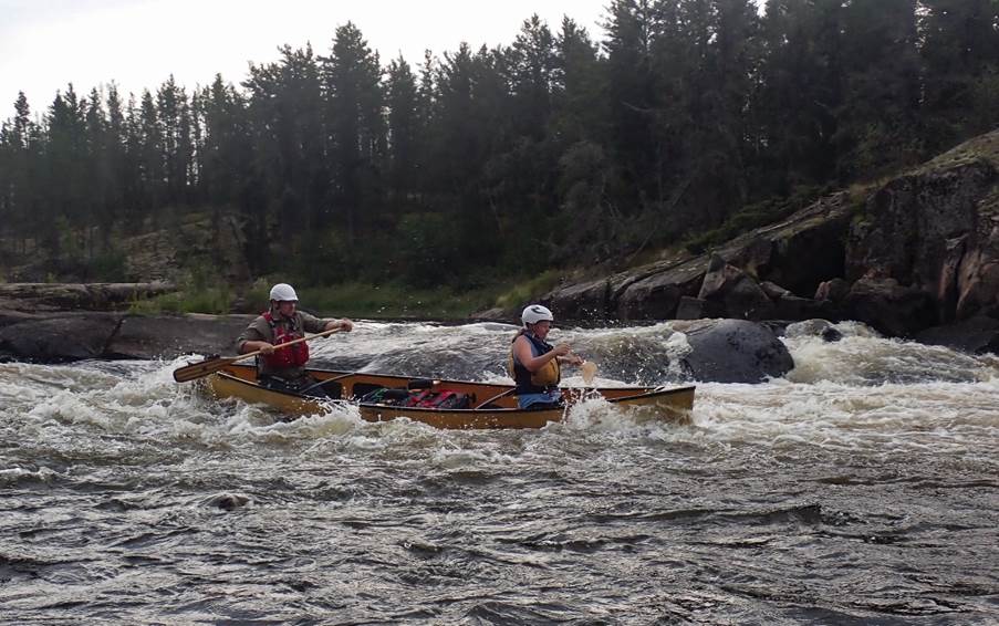
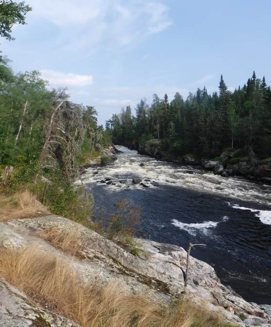
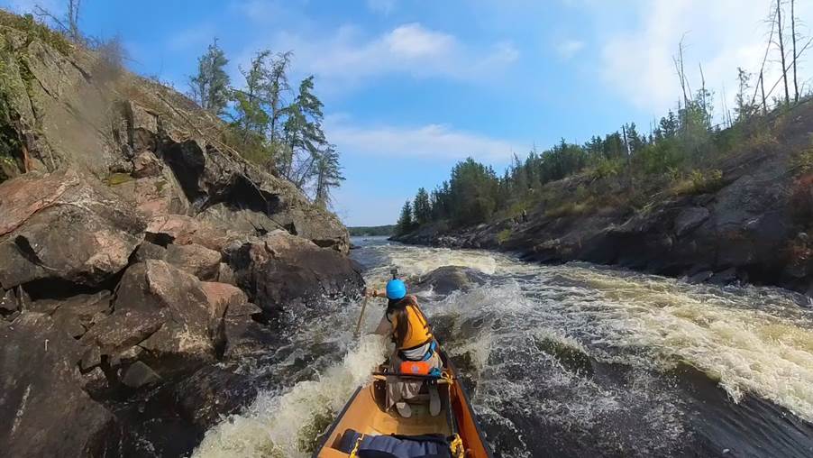
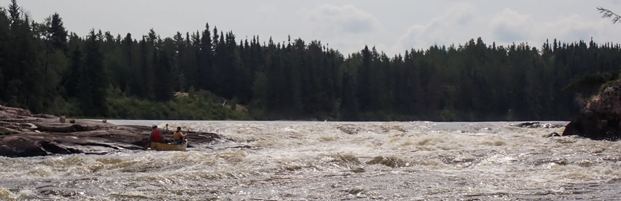
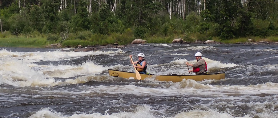
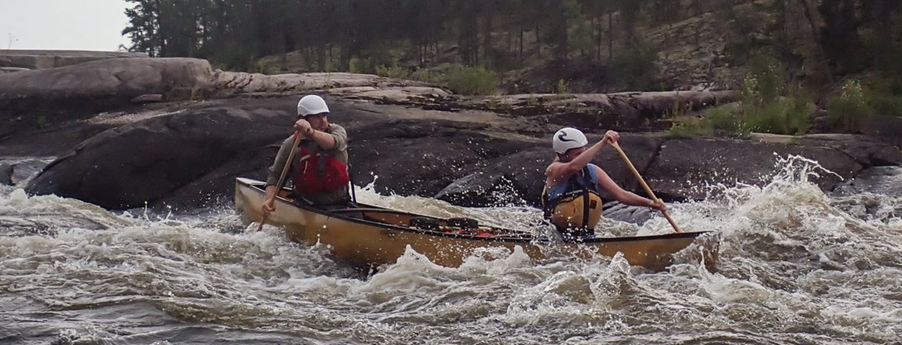
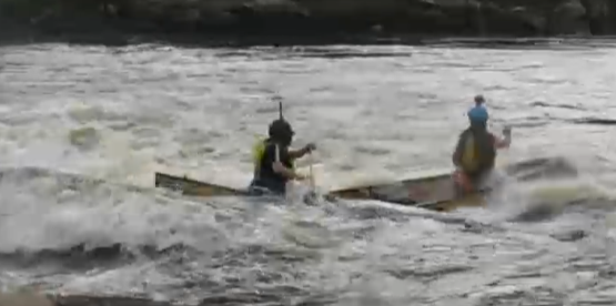
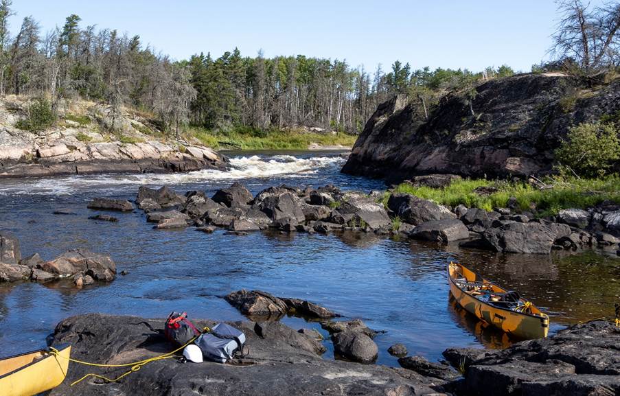
Before Barclay Lake, the Bloodvein is more of a collection of interconnecting lakes and waterways involving quite a bit of portaging between lakes, which is not what we were interested in. From Barclay Lake, the river starts quite open and unmoving with more lakes along the route interspersed with a couple of big rapids. It then starts to pick up pace and the rapid numbers increase, varying anywhere from grade 1 to grade 5. Eventually, the river narrows and the flow increases as the rapids continue. In all, there are 89 graded rapids on the Bloodvein and we paddled most of them and portaged quite a few of them.
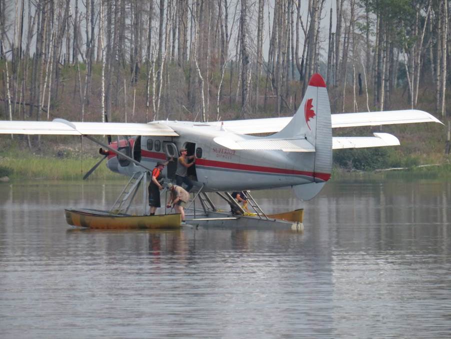
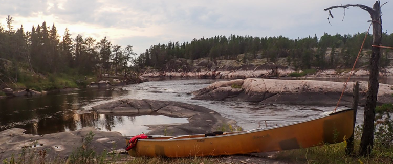
One of the deciding factors in this choice of river though? The only way to access the Bloodvein River is via float plane. Yes, it costs a little more, but it has got to be the coolest way to start any river trip! We would highly recommend it. It also adds to that feeling of remoteness when there are no roads, no other waterways, nothing.
For those interested in the geology/landscape/wildlife:
The Bloodvein flows through the Canadian Shield, also called the Laurentian Shield or Plateau. It is a geologic shield, a large area of exposed Precambrian igneous and high-grade metamorphic rocks. It forms the North American Craton, the ancient geologic core of the North American continent. It is a largely flat area, with the river dropping in steps over the rock ledges.
It is located within the Boreal Forest, which has a biome characterised by coniferous forest consisting mostly of pines, spruces and larches. It is the world’s largest land biome and covers most of inland Canada, Alaska and parts of northern USA. There have been quite a few wildfires over recent years and this was evident along the Bloodvein where large areas had been burned and only the burnt, bare shells of tree trunks remained, although most such areas we passed through showed new growth had begun in the years since the fires.
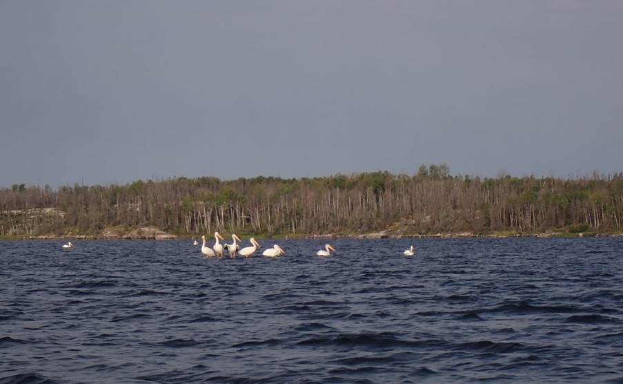
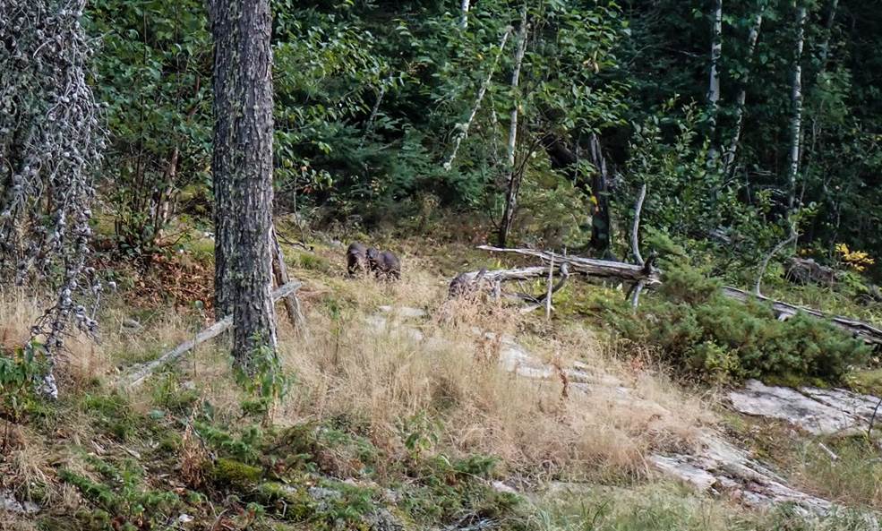
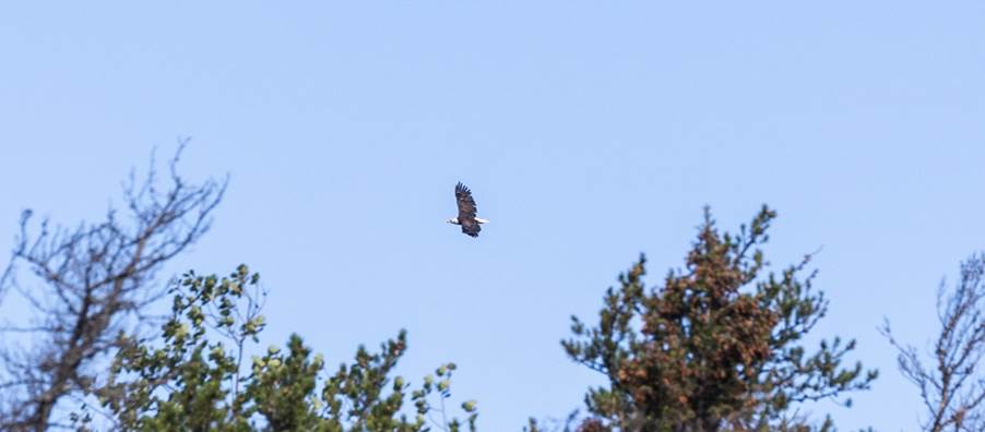
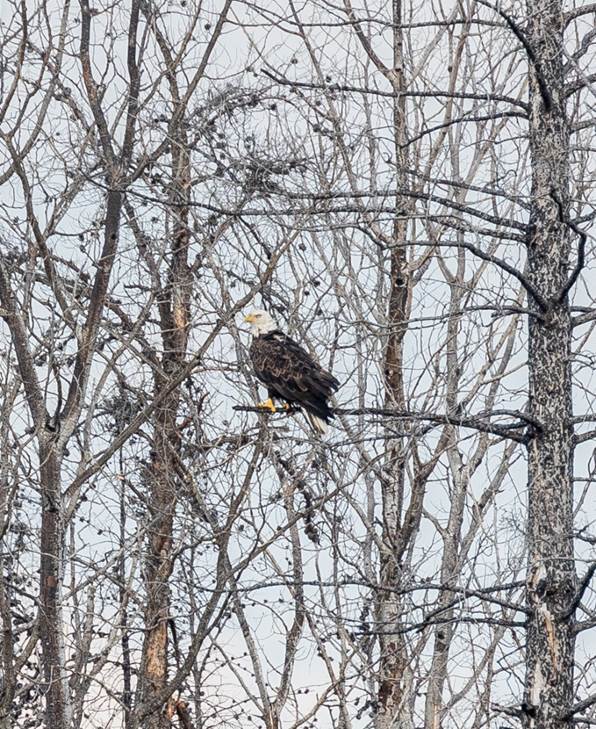
The area is home to an array of wildlife include black bear, moose, caribou, wolverine, beavers, otters and a variety of birds including bald eagles and to my surprise, pelicans! The wildlife out here is largely not accustomed to human contact and can be quite elusive, especially if they hear you coming… for example if anyone in your group just never stops talking!
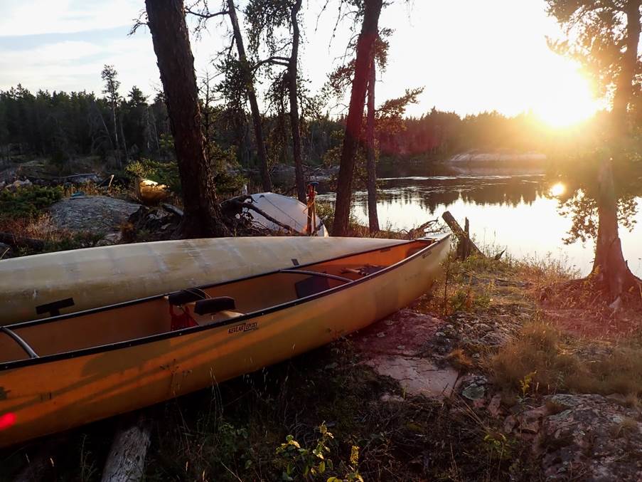
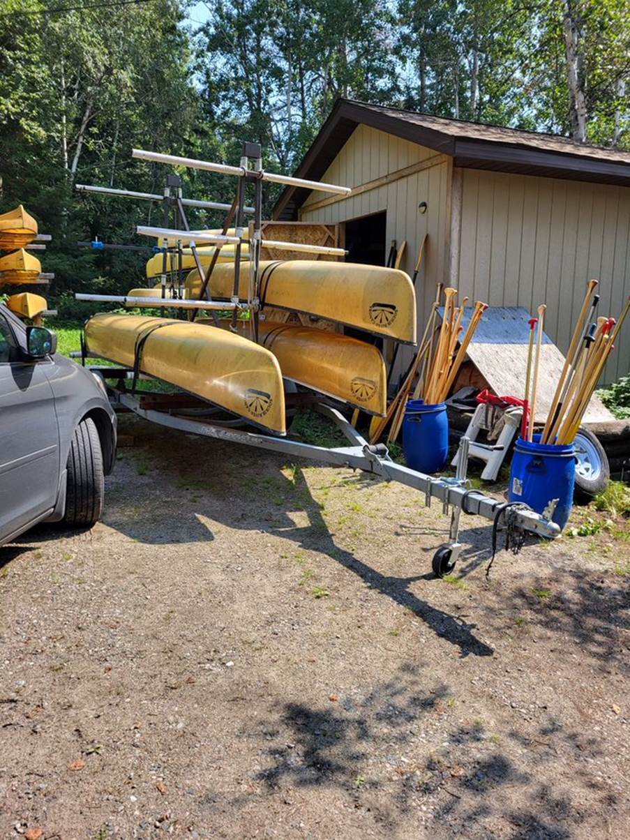
We were outfitted with canoes (Souris River Skeenas 17’8 Kevlar tandem canoes), paddles and buoyancy aids by Albert Rogalinski of Goldseekers.net. He also collected us from Winnipeg and drove us 5½ hours (just round the corner 😉) to Red Lake, arranged the float planes to Barclay Lake, and collected us at the end and dropped us back to Winnipeg.
Follow the Trip Reports to read how it went and get inspired for your next adventure…
Bloodvein River, Canada
Getting there and Day 1 – Barclay Lake
by Mike Alter
I can’t speak for the rest of the team, but Ruth and I had been putting
in the hard miles to prepare for this trip. We are both independent souls, with
different boating styles, who enjoy paddling our own boats, so with thoughts
turning to the hundreds of white water kilometres to
be paddled as a tandem team (the dreaded divorce boat) we had known that we had
to get some serious tandem paddling in.
As such, we had paddled from Sandy Lane car park to Chester Bandstand –
and back. 3km of flat water and not divorced, yep, we were ready!*
The trip started so well, we arrived at Manchester airport to be met by
the most courteous bus driver ever. He got out of his cab to help us load our
100ltr dry bags into the bus. When we pulled up at another bus where Nikki was
waiting, he again got out to help her load her 150 ltr
dry bag, saying “Your friends are on there already” I wonder what had given us
away???
Check in went well, but then Ruth and I were selected for a random full
bag search. Now, that isn’t a problem when you are going to Greece for a week,
but an expedition is a rather different matter. We had prepared by already drybagging everything within the kit bag and were not
allowed to touch during the search. You can imagine the scene at security,
where everyone can see:
What’s this? 20m throw line to rescue people (20m rope gets emptied out)
What’s this? 18m throw line to rescue people (18m rope gets emptied out)
What’s this? Tent (emptied out), Sleeping bag (emptied out) clothes, wet
boots, river knife …. You get the drift.
Sadly, when it got to the cookwear, the fuel
bottle and pump still had the faintest smell of fuel in them despite my
cleaning efforts – that was them confiscated. Luckily
she didn’t check the stove as that would have gotten expensive.
After that, the flights went well and when we reached Winnipeg
we got a taxi to a hotel that had been specifically chosen so that it would not
be noticeable if we had to hang wet paddling / camping kit up to dry in on our
return – you get the picture.
Next morning we woke to the devastating news that Graham’s bags had not
arrived – he literally only had the clothes he was standing up in. All his
paddling, camping and cooking kit was somewhere (but not here). The waiting
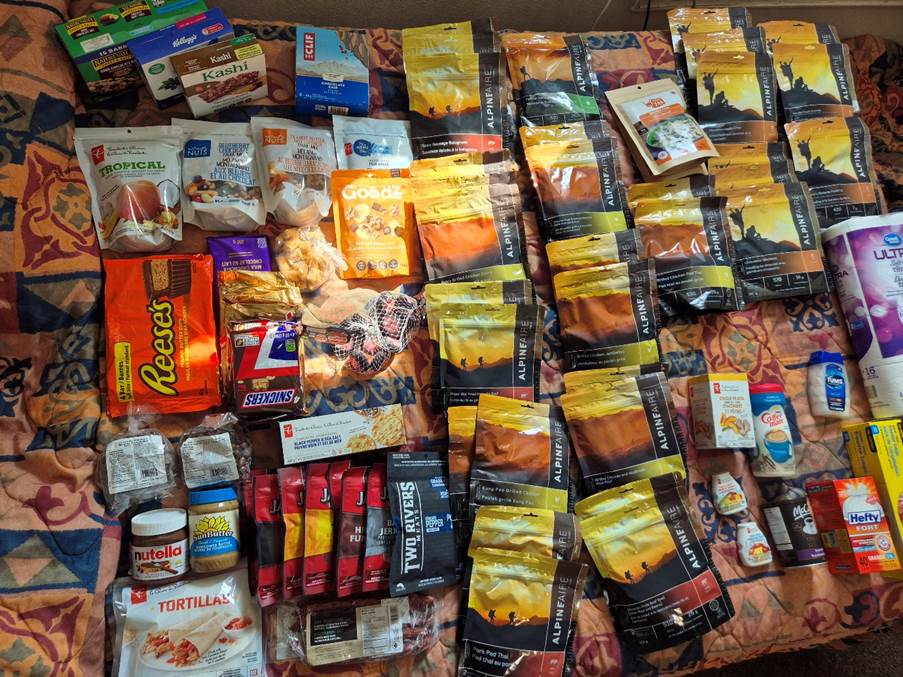
game began to see if it arrived in the next 24 hours before we left on the 6 hour drive to our starting point. But in the meantime it was time to stock up with food supplies (and a
new fuel bottle and pump) for the trip as there were no possibilities of
resupply.
All stocked, and with no signs of Graham’s kit, we were collected for
the 6 hour drive to Red Lake. My choice of cheese and
crackers for lunch would come back to haunt me.
The excitement was building as we drove through the Canadian Shield to
Red Lake. Here we collected the boats and arranged camping equipment for Graham
– clothes had been sorted out within the group, except footwear – so Graham
headed with the outfitter to the shops to later return with some crocs (nice
sensible footwear for portaging). We also discussed our plans with the
outfitter, signed away our lives and gave instructions about how many days
should be left before they came looking for us. Also, what type of rescue we
were prepared to pay for.
Life suitably signed away we drove to the lake where we were to begin
the next stage of our journey!
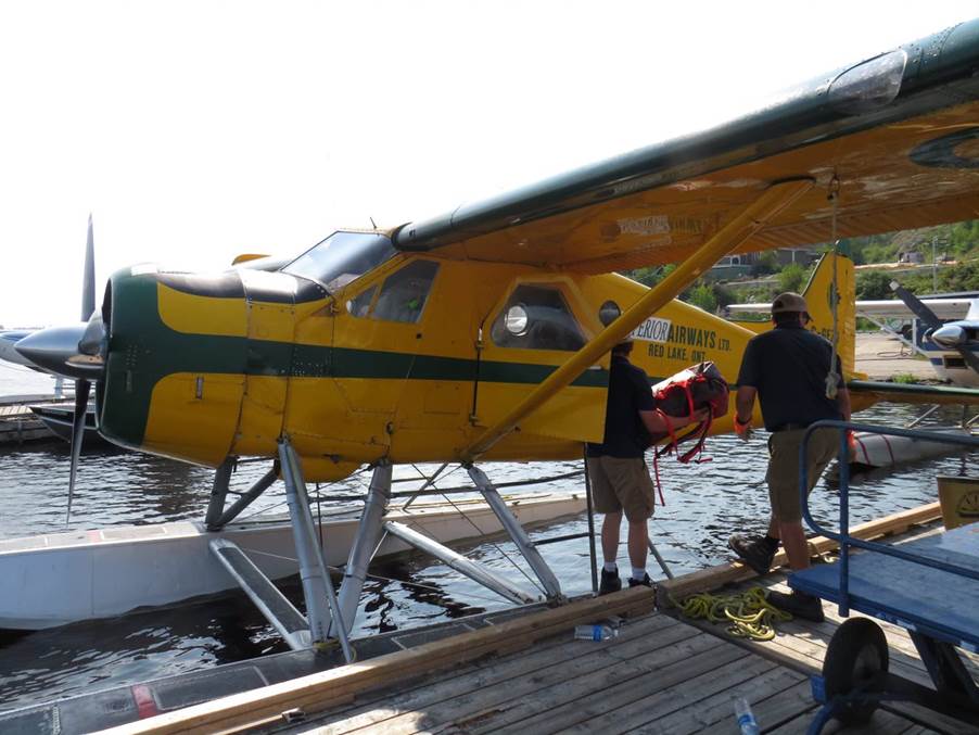
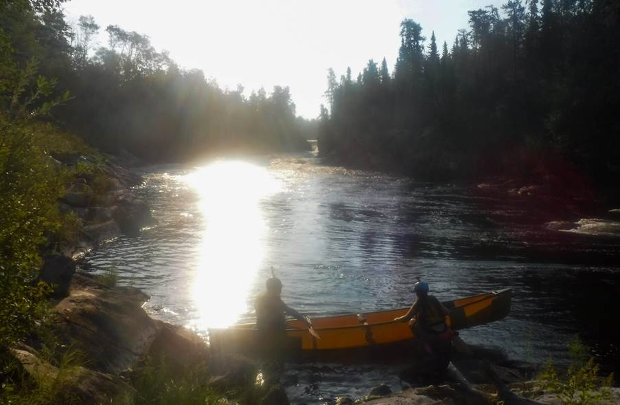
Pulling up at the shore, we saw the two float planes that we had hired
to take us into the wilderness. Ruth and I were in the 70
year old Beaver, whilst the 4 other members were in the far younger
Otter.
I was nearly wetting myself with excitement!!!! But that soon came down
to earth when I was told that we had to load the baggage onto a cart for each
plane, and that we then had to go and be weighed (oo,
errr, not expecting that).
Luckily we were light enough, so the crew began
tying the canoes onto the outside of the planes – I hope they had their knot
badge from Scouts.
The Otter crew had it easy, they could just stand on the float and climb
the ladder into the plane. But, the Beaver is a far
smaller plane, and we had to step from the jetty up and across the canoe into
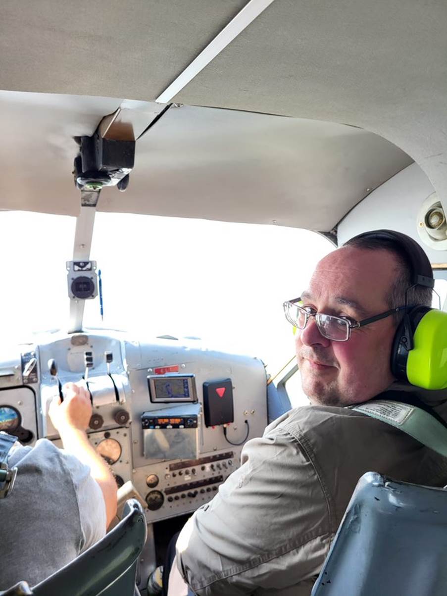
the plane. It was quite a stretch. Once in, Ruth had kindly agreed that I could
have the co-pilot seat – full on Top Gun!!!!
Final briefing in the Beaver was that we had to wear the ear defenders
as the plane was old and loud, but that I could open the windows. The Otter
crew had a bit more comfort, but I was glad to be in the Beaver.
A brief stutter, some more pumping by the pilot, and the engine roared
into life. We taxied down the lake (quite smoothly really) and into the air – a
sticker on the console advised the pilot that the max speed with canoes on the
outside was 100 knots.
Flying over the wilderness, the vastness of the wilderness struck home.
But that soon passed as the otter caught up, the canoes under wing looking like
missiles on a fighter jet. The pilots worked together to fly in unison so we
could get photos of each other, but it felt like a dog fight in Top Gun…
“Too close for missiles, switching to canoes”
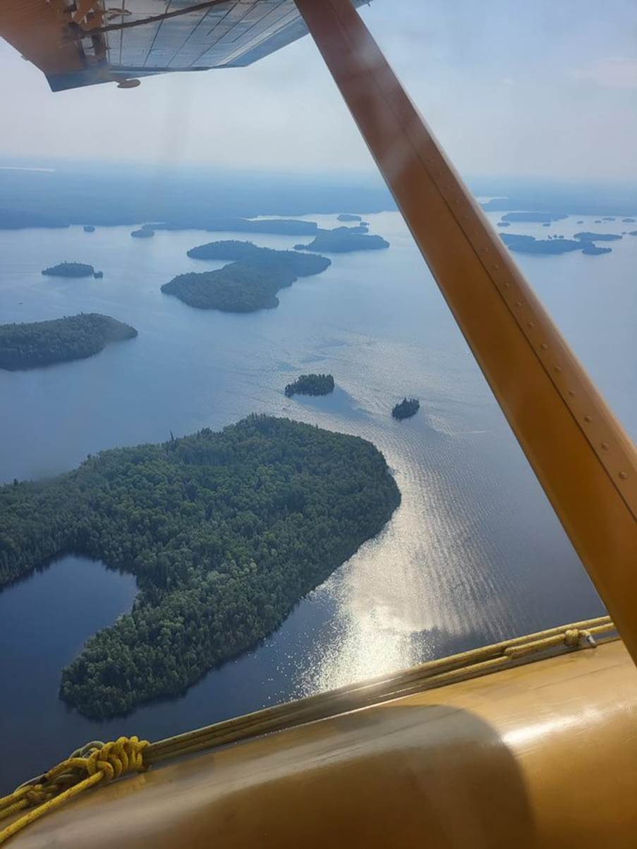
All too soon we reached Barclay Lake, our starting point. This created a
further trip than most paddlers use, so the pilots had to give some extra
checks before landing – making sure the lake was clear of obstructions,
wildlife etc.
The landings were smooth, but I was quite surprised as we came to a stop
in the middle of the lake, as the pilot turned to me and said – just sit tight,
I will untie the canoe and we can load you into it
here. I thought we were going to unload at the shore like they had in all the
online videos I had seen.
Oh well, a most unusual baggage reclaim.
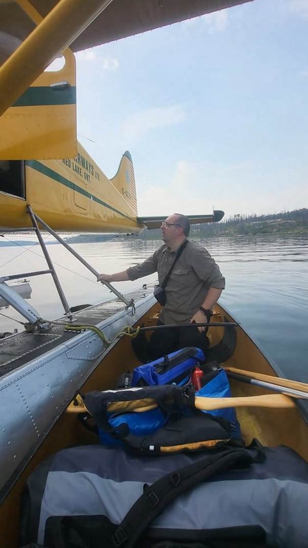
Boat loaded, the pilot told us to just paddle away a little bit, and
with that he was off. The engine roaring noisily as the plane fought gravity,
and as it flew away we were left in the silence of the
wilderness. A quiet wilderness that meant we were committed to the journey and
a long way from help if anything went wrong (What could possibly go wrong, we
had all agreed to play it safe and be extra careful with the canoes – our only
means to get down the 250km of river).
We paddled over to the other canoes and headed past resting pelicans to
the Island where we had planned to camp. The big sky and tranquillity of the
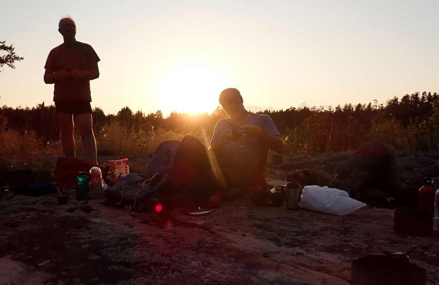
vista was overwhelming – we had begun our adventure!
This was going to be special!
* We had actually paddled together in the past, so
this was just refreshing of the skills.
Click or tap for more photos…..
Day 2: Barclay Lake – Artery Lake (30km)
by Ian Bell
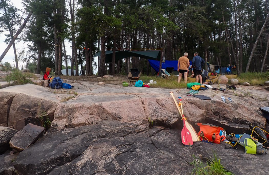
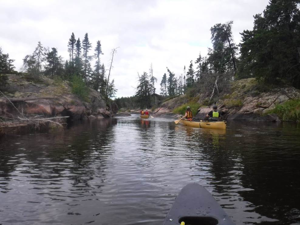
Having had a very comfy first night out in the wilderness on our island camp. We woke keen to get underway. Haveing breakfasted and repacked the kit, we were ready for the off. A quick check of the map and we started to paddle. The map check being more of a formality as Nikki had noted the route out of the lake from the plane as we flew in.
We paddled past the pelicans roosting on a low lying rock island between where we had landed and the camp island.

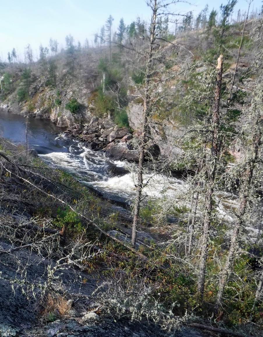
As we left the lake and entered the more distinct river channel. There was evidence of a forest fire from 2 years ago.
The teams settled into a paddling rhythm and kept an eye out for moose but did not see any on this occasion. Probably because the best opportunity would be very early morning or dusk when they feed. By now the temperature was rising so the obligatory elevenses where taken on an overgrown bank with some trees for shade.
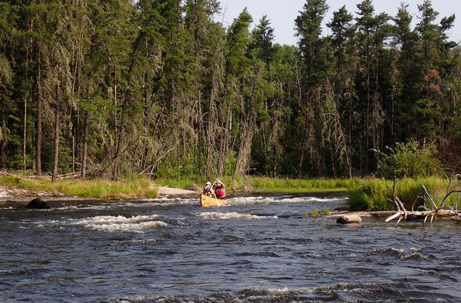
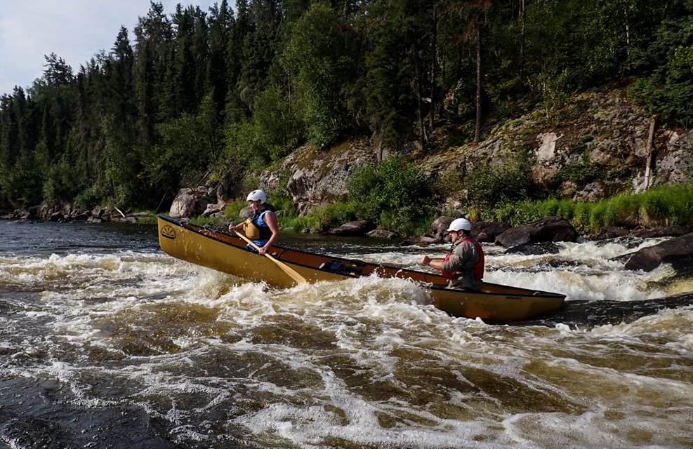
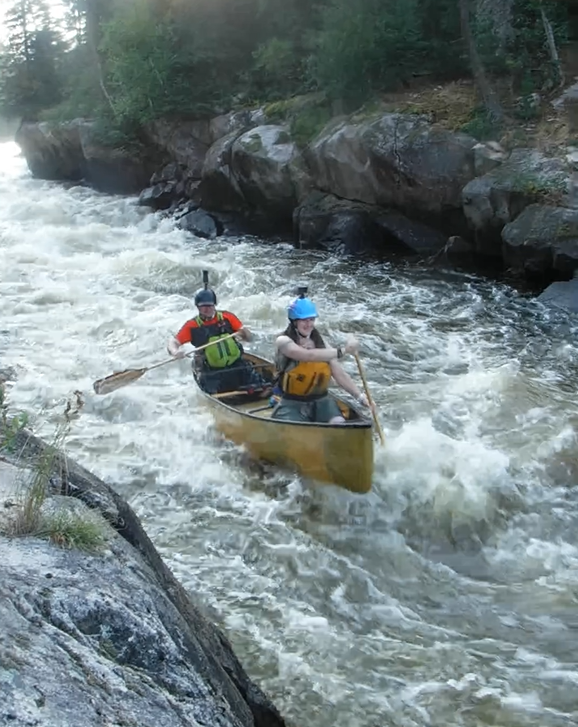
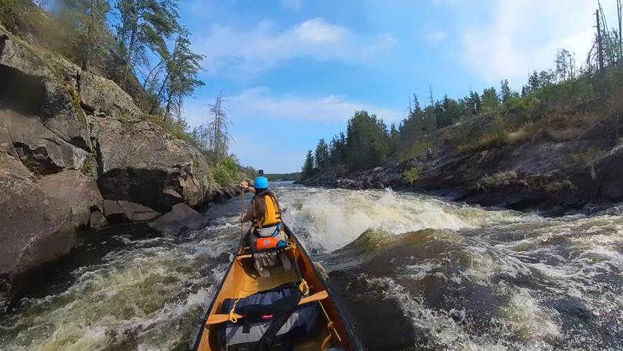
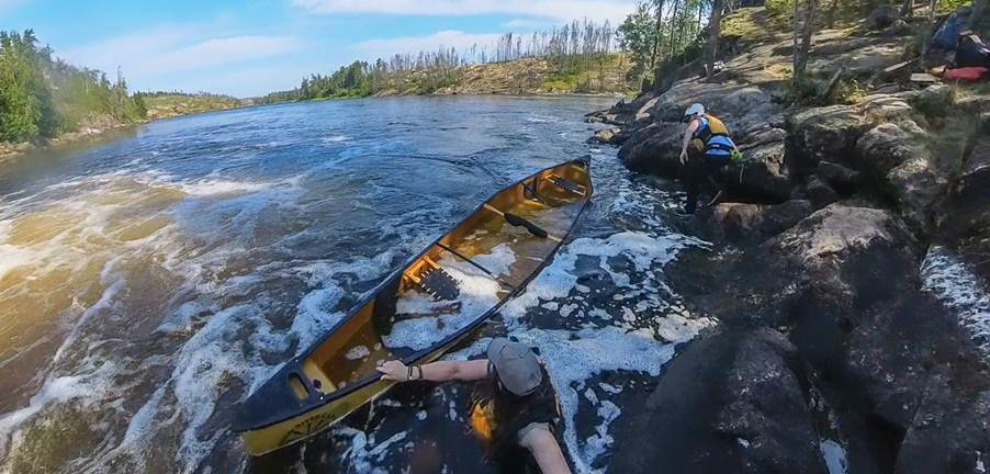
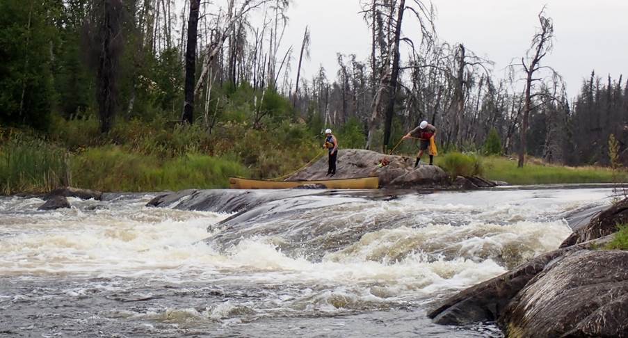
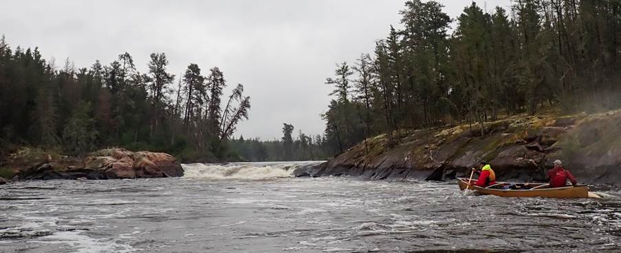
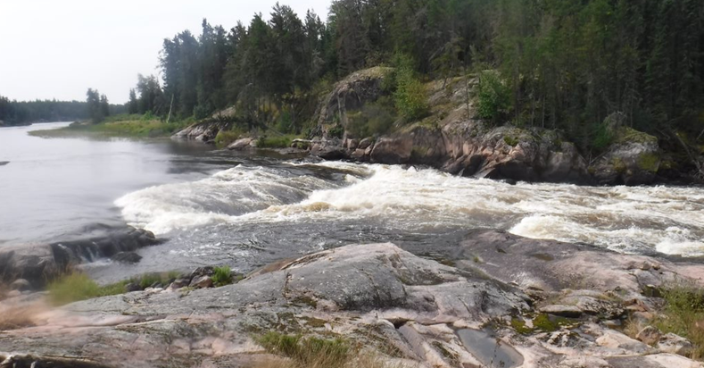
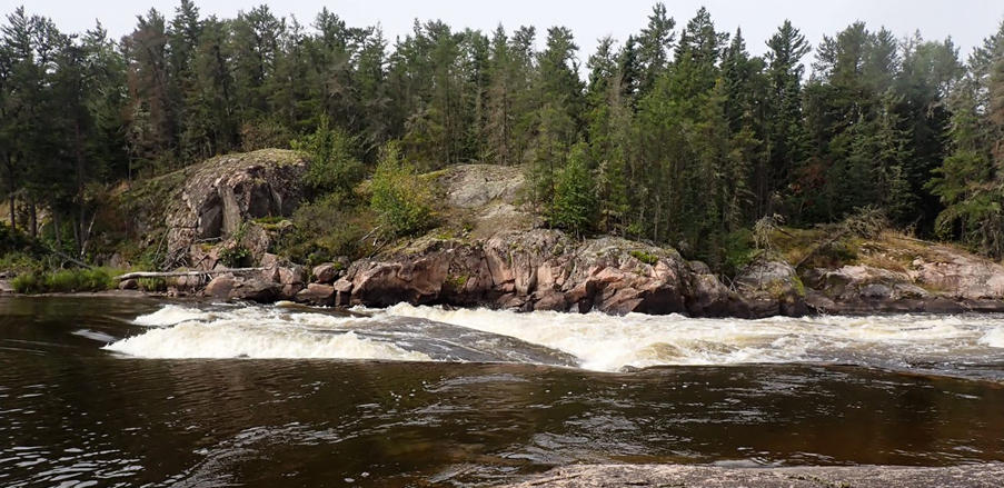
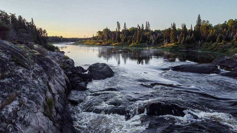
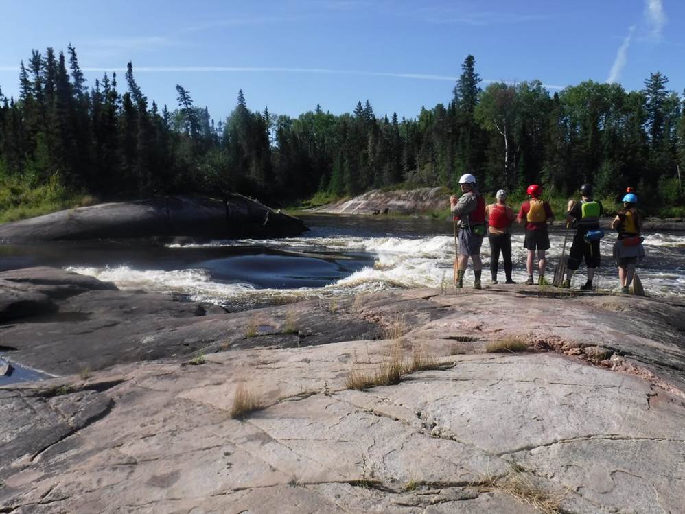
We passed a small pictograph site before reaching the first significant rapid of the river. Rapid 8 - our first rapid with a choice of routes, north was a short 30m portage around a DNR (Do Not Run) and paddle out a grade 2, south was a grade 4 with a 20m portage option.
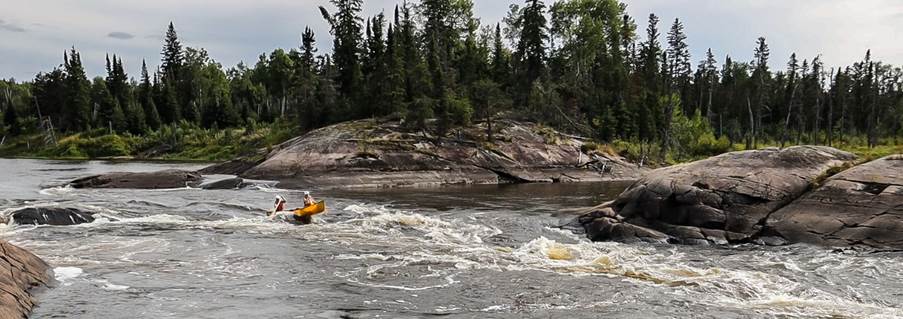
We went north for our first bit of white water. After the portage of the DNR we inspected the lower part of the Rapid deciding on the line we would take. Graham and I found ourselves back on the water first and so were the first boat to run this rapid. This was a steep and good grade 2+. We all managed to make it safely down and then continued on.
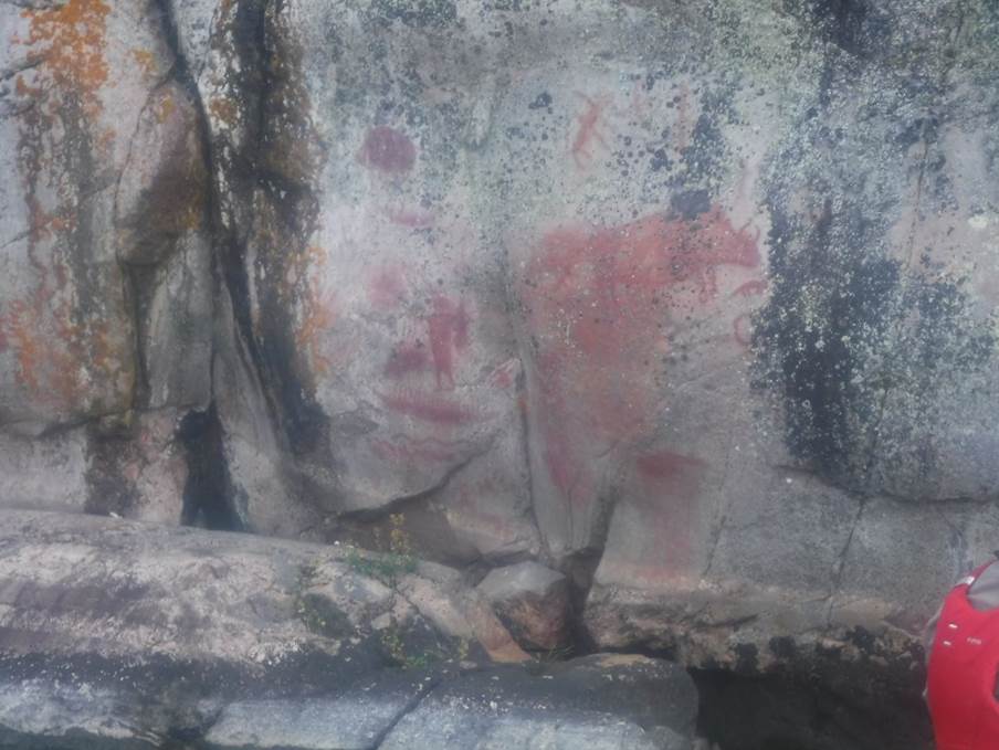
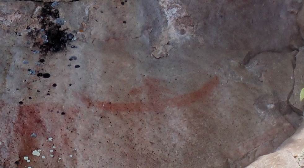
Next, we found the best preserved of the pictographs and remains of an offering of tobacco that previous groups had left here. These are the ones featured in the various videos of previous trips that are available on YouTube.
From here the river opens out into Artery Lake. We saw a couple of fishing boats (small open rowing boats) with a couple of people fishing. There is an off-grid fishing lodge at the other end of the lake and an off-grid cabin in poor repair where one of the campsites was marked. These would be the last people we would see for a week or so.
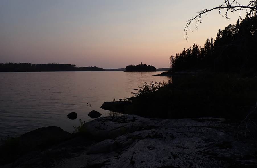
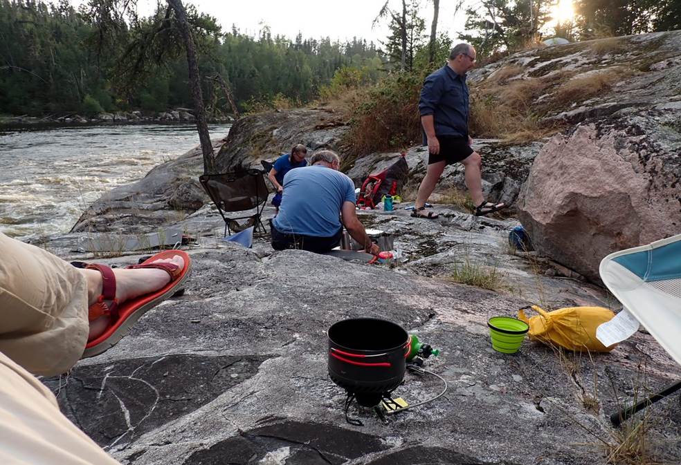
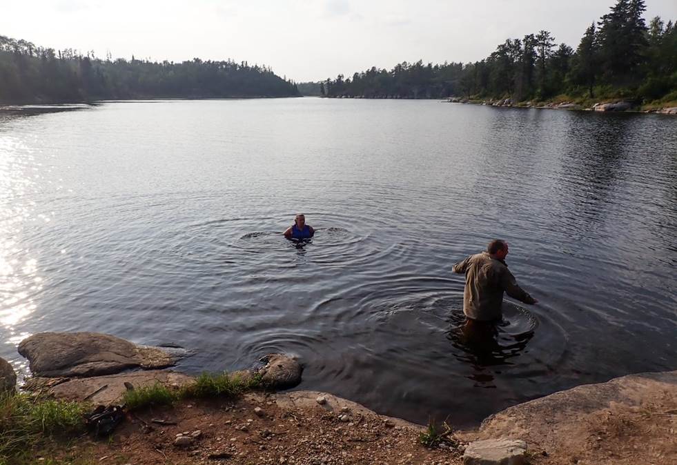
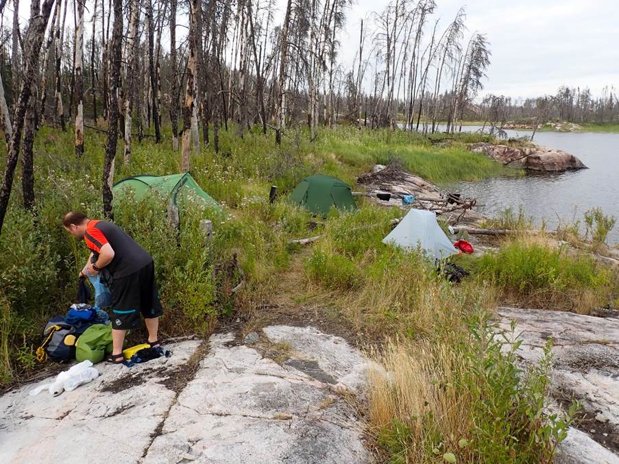
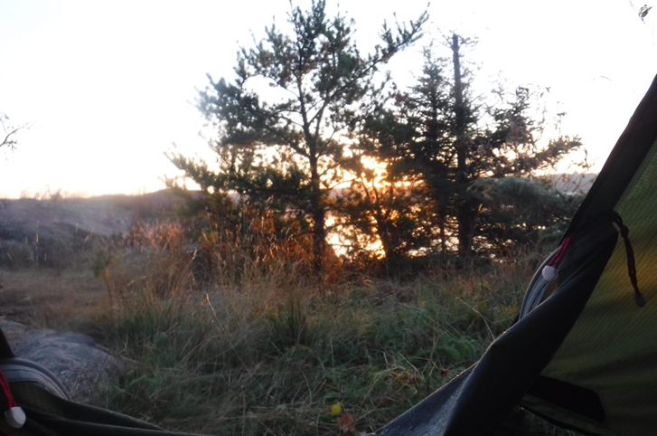
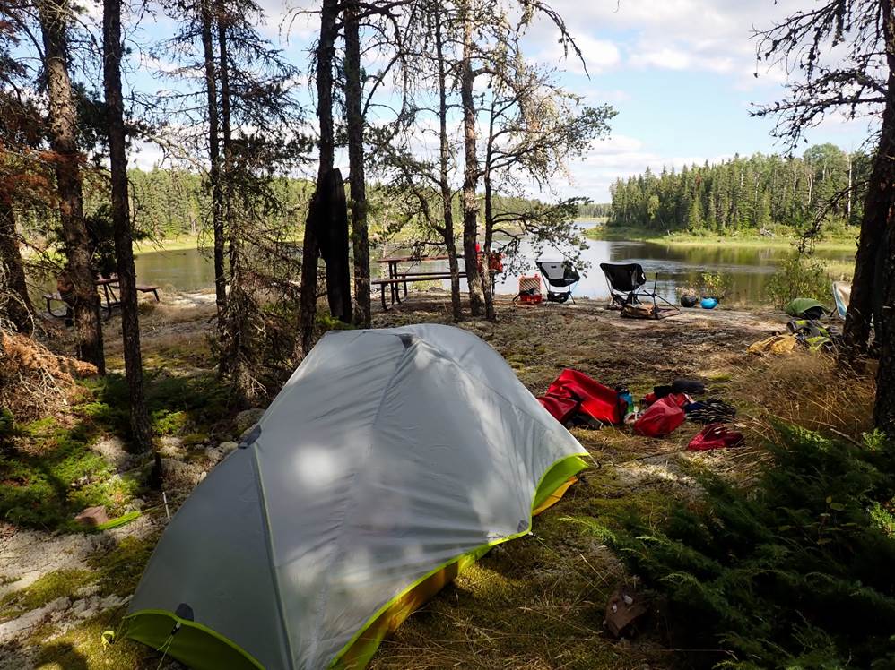
We paddle up a small side arm of the lake looking for another pictograph site and suitable camp spot before back tracking to the headland at the end of the arm as that offered the best camping option. This promised a light breeze to keep midges down, a good view across the lake toward the route we would take following day, and ample opportunity for a refreshing evening swim. As the temperature was about 30 degrees C, evening swims where a welcome way to refresh and cool down.
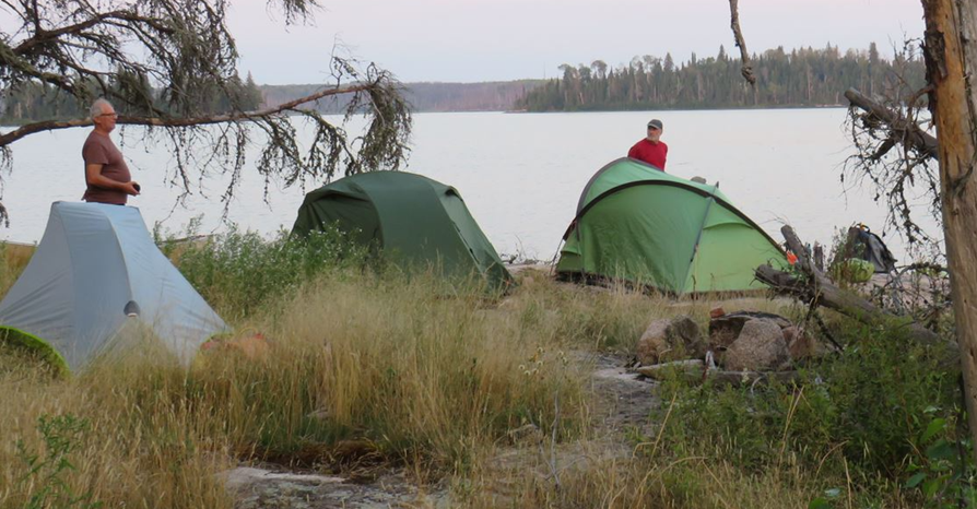
Camp pitched and swim done, we settled into a standard expedition evening routine of cooking meal and cleaning up ready for bed either at dark or if midges appeared. Only 2 days in and everyone was well into expedition mode.
Click
or tap for more photos…..
Day 3 - Artery Lake to Stone house Rapids (28km)
by Ruth E
Today was the first day of multiple rapids, and multiple portages!
After breaking camp, off we set for a day covering 28km and rapids 10 to 23.
The weather was glorious and very warm!
We came to the first rapid, number 10, which separates the upper part of Artery Lake from the lower part. Martin & Nikki paddled it first and found out it was rather shallow and rocky, so it was decided the other boats would portage it using the boat rails! This made portaging easy as it was a ladder with rollers instead of rungs.
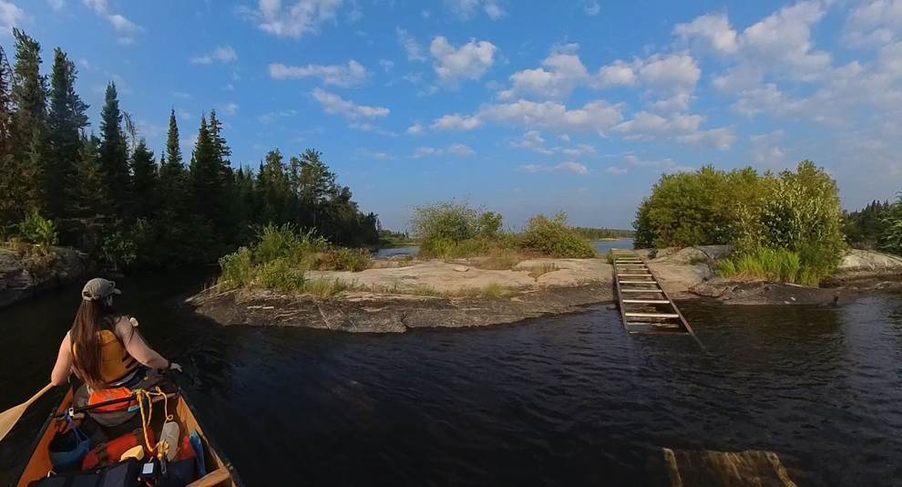
Very easy to use for the loaded boats, but you had to watch out as you got to the bottom as it was a tad slippy!
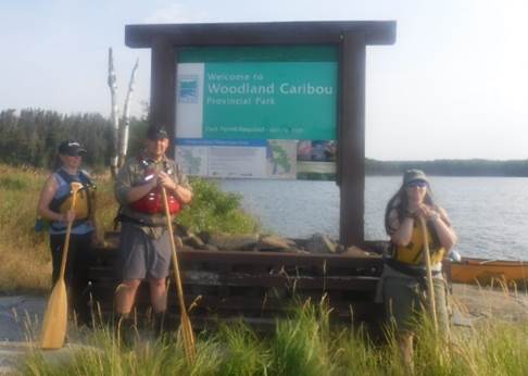
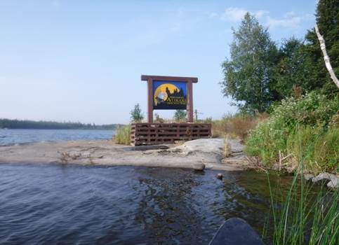
We then crossed territories from Woodlands Caribou Provincial Park in Alberta into Atikaki Provincial Park in Manitoba.
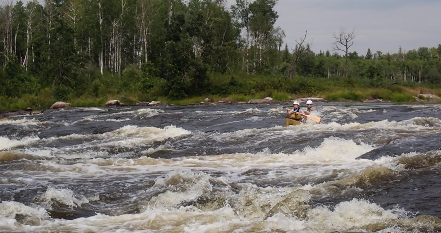
From there we went on to rapids 11 & 12 which were bouncy grade 2’s with some bailing required. Followed by a grade 1 rapid.
Found on a rock after Rapid 11 – a Canadian Heritage River
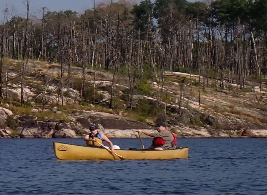
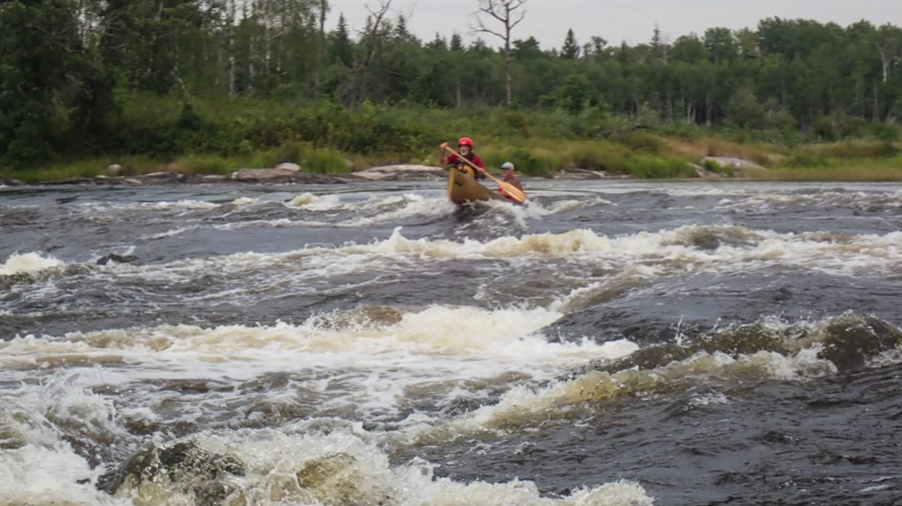
Next came rapid number 14, Moosebone Rapid, and this was a grade 3. We hopped out to inspect and decided to run it, only keeping the heavier bags in the boats and removing all lighter and smaller items. And this was the photo of the day, taken by Nikki:
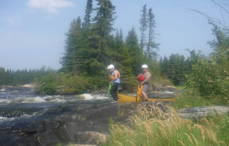
We breezed through rapid 15 and onto rapid 16, a grade 5, which we had planned to portage river left by lining the boats down. But the path was too overgrown to safely line the boats down, so instead we hopped over to river right and proceeded to portage the 325m – the first proper portage!
Rapid 17 this was a grade 4/5 so portage was required, but only 35m this time.
Rapid 18 Nutcracker Falls was next, there was a 75m portage. Ian & Graham decide to walk, whilst the rest decided to practice their lining skills!
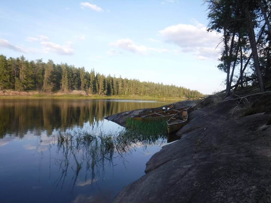
We then continued on to paddle across Bushey Lake and hunt for more Pictographs.
Rapid 20 was a grade 2 and paddled smoothly once the line was established.
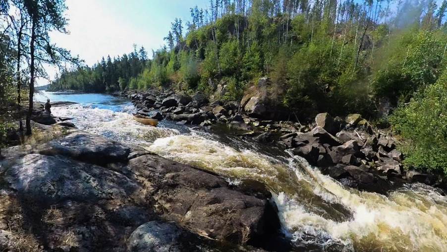
Then we were onto the final rapids of the day which led into our campsite at Stonehouse Falls (rapids 21 – 23).
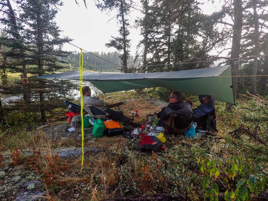
These were all “Do Not Run” rapids which meant we had a hefty portage, along the undulating and challenging terrain totalling nearly 500m in 30 degree heat!
We pitched our tents on a high rocky ledge, overlooking the lower part of the rapid. Our cooking area below and away from the tents (being Bear safe!)
We also had a few visitors check us out from the far bank, whilst we were relaxing in the evening. A family of 3 otters!
We finished our day with a cooling swim at the bottom of the rapid. Mike demonstrating the “when the water reaches the parts “moment!!
Click
or tap for more photos…..
Day 4 -
Stonehouse Rapids – Goose Rapids (27km)
by “Martin Aldridge”
Well what a rollercoaster of a
day. Three great successes, and then a
near disaster.
…
So, I’m going to start this report with restating one of the
golden rules of expedition (especially wilderness expeditions), and that is,
you MUST always take care of your boat.
It is the one piece of equipment that is hard to replace, that you don’t
have a spare of in the group, and the one that will get you out of there.
Sadly, on this day, we got a stark reminder of this.
…
We awoke to another beautiful morning, this time overlooking
Stonehouse Rapids. I sat to enjoy the peace and tranquillity with a cup of
coffee, and by the time I had finished my coffee, Nikki had the tent down and
packed away (hmmm, Nikki added that bit!).
Nikki and I had decided the night before that we might run
the grade 3 rapid our campsite overlooked so we had left our canoe at the top
of the rapid. We took the rest of our kit to the bottom where the other two
canoes were already waiting.
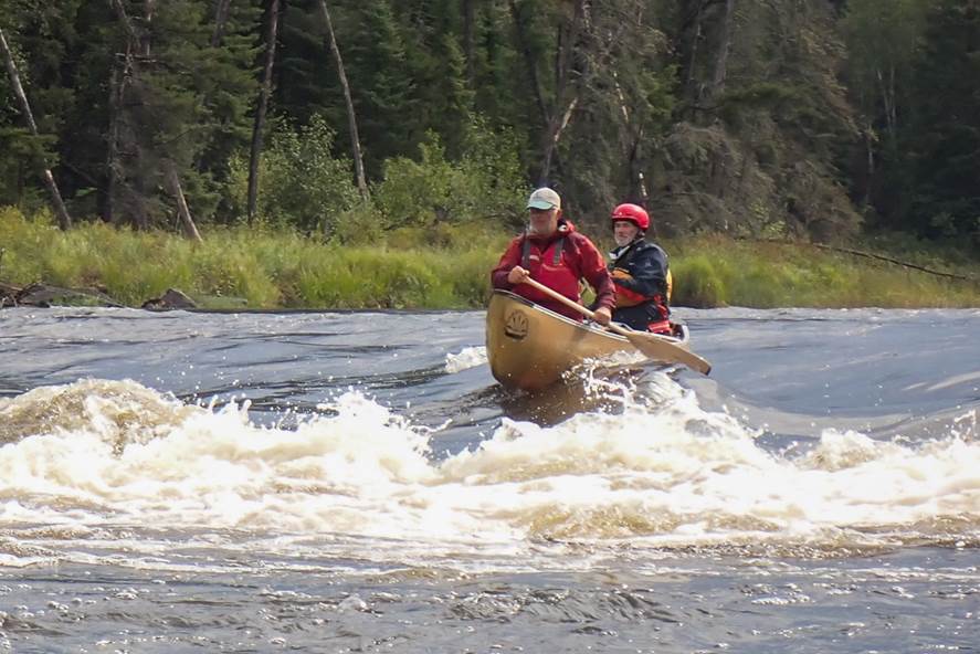
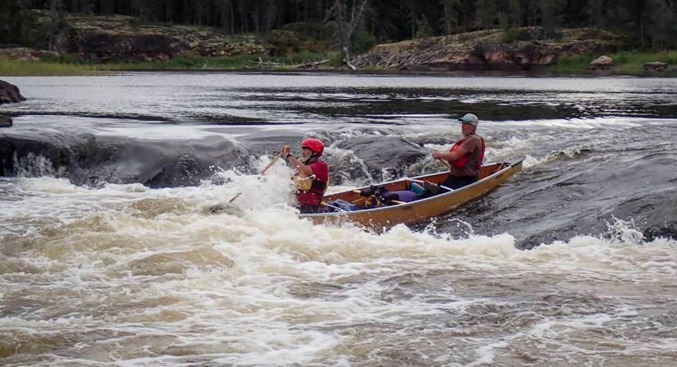
We made sure we both knew the intended line and then we
launched. As we brought the canoe around to get our first view of the rapid
from on the water, we saw just how big it was. As we approached the top, a rock
just beneath the surface forced our line but it worked out perfectly. We
bounced our way through big waves and across the river to avoid the rocks and
were pretty pleased we nailed the line, and had great
fun doing it. Now just to empty all the water from the boat!
Morning wash out the way, we loaded
our canoes and set off altogether.
We all negotiated the next complicated Grade 3 successfully.
We were then pootling along on the lookout for a Grade 4. We
could hear something but see nothing. We could see the river narrowed but no
sign of a rapid. Then, all of a sudden, we saw the
almost invisible horizon line that hid what was below it. We landed at the head
of the portage trail. The portage trail was a long one and went high above the
rapid. Part way along, we got a view of the rapid down below and we could see a
paddle-able line.
With the smaller items already portaged, Nikki and I decided
to run the rapid with the big heavy bags as we could see the line clearly and
decided it was perfectly runnable. The others didn’t fancy the rapid but were
happy to video us from the bank.
We planned our line from the top of the “hill” – drop in to
the first wave on river left, stay left of the big rock and hole behind it,
then cross hard right to avoid the big rocks at the bottom. We then launched
and paddled around to the rapid.
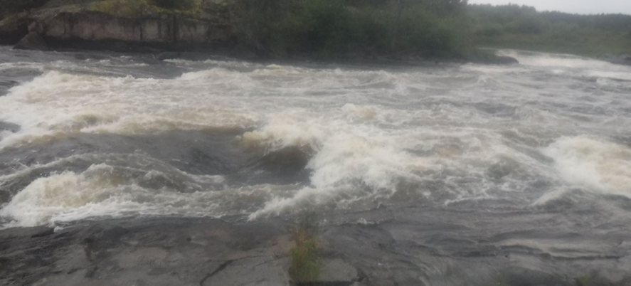
Oh my, the view from the water made it look much much bigger! The
first wave was big, but it was dwarfed by the huge water-covered rock beneath
it, which dominated the view of the rapid. It was huge and if we’d had time to
think, even just a little bit… scary! Keep to the plan! As we bounced over the first wave though, the
biggest question was whether we would fit between the big rock and the cliff
face that formed the left hand river bank. Suddenly
this looked a much narrower gap than it had from above!
We breathed in and paddled our way through and past the
massive hole behind the rock and worked together to move right across the
river, just in time to miss the rocks on river left. We eddied out at the
bottom with big smiles on our faces. What awesome fun!
After two awesome rapids successfully ran this morning, we
were on a high, but unbeknownst to us that was
all about to change…
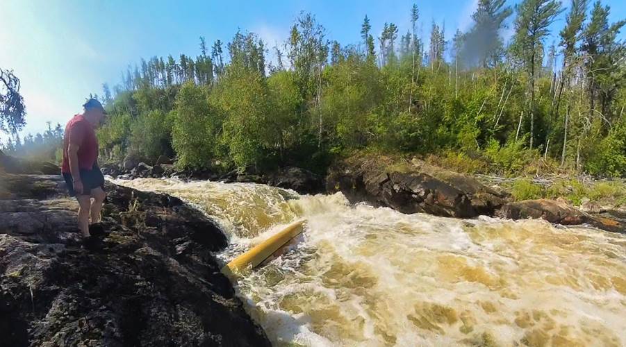
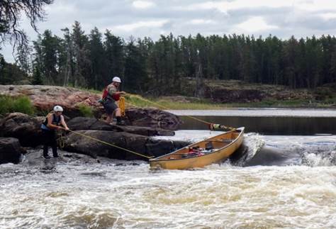
Next up was X-Rock Rapids, an
island with a Grade 5 on river left and a Do Not Run on river right, with a portage
over the island inbetween. We unloaded our kit and pulled the empty boats up
away from the river. We portaged the bags down to the bottom and just as
we were putting them down, we heard Ruth shouting. We went running just in time
to see our canoe floating down the rapid on its own. So
it turns out that WW spec Kevlar boats are still very light and these were very
long, and with the only gust of wind we’d experienced that day, the boat launched
off the rocks into the river before anyone even knew what happened.
Well, that got the heart racing as I watched it coming
around the corner upright around the top part of the grade 5. To be honest, the boat was very happy at that
point, as that part of the rapid wasn’t really a grade 5, the coming massive
hole though, that was another problem.
After getting Nikki into the water to swim to the boat for
when it arrived in the pool at the bottom, we watched with horror the boat go into the stopper and recirculated before vanishing
completely for what felt like forever (it turns out it was only 5 seconds).
Where’d it go?...
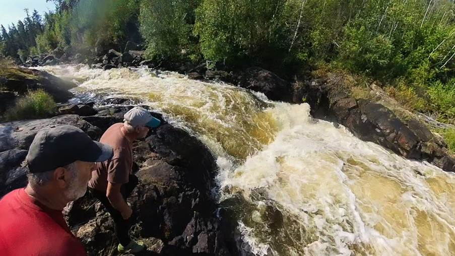
Thankfully it resurfaced.
Nikki managed to grab the boat before recirculating again, with Ian having
hold of Nikki, and Ruth then grabbing the stern and the team got the boat to
dry land. It was bad, not impossible,
but bad.
Poorly boat ☹
The aluminium gunwales were bent and broken in places, the
stern seat had popped its rivets on one side, as had one of the aluminium
thwarts, and that side of the canoe was bent out in an interesting shape.
Golden rule now broken ☹. Always
look after your canoe! On an expedition
like this, in the wilderness, miles from anywhere or anyone, you are completely
dependent on your canoe to get you to the end. Do not risk it! We had broken
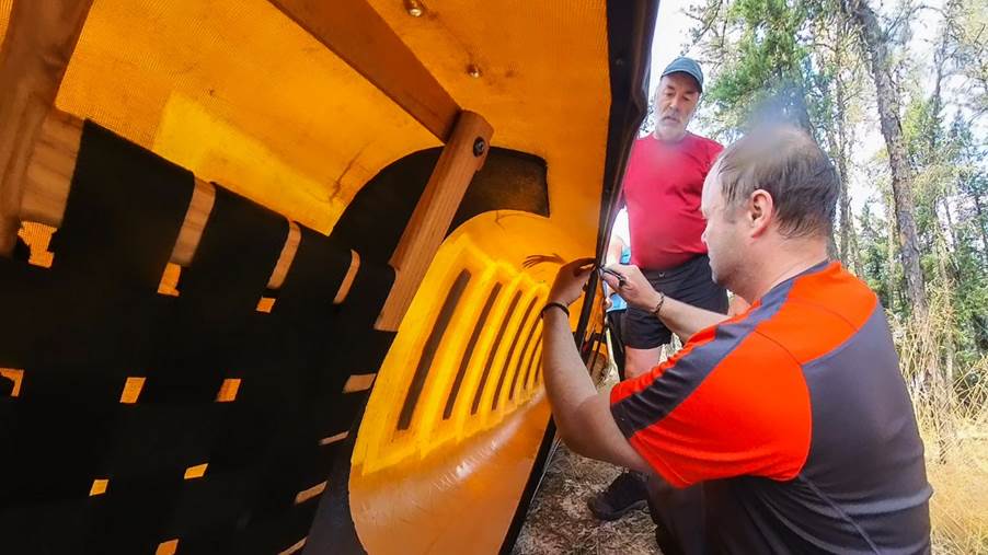
ours. My good day had become a very bad day.
Elevenses became lunch as we set to repairing the canoe. A
lot of Gorilla Tape, a few screws and a good bit of swearing later, the seat
and thwart were reattached and the canoe was back to
looking vaguely canoe shaped, ish… well, maybe not
quite canoe shaped, but at least there were no holes or leaks!
A very near miss and one that will not be forgotten, I then
changed my behaviour to always tie up the canoe, no matter how safe it looked.
Well back on the water in our newly redesigned canoe …
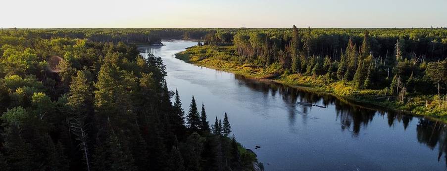
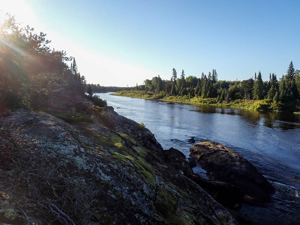
The river today had been quite wide, open and flat,
narrowing every few kilometres for a rapid before opening up
again. We had another wide flat section before reaching another portage around
a Grade 5. This time, we made sure the canoes were all tied to something, even
if they were well out of the water!
Finally, we finished the day with a Grade 1 rapid and camped
just before Goose Rapids.
The rest of the group went for a swim while I sat
contemplating the damage to the canoe and reflecting on the day’s events.
Day 5 – Goose Rapids – Rapid 37 (22km)
by Graham Rowe
Comfortable, dry night at a rocky Peninsula/Island Camp…
Pleasant morning and start, but a change in the weather was
to come.
Ian in the bow, myself at the stern.
Short easy water to Goose Rapid (rapid 29). The grade 5 of
the first drop was an obvious portage, then put in for the straightforward
second part at grade 2. The third part Nikki and Martin ran, but the awkward
ledge within had Mike and Ruth, and ourselves lining
to the right, then easily through the forth element.
Round The Bend Rapid (rapid 30), labelled as a grade 2 was
closer to grade 3 as we navigated our way around the river and between the
rocks.
Rapid 31, grade 3 we all shot clean. Point the boat to avoid
the following wave train, with the worst being a bit of a bail. The sky was
changing by now, though what followed came quickly without much warning as
stayed longer than was hoped.
Crater Rapids (rapid 32) was too complex to unravel. Any one
element would have a solution, but at the end of that element a big problem to
be avoided… and the next, and the next. We portage the lengthy, well-worn route
to the right, and halfway through thunder and rain set in. Elevenses at the
put-in was a wet affair and though the heavy rain didn’t last much more than an
hour the dampness stayed the rest of the day and through into the following
morning.
Even though the rain wasn’t cold, it cooled things down. We
pressed on with alternating head-breezes, slipping through rapid 33 (grade 1
but closer to a 2) to meet the confluence of the Gammon River from the south,
and shortly after the easy rapid 34 (grade 2 but easier than the previous grade
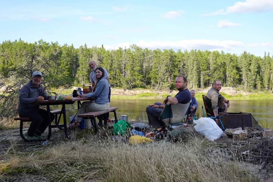
1), then Stagger Inn (Bennet Trappers Cabin).
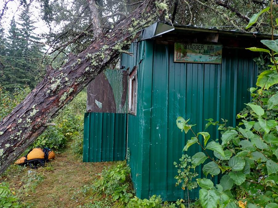
Chance for a stop, eat and explore. It was in as poor a
state as documented the year before, and though sound in structure needed a
solid dose of TLC to render it as luxurious as previously known a decade
earlier. We signed the visitor’s book. It appeared people were passing through
every three or so days through the main season. We speculated somewhere between
180 and 220 folk undertake the descent each year.
Considering the range of campsites we used, the impact didn’t hint at any more.
Steadily onwards to Rapid 35 (grade 2), and then the obvious
choice of the North Channel option (A) at Rapids 36 A and B. Option B is an
obvious do-not-run given what you hear from above, then see looking back. A was
a quick inspect then thread and manoeuvre through the three phases at grade 2
(1+).
The finale of the day was the Rapid 37 at barely grade 1.
The camp site for the evening was on the right shortly after, and welcome given
the general dampness that lingered after the earlier rain. The campsite was
clearly not popular with other travellers given we scratched around a while
before settling, and compared to others, likely the least favourite of the
team, but more than serviceable. (One reason why this campsite might only
occasionally be used is that only a relatively short distance before, namely
the Gammon River confluence, is one of the really classy
camps of that section, the Red Rock Café. We noted the spot, but it was ‘too
early’, given our expectation that day.)
The damp remained through into the morning, but thankfully
there was no further rain.
Click
or tap for more photos………
Day 6: Rapid 37 – Kautunigan Lake (24km)
by Nikki Aldridge
After our usual breakfast and de-camp, we had an easy start
to the day's paddling. Before long we reached our first rapid of the day, which
was an easy grade 2.
That was followed by another divergence in the river. The
South route would take us via Island Rapids, a Grade 4/5, or in other words, a
lengthy portage. The North route offered a far more inviting option, starting
with a Grade 2 leading to an island with a Grade 4 to the right. Approach to
the island was blocked by a couple of dead trees down across the river and we
had to weave between them.
Once safely landed on the island, we bushwacked our way to
get a view of the rapid. It was not paddle-able so we
returned to our boats and floated/lifted them down the shallow, rocky left side
of the island. A very easy portage. It also provided the perfect opportunity
for the obligatory elevenses stop.
This was quickly followed by a Grade 2 ledge drop and eddy
out avoiding the rocks. Mike and Ruth had a minor collision with the rock side
of the rapid and for a split second we thought they were going to conduct a
riverbed inspection but no such luck! This was immediately followed by another
Grade 2 flushing us out of the narrows into a pool.
We were then on the look-out for a Grade 1 which signalled
the approach to a Grade 5. The Grade 1 was at the convergence of the North and
South channels of the river and we were not 100% sure
whether it was the Grade 1 or not until we heard the noise and saw the horizon
line in front of us that was not looking or sounding very Grade 1 like at all!
This was a relatively straight forward 180 metre portage. Graham was quickly
done with his bag and sat with a hot drink and biscuits while the team helped
each other with the rest of the kit.
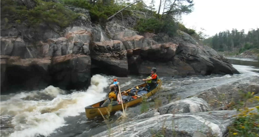
The next rapid of note followed soon after, Shangri-La, a
Grade 3. The river is funnelled through a narrow gorge here and the rapid is a straight forward but fairly steep wave leading into a big
and bouncy wave train. Martin and I ran it first while the rest watched. We
then quickly bailed our boat and got in position for photos of the others. I
got a throw line ready, just in case, but obviously the camera took priority!
Ian and Graham came next and flew over the waves, ensuring the camera was put
to good use, the throw line not so much. Mike and Ruth didn't fancy bailing
their boat and chose to portage this one.
A couple more sections of swift water quickly brought us to Okeegee Falls. Okeegee means
water that circles or eddies. This was a very short portage past the main drop,
a Grade 4, and then a short paddle to where 3 big rocks spaced across the river
created a Grade 2 with options. The recommended route is the furthest river
left line and this was the one taken by Ian and Graham
and Mike and Ruth. Martin and I felt like challenging ourselves with the more
exciting line on river right which was a bouncy wave train skimming the edge of
a stopper.
From here, we had a stretch of flat water for the last few kilometers to Kautunigan Lake,
which looked beautiful in the late afternoon sun as the river opened into the
lake before us. We quickly spotted the headland we planned to camp on and after
a quick look around were satisfied with the site.
As we unloaded, we were greeted by a little chipmunk but
before any of could get a camera out, he was gone.
We set up camp and went for a swim/bathe in the lake, drying
out in the sunny breeze before sitting down to dinner looking across the lake.
This site was not the best for camping spots and was rather lacking in toilet
facilities with the bush being rather thick, but it had stunning views.
There was also plenty of space out on the rocks where we ate
dinner for me to get the maps out to dry and re-organise ready for the next
day.
As usual, we went to bed when the mozzies started their
dinner…
Click
or tap for more photos…….
Day 7: Kautunigan Lake - Dancing
Fire Rapids (31km)
by Mike Alter
Despite what Nikki has said about Day 6, we (Ruth & I)
were never in any danger of inspecting the riverbed. Well, that is how it felt
whilst running the rapid and giving a big palm push off the rock whilst the
boat was at about 45 degrees, I may however review this opinion if we see some
external footage.
Anyway, enough about yesterday – today was looking to be a
glorious day, another glorious day! Only 119km to go.
Waking early at “Panoramic Campsite” we were all now well
into the routine of smoothly breaking camp – especially as the weather gods
were being so kind. For Ruth and I, we breakfasted on
some oatmeal porridge, a rice crispy bar and some coffee, before splitting
tasks to be efficient within the group.
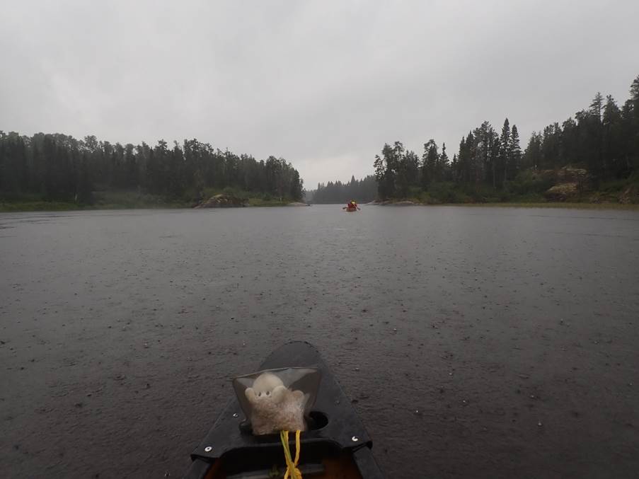
The lake was calm, to the North the wilderness was just
referred to on the maps as “Swamp of the New World” – let’s not go there – so
like the explorers of old we headed west to investigate the next batch of
pictographs. Sadly, we didn’t find them, but the blast across the lake had got
those paddling muscles toned up (just need to worry about the rest of the
body).
We entered the river channel under blue skies, aiming to
cover some distance before the blazing sun hit hard. The aim of the day was to reach
a proposed campsite at the beautifully named “Dancing Fire Rapids”.
The first rapid of the day (named rapid 47) was supposedly a
class 1, but felt like a lovely class 2 play wave, came and went. We paddled
on.
After more flat miles we passed a rather nice-looking lodge
that Ian and Graham decided to have a mooch around – we paddled on.
After more paddling, and having
been on the water for over 2 hours, we passed a canoeist who was still
breakfasting in his camp (obviously had more time than we did). He advised that
he has already been paddling for 12 days, had put in about 10km further up than
us, and was portaging everything above G1. He looked like a man enjoying his
solitude, so we didn’t tarry too long.
The next named rapid (48) was the class 4 Chap falls. As
with all the larger rapids, we stopped to have a look – remember, on expedition
you MUST paddle within your limits and protect the boats! The guide had
suggested a 10m portage if not running. We saw the size of the river wide hole,
the only break was a shallow slide near the bank that would
likely damage the boats or push you into the hole or large standing waves
beyond (swamp). So, with thoughts of protecting the boats we decided to portage
an extra 10m (it’s a hard life) and put in on the G2 below.
However, seeing as it was about 11, and this was a lovely
spot, we decided to stop for 11’s. I normally enjoy 11’s, but the unexpected
heat had destroyed my cheese on the first full day, and had melted the mars
bars into soft lumps of mess. Luckily I had a fruit
pot for each day, but day 7 of dry crackers and a fruit pot was not great. I
was surprised that Ruth hadn’t hit me with her paddle.
Anyway, we launched into the fast-flowing G2 and were on our
way.
Rapids 49 (G1) and 50 (G3) were great fun – and then we
reached Meekinako (Turtle) rapids.
Meekinako is only G2 Technical,
and we were all feeling great in our paddling, so Nikki stayed with the boats
whilst the rest of us went to scout as, although not too difficult, it was a
very wide rapid that covered a long stretch. Assured of his line, knowing what
curling wave he wanted to hit so as to access the
correct downstream V, Martin returned to collect Nikki and run it first.
They headed out into the middle of the river, but it soon
became apparent that there were so many curling waves, it was impossible to
identify the specific curling wave they had been aiming for (especially as
Nikki didn’t know what curling wave she was meant to be looking for). Never
mind, with a few more scrapes and bumps, that we could see on the bank, they skilfully
navigated the rapid.
Ian and Graham went next,
before Ruth and I
followed last. We were continuing to use our cunning plan – Ruth volunteered to
film everyone from the bank, so we could identify best lines. Heading into the
rapid, Ruth strained like a giraffe to spot our agreed line, and we got it. Great
job Ruth!
Rapid 52 was fun! A lovely little entry that suddenly
dropped you into big standing waves that sploshed into the boat. We all had
huge smiles.
Several more miles and we began to enter Dancing Fire Rapids
– a series of distinct rapids over a considerable distance.
The first rapid passed without much notice. The 2nd
G2 we all got out to inspect as the guide book had
stated “Lift over (portage) river right or run left with big brace through
the diagonal wave”. We looked at the rapid and decided that we didn’t fancy
the BIG diagonal brace, but that the rapid would go on the right over the
ledge.
As blind probes, and with the thoughts that their canoe was
already “weathered” so why break the others, Nikki and Martin went first.
Unfortunately, a current took them about 40cm to the left of where we all had
planned to go. Nicely through the first wave, and initially nicely through the
second. However the second contained a ledge, and with
the damaged gunwales not able to support the boat, the back of the boat visibly
moved independently to the rest of the boat as it went over the drop. In the video, you can clearly hear those on
the bank go “Ouch”.
With thoughts turning to having to fix the boat, and not
wanting to damage any more boats, the other 2 boats portaged.
Another rapid and we reached our camp for the night. This
was another amazing campsite, with the added bonus of
a “lazy river” swim spot. You could jump in at the top of the rapid and just
float through the rapid, and around the corner to the get out. Sadly, I had
forgot a rubber ring, and as not the strongest swimmer I again had my PFD on
for my evening swim / wash. The river was not quite as lazy as I had thought –
lesson to me, get back to the pool once home.
The others meanwhile swam across to an island and a small
wave which, with a bit of practice, they were able to body surf on.
With repairs to the boat contemplated, a tarp was erected as
we were expecting iffy weather. The rains never came during the night, but we
did have strong winds and a most amazing silent electrical storm that went on
for several hours.
We are so lucky to have been blessed with the chance to
paddle this amazing river. Nikki’s efforts in producing maps for us were
enabling us to keep going at good pace. But it was taking a toll on kit – one
boat damaged, my shoes beginning to part from the soles, a portage pack holed,
the window delaminating from my tent’s flysheet and a thermarest
with a hole in it, luckily we had repair kits.
Here’s looking to tomorrow, more amazing paddling with great
friends.
Click
or tap for more photos…….
Day 8: Dancing Fire Rapids – Rapid 65 (10km)
by Ian Bell
After a night of lying in the tent and watching the lightning
storm but not hearing any thunder and no rain, we had a late start due to
having to complete the repair to Martin and Nikki’s canoe. This gave a chance
for a more relaxed morning start than the last few days.
Once underway we started the paddle by running the rest of
Dancing Fire Rapids. Rapid 56 was a class 2 that was easier than most of the
class 1s so far. All down without any incident.
Rapid 57 - Class 3 which was closer to a class 2 after
inspection.
Rapid 58 - Class 2/3 we had to portage because it was too
rocky at the bottom
Now out of Dancing Fire Rapids we continued
on down the river, hearing thunder rumbling for ages with no lightning
or rain, air temperature was a bit cooler today.
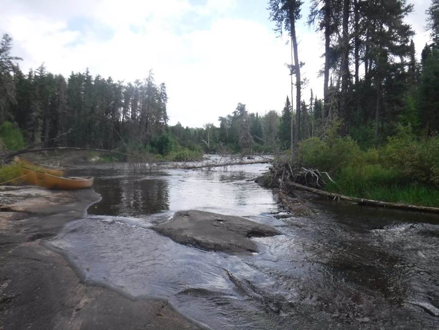
Rapid 59 - Canyon rapids class 3 into a class 2 - the class
3 was a 3-foot ledge we couldn't paddle so we portaged and lowered the boats
over the ledge, the class 2 section was nothing.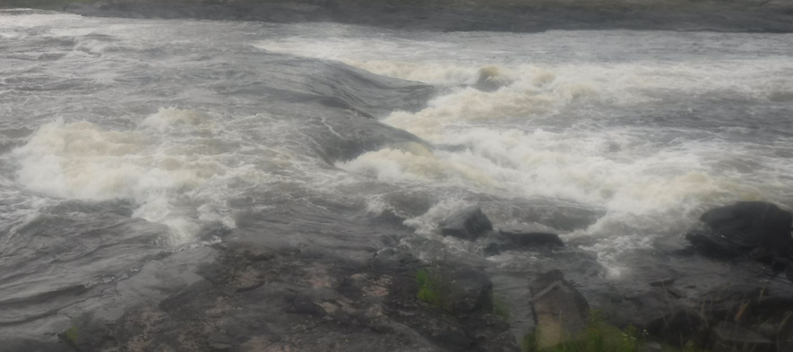
Rapid 60 - book says portage with no indication of grade -
we would say 3+/4-. An initial wave entry river left, then hard right to a
small V beside a big ledge stopper. After inspection and debate Martin and Nikki
decided that they would give it a go, with the rest of us watching, but I think
minds already made up that we would portage as the line was extremely tight. I positioned
myself so that I could provide them with some hand signals to assist with
staying on line. The result of this was me waving LEFT
as fast as I could, they reacted to this but only just hit the V at the bottom
of rapid. Their boat appearing to just clip a rock on exit. The rest of us then
opted to portage this rapid. Discretion being the better part of valour.
Rapid 61 - Island Chutes starts with a portage followed by a
class 2 we assumed we would have to portage, so we did the 105m portage past
the grade 2, except Mike who got carried away and portaged below a second grade
2 - a 475m portage marked as "unnecessary" much to Mike's dismay!
Graham, having also taken his bag to that point, rejoined me.
Having assessed rapid 62, which was immediately after Island
Chutes, Graham and I set off to reunite with Mike and the kit at the end of the
“unnecessary portage”. Nikki ended up soloing this rapid with Martin making his
way down the bank as his space in the boat was now taken by Ruth’s bag which
she had portaged to the same place as the rest of us.
Rapids 63 & 64 - a grade 1 and grade 2 - very easy so no
dramas.
Having decided that this would be a short day and that we
will make mileage up over the next couple of days, we started looking for camp
spots and found a suitable location, just before a grade 1, on a windy rock peninsula.
As we were now well into expedition mode it was the usual pitch
camp, evening swim, tea and enjoying the sunset before bed.
Click
or tap for more photos…….
Day 9: Rapid 65 – Rapid 78 (29km)
Breaking camp is now a well-oiled process; tents down, kit packed away,
breakfast eaten, boats loaded and away we go again! The weather was a bit
kinder today, back to more sunshine albeit with some headwind throughout the
day, pushing Force 4 at times.
The first rapid appeared within 50m of camp, followed by more flat
sections with grade one ripples.
Taking the North route with the hope of water levels staying up.
Then came rapid 70! This was technically a Grade 1, but experience has
taught us that their grading system is open to “interpretation”. It turned out
to be a steep V drop in, then avoid the holes and stoppers just below – making
it more of a grade 3- than a grade1!
Nikki & Martin ran it first taking river left route of the V,
clipping the tail of the boat on a rock, which caused some more excessive “flexing”
of the boat, but it held together. Ian & Graham then ran it on the right
side of the V, creating a wet ride for Ian at the bow!
Mike and I decided to use the dryer tactic of lining the boat down,
especially as we were becoming more proficient at it!
Next came number 71: Manitou
rapids – made famous in Ray Goodwin’s video as the rapid that nearly killed
him. For us, with our water level, it was relatively non-descript.
Next came Kashaweposenatak rapid (72) which
was a Do Not Run. This was located in a well burnt
area of the river. The portage consisted of a 60m carry over fallen burnt trees
and rocks, followed by a quick paddle across a pool and then another 65m carry
over rocks. We stopped for 11’s and discussed the possible fantasy lines (which
you would probably need a kayak for)!
Kakasannapeekak rapid came
next and after a good scout on the bank, Martin & Nikki paddled it first.
Unfortunately, there was a breakdown of communication between the front and the
back of the boat which resulted in a non-elegant line which didn’t match their
intended plan!
Ian and Graham were next to run the rapid. They nailed the correct line all
the way through the rapid and on exiting they gave a thumbs up to Nikki
(photographing). Sadly, a huge boil then opened up
directly underneath their boat and proceeded to tip them out! The kit was secure,
and they then had a long swim to shore! And then as Nikki and Martin went to
assist, the same boil tried to eat their boat too!
Rapid 74 was a Class 5 portage of 135m, which is where we chose to take
our lunch and again, we found ourselves discussing the fantasy lines!
Rapid 76 was a class 4 with a 95m portage. As
we got out of the boats and began the portage, we managed to disturb the
midges, who proceeded to attack with a vengeance! Fortunately,
after about 20m it turned into large rocks to scrabble down to the put in below
the rapid, so we managed to escape from the midges!
Upon reaching the last rapid (78) Nikki and Mike had jumped out the boats to recce the campsite that was on the corner
of the rapid, whilst Martin & Ruth solo’d their
boats down to the bottom, with some hindrance from the head wind that decided
to appear!
Click
or tap for more photos…….
Day 10: Rapid 78 – Lagoon Run (24km)
by “Martin Aldridge”
After the morning coffee watching the morning view, and now with
regular drone flight done, time to pack up camp.
Day 10 started with some big rapids. Ankuasi
Falls was a grade 5 do not run. A short 5 metre lift over past the drop into a
nice little pool and we were able to launch into the run-out.
Next up was Namay Falls, another
grade 5 do not run to the right of an island. The left of the island was
supposed to be a 5 metre portage but the water level
was a little low and the portage a little drier and longer than 5 metres.
However, it was a beautiful spot for elevenses with a view of Namay Falls across the river, with a Bald Eagle keeping us
company.
The river then came to a split. The North channel detours
directly North for a couple of kilometres before turning back Southwest for
another couple of kilometres. The South channel was a much shorter but smaller
and narrower route. We opted to play it safe and go North. We had plenty of
time. There were a few easy grade 1-2 rapids along the
way.
The two channels merge again just before an island that
marks Namay Rapids. To the North of the island
another grade 5 do not run. However south of the island turned out to be a gem.
We rounded the corner to Namay
Rapids and spotted some people camping at the top. They were a family of four
who had paddled up from the get out and had been camping there for a couple of
days. We couldn't blame them, it was a beautiful spot and Namay
Rapids, consisting of three grade 2-3 waves and wave trains, turned out to be a
great, fun rapid that would have been great to stay and play on.

We left the family to their camp and stopped around the
corner for lunch.
This was soon followed by a fast grade 2 ledge.
A short flat section followed, leading to Akeeko Rapids, a long grade 3 with plenty of stopper waves
easily avoided by keeping right.

The final rapid of the day was Lagoon Run and access to the
campsite from below the rapid which overlooked the rapid. With that in mind,
after a quick inspection we each ran the rapid and although it was only a grade
2, the boily swirling water of the eddy was violent
enough to push us off line and back into the main flow
and wave train.
Breaking out slightly lower down we found the path up to the
campsite and soon had boats unloaded, pitches identified and tents up. We were
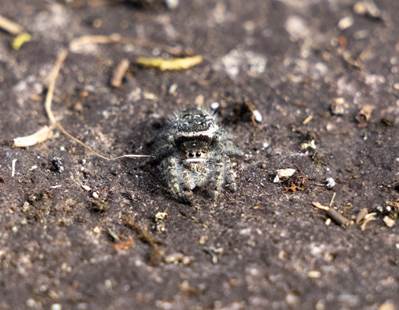
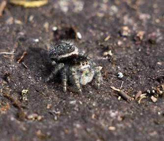
greeted by a teeny tiny spider that wanted to make friends. Tonight's site was huge with plenty of
camping space and multiple cooking areas to choose from. We choose to cook and
eat overlooking the stunning view of the Lagoon Run rapid.
Click
or tap for more photos……
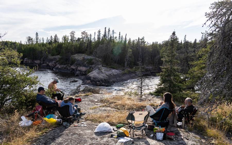
Day 11: Lagoon Run to Camp After The Bridge (10km)
By Graham Rowe
The massive camp on the north bank
of the Lagoon run offered a fine place to relax into the sunny morning. The
little tent drying that was necessary was easily achieved.
No rush today, and even less than
expected it turned out. Still, we were on the water at a respectable time and
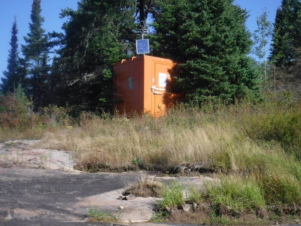
after a few kms came upon the river’s gauge station. Odd, so soon… thought to
be much further towards the end. This station is the critical source of
information for the volume flow and comparison of previous descenders
presentations.
Shortly after, we came to Meekisiwi Rapids (rapid 87 - grade 2/2+). A bold line hard
left with optional breakout on the left after the first part. No issues.
This is the final rapid and within
a few kms the egress bridge appeared, somewhat sooner than expected. The map
editions available are prints from before the ‘new’ road bridge and road were
completed and had confused where a review on Google Earth would have clarified
that the road was built from the areas electrical power line (which vaults the Bloodvein) service road which had long been there. The
remaining river to the Lake Winnipeg and Bloodvein
Village is a few hours paddle further on.
We stopped for elevenses and
established the egress point for the boats. A local work team stopped at the
bridge pull-out informed us that the weather would change overnight, which
proved useful.
Back in the boats we continued
downstream another 3km or so and spotting a camp with fire pit and picnic
tables on the south bank, pretty much decided collectively that out descent was
done. We hauled out and set camp to enjoy the day and evening simply absorbing
the evolving scenes or the last time.
As advised, after dark the weather
changed… the wind got up, the thunder and rain filled the night.
Click
or tap for more photos……
Day 12: The End
by Nikki Aldridge
The final day.
Not quite as planned given that we had already reached the
get-out a day early but hey…
We woke up to the sound of rain on the tents. Thunderstorms
had been forecast to come in at 6am and stay all day. They got the 6am part
spot on but by the time we emerged from our tents, the rain had stopped. We
were able to pack up and have breakfast in the dry.
We were in no rush this morning, given that we were being
collected at 10am and only had about 2km to paddle back upstream. So naturally,
everyone was on the water ready to go by 8am! It may have helped that we had
done a lot of organising and packing away of dry kit the day before.
We said goodbye to our last camp site and launched into a
headwind to paddle upstream to the get-out bridge. Martin turned on the GPS
recorder and spotted a text from Albert, our supplier/driver… he had locked the
keys in the van and was going to be late! We therefore decided there was no
point racing to the get-out, but it was too late for Ian and Graham who
seemingly were on a mission this morning and were well out of earshot.
Before long, the wind dropped and
we were able to enjoy a leisurely paddle back upstream. By the time we caught
up to the others, they were already out of their boat and unloading kit.
We then proceeded to set up a tarp in the car park beside
the bridge, get out our camping chairs (a luxury item worth the weight) and
kindles and wait.
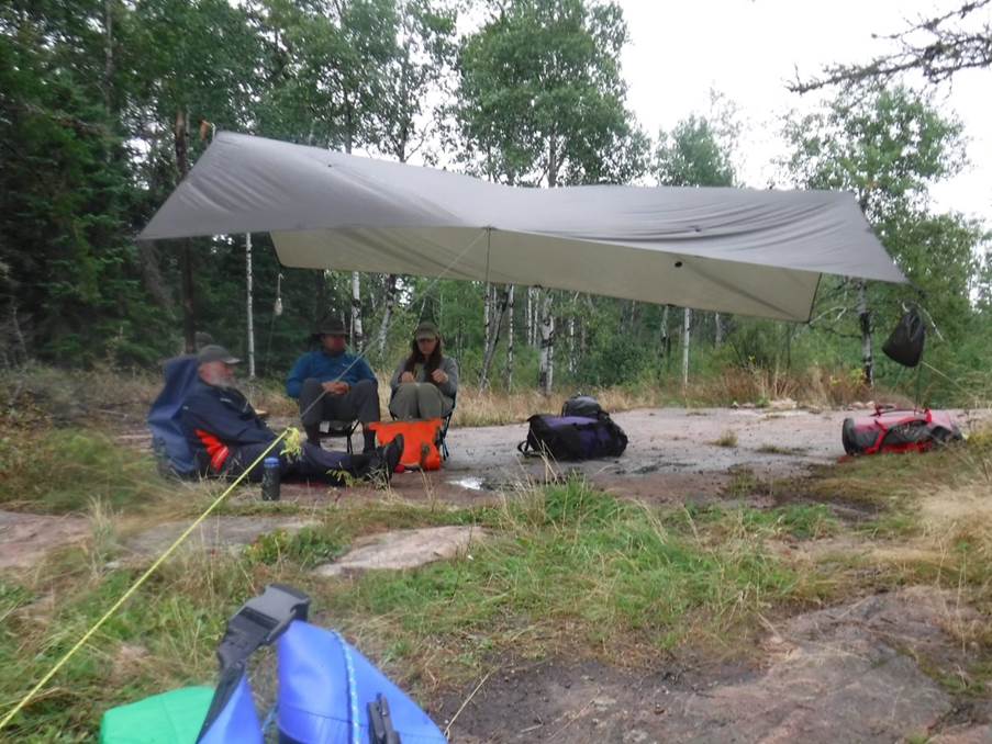
Fortunately, the rain held off and a few hours later Albert
arrived with his tail tucked between his legs…
We greeted him with equal apprehension as we told him about
his canoe and its ambition to become an unpiloted thrill-seeker (see the Day 4
post), and the subsequent damage. Luckily, he took it well, with a shrug he said “these things happen”. As recompense, we presented him
with the additional paddle we had found on Day 9.
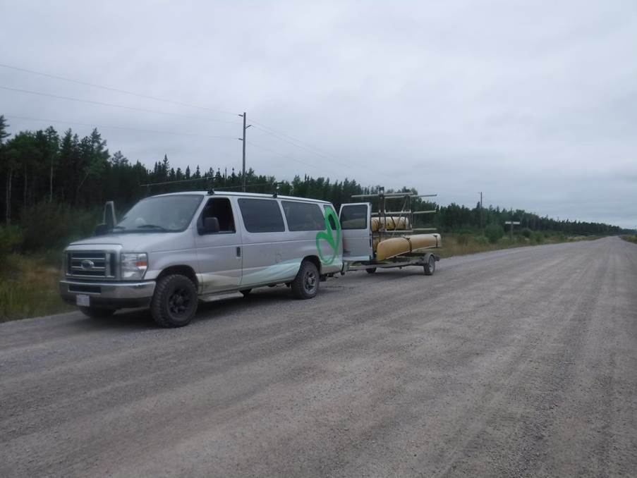
With boats and kit loaded, we piled into the minibus and as
we pulled away, we saw a little black something appear
from the bushes beside the road just up ahead. A small black bear skipped
across the road and disappeared into the bushes the other side. Our first and
only sighting of a bear this trip. Mike and Ruth observed that just 10 minutes
earlier they had walked past that very spot… bad timing guys!
We had a 3-4 hour drive back to
Winnipeg. En-route we couldn’t resist the smell of real non-dehydrated hot food
– fried chicken and potato wedges were order of the day… although we all
quickly realised that we should have shared the huge portions rather than
getting one each!
We were returned back to our
previous super-luxurious (read: cheapest around) hotel and went to an Irish pub
for dinner. The following day we went out to explore Winnipeg. We visited the
Manitoba Museum which covers everything from local history to geology,
dinosaurs to current wildlife and the first nations people to modern Manitoba.
We then visited the Fort Shopping Park where we had coffee
and cake, the Museum of Human Rights so that Mike could get a photo outside and
pretend he took his work seriously enough to visit the museum whilst on holiday
and finally, returned to the 2 outdoors shops where we had stocked up on
dehydrated food before our trip… and where they had a very pretty selection of
canoes and paddles that wouldn’t fit in our luggage, and a few other items that
would.
The next day, we discovered our biggest mistake with the
hotel was that they wouldn’t hold our luggage for us during the day and when we
arrived at the airport 3 hours before check-in we
discovered ours was the only Porter Airlines flight that day and so the
check-in desk wasn’t open yet either so we couldn’t check-in our bags. We
therefore made the most of the next 3 hours by exploring the arrivals area of
Winnipeg Airport which successfully filled the majority of
5 minutes.
Paddlers: Nikki & Martin Aldridge, Mike Alter, Ruth
Edwards, Ian Bell and Graham Rowe
Click
or tap for more photos…….