|
|
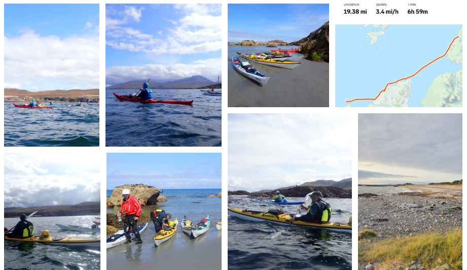
2025 Islay and Jura
Sea Kayak Trip |
|
News items or reports on club activities
should be sent to website@liverpoolcanoeclub.co.uk |
|

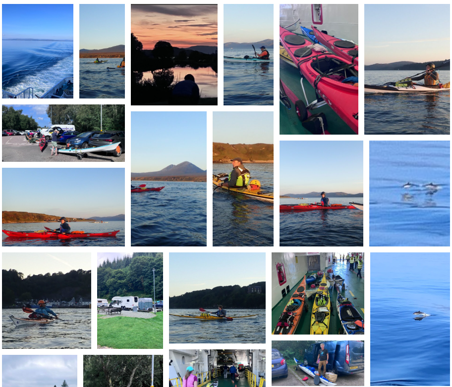
 This year's trip was to be the Inner Hebrides,
with backup plans to base ourselves from Leachive Caravan Park – Tayvallich in
poor weather, but with good conditions, we were to trolly the kayaks onto the
ferry at Kennacraig and paddle from Port Askaig on Islay. As usual, the trip was fully booked from
early in the year.
This year's trip was to be the Inner Hebrides,
with backup plans to base ourselves from Leachive Caravan Park – Tayvallich in
poor weather, but with good conditions, we were to trolly the kayaks onto the
ferry at Kennacraig and paddle from Port Askaig on Islay. As usual, the trip was fully booked from
early in the year.
With
high pressure giving ideal conditions for the trip out to the islands, we
booked the ferry and planned a 10-12 trip to make the best of the good weather.
|
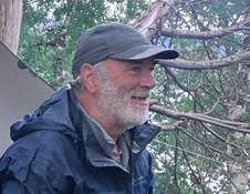
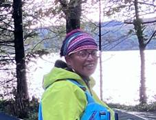
Ella |
Catriona |
Ian |
|
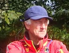
Dave |
Andy |
Frankie |
|
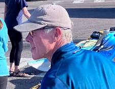
Debbie |
Keith |
Christine |
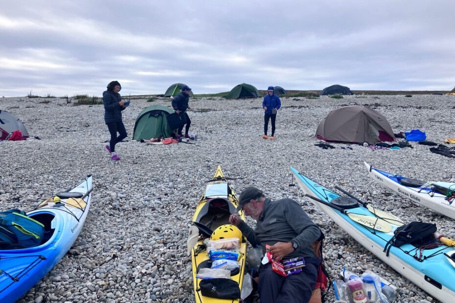
Day 0 Saturday 16th Getting to
Port Askaig
Team
“M” headed up on the Friday evening and camped next to the Crinan
Canal. There was a brilliant sunset. We had actually
gone to the campsite first, but were informed
that it would be £75 (£25 for each small tent) for the night. The couple
next door to our pitch had a family tent and were charged £25 + £5 for the
second adult. I seriously think Scotland has its camping fees a little
confused.
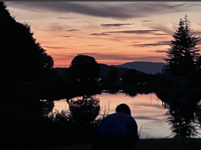
Our camp next to the Crinan Canal.
We
checked out all the best cafés for the morning and ended up in Tarbet.
Here we met up with the three other cars and enjoyed a second breakfast. With
all 9 of us together, we could discuss plans and look at the maps and possible
routes.
After
the late breakfast/lunch, we headed to the Ferry at Kennacraig,
which had free parking and security cameras to watch over the car park.
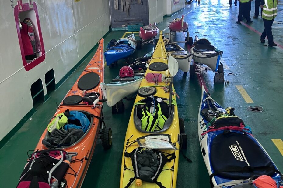
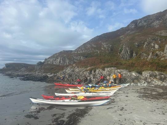
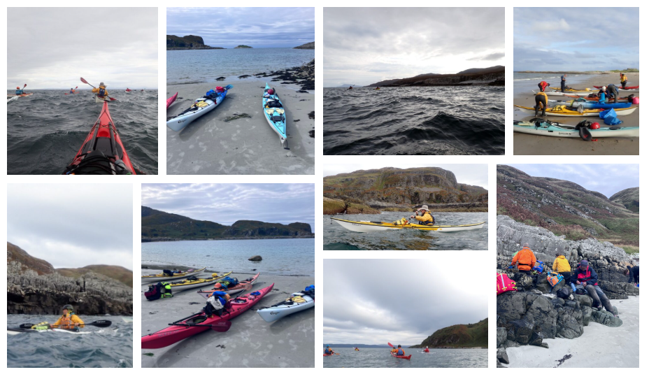
We soon had the kayaks packed, ready to paddle the short way to our camp as
soon as the Ferry landed on Isla. The kayaks proved stable on the
trolleys and were easy to wheel onto the car deck of the ferry, ready for its
departure at 6:00 pm.
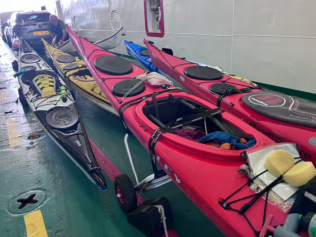
Our kayaks were
wheeled onto the car deck of the ferry, ready for its departure at 6:00 pm.
During
the 2-hour journey, we enjoyed an evening meal in the restaurant on board and
then went out on deck to check out the coastline. Unbelievably, we
saw a Fin Whale cross behind the boat. A few minutes later, there was a
large pod of about 25 Risso’s Dolphins. They were surfing the wake of the
Ferry and jumping clear of the water. The white scarring (naturally
developed over their lifetime) on their heads and bodies was very clear as they
leapt clear of each wave.
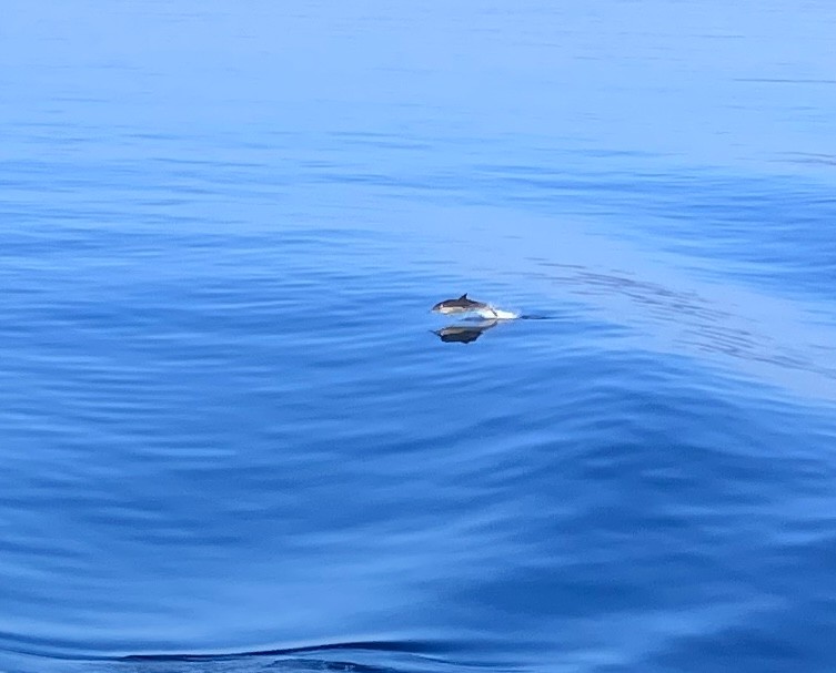
A large pod of
Risso’s Dolphins were surfing the wake of the Ferry
and jumping clear of the water.
As
we neared the port, we scoured the coastline for a suitable campsite. It
was going to be dark in less than two hours. Once docked, the cars
all left first, and then we wheeled our kayaks about 30m to the small slipway
in front of the pub. We dropped the kayaks off the trollies and carried
them to a small area of trees in the car park and secured them with a couple of
cables and a lock.
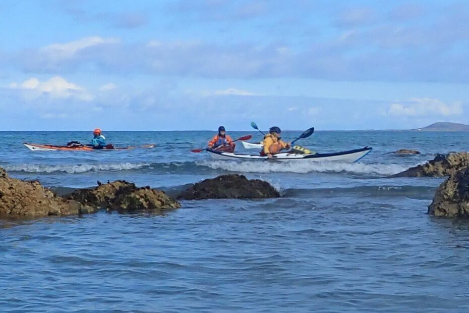
We
then got ourselves afloat. With fully laden kayaks, we headed out across
the Sound of Islay towards Jura. There was no suitable campsite on the
Islay side of the sound.
With fully laden
kayaks, we headed out across the Sound of Islay towards Jura
The
tide floods at about 6 knots on springs, but it was a neap tide, so it was only
half of this. We soon happened across a nice pebble beach for the night
and quickly had our tents up and all settled in for a good night’s sleep.
2025 Islay and Jura Sea Kayak
Trip Day 1 Port Askaig to Ardbeg by Catriona
Port Askaig to Ardbeg
Day
1 of our trip started with me mentioning the need for sunscreen for peel-wally
people (not quite correctly) and Ella announcing that we were on our own for
medical emergencies, as she is not back at work for 6 months.
We
left our camp just north of the Feolin Ferry on Jura
with enough sunscreen and no medical emergencies.
High
tide (a whole 70cm higher than low tide) was at 12:15, so the tide was not due
to flow south, our chosen direction, till about 10:30. To make paddling easier,
we eddy hopped our way down the coast of Jura, till we reached a small island,
Glas Eilean, just offshore. Here we saw deer swimming and jumping through
shallow water from the island to the mainland of Jura.
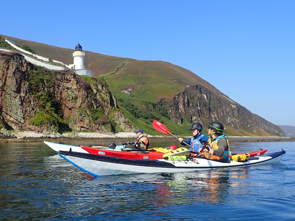
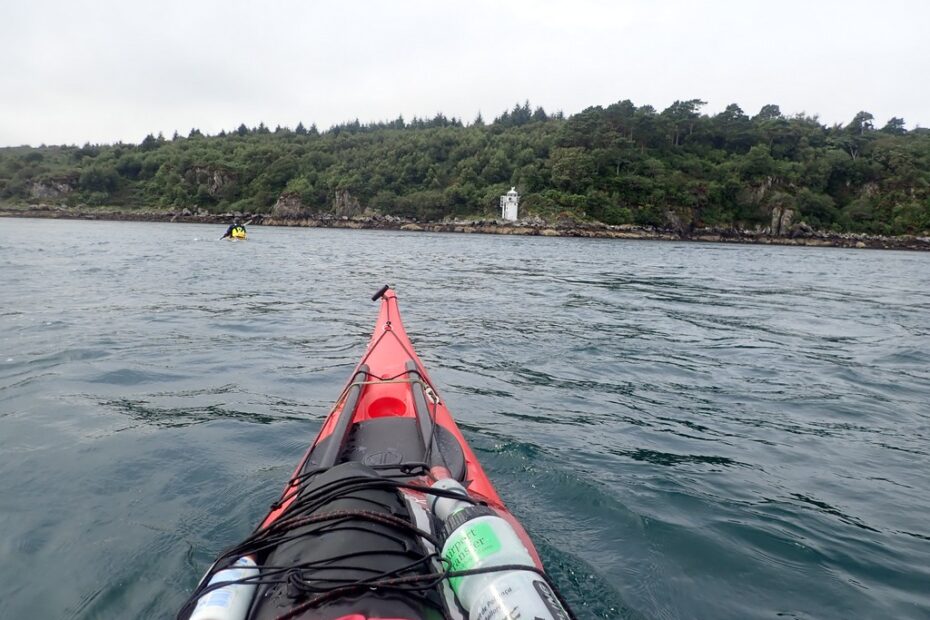
McArthur’s Head
Lighthouse
After
elevenses, on the Island (Glas Eilean), we crossed the sound of Islay to
continue our paddle along the east coast of Islay. Opposite the bottom of Jura,
there is a distinctive lighthouse within a white-walled enclosure.
Rounding
the bottom of the Island, there are several small islands and lots of seals. By
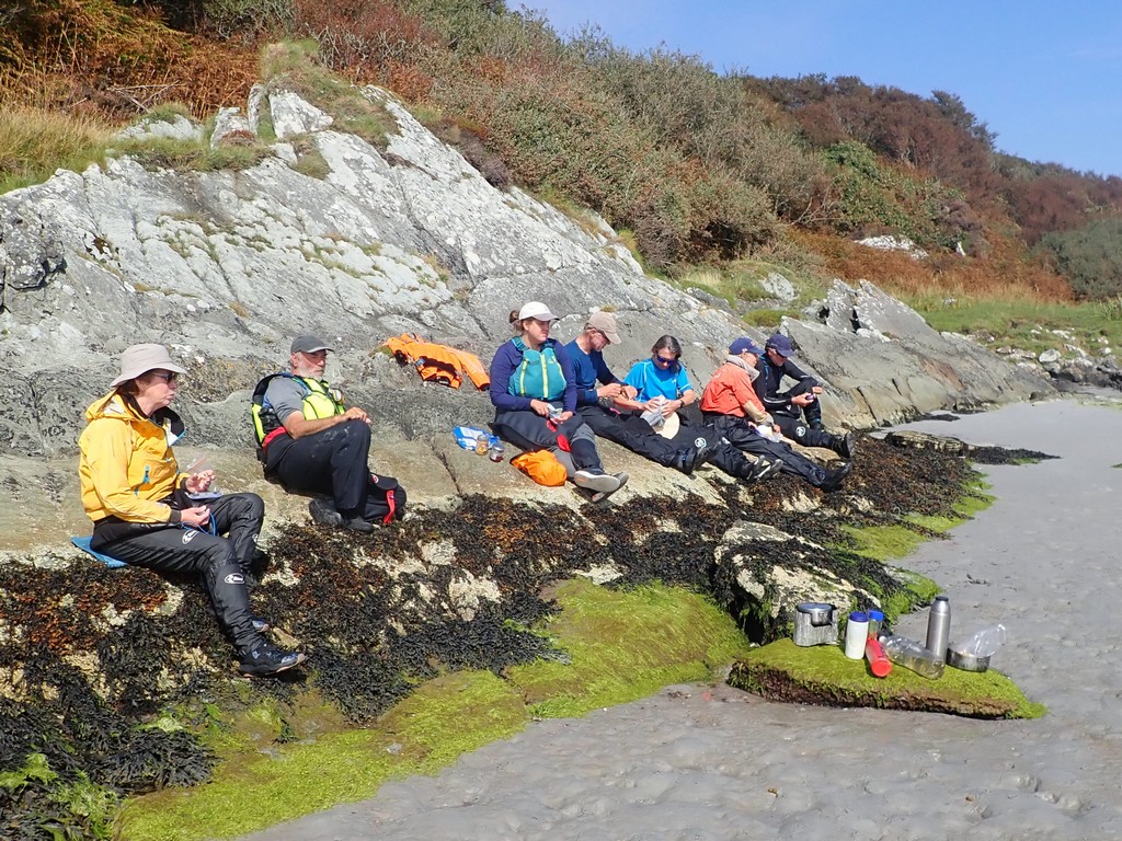
now it was getting really warm, and we took our cags off on the water, before stopping for second elevenses
on a warm, stunning beach.
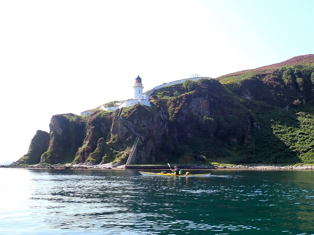
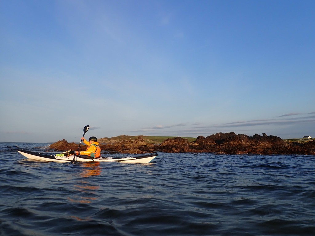
Ian paddles under
McArthur’s Head Lighthouse
We
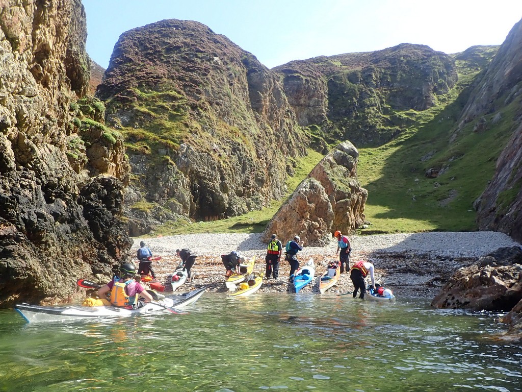
finished the last part of today’s trip and stopped to camp at an unnamed bay on
the South East coast of Islay. Here, we chose our
preferred camp type, sand or grass. It was beautiful with just enough wind to
keep the midges away.
Day 02 Monday 18th Eilean Imersay (Ardbeg) to the north end of Laggan Bay (Ghillie
Brae – Laggan Estate) by Debbie
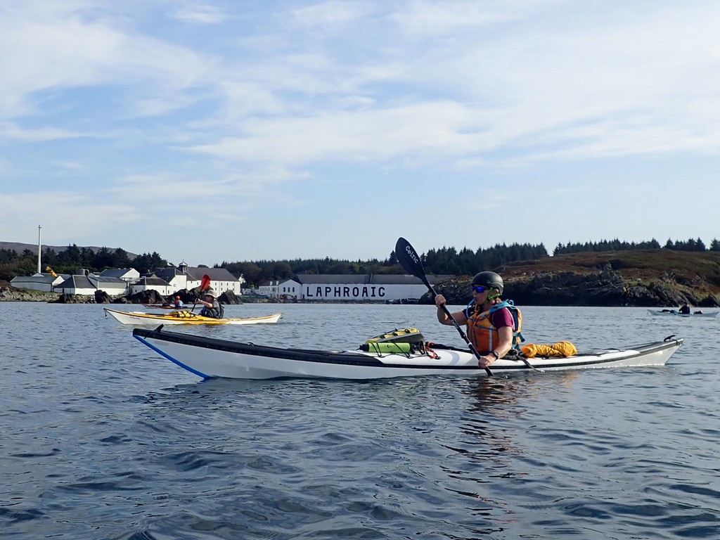
Packed
up and on the water promptly at 9.00, no time for faffing, we are now a fully
trained and slick team, urged on by the knowledge that in the next 6 Kilometres
there are 4 of the best distilleries Islay (Whisky capital of the world!) has
to offer. But…such an early start means none of them will be open for
“sampling”, we have been outmanoeuvred by our leader yet again. Whisky,
whisky everywhere and not a tot to drink. Those of us with a passion for the
water of life had to console ourselves with taking distant photos of the
distilleries as we passed them by, Ardbeg just round the corner, Laphroig, Lagavulin and then Port Ellen. Outrageous!
Whisky, whisky
everywhere and not a tot to drink.
In
fairness, we did land at Port Ellen briefly for first elevenses (Ella came up
with some superlative to describe first elevenses of the day, but now I can’t
remember it… supreme? superior?) to fill up our water bottles at the marina and
use the facilities in the ferry terminal.
Then
off we go again past Port Ellen lighthouse, a long day in prospect as we have to round The Oa peninsula. The Oa has the most
spectacular coastline of huge cliffs, with very few landing places for kayakers
and not an option for wild weather. However, the weather was perfect as
we rounded Rubha nan Leacan
at the southeastern point and turned north westerly, taking in the fantastic
coastline towards the Mull of Oa.
The
American Monument high up on the Mull commemorates the huge loss of life when
two troop ships sank in Islay’s waters in the last year of WW1. The area
around the Mull is now an RSPB nature reserve, home to choughs and golden
eagles. Catriona and I both think we saw an eagle, but we were accused of
marking our own homework. Ha.
Eventually, we
came upon a small, steep storm beach through a narrow gap in the cliffs.
Heading
up the coast after the Mull, it was tricky finding a second elevenses or
indeed, a first lunch spot. Eventually, we came upon a small, steep storm beach
through a narrow gap in the cliffs. Entertainment was provided by Ella –
anatomical nuances of the various bones/skulls/vertebrae littering the beach.
From
Rubha Mor, the northern point we reached on the Oa,
we set off across Laggan Bay, with views of idyllic sandy beaches (and the
airport) on our right. This was a lengthy paddle, about 7 Kilometres, but
we were anxious to get across and find a camp for the night, dreaming of golden
sand and midge-free cooking……
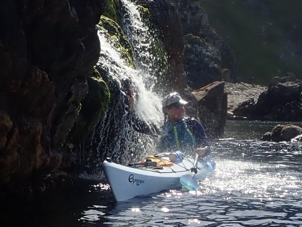
Ella sampling a
local waterfall
In reality, the golden sandy
beaches were left undisturbed in favour of potentially better toilet facilities
(rocks) and a huge mound of rotting seaweed (ugh) to drag the boats
through. One day…
Day 03 Tuesday 19th Ghillie Brae
to Kilchiaran Bay Beach by Ella
A
7.00 am start on the water meant that some alarm clocks were set as early as
5.00 am. The early start was to ensure we made it through the narrow channel of
water by Portnahaven during the slack period of tidal
movement. We had made good time, so we opted for a quick elevenses on the
shore, but as we snacked, the tide seemed to change before our eyes, which
meant jumping quickly back in our boats and heading off through the channel.
Christine paddles
through at slack water
After
passing by Frenchman’s rocks, we rounded the corner and relaxed our pace when a
bumblebee landed on my boat. Its wings were wet, and it looked tired. I let it
rest on my boat for an hour, while it dried its wings in the sun and enjoyed
some of “my emergency sweets” I shared with it. Fuelled by strawberry laces, it
took flight when we got closer to shore and left to rejoin its family.
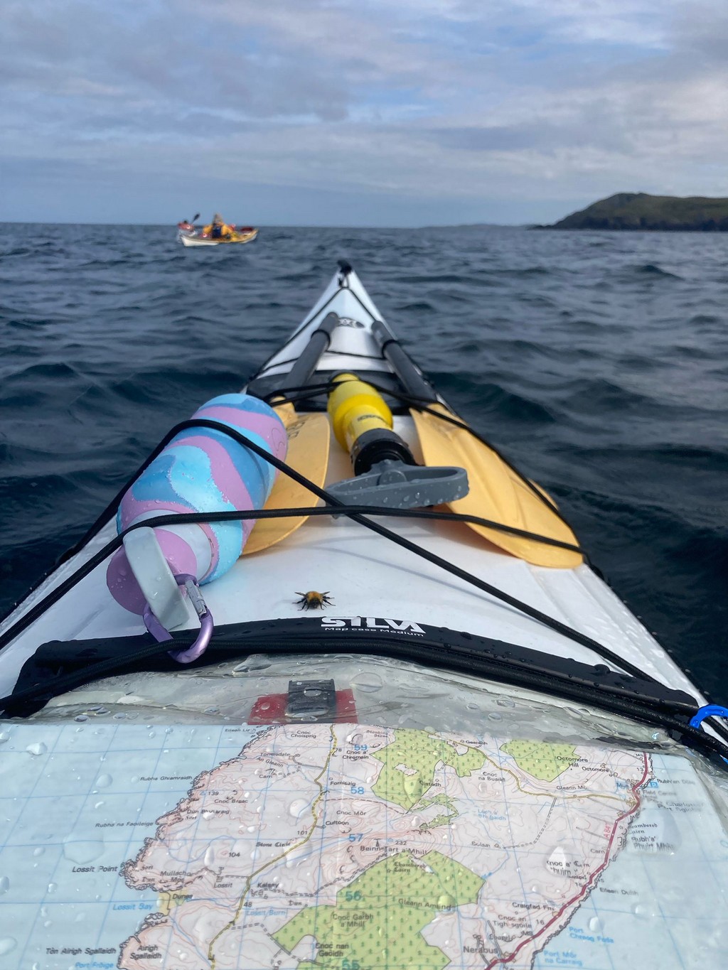
Rounding the SW
corner of Islay
The
early start meant an early finish at around 2.00 pm. The sun was out and we sat on the beach, sunbathing, reading books and
drinking tea (all the things you often associate with a Scottish kayaking
holiday).
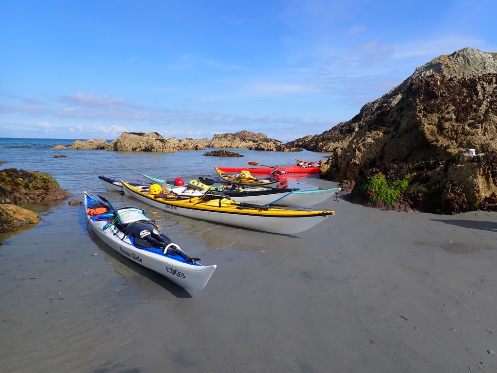
Kilchiaran Bay Beach and
campsite
Day 04 Wednesday 20th Kilchiaran Bay Beach to Nave Island by Andy B
We
rose around 7 am, struck camp, carried boats to the water’s edge, packed, and
were paddling by 9 am. We left Kilchiaran Bay,
crossed Machir Bay and paddled steadily northwards in calm conditions, assisted
by the tide.
Before
long, we had rounded Coul Point and made our first elevenses break in the Saligo Bay area. As we ate our snacks, Keith took the
opportunity to show us the tidal planning maps he uses to assess tidal flow
rates and direction, referenced to HT and LT at Dover as the benchmark. Some
minor amusement was caused as my boat decided to launch itself into the water,
but luckily the homing device I’d installed brought it quickly back to shore,
to the disappointment of onlookers who’d hoped for a bit more entertainment.
Before long, we
had rounded Coul Point and made our first elevenses break in the Saligo Bay area
Heading
north again, we had varied shoreline interest with a multitude of caves, geos
and gulleys, and sighted a white-tailed sea eagle, airborne with its prey. The
sea eagle is a notable feature of Islay’s wildlife, previously extinct but now
returned to the island. They are seen particularly around Loch Gruinart and the Oa peninsula, where they nest, and are
known to hunt barnacle geese. Hen harriers and golden eagles are also resident
and make Islay a great place for eagle sightings.
We
rounded An Clachan and after a further break, we were
paddling NW towards Ardnave Point. We’d elected to
camp on Nave Island, shown as a bird sanctuary on our maps, and situated just
north of the Point. Approaching the island, we came across large colonies of
seals beached on outlying skerries, intent on observing our approach. To the
alarm of some of us, many of the seals launched and several came closer,
surrounding us in a seemingly threatening manner. In fairness, they may just
have been curious or keen to guard their territory, as they made no attempts to
board kayaks.
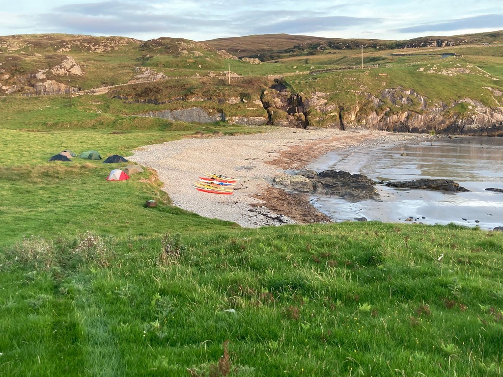
This time camping
on a raised (and level) pebbly beach.
Landing
on Nave Island, we carried boats up above the high tide line, unpacked and then
began the usual search for level campsites, this time camping on a raised (and
level) pebbly beach. Later, we discussed route options for the remainder of the
trip, bearing in mind the imminent onset of bad weather in a few days time. In short, either completing the circumnavigation
of Islay and Jura, arguably the preferred option, paddling a section of Jura’s
west coast or via the Sound of Islay, a stretch of its east coast. This would
leave a few days for a further trip, venue to be decided depending on the
weather and other factors.
Some
braved the sea for a short dip, then at the allotted time the midges appeared,
forcing a retreat into tents, and welcome sleep.
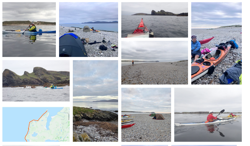
Day 05 Thursday 21st Nave Island
to Shian Bay by Christine B
A
day of crossings and decisions.
People
heard deer by the tents overnight, the heavy breathing and grunting….
Thursday was another lovely start to the day. A few seals are still
watching the campsite from their vantage point of the water, just off Nave
Island also known as Seal Island and Blue Duck Island to the LCC crew.
We
had a 9:00am start, though one person was on the water at 8:40am, 20 minutes
ahead of the last person, who was very timely.
We
had our first crossing of the day to complete as soon as we got on the water,
not only heading back to the mainland mass known as Islay, with our small
escort of seals, but passing Ardnave point and Loch Gruinart to head further up the north coast of Islay. The
coast was interesting with high cliffs, caves, arches and lots of goats.
We headed out for our usual elevenses stop, looking to stop at Port an t-Stuthain, but finding no easy landing spots, especially for
9 kayaks, we headed to Rubha Bholsa
to the arch and a beautiful sandy beach.
We headed
to Rubha Bholsa to the arch
and a beautiful sandy beach
After
the appropriate elevenses snack, we decided to start heading along the coast to
the end of the north-eastern end of the Island of Islay, where the Ruvaal, Rhuvaal, or Rubh’a’ Mhàil lighthouse is
situated. A working lighthouse which was built in the 19th century
(construction starting in 1857 and completed in 1859, costing £6,500 (£822,402
in current day terms)), which marks the approach to the Sound of Islay, a
narrow channel which separates the islands of Islay and Jura and allows a ferry
passage to Colonsay. The lighthouse, its
keeper’s cottages and boundary walls are all category B listed buildings.
While
admiring the lighthouse, Keith brought up the options A, B, C and D. Time
to make a decision, though none of us could remember
which option was which…. Keith did provide a couple of options. He
thought, given the tides and wind, we would be able to circumnavigate Jura
before the storm arrived on Monday / Tuesday, or we could head to Loch Tarbert
on Jura, but would be heading back against the wind and tide. After some
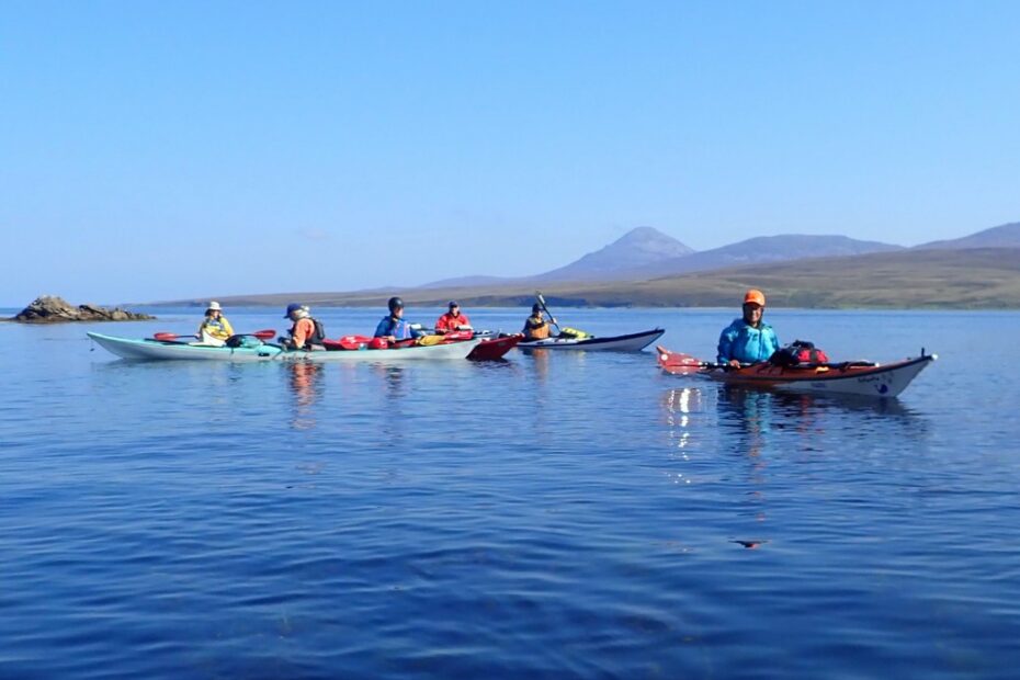
discussion, it was agreed to follow our circumnavigation of Islay with a
circumnavigation of Jura. This meant a crossing of about 10Km or 6 miles to a
point on Jura – described as the third sandy beach above the cliffs
!!! An area on the map which shows the raised beaches. In
readiness for the long crossing, jackets were removed as the sun had come out
and the temperature was certainly heating up (a heady 16C was noted for the day
with a mere 1 – 2 Bft of wind). We managed to
avoid the ferry to Colonsay and had an uneventful
crossing, but with many large jellyfish sightings, lots of chatter of the trip
to date, the trip ahead and any ad hoc conversation to pass the time.
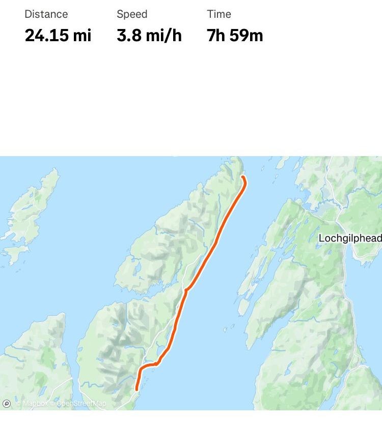
Route Day 5
As
we neared our third sandy beach above the cliffs, Keith asked if everyone had 3
days of water left, as he was unsure if there would be fresh water where we
could camp. Also, we had passed Loch Tarbert with its potential water
sources. Our priority at this point was to find a stop for second
elevenses, lunch or another break for eating and replenishing our depleting
source of energy. As we found a small rocky bay to stretch our legs,
there was much discussion of where exactly we were on Jura. Andy was
asked to check on his GPS !!! unheard of. We found we were at Rubha Dubh, and only about 1 Km away from our potential
campsite. We were given one last vote on carry on or return down the Straight
of Islay. We decided to carry on our quest to circumnavigate both
islands.
We headed to
Shian Bay, a nice sandy cove
We
headed on our last leg of the day to find a camping spot for the night, which
would take all 8 tents, not always an easy task. We headed to Shian Bay, a nice
sandy cove. Keith also provided another option we could camp on Shian Island;
however, the sandy beach won the day.
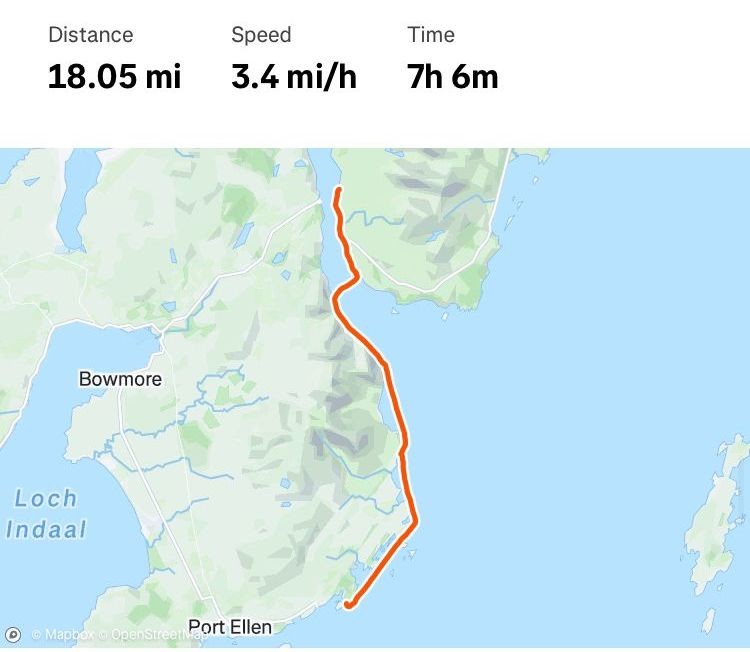
We
were off the water by 4 pm, having completed about 20 miles of paddling (though
slightly less in distance due to backtracking for elevenses) we even found that
we had a fresh water source at the Bay, so those low on water were no more.
So,
time to set up home once more and start cooking in case the wind dropped and
the midges arrived – luckily for us, no midges arrived all evening…. At this
point, we had a request from Catriona for a group “Happy Birthday” to her son
Ian as she had forgotten his birthday before
the usual washing and cleaning of pots, pans and ourselves took place in the
fresh water by the campsite.
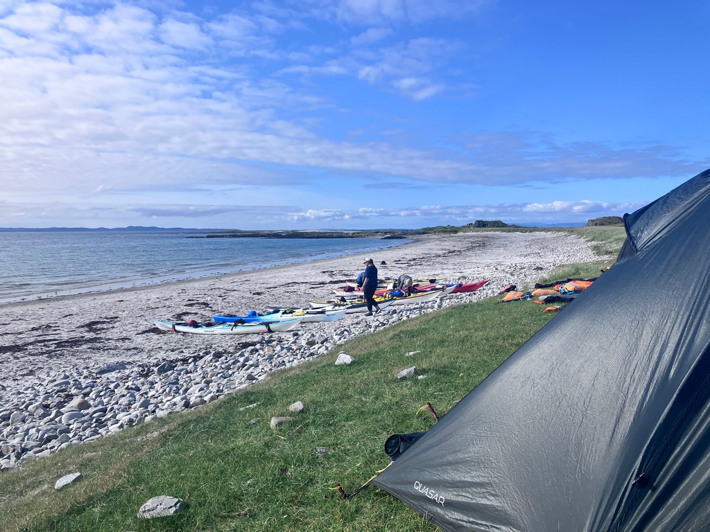
There
were many hoof prints on the sand and sightings of a
small herd of deer nearby. But nothing to stop the snores from the tents from 9
tired kayakers dreaming of the day’s achievements and the worries of the
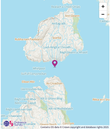
following day as the Gulf of Corryvreckan neared.
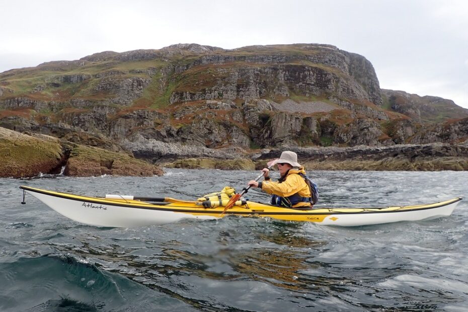
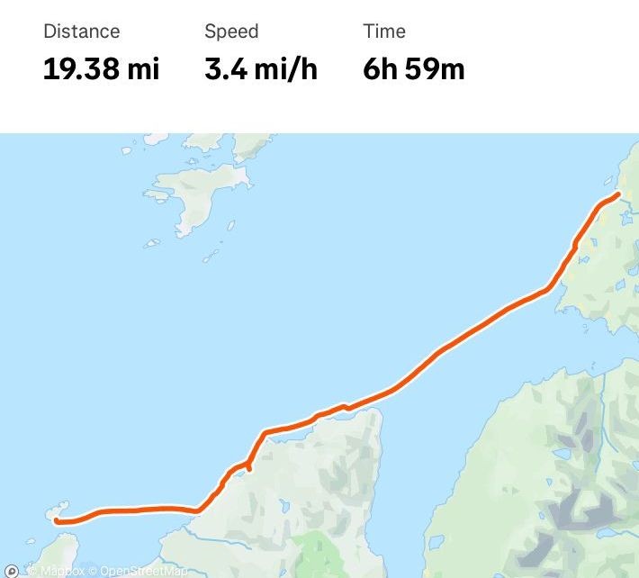
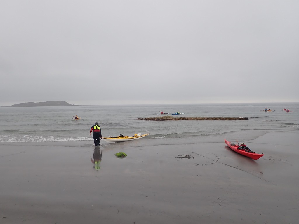
Day 06 Friday 22nd Shian Bay to Kinuachdrachd Harbour by Frankie A
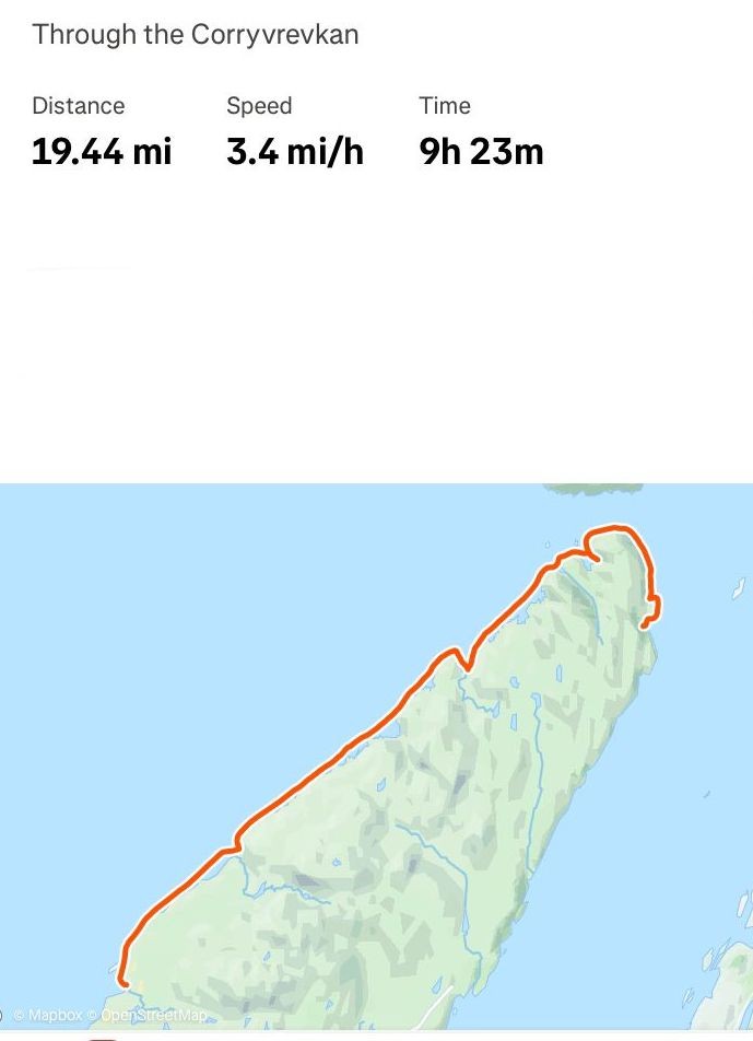
Route day 6
through Corryvrevkan
The
paddlers were still Frankie A, Andy B, Christine B, Dave B, Ella B, Ian B,
Catriona H, Debbie H and Keith S
Distance paddled 19 miles
From
a 5-star to a 2-star campsite was Keith’s summation of the day to come. Would
that come to pass? Day 6 plan centred on paddling through the Gulf of Corryvreckan at slack water/as the tide was favourable.
This meant a journey up the west coast of Jura, passing amazing, raised
beaches, arches and caves.
These
features were formed by changes in relative sea level during the Quaternary Ice
Age, as the land rebounded after glacial ice melted, leaving behind these
ancient shorelines and terraces high above the current sea level. The
largest and most visually striking are the unvegetated quartzite shingle
ridges of the west coast – the route we were paddling.
The
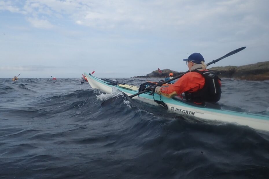
day started with more wind and sea state than we had so far this trip. There
was some surf as we launched, and Keith & Ian ensured everyone got safely
away at our usual 9 am start, which was actually by
8.53 am today.
As
well as the stunning scenery, the goats and deer provided much delight watching
them, watching us. A porpoise sighting was reported. I’m unable to verify this,
but I can confirm several eagles, real ones, not the seagull eagles from
earlier in the trip.
A further 4km up
the coast, we had a longer stop to await slack water and safe passage through
the Gulf of Corryvreckan
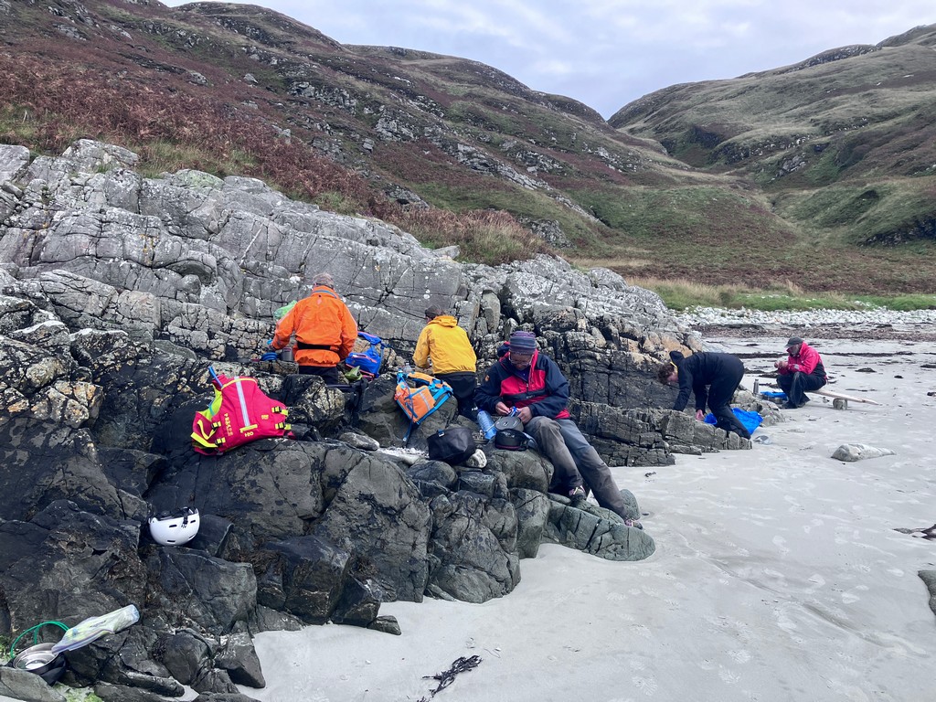
There
were 2 elevenses along the way. A short 10-minute comfort break followed by a
longer stop 8km further up the coast, where a bothy is located. The highland
cattle didn’t appear overly impressed.
A
further 4km up the coast, we had a longer stop to await slack water and safe
passage through the Gulf of Corryvreckan. As we made
our way to the long lunch/early evening meal, Ian made a sudden course change.
Debbie announced she was following Ian as she’d like to see her 71st birthday
on Monday. Ahead, we could just make out the white water of the whirlpool. The Corryvreckan whirlpool is the world’s third-largest
whirlpool, located between Jura and Scarba. The
standing waves are formed by water being squeezed through the narrow strait,
encountering underwater rock formations. The whirlpool is most active on spring
tides.
Rounding
the corner to the beach, there was some tide to navigate and a little bit of
excitement.
Rounding the
corner to the beach, there was some tide to navigate
Corryvrevkan
Here
we cooked a meal, anticipating a late arrival at a camping spot. 2.5 hours were
spent cooking, carrying boats further up the beach as the tide was rising,
eating and staying warm. Sleeping on rocks was also a popular activity. 3
walkers and a dog on the way to the bothy appeared from out of the bracken.
After a brief chat, they continued on, and we went on
with moving boats further up the beach with the tide. Then 5pm arrived, and we
popped through the Gulf of Corryvreckan and began the
search for a campsite. Caitriona was later heard to complain that this part of
the trip was too tame!
As
we scoured the coast for possible camp spots. We came across one of the
possible options, which had a semi-permanent campsite in situ. This was quickly
discounted, so we carried on to the harbour at Kinuachdrachd.
We soon spotted one tent already in situ, probably a rambler or two. It was our
only choice left with fading light, so we opted for a spot on or next to the
small stone pier. In the end, it proved ideal, and most found a flat piece of
land and enjoyed the last of what small breeze remained.
Day 07 Saturday 23rd Kinuachdrachd Harbour to the Jura Hotel by Dave Brown
Route for day 7
Finding
a place to put up my tent was fun, as I was competing with people who were
changing their real estate very fast. However, we all settled down to a quick
night’s sleep as we had to be up & on the water by 7 am, so that meant for
me a 5.00 am get up, eat something, pack up & then pack the boat.
We
all made the put-in time on the water despite the midges, paddling out just a
bit gets rid of the pesky little beasties {sometimes}, paddling into the flow
was fantastic, so fast & really moving, thanks to Mr Steer for his tide
planning really worked very well.
Our
first stop was Tarbert Bay, a very small entrance to an inlet not very big, 2
stars for that too !!!!!.
Well,
that was the first elevenses stop, back out to the flow and still going fast.
In the distance to our left was the Skervuile
lighthouse, which was established in 1865 and was automated in 1945, south east of the entrance of Lowlandmans
Bay.
Next
on our list of things to look for, well, you can’t miss them, are the Jura Paps at 785m These 3 hills are made of Quartzite with
distinctive conical shapes resembling breasts -that’s what Wikipedia said about
them!!!
Rubha Bhride with cows, lots of them, but enough space for our 9
sea kayaks
2nd
elevenses & lunch, that was a sandy beach at
Loch na mile beach, Rubha Bhride with cows, lots of them, but enough space for our 9
sea kayaks – nice little break soaking up the
sun.
We
had been working hard and we wanted the tide to be right on our last leg, not
far now, just across the bay to the Famous Juar hotel
camp site with hot showers and yes someone else cooking the food, fantastic
paddle and we were all looking forward to the evening entertainment which was
live music and singing by the beach bar next the the
camp site !!!!!!!!!.
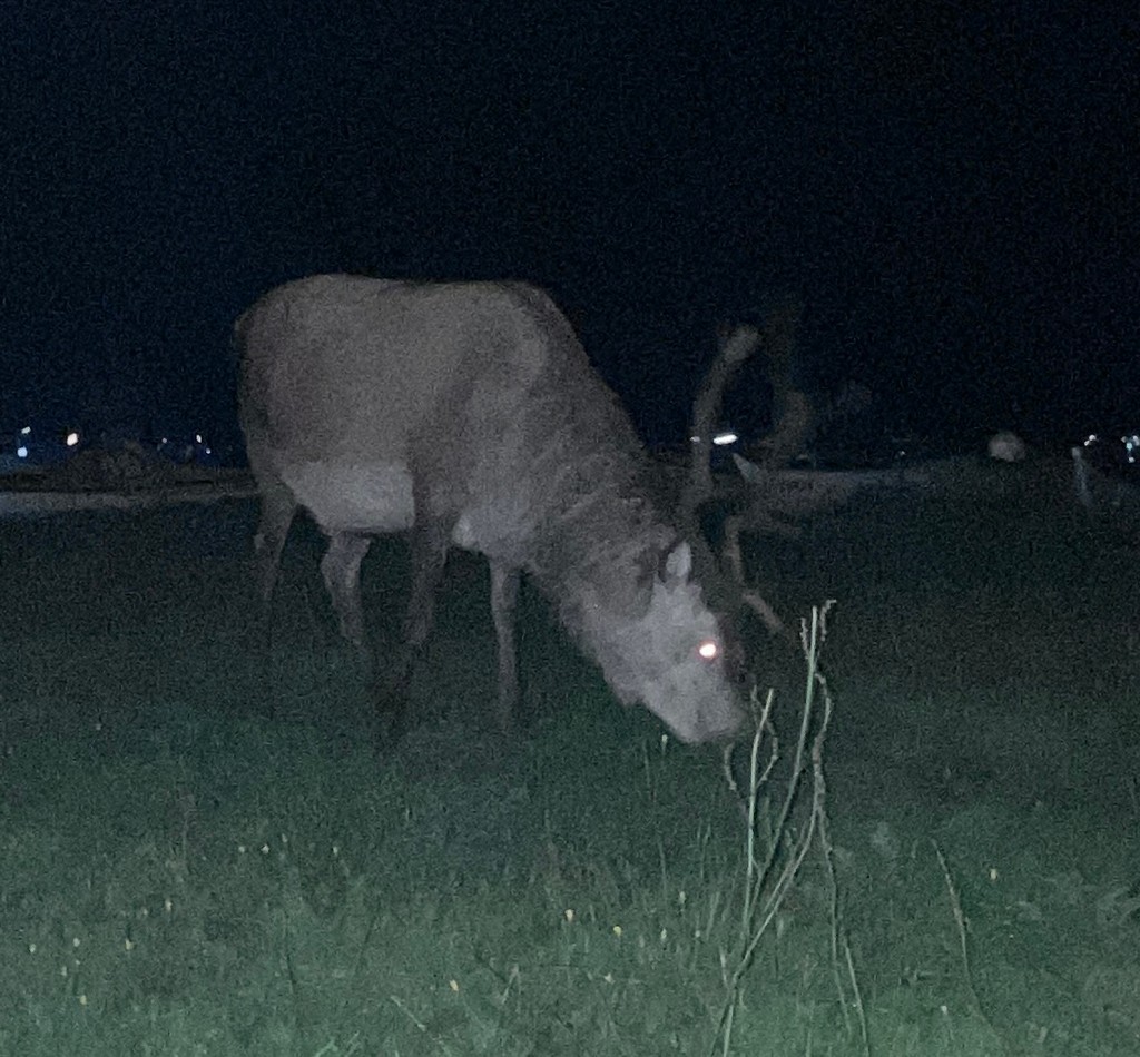
The Jura Hotel
lawn had visitors in the night
I
was so tired I fell asleep very fast, and had a lie-in & on the water for
10.00 am
Dave.
Day 08 Sunday 24th Jura Hotel to
Port Askaig and back to Lochgilphead by Ian Bell
The
timing of the tide made for a sensible start on water at 10 to catch the last
of the ebb tide south to the end of the island. This we did with good
assistance from the tide. We then spent some time considering landing on one of
the outlying islands for eleven-is. After the usual debate about the quality of
the landing and midge potential, we paddle into the bay on the south corner of
the island to a better sandy beach. With the wind being mainly from south /
southeast, it meant a surf landing and exit from the beach.
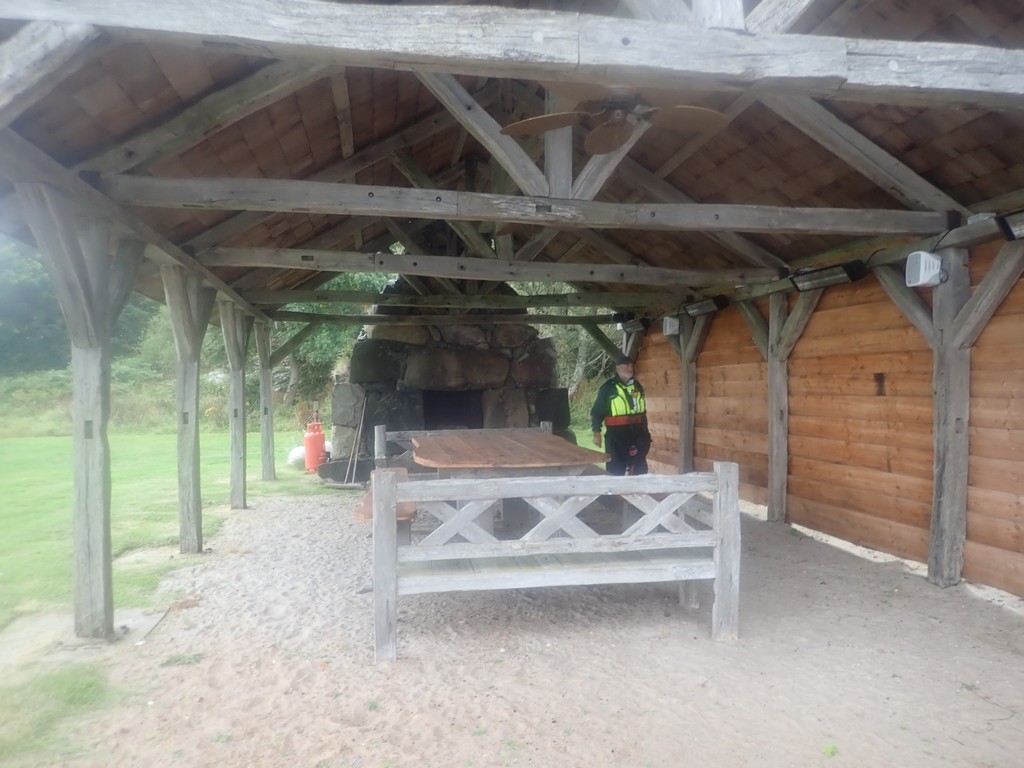
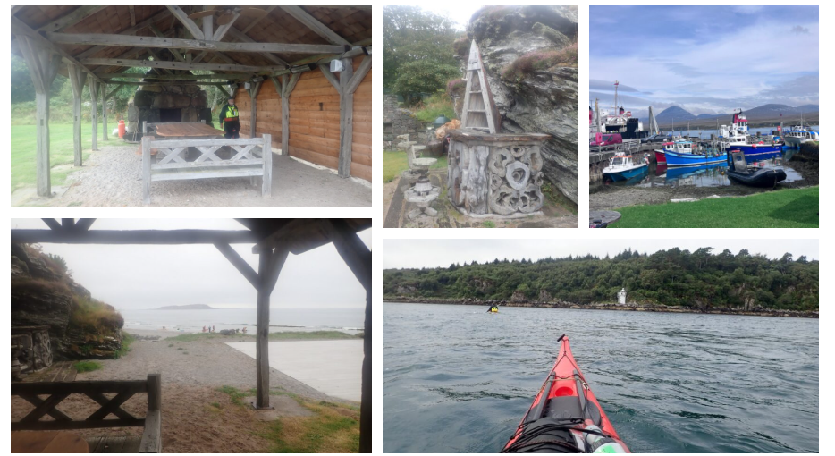
Fire pit,
barbecue, and a covered open seating area including a bar and beach tables.
This
beach was directly in front of Jura house, the local manor house and obviously
their private haven, judging by the facilities that were there. A fire pit,
barbecue, and a covered open seating area, including a bar and beach tables. No
one was around, so we had a short break while we waited for the turn of the
tide, so we could take the young flood up the sound of Islay back to Port Askaig and spend some time there before catching the
evening ferry back to the mainland and driving to Lochgilphead to find a
campsite for the night.
Launching back
into the Sound of Islay
Once
back on water, we had a free ride on the tide past the rocks and a small
outlying island where we had seen the deer swimming on the first day.
As
we approached the port of Askaig, we used the light
mark as a reference point to ensure we were not swept past the landing point
and set a parabolic course across the channel to avoid any hard ferry glide at
the end. As we did this, we kept an eye out for any other traffic but had no issues.
As the group passed the moored Lifeboat, we turned into the fish harbour and
landed on the small beach.
The fishing
slipway at Port of Askaig,
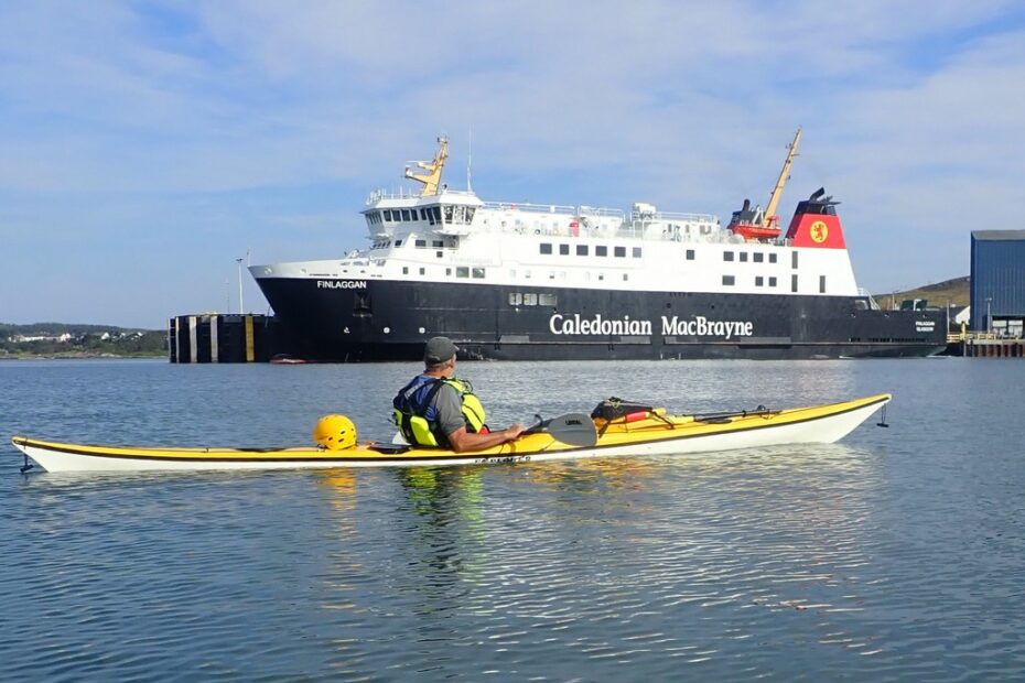
Having
landed, boats were first lifted clear of water as the tide was rising. Then up
onto the parking area at the top of the ramp. Once all were up, Keith and a
couple of us went and retrieved the trolleys from the tree they had been left
chained to for over a week before. Once that was done, the boats were fastened
to the trolley and were ready for the evening ferry. The group then got changed
out of their paddling attire and made plans to fill the few hours until the
evening sailing. For most, this involved a drink in a pub or a visit to the
small shop across the road. Both of which were being staffed by the same young
man who had to keep running between the venues as customers came and went. I
think he was also checking people into hotels and serving fuel at the petrol
station 1 door down.
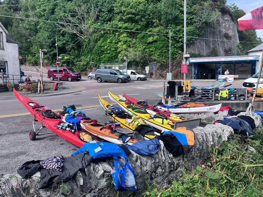
The boats were
fastened to the trolley and were ready for the evening ferry.
Some
spent time watching the local ferry that links Islay and Jura, demonstrating
how to do proper ferry glides. Others talked of walking to a Distillery but
decided it was not worth it. Others chilled and watched the activity around the
port.
Before
long, our boarding time arrived. We were directed to board first. Once on
board, seats were secured in the dining area and meals ordered and eaten. The
trip back seemed quicker than the outward journey, and before long, we were
leaving the ferry and loading kayaks back on the cars. It was now 8 pm. For
anyone wishing to paddle the Inner Hebrides but not wanting to do a long,
exposed crossing, then trolleying your kayak on and off ferries is an easy
option.
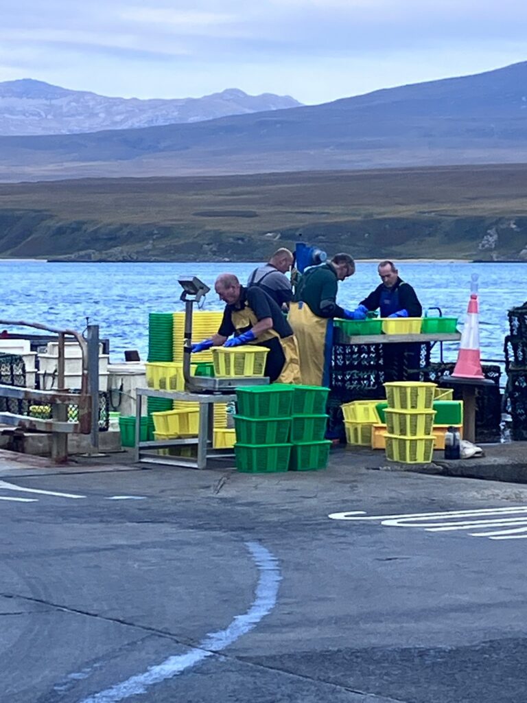
Skilled fishermen
cleaning their catch before being loaded onto refrigerated lorries bound for
the mainland
Once
loaded, we drove to try and find a campsite that would still take tents. The
only one in the area that seems to do this, according to their website, was the
one in Lochgilphead. As it was now past the expedition’s bedtime and with the
campsite closed for the evening, we decided to wild camp on the side of the Crinnan Canal for the night. We would find camping the next
day, as that would be a rest day / bad weather day. So
we returned to the place “team Mercedes” had stayed on arrival, having driven
up on the Friday, while others were still at work. Soon, tents were up and everyone was fast asleep.
![]() 2025
Islay and Jura Sea Kayak Trip Day 9 Tarbet and Lochgilphead
2025
Islay and Jura Sea Kayak Trip Day 9 Tarbet and Lochgilphead
So we woke early after a sheltered night
from the remains of Storm Erin. The Crinnan Canal
campsite next to lock 10 was our favourite overnight stop. (There is a
campervan overnight parking area there, but a nice area for tents next to the
lock gate).
Ex-Hurricane
Erin’s remnants were predicted to bring rain and wind to the UK around August
25-26, 2025, with the Met Office issuing warnings for potential heavy downpours
and flooding in Wales and other areas. While the hurricane itself wouldn’t
hit, its weakening system was expected to cause a significant shift in weather
after a period of dry, hot weather.
We
packed up and headed back to Tarbet and to our favourite cafe – Cafe Ca Dora.
We enjoyed a leisurely breakfast and then set about discussing options for the
last 4 days of our trip. It was clear that we would not get settled conditions,
and any paddling would be a little “bitty”. Dave was using his road atlas to
help plan options, and then someone spotted Loch Awe. This was an inland option, but would be ideal for a more sheltered option given
the forecast. It did not take long for everyone to agree on the Loch and
castles trip from Tuesday to Friday.
We
paid the bill and then explored the harbour and the surrounding town. We found
several signs advertising the NW Coast Kayak trail, but then it was time to
find a campsite and to prepare for the next part of our trip.
Debbie
had stayed at the campsite at Lochgilphead before, and we headed there to see
our options. It proved ideal with good showers, a quality grass pitch with
picnic benches and a friendly owner. We spent the rest of the day sorting gear
and relaxing. We ate in the best restaurant in town, the 2-star Indian and were
glad we had booked, as we took up most of the tables.