|
|
Club Expedition to
Alaska 2016 Island and return via Port Nellie Juan) |
|
|
News items or reports on club activities
should be sent to website@liverpoolcanoeclub.co.uk |
||

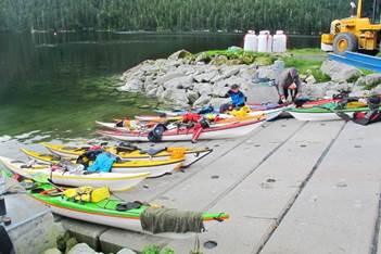
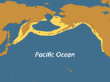
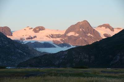
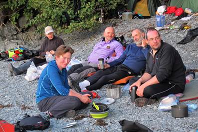
Club Expedition to Alaska (Whittier to Perry Island crossing
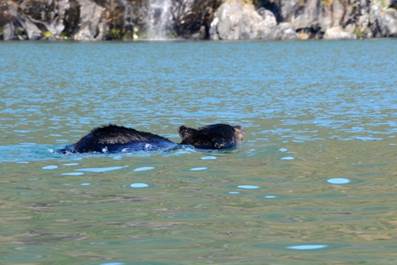
over to Knight Island and return via Port Nellie Juan) “Can bears swim?”
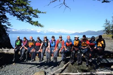
This clubs` expedition to Prince William Sound is now well
established with trips in 2008, 2010, 2013 and again in 2016. This time we
headed out to the islands in search of whales.
This involved some fairly long open crossings including some in fog. We
were stormbound for a day with strong gusty winds and waterspouts and on
another encountered the heaviest 24 hours of rain any of us could imagine.
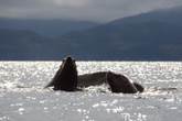
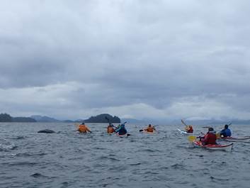
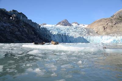
Every day we encountered something interesting including; humpback
whales, black bears, Steller Sea lions and common harbour seals, sea otters,
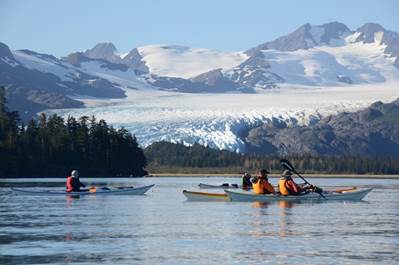
bald headed eagles and many other sea birds; they seemed to be everywhere. We also paddled up to several enormous
tide-water glaciers.
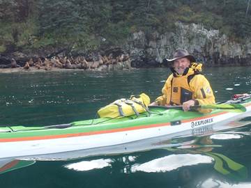
Our friend Levi Hogan (below) shuttled us to and from Whittier
along with supplying his fleet of high quality UK Sea kayaks.
|
|
|
|
|
|
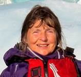
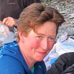
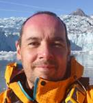
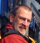
Carole Thomas |
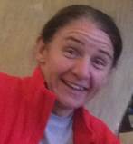
Debbie Hughes |
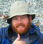
Dave Rider |
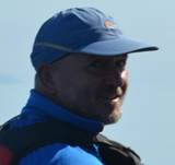
Ian Bell |
|
|
|
|
|
|
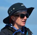
Catrionia Hare |
Pete Thomas |
Nicki Corbett |
Brian Green |
|
|
|
|
|
|
|
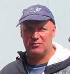
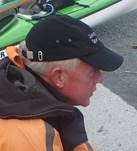
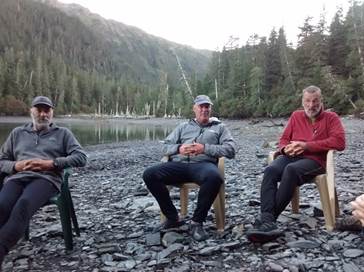
Mike Alter |
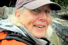
Kathy Morton |
|
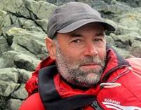
Don Brooks |
Mark Pawley |
The flight out and getting to
Whittier
|
|
|
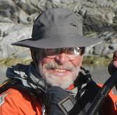
Levi Hogan from Turnagain Kayaks |
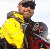
 This
year, not only did we find a new outfitter, Levi Hogan and Turnagain kayaks but
we also found cheaper and more direct flights via Iceland. Consequently, we had a much larger group than
normal with 13 of us making the journey out to Anchorage. The flights cost around £800 with short stop
over (2hrs) in the new North Atlantic hub of Reykjavik. On the way-out we were all kicking ourselves
as we should have booked a couple of days in Iceland instead of flying straight
through. We had to endure numerous
advertising videos and TV programmes teasing us with the best that Iceland had
to offer.
This
year, not only did we find a new outfitter, Levi Hogan and Turnagain kayaks but
we also found cheaper and more direct flights via Iceland. Consequently, we had a much larger group than
normal with 13 of us making the journey out to Anchorage. The flights cost around £800 with short stop
over (2hrs) in the new North Atlantic hub of Reykjavik. On the way-out we were all kicking ourselves
as we should have booked a couple of days in Iceland instead of flying straight
through. We had to endure numerous
advertising videos and TV programmes teasing us with the best that Iceland had
to offer.
After our midmorning departure from Manchester we arrived in Alaska 12hours
later at 5pm local time and still in daylight.
A quick free shuttle to our hotel and we were unpacking in 3 large and
spacious rooms. That evening we
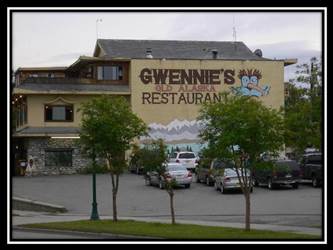
discovered Gwennie’s Old Alaska
Restaurant, just opposite our hotel.
Great home cooking. More
Photos……….
Day One (Thursday) – Whittier to
Entry Cove
 In
the morning we washed and showered and went down for a full continental
breakfast at 6:30am. Levi arrived spot
on time and was towing all the kit in a large car transporter trailer. The shop took longer than expected and seemed
to cost considerably more than in the past.
Despite this we made the 11:30am tunnel and were packing the kayaks soon
after midday at the Lazy Otter beach just opposite the Ferry in Whittier.
In
the morning we washed and showered and went down for a full continental
breakfast at 6:30am. Levi arrived spot
on time and was towing all the kit in a large car transporter trailer. The shop took longer than expected and seemed
to cost considerably more than in the past.
Despite this we made the 11:30am tunnel and were packing the kayaks soon
after midday at the Lazy Otter beach just opposite the Ferry in Whittier.
Levi was keen to try and catch the next tunnel in an hours’ time
so we rushed to unpack our flight bags and spare items and threw them into 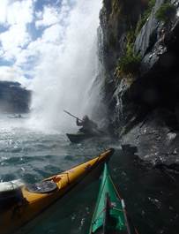 his
trailer. We then finished our packing
and made our way onto the water. We left
the ferry port of Whittier with a warning from the ferocious cries of an
officious looking female security guard “sir, you are committing a violation –
move away now.” I am not sure if she
would have drawn her pistol but her hand was certainly resting on her
holster! Brian made haste away from the
beach, apparently, his stern had drifted a foot or so between one of the piles
of the jetty.
his
trailer. We then finished our packing
and made our way onto the water. We left
the ferry port of Whittier with a warning from the ferocious cries of an
officious looking female security guard “sir, you are committing a violation –
move away now.” I am not sure if she
would have drawn her pistol but her hand was certainly resting on her
holster! Brian made haste away from the
beach, apparently, his stern had drifted a foot or so between one of the piles
of the jetty.
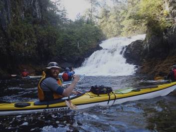
We turned left and headed for the north shore of Passage
Canal. Here we found the two waterfalls
made famous by the Kittiwake rookery above.
We just had to test the dryness of our waterproofs.
fter numerous photographs we moved on along the shore 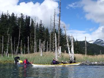 exploring
the many bays and coves passing below the Billings Glacier. Several possible sightings of bears proved
fruitless and often turned out to be dark rocks on the shore. We also discovered several groups of dead
trees near the shoreline, almost certainly killed during the 1964 earthquake
when much of the land in the area sank by over a metre. This has allowed saltwater to inundate the
shore line and has literally poison them where they stood.
exploring
the many bays and coves passing below the Billings Glacier. Several possible sightings of bears proved
fruitless and often turned out to be dark rocks on the shore. We also discovered several groups of dead
trees near the shoreline, almost certainly killed during the 1964 earthquake
when much of the land in the area sank by over a metre. This has allowed saltwater to inundate the
shore line and has literally poison them where they stood.
fter a few hours we reached the end of Passage Canal. It was soon going to be dark and we were
looking for possible campsites just in case we did not make our intended
destination of Entry Cove. I paddled
into Logging Camp Bay to check 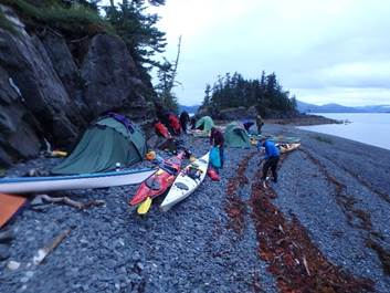 out
any possibilities. I quickly hopped out of my boat leaving it next to the beach
and by the time I had climbed the shingle beach the stream had started to wash
it along the beach. I returned to it but
had to wade around the top of the channel and this was long enough to push it
out far enough to require me to wade into my waist to recover my boat. Mike had been keeping an eye on me from
about half a Km away and too far to stop me having to get wet.
out
any possibilities. I quickly hopped out of my boat leaving it next to the beach
and by the time I had climbed the shingle beach the stream had started to wash
it along the beach. I returned to it but
had to wade around the top of the channel and this was long enough to push it
out far enough to require me to wade into my waist to recover my boat. Mike had been keeping an eye on me from
about half a Km away and too far to stop me having to get wet.
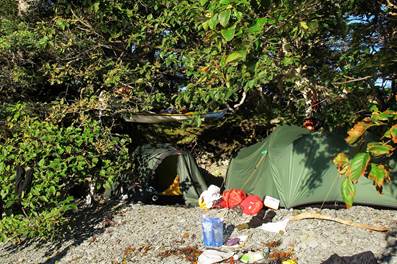
The site was not ideal, especially for a large group of 13
people. We headed on to Entry Cove but
as we rounded the point we found 3 kayakers already camped there. While they
would have moved over and made space it was clear they were not keen. The light was now fading fast and we decided
to camp on the shingle spit and small beach just before the small island at
Entry Cove. This actually turned out to
be ideal if only a little short on space.
This did not matter as we soon flattened the top berm into tent sized
platforms. It was neap tides so there
was little chance of the tide coming up to the tents and we had plenty of room
to cook the evening meal on the beach below the tide line. We of course had the added bonus of the view out towards Esther
Island the Prince William Sound and beyond.
Keith Steer More
Photos………. Voice over……..
Day Two (Friday) – Entry Cove to
Perry Island
WALLY
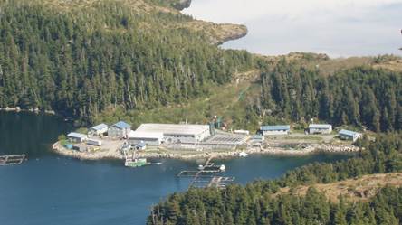
NOERENBERG HATCHERY
The Wally Noerenberg
Hatchery (WNH) is the second PWSAC-owned hatchery located in Lake Bay on the
southern end of Esther Island in Prince William Sound, approximately 20 miles
east of Whittier. The hatchery was built in 1985 with monies borrowed
from the Alaska Fisheries Enhancement Revolving Loan Fund. WNH is
currently permitted for 148 million pink, 165 million chum, 4 million coho,
and 4 million Chinook salmon eggs annually. Sockeye salmon
were also cultured at WNH in the past and was transferred to the Main Bay
Hatchery in 1990.
Klint Hischke, WNH
Hatchery Manager leads a permanent, year-round staff of eight along with
a seasonal staff of 12 during the summer months. Klint has worked with
PWSAC (Remote Programs, CCH and WNH) since 2013. He received his B.S.
in Water Resource-Fisheries with a minor in Aquaculture from University of
Wisconsin, Stevens Point. All the Hatchery
Managers enjoy giving tours, showing off their hatcheries and the fish, so
please stop by if you are in the area. All the hatcheries can be
contacted on VHF 16. This marine park is located on the southern end
of Esther Island, including Lake and Quillian Bays. Lake Bay houses one of
the world's largest fish hatcheries. You can also carefully navigate to the
head of the bay for an anchorage. A hike along the eastern edge of the lagoon
and through a low, forested pass brings you to Esther Lake. The land is too
wet and uneven for camping.
The Wally H. Noerenberg Fish
Hatchery is owned and operated by the Prince William Sound Aquaculture
Corporation (PWSAC). PWSAC is a private, non-profit corporation operating
under a special permit with Alaska State Parks. Fresh water can be obtained
from the floating dock near the hatchery. Mooring buoys in front of the
hatchery may be used if available. |
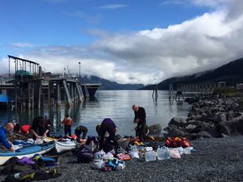
 After
a reasonable first night on the small shingle beach we woke and cooked
breakfast and made some readjustments to our packing of our kayaks. We were soon on the water and paddling across
Port Wells, a relatively large crossing looking north towards the enormous
glaciers of Harvard and Yale. After a
few hours, we passed Esther rock and were heading for Point Esther.
After
a reasonable first night on the small shingle beach we woke and cooked
breakfast and made some readjustments to our packing of our kayaks. We were soon on the water and paddling across
Port Wells, a relatively large crossing looking north towards the enormous
glaciers of Harvard and Yale. After a
few hours, we passed Esther rock and were heading for Point Esther.
We made our way around the coast looking for a suitable landing
spot for either lunch or possibly a campsite for the night. The only landing looked like the fish farm by
the stream running out of Esther Lake.
We hauled ourselves out on the concrete slipway for a late
elevenses. However, after a few minutes
some of the workers approached and asked if we would like a tour of the
farm. This was totally unexpected but we
readily agreed as it was soon to be the end of their break and  everyone
would start to “farm the fish”.
everyone
would start to “farm the fish”.
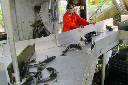
The operation was fascinating.
The hatchery actually intercepts the salmon as they tried to make their
way up the fast-flowing steam, mechanical lifts transported the fish into the
factory where they were sorted into male and female, the eggs were cut out of
the fish and then inseminated and placed in fresh water which hardened the
eggs. These are then reared and released
back into the wild giving between 87 and 92% yield as opposed to 3-7% if left
to nature. 2013 was one of the most successful years on record for the hatchery
with 147 million eggs taken.
|
Brood Year |
|
|
|
|
|
2013 |
147,000,000 |
128,000,000 |
17,239,722 |
13.47% |
During our tour, we had to make several returns to the kayaks to
stop the incoming tide taking them away.
After thanking Cliff, our tour guide we had a late lunch 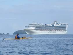 before
deciding to head off again towards Perry Island.
before
deciding to head off again towards Perry Island.
During the crossing, we began to hear the barking of a seal colony
on Egg Rocks. This was incredibly loud
despite being several miles away. As we neared the coast of Perry Island an
enormous cruise ship passed us on the “Marine Highway” heading towards the
Harvard and Yale Fjords. We knew the
route as a very similar vessel has passed us on a previous trip (See
account of 2008 trip…..)
As we progressed around the North-east coast looking for our
campsite we came across another colony of Steller Sea Lions sunning themselves
on the rocks. Their calls were
incredibly loud. As we drifted by some
of the younger Sea Lions entered the water to chase and warn us off while the older
and more menacing ones roared and bellowed from their perches high on the
rocks. We spent about 30 minutes passing
by before being “seen off” towards our camp spot for the night.
![]()
Steller Sea
Lion
Type: Mammal Diet: Carnivore Average life span in the wild: 18 (males); 30 (females) Size: 7.75 to 9.25 ft (2.4 to
2.8 m) Weight: 1.2 tons (1.1 metric tons) Group name: Raft (in water);
colony (on land) Relative:Size relative to a 6-ft
(2-m) man
Steller Sea Lion Range |
Steller Sea Lion Eumetopias jubatus
Steller sea
lion breeding is one of nature's great mass spectacles. When Females begin
to reproduce at about five years of age and typically have one pup per year.
Sea lion mothers care for their young and recognize them by a keen sense of
smell. Females slip into the sea to hunt and return to their young with the
day's catch—identifying their own offspring by touch and scent. These animals
are social and also gather at various times throughout the year when mating
and breeding are not taking place. Even in crowds, the big bulls are unmistakable—they
are three times larger than females. Most Steller
sea lion populations declined markedly in the 1980s and 1990s, even though
the animals are protected. Scientists are unsure what factor or combination
of factors is responsible for the decline. |
Most of us
were pretty tired now after a full day’s paddle (we had effectively done two
days in one) and were keen to find a place to put our tents. As we rounded a corner the we started to see
where the campsite should be. A small
peninsula of land gave way to a sheltered beach with tent spaces between some
pine trees. On the other side of the
peninsula was an idyllic round bay which was a perfect natural harbour. We fixed the camp and cooked our evening
meals before dusk came rolling in. I
retired to my tent to fall readily asleep.
Ian Bell More
Photos……. Voice over……..
Day Three (Saturday) – Day 3
Perry Island to Ingot Island (approximately 17 miles)
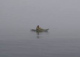
Just before dawn I crawled quietly out of our tent to answer a
call of nature. It was foggy and very damp and the tent was soaking wet from
the 100%humidity. I got back into the tent and waited for it to get light,
hoping that the sun would rise, burn off the fog and dry everything out. At
0700 it was time to get out and get going as we had a long day ahead of us but
the fog still persisted even by the time we were all fully packed and on the
water at about 08:45.
 Keeping
close to the coastline, we made our way out of the sheltered bay where we had
camped for the night on a shingle beach. Enjoying the task, a number of us
navigate continually on these trips, while the majority appeared happy to just
follow. One or two carried a map and a deck compass but just pretended to
navigate, content at just looking the part I guess.
Keeping
close to the coastline, we made our way out of the sheltered bay where we had
camped for the night on a shingle beach. Enjoying the task, a number of us
navigate continually on these trips, while the majority appeared happy to just
follow. One or two carried a map and a deck compass but just pretended to
navigate, content at just looking the part I guess.
In the thick fog, even the navigators were slightly perplexed
about our exact position. It was taking a while to get our eye in with the
scale of the map and the almost 20 degrees of local variation. We were
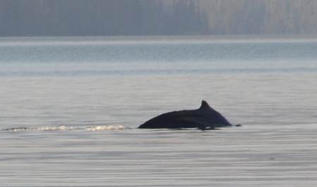
concentrating so hard that the sudden appearance of a Hump Back Whale, braking
surface to breath close-by, took us all by surprise and completely stopped us
in our tracks. It was quite close to us and we all got a good view as it
surfaced once or twice before disappearing altogether out of our lives. Our
almost daily 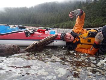 encounters
four years ago with these fabulous mammals, gave us hope that we would see more
on this 2016 trip and here, early on Day 3, we got our first and all-too-brief
sighting. They really are special and I always feel very privileged whenever I
get close to them.
encounters
four years ago with these fabulous mammals, gave us hope that we would see more
on this 2016 trip and here, early on Day 3, we got our first and all-too-brief
sighting. They really are special and I always feel very privileged whenever I
get close to them.
With the excitement over we decided we knew roughly where we were
so headed for a nearby beach for an extended break while willing the visibility
to improve. Stoves were lit, brews were made and a small fire dealt with some
of our burnable rubbish that was beginning to accumulate. Maybe 90 minutes went
by on this beach when, I think it was David Rider, piped up that he could see land
in the distance. We all got back into our boats and paddled off cautiously into
the mist. Sure enough, rounding Billings Point, a small headland on Perry
Island, we could clearly see Lone Island some 3 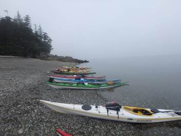 miles
in the distance. This wasn’t our final destination for the day but it gave us
somewhere to aim for. It was Catriona’s turn to lead the group today so she got
herself out front and pointed her boat towards a small beach, just about
visible, on the north-western end of Lone Island. We all tucked in behind her
while Keith made it his business to reel in anyone who fanned out too far away
from Catriona’s course.
miles
in the distance. This wasn’t our final destination for the day but it gave us
somewhere to aim for. It was Catriona’s turn to lead the group today so she got
herself out front and pointed her boat towards a small beach, just about
visible, on the north-western end of Lone Island. We all tucked in behind her
while Keith made it his business to reel in anyone who fanned out too far away
from Catriona’s course.
It wasn’t long before we reached this beach and we all got out to
have yet more food and drink in preparation for the next, very long, leg of our
passage. Rounding Lone Island North-about and with the fog almost completely
dissipated, we eventually caught sight of Ingot Island, some 12 miles to the
South East. This was going to be a major open passage and certainly one much
longer than most of us had ever completed. Catriona got into the lead again and
off we went into what turned out to be a calm and easy passage. We had plenty
of time to chat and gaze into the distance and, although some of the land was
off our map, we reckoned we could see way out of the Prince William Sound area
and probably out 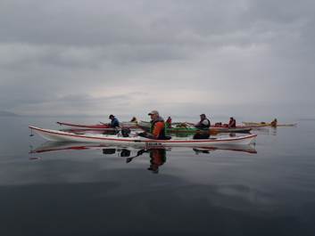 into
the Alaskan Gulf and the Pacific Ocean itself. This was incredible stuff. Being
close to shipping lanes, a watch was kept on channel 16 just in case anything
big was about to head our way. In the event, nothing but the occasional small
fishing boat crossed our path. Hopefully they saw us but none of them appeared
surprised to see us in the middle of nowhere and, unconcerned, they passed us
by at speed.
into
the Alaskan Gulf and the Pacific Ocean itself. This was incredible stuff. Being
close to shipping lanes, a watch was kept on channel 16 just in case anything
big was about to head our way. In the event, nothing but the occasional small
fishing boat crossed our path. Hopefully they saw us but none of them appeared
surprised to see us in the middle of nowhere and, unconcerned, they passed us
by at speed.
After what seemed like ages, Ingot Island began to grow larger and
we could see trees and other features. There was plenty of daylight left when
we finally arrived at our destination camping beach and the sun had heated up a
rocky outcrop where most of us hung tents and other gear to dry off from the
previous night. We settled down to sort out our camp and everyone started to
cook their evening meal. Caz and I chose a comfortable spot but there was an
odd smell about the place. It turned out to be the smell of bear and sure
enough, it appeared that a bear had made its bed close-by the night before.
There was bear poop here and there and obvious signs of crushed vegetation. We
quickly moved much further down the beach and carried on cooking.
By the time we had finished our meals, most of us congregated on
top of the outcrop as the view was captivating. As we all gazed around in awe,
multiple gun shots rang out from miles away. Perhaps these were Americans
firing at empty beer cans but it was more likely that they were hunting bear!
We slept that night hoping that the gun shots hadn’t driven angry
bears in our direction.
Pete Thomas More
Photos……. Voice over……..
Day Four (Sunday) – Ingot Island
to Knight Island
Waking up to a magnificent view of snow covered mountains; we
followed the now routine 2-hour sequence to get on the water for 9.00am.
 Wake,
retrieve bags and food from bear cash, toilet, wet wipe wash, sun cream on, contact
lenses in, kettle on, pack sleeping bag, pack my Thermarest and anything else
in the tent, cup of tea and breakfast, clean teeth, collapse and pack tent
(sometimes soaking wet), carry boats near to water, pack everything into kayak,
put on paddling gear, and finally, ready to go!! Just as the water reaches the
boats.
Wake,
retrieve bags and food from bear cash, toilet, wet wipe wash, sun cream on, contact
lenses in, kettle on, pack sleeping bag, pack my Thermarest and anything else
in the tent, cup of tea and breakfast, clean teeth, collapse and pack tent
(sometimes soaking wet), carry boats near to water, pack everything into kayak,
put on paddling gear, and finally, ready to go!! Just as the water reaches the
boats.
With a forecast of deteriorating weather, we set off in a south
westerly direction across Lower Passage to Passage Point, heading down Knights
Passage leaving Knights Island to our left. We had originally hoped to travel
down the outside (eastern side) of Knights Island but the weather was not
settled enough to do this.
We passed Herring Point covering some ground that we had paddled 4
years previously, passing the beach on which we celebrated Debbie’s birthday,
her birthday was again to be celebrated on this trip in a few days’ time.
Just before stopping for lunch a humpback whale appeared alongside
us for about 30 seconds before it disappeared with a flick of its tail as it
dived away. Lunch was had on a reasonably sized beach as it was mid tide, these
beaches change dramatically at high water leaving very narrow areas of
shingle to pitch the tents, unbeknown to us at the time, we would see this
beach again.
 After
a 30-minute lunch stop we set off passing Lower Herring Bay heading for our
proposed next campsite in Johnson Bay. This campsite was especially chosen as,
on the map, it looked well tucked in and sheltered. The weather was
starting to deteriorate and a head wind was beginning to be felt. After a
fairly long day, we eventually reached Johnson Bay and we were all looking
forward to stopping for the night. By now the weather was getting decidedly
miserable dull and damp with the wind picking up all the time.
After
a 30-minute lunch stop we set off passing Lower Herring Bay heading for our
proposed next campsite in Johnson Bay. This campsite was especially chosen as,
on the map, it looked well tucked in and sheltered. The weather was
starting to deteriorate and a head wind was beginning to be felt. After a
fairly long day, we eventually reached Johnson Bay and we were all looking
forward to stopping for the night. By now the weather was getting decidedly
miserable dull and damp with the wind picking up all the time.
Oh! but where was the campsite? The place marked on the map was a
rocky stream bed with no option for 6 tents. All of the navigators in our group
double and triple checked everything but still agreed we were in the right
place according to the map, it was just that the campsite was unviable. A bit
despondent we mooched about the area hoping to find an alternative in the close
vicinity but no luck. What now? It was getting late in the afternoon so
other options were not really viable. The only realistic option was to turn
around and head back to our lunch time stop. So off we set not looking forward
to a long paddle back, which in fact with the wind now behind us and all
paddling with heads down in the light misty rain took just 90 minutes.
With only just enough room for all the tents along the narrow
strip above the high-water mark, we gratefully set up camp, this was nearly not
enough as high water the following day nearly breached a tent or two, as you
will read in the Day5 instalment.
Carole Thomas
More
Photos……. Voice over……..
Day Five (Monday) – Knight
Island (Storm Bound)
After
yesterday’s planned campsite to the south of Knight Island did not come up to
expectations, non-existent in fact, here we were, camping on a beach not marked
as a camp site and…. storm bound. That’d be easy for my write up day then –
stormbound…but no, it was an action packed day to say the least. 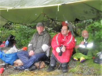
I find it hard to believe that there are so
few places to camp in such a huge area but room for any tents, let alone as
many as we had are hard to find. It was
obvious we were going nowhere for the foreseeable future as the winds were
already strong, forecast to get even stronger and it was raining. The tents
were crammed at the very top of the beach on the usual shingle, worryingly
close to the last high tide strand mark.
Despite major earth works the evening before to flatten out enough level
space to pitch, several tents were at crazy gradients with few reliable anchor
points
The
cooking tarp was pitched at one end of the beach and after breakfast Kathy and
Nicky, with the help of Don and Mark, set to with major earth works to re pitch
their tent. The resulting tent platform
was a remarkable feat of civil engineering, with substantial log ramparts, but
would it be sound enough to survive the next high tide?
With
little else to be done I retired to the tent, (my side of the tent had a crazy
slope banked up with full dry bags but was remarkably comfortable  considering)
to read. The wind increased with
forceful gusts which necessitated me bracing my feet against the tent poles to
stop them inverting. At one stage I
stuck my head out to see sheets of water being lifted off the surface of the
sea and hurled in our direction. I was
just considering going out into the tempest to get a coffee when the biggest
gust ever hit the tent almost flattening it and Ian was shouting outside that
the porch was flattened. I scrambled
out while he held the flapping awning and emergency repairs had to be
done. The tide was also causing concern
by this time – we spent the next hour under the cook tarp watching as the water
got nearer and nearer. One of our guy ropes was tied to a log which started to
float. Boats were pushed further up into
the trees. At the opposite end of the beach to the cook tarp, what was a tiny
trickle of water from the cliff above yesterday had turned into a raging
torrent, and the tipi tent, pitched right in the middle of the beach, now had a
large stream running towards it from the forest, which then disappeared under
the shingle (and tent) to reappear on the beach and drain into the sea. No
shortage of water on this beach, which was slightly ironic as Brian had kindly
paddled round to the next bay the night before to fill several water containers
because we were getting low on supplies.
considering)
to read. The wind increased with
forceful gusts which necessitated me bracing my feet against the tent poles to
stop them inverting. At one stage I
stuck my head out to see sheets of water being lifted off the surface of the
sea and hurled in our direction. I was
just considering going out into the tempest to get a coffee when the biggest
gust ever hit the tent almost flattening it and Ian was shouting outside that
the porch was flattened. I scrambled
out while he held the flapping awning and emergency repairs had to be
done. The tide was also causing concern
by this time – we spent the next hour under the cook tarp watching as the water
got nearer and nearer. One of our guy ropes was tied to a log which started to
float. Boats were pushed further up into
the trees. At the opposite end of the beach to the cook tarp, what was a tiny
trickle of water from the cliff above yesterday had turned into a raging
torrent, and the tipi tent, pitched right in the middle of the beach, now had a
large stream running towards it from the forest, which then disappeared under
the shingle (and tent) to reappear on the beach and drain into the sea. No
shortage of water on this beach, which was slightly ironic as Brian had kindly
paddled round to the next bay the night before to fill several water containers
because we were getting low on supplies.
By
high tide, the sea was inches from most of the tents but occasional waves were
actually splashing up the side of Don and Mark’s tent. Getting from the tents to the cook tarp
required wading. It was a close-run
thing and we heaved a sigh of relief as the water receded - the next tide would
not be as close. Eventually the wind
dropped, the rain stopped and we were able to continue the next day, back
across to Point Newell on the mainland and to a camp site with a little more
distance between tents and high tide.
Phew!
Debbie Hughes More
Photos……. Voice over……..
Day
Six (Tuesday) – Knight Island to Crafton
Island - Time to get going again…..
We
awoke to more rain but looking across the knight island passage it was starting
to look less angry. The winds were abating a paddling day was looking to be in
the offing, but not straight away. Morale was low this two-day storm was
sapping at everyone.
As
breakfast was conjured and consumed the weather forecast were checked and time
to change plans…… strong winds where still blowing in north with a small boat
advisory for passage canal and not looking better for a few days but dying down
locally. Not enough time to get to icy bay and leave a few  day’s
spare to get back in case of more storm bound days.
day’s
spare to get back in case of more storm bound days.
So
after packing away sodden tents and reacquainting ourselves with our boats we
bid farewell to our home for the past 2 days.
Crossing
the knight island passage and the marine highway shrouded in a clinging mist,
we were treated with atmospheric views of Chenga island and the elegantly named
dangerous passage. Moral was starting to improve and smiles where even seen as we
all became warm again. Happy to be paddling. Chenga island is one of several
areas which are private lands owned by the first peoples of the area. And you
could see why. It had a mystical aura heightened by the mist clinging to it.
Landfall
was made at Point Nowell where we had lunch and a much-needed break. 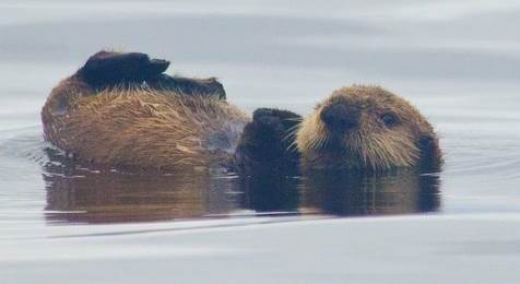 Thankful
to be getting back into the rhythm of paddling. The weather was still not
idyllic with light rain but the lure of a camp site with a cabin was keeping
morale high and the knowledge we were once again on the move. The beach was a
pebbly beach offering views of our home on knight island.
Thankful
to be getting back into the rhythm of paddling. The weather was still not
idyllic with light rain but the lure of a camp site with a cabin was keeping
morale high and the knowledge we were once again on the move. The beach was a
pebbly beach offering views of our home on knight island.
Once
refuelled on fine fare, we headed north hugging the shore in the hope of seeing
wildlife which was being quite illusive. (I don’t blame them the weather wasn’t
the greatest) but we saw the ever-present eagles keeping an eye on us though.
Magnificent beasts looking proud and elegant in their perches in the pines of
the temperate rainforest. We crossed Eshmay bay and then on to Crafton island
with the weather starting to improve and the first glimmer of sky which we
hadn’t seen for days.
The
beach is regarded as one of the best campsites in the Sound. It is situated on
a gravel spit that sticks out almost linking the main Crafton island with 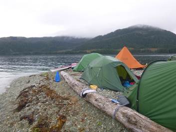 its
smaller isle. It was truly beautiful and sheltered from a swell that was
squeezing through the gap and pounding the coast near falls bay. With this
beauty and sheltered spot no wonder someone in Alaska’s past had built a
prospector’s hut. Now in trust with the state and protected under
its
smaller isle. It was truly beautiful and sheltered from a swell that was
squeezing through the gap and pounding the coast near falls bay. With this
beauty and sheltered spot no wonder someone in Alaska’s past had built a
prospector’s hut. Now in trust with the state and protected under 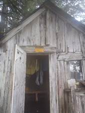 law.
law.
As we
adjusted to the settling conditions and begun the now automated function of
setting up camp. A lone humpback swam right past in the passage between the
main land and Crafton island no more than 500m away without a care in the
world. A truly special Alaskan experience.
As
the night drew in the clouds kept lifting and we were treated to a lovely
evening to dry gear out and have a nice relaxing evening to recoup and rest
with the chance to take a swim and just enjoy being in the wilderness.
Wondering what tomorrow will bring.
Dave Rider More
Photos……. Voice over……..
Day
Seven (Wednesday) – Crafton Island to Falls Bay
Wet and windy (storm
bound), dry and windy (storm bound, lunch), dry, we can go :-) !!!, wet, very
wet, exceedingly wet, the most wet I have been when not under water.
We woke up to rain,
wind and a reasonable amount of swell and choppy water off shore, so after breakfast
most of us went back to our tents. I managed to get out the tent for elevenses
to find that it had mainly stopped raining, and there were a number of hardy
souls looking at the view from under the 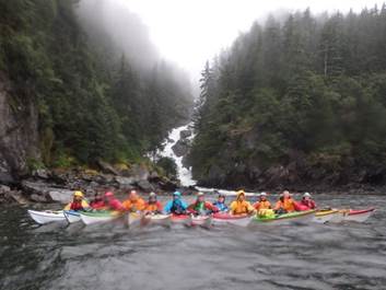 tarp, and beginning to get a bit restless with the lack of
activity. Time to try walking around the island, which didn't work as the tide
just did not go out far enough.
tarp, and beginning to get a bit restless with the lack of
activity. Time to try walking around the island, which didn't work as the tide
just did not go out far enough.
After lunch the
conditions had calmed down and we packed up we set off to find our next camp.
By now it had started raining again but we had a bit of fun in the swell on the
way around to Falls Bay. Where we stopped to fill our water supplies and have
mid afternoon snack before heading off again. We spent some time getting wetter
playing in the impressive water fall the bay is named after, well some people
did. By now the rain was torrential and I think it would be fair to say that we
were all a bit 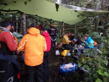 miserable by now, and wondering if we could cope with any more
rain. Keith suggested that we returned to the wooded area where we had picked
up our water supplies to camp. None of us needed too much persuading to give up
for the day.
miserable by now, and wondering if we could cope with any more
rain. Keith suggested that we returned to the wooded area where we had picked
up our water supplies to camp. None of us needed too much persuading to give up
for the day.
We put up the main
cooking tarp and the tents. We hung spare tarps over the tents, in the hope
that it would keep things a little bit drier. After a very wet tea, several
cups of team and collective attempts to remain cheerful I gave up on the day
and went to bed, so if anything exciting happened after 8:00pm I missed it.
|
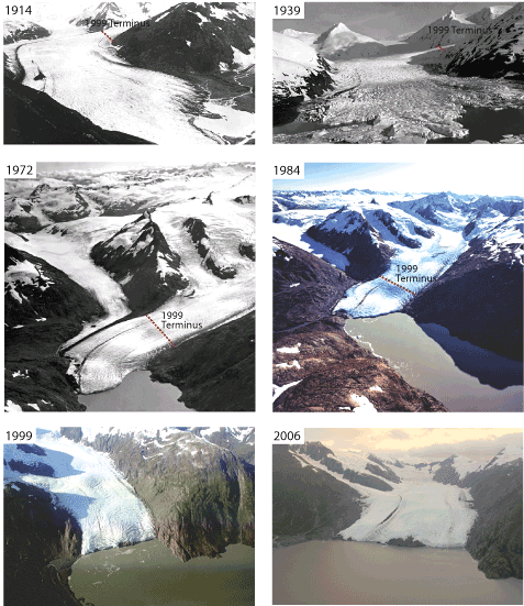
Many glaciers in Alaska are retreating.
Photo Plate. Series of photographs of the terminus of Portage Glacier. |
The best thing about
this campsite was pitching the tent on soft mossy ground (after Dom had helpfully
suggested we moved our camp from a potential puddle collecting hollow) and
actually being so tired that I managed to sleep for nearly 12 hours.
Catrionia Hare More
Photos…… Voice
over……..
Day
Eight (Thursday) – Falls Bay to Moraine ridge in Derikson Bay (Nellie Juan
Glacier)
WET, WET, WET . . . sums up the way we all
felt as we awoke on the morning of day eight of our expedition.
Having had to retrace our steps back to
Falls Bay the previous evening in increasingly heavy rain there had been no
let-up in the weather and the relentless downpour had battered our camp spot
all night. Even the patchwork of tarps
we had strung above our tents from the surrounding trees did little to deflect
the deluge.
Donning cold gear already wet through
from days of rain, emerging from our tents it was easy to start to believe that
this was how the rest of the trip was going to be. Breakfast and brewing up started as a cold,
damp and glum affair but once warm drinks started to trickle down the usual
smiles began to return to the group.
Cheerfulness in the face of adversity or just a bunch of nutters?
Having all wished Debbie a very Happy
Birthday and provided her with a soggy card, we got packed up and on the
water. As we paddled back out of Falls
Bay I came across a large eagle feather which served as a handy birthday
present for Debbie and was soon installed on the front of her kayak. I’m sure this may have brought us some good
luck as within an hour the rain finally began to ease off.
By the time we stopped for elevenses on
an island just to the east of Lighthouse Reserve the rain had stopped
altogether and heavy cags began to be taken off. We continued onto McClure Bay which is the
site of an old and long abandoned salmon cannery. Here the rusting remains of huge boilers, old
engine parts and other pieces of unrecognisable machinery lay all along the
rocky shoreline and suggested a ghostly echo of the industry that once thrived
in this inhospitable place.
A large waterfall roared down from the
back of McClure Bay and after a leisurely lunch some of us played briefly in
the surging waters at its base. Leaving
the remains of the old cannery behind us we headed south into Nellie Juan
Fiord, by which time the sun had made a welcome return.
Passing Division Point we again
marvelled at the stunning scenery that surrounded us as the clouds that had
dogged us for the previous days began to move away. A long but enjoyable paddle down the fiord
brought us to Derickson Bay where a moraine ridge left behind by the retreating
glacier provided what might have been an excellent camp spot for the
night. I say ‘might’ because this was to
be our first of many evenings spent in the company of the dreaded Alaskan Black
Fly.
The moraine basked in early evening
sunshine and the light winds soon worked a treat in drying our wet tents and
kit, it was almost perfect except for the infuriating black fly that had
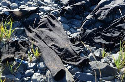
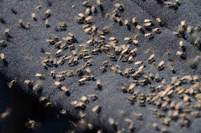
appeared in clouds within minutes of us landing on the shore. These flies, most of which don’t bite but
some that definitely do, seemed to infest all of the glacial moraine areas of
the bays we visited, often quickly appearing when we paused from paddling even
when some distance from shore.
I suspect that one of the main reasons,
aside from the cold winters, that most of Alaska remains unoccupied by humans
is the presence of these flippin’ black fly!
However, despite the annoying flies it
was great to see the back of the rain and it turned out that this was to be the
start of many more days of glorious Alaskan sunshine.
|
|
|
|
Brian Green More
Photos……. Voice
over……..
Day
Nine (Friday) – Moraine ridge in Derikson Bay (Nellie Juan Glacier) to Taylor
Glacier
 After
a dry night camping on the moraine spit in Derikson Bay we woke up on day nine
to a beautiful sunrise lighting up the mountains above the top of the Nellie
Juan glacier.
After
a dry night camping on the moraine spit in Derikson Bay we woke up on day nine
to a beautiful sunrise lighting up the mountains above the top of the Nellie
Juan glacier.
Unfortunately, we were still plagued by the blackflies which seem
to love to make their home on glacial moraines, the fact that this was such a
glassy, still morning really didn't help.
We needed to make the usual early start to catch the last of the
flood tide which was flowing through a shallow river-like entry to the
glacier. This shallow section had been
formed over many thousands of years by the glacier dumping moraine material
before gradually retreating to its present position.
It was in this shallow section that Dave decided to run a test to
see if his go-pro floated, sadly it 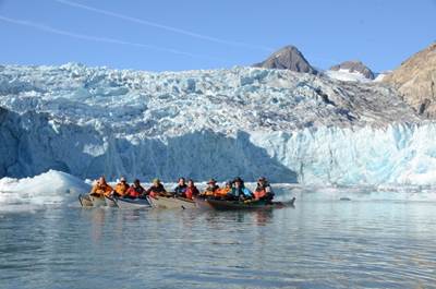 didn't,
the start of an expensive day for Dave!
didn't,
the start of an expensive day for Dave!
We paddled with a little current (the last of the flood into the
inner lagoon) and we encountered small icebergs which had been calved recently
whilst there were also bigger bergs the size of cars and even bigger. These larger bergs had grounded in the
shallows and probably had been there a while gradually melting. One of the
larger, free floating bergs had become top heavy as the water melts away the
ice below water very much faster than the air above water, it reminded me of my
old P&H Quest as it was definitely happier to turn over and stay that way.
 We
paddled on in bright sunshine although the air temperature was quite cold until
the water deepened and we entered a steep sided valley leading to the glacier
where we spent some time photographing.
The glacier was far from quiet.
There were thunder-like rumblings as the glacier ground its way slow
along the floor of the valley.
Occasional loud cracks like rifle shots rang all around as we tried to
guess where the next big calving would take place.
We
paddled on in bright sunshine although the air temperature was quite cold until
the water deepened and we entered a steep sided valley leading to the glacier
where we spent some time photographing.
The glacier was far from quiet.
There were thunder-like rumblings as the glacier ground its way slow
along the floor of the valley.
Occasional loud cracks like rifle shots rang all around as we tried to
guess where the next big calving would take place.
We gave the glacier lots of respect and didn’t approach too close
to the foot of the ice cliffs but slowly soaked up the atmosphere. When we had enough we started to paddled out
as the tide 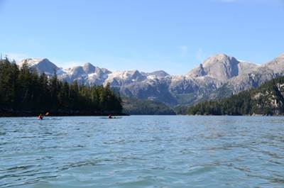 would
drop in the lagoon and leave us high and dry.
We came across some beautiful common seals basking on the ice floes and
after a few photographs we left them to their peace.
would
drop in the lagoon and leave us high and dry.
We came across some beautiful common seals basking on the ice floes and
after a few photographs we left them to their peace.
We then paddled out turned and left at the point and paddled past
“deep water bay” where there was a rock feature to rival half-dome in Yosemite.
We stopped for a late elevenses under a towering granite cliff. Snow patches above provided so cool, clear
drinking water for elevenses. 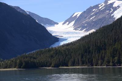 This
was an ideal sun-trap and most of us took the opportunity for a good wash; some
even washed their hair and clothes.
This
was an ideal sun-trap and most of us took the opportunity for a good wash; some
even washed their hair and clothes.
After an hour and half we paddled across Greystone Bay and at
Cockstone Point crossed Kings Bay to finish the day at our campsite below
Taylor Glacier.
Camping sites here was a little illusive and estimations using the
rule of twelfths suggested that Keith, Dave and Brian’s tent would be
underwater. They resisted the urge to
move it until they had no choice. I had
a couple of inches to spare and Kathy and Nicky’s tent was lifted at the edge
to let the last couple of inches go under the tent before receding shortly
after.
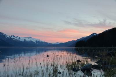
The warm air held back the cold air high on Taylor Glacier until
the evening cooled and a katabatic wind formed suddenly creating a stream of
mist on the water out of the valley.
|
|
|
|
Black flies once again were a nuisance and they tended to be
attracted to warm black clothing, or was it the smell?
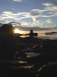
The day ended with another beautiful sunset.
Mark Pawley More
Photos……. Voice
over……..
 Day Ten (Saturday) – Taylor Glacier to Small Island
near Applegate Island
Day Ten (Saturday) – Taylor Glacier to Small Island
near Applegate Island
It was Saturday and although there were still some flies around,
we managed to have breakfast reasonably undisturbed. Although the work involved
every morning in retrieving your food from the bear cache, packing away the
tent etc., sorting lunch, packing the boat, getting dressed in damp smelly
kayaking gear (the list goes on) was wearing me down, I really enjoyed
breakfast because every morning the view was breath-taking. I always felt very
relaxed and extremely lucky sipping my cuppa whilst taking in the amazing
views.
We were on the water by 9am and with the land to our left we headed
north. Everything and everyone was calm and as we 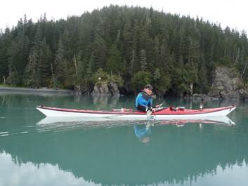 paddled,
people broke off into smaller groups chatting. It’s funny how the majority of
conversations are about food - well mine and Kathy's were!! We had become
experts at making our discussions about that evening's meal last for hours. I
remember Brian, Kathy and I after only an hour or so on the water, talking for
ages about how to make the perfect
paddled,
people broke off into smaller groups chatting. It’s funny how the majority of
conversations are about food - well mine and Kathy's were!! We had become
experts at making our discussions about that evening's meal last for hours. I
remember Brian, Kathy and I after only an hour or so on the water, talking for
ages about how to make the perfect 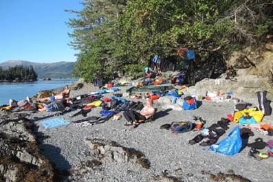 bacon
butty - what torture that was?!?!
bacon
butty - what torture that was?!?!
Elevenses was a tad late, but we snacked on quite a large beach -
again with great views (I sense some repetition here). Mark, Caz and I managed
some yoga, well I say managed, Mark and I managed something but it wasn't yoga,
while Caz was bending like a rubber band. And then we saw life - yes other
humans, and not just normal humans - kayakers!!! We waved and shouted but were
completely ignored - had they seen us making some strange poses on the beach?
Could they smell us from 500 yards away? Ah well, that was the excitement over,
back on the water we went. As we came out of the bay we could see the pesky
paddlers who I think had picked up some speed so we couldn't catch them.
The sun was really hot now and the views were lush. We needed a
water stop, but the one we went to first didn't have a suitable landing spot so
we paddled on to look for something else. We found a smelly place with lots of
dead and rotting salmon, where there was a small stream and all filled up our
water bottles there. We did intend to go further, but we stopped at Small
Island for lunch - and it was small. Before eating lunch, everyone lost a few
layers of clothing as it was really, really hot by now. As everyone lay
sprawled out over the small beach, it was decided we would stay here for the
night. The search began for a good spot for the tent. Only two tents could fit
at the very back of the beach, whilst everyone else had to locate on the top
raised grassy part of the tiny island. Boats were emptied and carried up and
lifted onto the raised grass. The beach resembled a plane crash, gear and people
scattered all over the beach.
|
|
|
|
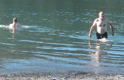
It was a nice relaxing afternoon, we dried all our gear in the sun and took our
time cooking dinner. Some of the men stripped off and bravely had a dip in the
cold water. Mark decided to swim around the island in just his undies, a feat
which I think deserved a certificate and a badge that he could sew onto his
underpants. Kathy was on life guard duties, but she'd nearly finished her cuppa
before deciding to get up and go and look for him as he'd been out of sight for
quite some time. The only time anyone got up was to move their gear slightly up
the beach as the tide gradually came in. A fire was lit to burn some rubbish
and the high tide forced everyone to bed as there was no beach left on which to
stand.
Nicola Corbett More
Photos…… Voice
over……mp3..
 Day Eleven (Sunday) – Small Island near Applegate
Island – Surprise Cove
Day Eleven (Sunday) – Small Island near Applegate
Island – Surprise Cove
 The day started
with the sunlight shining on the tent even though we were in the forest,
fantastic a dry day but remembering not to crawl straight out the tent as there
was an 8 foot drop to the beach most people were up by this time and busily
packing for a 9 o'clock start. So, after
having a brew I also started with some packing.
Then Dave casually walked around the corner from the other side of the
beach and in a nonchalant manner announced “There is a whale around the corner
about two cables off” (that's 370 metres to you and me). The man has been at sea too long is that why
he has a beard !!, But to my surprise it did not create a lot of
excitement. Have we seen that much
wildlife that we are now desensitised to all of this? Mark soon scurried off with his 300mm lens to
capture that once-in-a-lifetime photograph. Keith jumped in his boat and off he
went to track it down.
The day started
with the sunlight shining on the tent even though we were in the forest,
fantastic a dry day but remembering not to crawl straight out the tent as there
was an 8 foot drop to the beach most people were up by this time and busily
packing for a 9 o'clock start. So, after
having a brew I also started with some packing.
Then Dave casually walked around the corner from the other side of the
beach and in a nonchalant manner announced “There is a whale around the corner
about two cables off” (that's 370 metres to you and me). The man has been at sea too long is that why
he has a beard !!, But to my surprise it did not create a lot of
excitement. Have we seen that much
wildlife that we are now desensitised to all of this? Mark soon scurried off with his 300mm lens to
capture that once-in-a-lifetime photograph. Keith jumped in his boat and off he
went to track it down.
We
all got on the water but by the time we got around to the other side of the
island Keith was far in the distance. Finally, when he returned he said “I've seen
it three times” but we will have to take that with a pinch of salt.
So
now we are all regrouped and we start to leave the small island that is
situated between Mink Island and Applegate Island. We are soon turning north and heading up
Culross Passage which is only suitable for small craft. We soon reached our first place of interest,
Picturesque Cove where Ian spotted two brown objects on the beach. We thought this 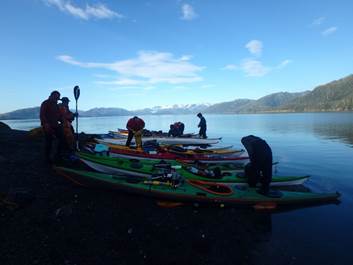 was our second
sighting bears on a beach but after going around the corner we found out they
were couple of dogs belonging to somebody camping in the bay. There were several weekend pleasure craft
anchored here. We spotted a waterfall
the back of the cove on the map so decided this would be a good place to fill
up with fresh running water. After
quietly paddling in we found there were lots of black flies and Seagulls
feeding on the remains of dead salmon that had spawned. However, Brian had spotted a black bear on
the shore to the right, he says that he signalled with the usual sign (two
fingers on the head making two ears) but by the time we noticed some minutes
had passed and the bear had wandered back into the undergrowth.
was our second
sighting bears on a beach but after going around the corner we found out they
were couple of dogs belonging to somebody camping in the bay. There were several weekend pleasure craft
anchored here. We spotted a waterfall
the back of the cove on the map so decided this would be a good place to fill
up with fresh running water. After
quietly paddling in we found there were lots of black flies and Seagulls
feeding on the remains of dead salmon that had spawned. However, Brian had spotted a black bear on
the shore to the right, he says that he signalled with the usual sign (two
fingers on the head making two ears) but by the time we noticed some minutes
had passed and the bear had wandered back into the undergrowth.
Paddling north again the sea state was getting
larger so we decided to cross over to the Lee shore. By this time, it was lunch
so we found a nice grassy beach that was kind to the boats sitting under a high
mountain rising to about 1500m.
 After a pleasant
lunch, we headed towards the narrow part of the passage with several
islands. We have a long bay on our left
and Goose Bay on the other side This is where the group had to paddle close to
each other as there were high speed boats now passing us at close proximity as
we were cutting across the channel where they speed between the islands.
After a pleasant
lunch, we headed towards the narrow part of the passage with several
islands. We have a long bay on our left
and Goose Bay on the other side This is where the group had to paddle close to
each other as there were high speed boats now passing us at close proximity as
we were cutting across the channel where they speed between the islands.
 Now we had reached
the top of Culross Passage, and rounded the point where we stopped for another
break on a steep shingle beach which caught the late afternoon sun. There was a large log washed up on the beach
behind which gives some idea of the fetch here to the north and massive
glaciers some 60 miles to the north.
This log seat proved too good an opportunity for a photo to miss.
Now we had reached
the top of Culross Passage, and rounded the point where we stopped for another
break on a steep shingle beach which caught the late afternoon sun. There was a large log washed up on the beach
behind which gives some idea of the fetch here to the north and massive
glaciers some 60 miles to the north.
This log seat proved too good an opportunity for a photo to miss.
As
the sun cast its shadow on the beach we got back on the water and turned to
cross the wide Cochcrane Bay. We reached
our campsite after about an hour and a half of paddling and in good time to
check into Surprise Cove State Marine Park.
We knew this site well from a previous trip and had the luxury of
camping platforms for the tents, picnic tables and steel boxes for the food
(bear -safe food cache) and a wooden hut with the loo. Just a perfect day in this amazing place.
Don Brooks More
Photos…… Voice over…….mp3.
Day
Twelve (Monday) – Surprise Cove – Willard Island
Leaving
the brilliant campsite at Surprise Cove, the team headed off towards Blackstone
Bay. Entering the bay, we were granted a superb view of the Tebenkoff Glacier,
it stretched on for several miles, but there was no time to investigate as the
team’s go al lay further into Blackstone.
 The
weather was perfect, flat seas, bright sun and no clouds or wind as we headed
down the bay. Stopping for 11’s, the midge which had not appeared to be a
problem, forced some of the team to eat quickly and then get back on the water.
Suitably fed and lathered in sun cream, we continued our endeavour. Rounding
the next point, we were treated to the most amazing vista of the Blackstone
glaciers. Wow!
The
weather was perfect, flat seas, bright sun and no clouds or wind as we headed
down the bay. Stopping for 11’s, the midge which had not appeared to be a
problem, forced some of the team to eat quickly and then get back on the water.
Suitably fed and lathered in sun cream, we continued our endeavour. Rounding
the next point, we were treated to the most amazing vista of the Blackstone
glaciers. Wow!
Even
from over 16km out, the ice was awe inspiring. We paddled on, eating up the
kilometres until lunch was held on an old terminal moraine that is 7km from the
current glacier head wall and was the site of several kayaker deaths – the sea 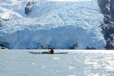 can
become confused as it speeds up over the shallows.
can
become confused as it speeds up over the shallows.
Fully
fuelled the team was eager to crack on, counting off the glaciers (there are 8)
as we paddled deeper into the bay.
Nearing the entrance to the Beloit tide water glacier, half of the team
held back whilst several members entered the gorge so as to get a better view –
approaching glaciers can be very dangerous. There was no floating ice in the
bay, the glacier was eerily quiet except for the waterfall of melt water
cascading down to the sea.
Despite
the bright, ill positioned, sun, the team posed for several photos before
continuing to the next glacier. Approaching 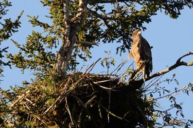 the
second tide water glacier (Blackstone), a very strong katabatic wind caused the
group to split, with most staying back whilst some foolhardy adventurers
battled up to the glaciers head wall. Again, there was no ice in the bay and
many photos were taken.
the
second tide water glacier (Blackstone), a very strong katabatic wind caused the
group to split, with most staying back whilst some foolhardy adventurers
battled up to the glaciers head wall. Again, there was no ice in the bay and
many photos were taken.
Leaving
the glacier, the adventurous paddlers headed towards a hanging glacier that had
previously caused the death of several kayakers when ice had fallen on to them.
Alas global warming has caused the ice to retreat and in the summer the glacier
is no longer as dangerous – although the members that had held back did tell
those of us that had approached the glacier that a rather large (i.e. house
sized) piece of ice had detached and slid down the cliff above us, something
that we had not been aware of at all.
Photos
taken the group re-joined and headed to the campsite on Willard Island, the
site of a previous LCC trip campsite where the strange nature of the tides in
Prince William Sound had first became apparent!
40km
done, a great day!
Mike Alter More
Photos……. Voice
over…….mp3.
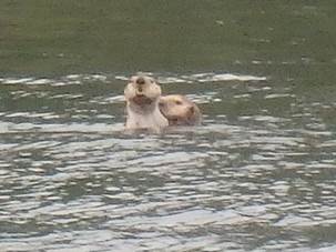
Day Thirteen
(Tuesday) – Willard Island to Squirrel Cove “Swimming bear, grumpy otters and
other swimmers….”
After a heavy
paddle against a massive wind up to Blackstone the previous night, some
opted for a leisurely start, whilst the hardcore lot set off just after 8 to
revisit the glaciers. 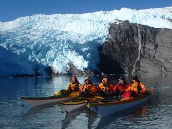 They had an
entirely different experience to the previous day’s paddle, as the glaciers had
calved huge bergy bits, some growlers and plenty of great brash ice. Oh, and
there was no wind! And probably considerably less noise as Nicky and I were
back at camp.
They had an
entirely different experience to the previous day’s paddle, as the glaciers had
calved huge bergy bits, some growlers and plenty of great brash ice. Oh, and
there was no wind! And probably considerably less noise as Nicky and I were
back at camp.
Plan A was very
civilised. The lier-inners were to be packed up and ready with a brew for
elevenses for the returning paddlers. Keith, realising this was no time
to get soft, revised the plan for us land lubbers. We were to be ready to
paddle AT 11! 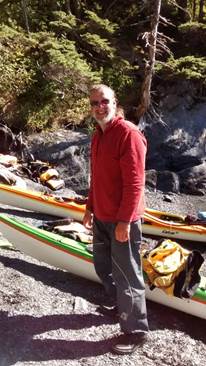 Not “around 11” which Ian stresses in his voiceover. There was to
be no messing, no brew for the paddlers, no snacking….on the water ready to
paddle at 11!!
Not “around 11” which Ian stresses in his voiceover. There was to
be no messing, no brew for the paddlers, no snacking….on the water ready to
paddle at 11!!
Unable to really
lie-in, at 7:30, a few of us had stumbled, around the shore in search of a
working stove (2 teams’ stoves had packed in by this point - seems the MSR is
the recommended petrol stove of choice, but more on this later). Ian, after
some gentle persuasion, kindly left us his stove to assist in our plan for a
leisurely breakfast on the beach as we watched the intrepid paddling team set
off for their 19km round trip. Safe in the knowledge we had 3 and ½ hours
before we “HAD TO BE READY ON THE WATER”, we took great pleasure in not rushing
to breakfast, break camp and pack our boats within an hour of getting up.
After the long
walk to the bear cache (we were finally on a beach big enough to put it more
than 200 yards away), the hardcore lier-inners (Nicky, Pete and Caz almost made
it to 8am) appeared and we all enjoyed a leisurely breakfast in the sun. Down
to our last days of supplies, Debs pulled it quite literally out of the bag by
appearing with pancake mix! Alas, whilst I tried to whisk lumps out of our mix,
I took my eye of the aforementioned MSR which should have been simmering a soup
mix for lunch. MSR doesn't do simmering. I’d burnt the soup!! Faced with the
wrath of Nicky, I was saved by the distraction when Brian spotted a chick’s
head appearing from the nest above where Ian and Mike’s tent had been with the
large bird of prey we’d spotted the night before. We were delighted, especially
Debbie, who had been anxious the eagle/ falcon was a juvenile and our presence
may have prevented its parents returning. Sure enough, I later watched 4
fledglings follow mum out of the nest on 3 or 4 trial flights. Looking at
Mark’s photos, I think it was a golden eagle!
The boats were
packed, stoves and coffee were away (there would be no time for elevenses when they
returned), Brian had finished his book. We were in our boats and ready to go by
10:45. 11 o’clock came and went, but even with Brian's binoculars, Team Glacier
could not be seen. We'd heard a few huge cracks, and seen one huge chunk of ice
calving into the water. Slightly nervous, given the strict timeline we were led
to believe would be followed, Pete radioed through to Keith who confirmed all
were still alive and afloat. We returned to land to wait.
At 11:34, Ian
arrived back, keen to be reunited with his stove. The rest of them sauntered
along behind. On the 2nd attempt to get in the boats, Pete lost his balance
(probably due to the shock of not being on the water at 11!). His back remained
dry but his boat needed a good pump out..... Was this swimming??
 At 11:55, we made
our way through the tiny channel that had filled over the morning separating
Willard island from the land and set off towards the waterfalls. It was to be our last full day of paddling,
and, as we were getting ever closer to civilisation, we all thought the
wildlife was
At 11:55, we made
our way through the tiny channel that had filled over the morning separating
Willard island from the land and set off towards the waterfalls. It was to be our last full day of paddling,
and, as we were getting ever closer to civilisation, we all thought the
wildlife was 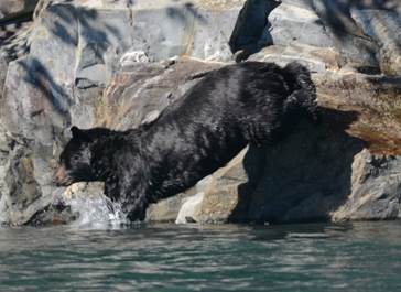 pretty much over.
As we paddled
away from the glacier, a few of us spotted a big, dark log floating in the
water, thought nothing of it and carried on chatting about the morning’s
highlights for each team. As we got closer, it appeared that the log was moving
differently to most logs and had a nose and eyes. It was in fact a large bear
swimming across in front of us. Not clear where it had come from, it had
certainly had more than a couple of km to swim. Having had an almost bear-less
trip, we couldn’t have wished for more. After drifting a little bit close to
it, we managed to position ourselves in a less intrusive way and watch it swim
to shore and climb out on to the rocks. What an incredible sight!
Completely awe
struck, we paddled on, Mike leading us past some incredible waterfalls.
Some eejit tried paddling through to fill her water bottle from them, only to
get soaked and get no water in her bottle. We saw 3 huge jetskis, and were
delighted when they went straight past our planned lunch stop, and the roar of
their engines faded. We found another magical beach in the sun to enjoy
lunch, and I was able to dry off after my foolish waterfall adventure.
 We couldn’t believe our luck. What a way to
start a day! Glaciers, golden eagles, swimming bears….. Nicky and I were
distracted enough not to mind the burnt, slightly cold soup. And our luck
improved yet further, when Mike and Ian stumped up another packet of crackers
so we didn’t have to eat cheese served on salami! Life doesn’t get better. Or
does it……
We couldn’t believe our luck. What a way to
start a day! Glaciers, golden eagles, swimming bears….. Nicky and I were
distracted enough not to mind the burnt, slightly cold soup. And our luck
improved yet further, when Mike and Ian stumped up another packet of crackers
so we didn’t have to eat cheese served on salami! Life doesn’t get better. Or
does it……
A beautiful
dragonfly sat on the boats for a good 10 minutes whilst we all 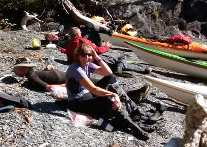 photographed it, and then, about 10 feet in front of Mark, a river
otter popped it’s head up. Delighted for Mark, but wishing we hadn’t missed it,
it kindly popped up again, and again, with another otter. The pair of them kept
popping up, swimming in towards shore and then diving to pop up further along
the beach and repeat the moves. They were chattering all the way across, as
though one was saying “I told you to keep an eye on the beach. How are we
supposed to get through to the woods now? Maybe we can get between that red and
yellow boat, come on”, and we watched them for 2- 3minutes before they realised
we had the beach covered and they’d have to go around to another bay. Days like
this are what sea kayaking and, indeed, life is all about. If Team Glacier had
made it back for 11, maybe we wouldn’t have seen all this incredible wildlife!
photographed it, and then, about 10 feet in front of Mark, a river
otter popped it’s head up. Delighted for Mark, but wishing we hadn’t missed it,
it kindly popped up again, and again, with another otter. The pair of them kept
popping up, swimming in towards shore and then diving to pop up further along
the beach and repeat the moves. They were chattering all the way across, as
though one was saying “I told you to keep an eye on the beach. How are we
supposed to get through to the woods now? Maybe we can get between that red and
yellow boat, come on”, and we watched them for 2- 3minutes before they realised
we had the beach covered and they’d have to go around to another bay. Days like
this are what sea kayaking and, indeed, life is all about. If Team Glacier had
made it back for 11, maybe we wouldn’t have seen all this incredible wildlife!
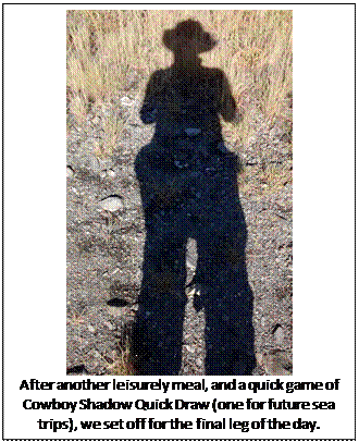
After another
leisurely meal, and a quick game of Cowboy Shadow Quick Draw (one for future
sea trips),
we set off for the
final leg of the day, round to the campsite. Keith had been in a
mischievous mood all day. After Ian leant us his stove in the morning, somehow,
Keith managed to steal a part of it before Ian set it up for lunch. Briefly
making Ian feel like he shouldn’t have lent it after all. Given his mischief,
Nicky assumed that Keith was making whale noises and she turned to chastise him
only to see a humpback’s tail disappearing into the water behind us. We all
caught a brief glimpse. It was the kind of day you just couldn’t write!
It was a gentle paddle around to our last campsite in Squirrel Cove.
Another ‘luxury’ one with tent platforms and a toilet !!
Brian went for a quick swim to freshen up and try to work up an appetite
before dinner. It was the end of the trip. All food must be eaten, and
Catriona’s boat seemed to still be full of food. I don’t think Brian could have
swum far enough. The time had come for Nicky and I to crack open the red
cabbage, and we finished our day with the worst meal of the trip – purple rice
and 2 curries resembling….., well, let’s just say it wasn’t appetising, but
even that couldn’t dampen our spirits. 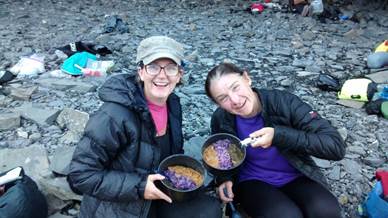
 We sat on the beach, (some people in chairs! – it really was a
luxury campsite) and reminisced about the trip.
We sat on the beach, (some people in chairs! – it really was a
luxury campsite) and reminisced about the trip.
So many wonderful
sights, experiences, laughs, animals, friendships……and what a magical day to
end on. After a quick reccy of the tent tensions (see video for Nicky’s
TV commentator career launch), Nicky and I went back to our platform. Pete was
snoozing and Caz was chatting with a squirrel in the tree…… Perfect.
Kathy Morton More
Photos……. Voice
over……mp3. Voice
over part 2 ……mp3
Day
Fourteen (Wednesday) – Squirrel Cove to Whittier
Waking on the last day we were on the water extra early (7am ish).
Some said this was to ensure we made it back to Whittier in 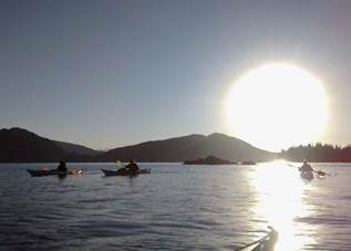 time to be collected by the driver, but I
think it was more the thought that if we got back early then there was a chance
for a meal at the restaurant.
time to be collected by the driver, but I
think it was more the thought that if we got back early then there was a chance
for a meal at the restaurant.
|
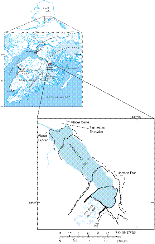
Portage Glacier is a natural gap
for strong, gusty winds The
Portage Glacier was named by the scientist Thomas Mendenhall in 1898, while
serving as the Superintendent of the US Coast and Geodetic Survey who was
responsible for establishing the exact border between Alaska and Canada. The
glacier is part of the Chugach National Forest, located south of Portage
Lake. This lake is being formed by the melting of the glacier which has been
retreating substantially for the past fifty years. Its
name suggests and easy or low gap in the surrounding mountains and this is
often exploited by westerly winds blowing down Cook inlet and the Turnagain
Arm. They are then funnelled through
the mountains and down on Whittier and Passage Canal as Icey blasts. These winds are often much stronger in the
afternoons. Katabatic
winds…
|
Cathy was leading, the team had a leader each day, and we were
under orders to follow her route so as to avoid entering the busy shipping
lanes. I'm not sure if it was last day eagerness / inquisitiveness, but the team
spread out (a common problem of LCC sea paddling) and so we added wing men to
ensure the group stayed within sensible distances - this is probably something
to think about on normal club trips.
As we began to enter deeper into Passage Canal the wind picked up
noticeably and the team began to hug the shoreline. With the increased wind,
there was increased waves, but despite coming to the end of the trip the team
cope admirably and were rewarded by sight of a Humpback Whale - something that
surprised us all given how far up 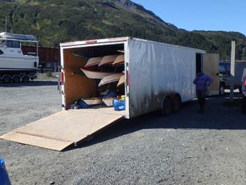 Passage
Canal we were.
Passage
Canal we were.
Battling on, the wind changed direction. It was now a full-on head wind, gusting force
6 or more as we clawed our way closer to Whittier. No choice but to swing back
into proper paddling mode and paddle hard. A final effort saw us reach the slip
way where we had launched 14 days earlier. A few congratulations and then the
team swung into action, unpacking boats and getting kit out of the way as this
is a working port.
We had all unpacked and had a 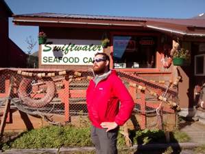 brief
explore by the time the transport arrived. We loaded the van quickly, but after
a brief discussion decided rather than rush for the tunnel we would head for a
celebratory meal at the now traditional end to the trip at the “Swift Water
Café” in Whittier. A great end to a great trip!
brief
explore by the time the transport arrived. We loaded the van quickly, but after
a brief discussion decided rather than rush for the tunnel we would head for a
celebratory meal at the now traditional end to the trip at the “Swift Water
Café” in Whittier. A great end to a great trip!
Mike Alter More
Photos……. Voice
over……mp3.
Advice for future trips:
1/ Food available from Fred Mayers from 6:30am / Seyers Mall 24hrs
or Sainsbury`s on route.
2/ Getting to Whittier is relatively easy (train, hire car or
shuttle bus). We used Levi Hogan this
time. ($500 for the whole group plus
Gas, tolls and tips)
3/ UK style sea kayaks available for hire from Levi Hogan (http://www.turnagainkayak.com/)
(including delivery, top of the range paddles, BA, Flares and Pepper Spray etc)
4/ Need bug head nets in worst areas. (Although late August is the
best time to go rather than July.)
5/ Large lightweight tarp is very useful to cook under and for
shelter from the rain.
6/ All stoves should be of the same fuel in case one has a
mechanical problem. Such a long expedition means that you take only enough fuel
for yourselves.
7/ Tents should be capable of pitching on rounded pebbles on the
beach immediately above the tide line. Do not expect to use pegs in the
conventional way but they can be buried sideways with the guy clove-hitched
onto the middle. (similar to a dead-man or snow stake). They should be 3+ season tents and be pretty
waterproof. In very heavy rain a spare
tarp can be hung over them to shield them from torrential rain.
8/ Paul Twardock`s book “Kayaking and Camping in
Prince William Sound” A Kayaker's Paradise is an
excellent reference. National Geographic publish a topographical, waterproof
map of the west of the sound (Sheet 761)
9/ Keep bear safe! All food needs to be sealed x 3 (2 zip-locked
bags + 1 dry bag) and stored overnight away from the sleeping area (50m).
Processed foods are far easier to keep bear safe (soup and pasta etc) and are
easier to prepare. Tooth paste and wash
kits kept with foods – not in tents. Hand flares are probably better than
pepper spray as defence against marauding bears. It is impossible to hang all
your food for a two-week expedition so a bear cache is used covered with a tarp
and pots etc hung on the outside to try and alert you if it is raided.
10/ Neoprene boots with over trousers are ideal for keeping your
feet dry and launching boats on the gravel beaches. (Wellington Boots would do
a similar job but may not be as comfortable)
11/ $12 toll on tunnel to Whittier / Lazy Otter for charter
boat drop-off or to pay for parking by the small beach under passenger ferry
ramp. Launch fees for the beach is $3
per person. The tunnel into Whittier is
at half-past the hour and out of Whittier on the hour. (Except when a train is going through it)
Carole
Thomas, Debbie Hughes, Dave Rider, Keith Steer, Ian Bell, Catrionia Hare, Pete
Thomas, Mark Pawley, Don Brooks, Nicki Corbett, Brian Green, Mike Alter and
Kathy Morton