|
|
Club Expedition to
Alaska 2018 |
|
|
News items or reports on club activities
should be sent to website@liverpoolcanoeclub.co.uk |
||

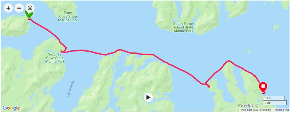
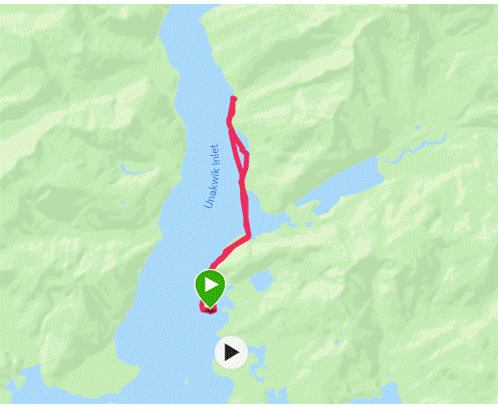
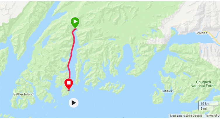
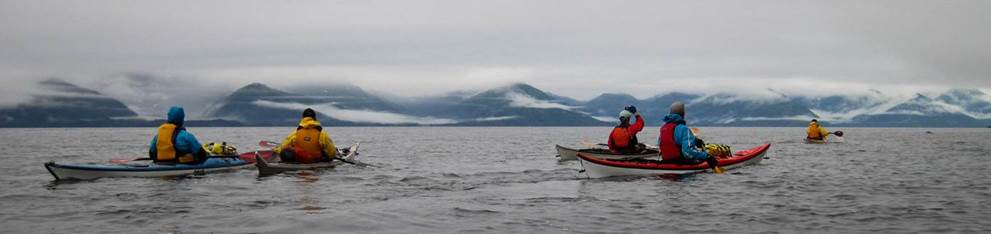
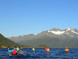
Club
Expedition to Alaska (Whittier to Perry Island, Meares Glacier and Unakwik Inlet and return via Esther Island) “A Temperate
Rainforest?”
This
club’s expedition to Prince William Sound is now well established with trips in
2008, 2010, 2013, 2016 and again in 2018. This time we headed out to Perry
Island in search of whales and then to Unakwik Inlet
to find Meares Glacier. This involved some fairly-long, open
crossings; including several in the thick fog. We were stormbound for several
days with strong gusty winds and heavy rain.
Every
day we encountered something interesting including, humpback whales, black
bears, Orca, Steller Sea lions and common harbour seals, deer, sea otters, bald
headed eagles and many other sea birds.
They seemed to be everywhere. We also paddled up to enormous
tide-water glaciers.
Our
friend Levi Hogan (below) shuttled us to and from Whittier along with supplying
his fleet of high quality UK Sea kayaks.
|
|
|
|
|
|
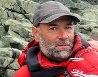
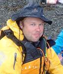
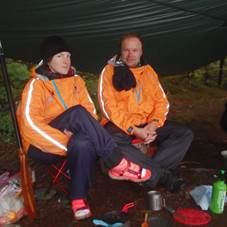
Keith Peek |
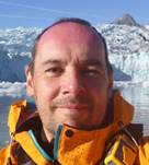
Mark Pawley |
Ruth Edwards |
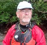
Ian Bell |
|
|
|
|
|
|
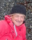
Mike Alter |
Andy Garland |
|
Martin Aldridge |
|
|
|
|
|
|
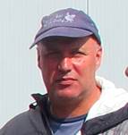
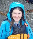
Roger Morgan |
Chris Preston |
Frankie Annan, |
Nikki Aldridge |


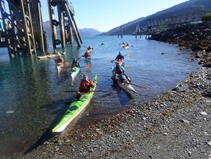
The
flight out and getting to Whittier
|
|
|
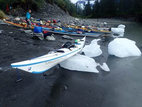
Levi Hogan from Turnagain Kayaks |
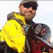
 This year, not
only did we find a new outfitter, Levi Hogan and Turnagain kayaks but we also
found cheaper and more direct flights via Iceland. Consequently, we
had a much larger group than normal with 12 of us making the journey out to
Anchorage. The flights cost around £800 with a short stop over
(2hrs) in the new North Atlantic hub of Reykjavik. On the way-out we
were all kicking ourselves as we should have booked a couple of days in Iceland
instead of flying straight through. We had to endure numerous
advertising videos and TV programmes teasing us with the best that Iceland had
to offer.
This year, not
only did we find a new outfitter, Levi Hogan and Turnagain kayaks but we also
found cheaper and more direct flights via Iceland. Consequently, we
had a much larger group than normal with 12 of us making the journey out to
Anchorage. The flights cost around £800 with a short stop over
(2hrs) in the new North Atlantic hub of Reykjavik. On the way-out we
were all kicking ourselves as we should have booked a couple of days in Iceland
instead of flying straight through. We had to endure numerous
advertising videos and TV programmes teasing us with the best that Iceland had
to offer.
After our midmorning departure
from Manchester we arrived in Alaska 12 hours later at 5pm local time and still
in daylight. A quick free shuttle to our hotel and we were unpacking
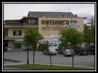
in 3 large and spacious rooms. That evening we discovered Gwennie’s
Old Alaska Restaurant, just opposite our
hotel. Great home cooking. More
Photos……….
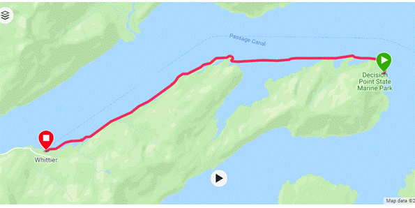
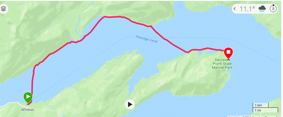 16th August (Thursday) –
Whittier to Decision Point
16th August (Thursday) –
Whittier to Decision Point
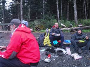
After rising early and helping
ourselves to the buffet breakfast of Waffles, toast, tea or coffee, cereal,
muffins, fruit and yogurt we returned to our rooms to pack and get ready.
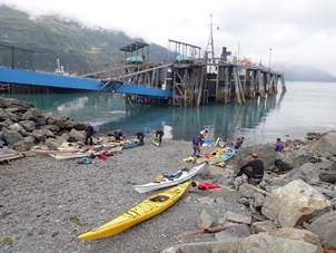
Levi Hogan from Turnagain Kayaks turned-up
exactly on time at 9:00am. We put our bags into the enormous sea
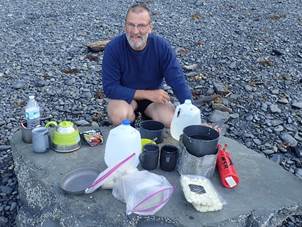
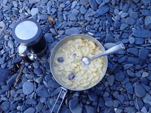
kayak trailer (and old car transporter trailer) and headed to Fred Mayers to buy our food. 60 mins later and we had
all purchased what we thought would be enough food to keep us nourished for two
weeks. We were cooking in groups of two with a petrol stove
between us.
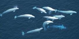 Driving along Turnagain Arm on
Highway One we saw a group of white beluga whales. We turned up towards Portage
Glacier and the old converted railway tunnel which is the only way into
Whittier. We only just made it with 2 minutes to
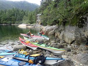
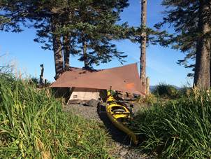
spare. We unloaded the boats, gear and food at Lazy Otters
slipway and beach which is right next to the ferry terminal. Within
30 minutes Levi was ready to leave, taking our airport bags with him in the
trailer. We topped up with water and were ready to paddle out into
Passage Canal some 45 mins later.
Driving along Turnagain Arm on
Highway One we saw a group of white beluga whales. We turned up towards Portage
Glacier and the old converted railway tunnel which is the only way into
Whittier. We only just made it with 2 minutes to
spare. We unloaded the boats, gear and food at Lazy Otters
slipway and beach which is right next to the ferry terminal. Within
30 minutes Levi was ready to leave, taking our airport bags with him in the
trailer. We topped up with water and were ready to paddle out into
Passage Canal some 45 mins later.
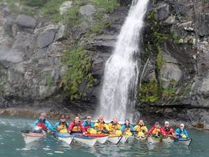
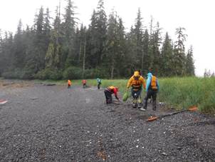
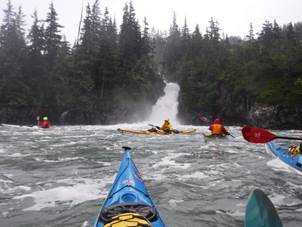
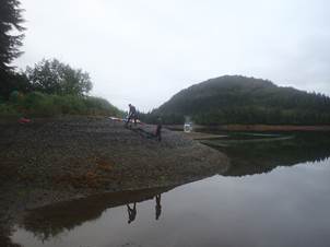
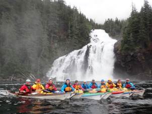
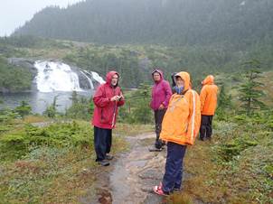
Our first stop was Kittiwake Falls, two tall cascades over steep rock which
fall directly into the sound. Nikki tried to go behind the falls,
but it was low tide and there were too many rocks in the way. Group
photo over we headed out along the north shore marvelling at the scenery and
wildlife. Bald Headed eagles peered down at us from nearly every
lone pine. Two red sails were spotted in the
distance. As we came nearer the turned out to be pedalos
/ kayaks / sailing Trimaran combinations that are hired out for the day from
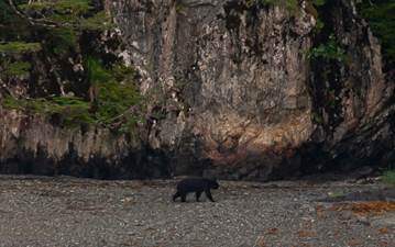
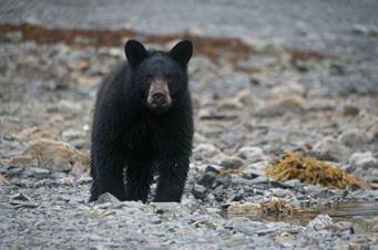
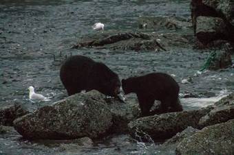
Whittier. Near Billings Creek we spotted our first bear, it was fishing
for Salmon near one of the fresh water streams where they come to breed.
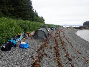
We crossed over to Squirrel Point and checked out the campsite
there. Nobody was using it, so it was a possibility if Decision
Point was too crowded. We rounded the headland and could see in
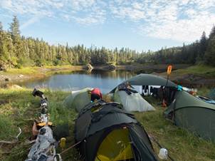
three directions. The Marine Park campsite at Decision Point
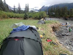
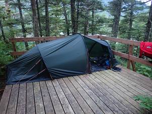
was ideal. 4 camp platforms, a shingle beach with access on both
sides and excellent views, a steel bear-proof food cache and an outhouse
(composting toilet). We cooked on the beach and set up camp on the
point and settled down to our first night out in the sound.
|
|
|
|
Keith S More
Photos………. Audio
Report……..
17th
August (Friday) – Decision Point to Perry Island
We awoke
early after our first night’s camp in Prince William
Sound. From the campsite at decision point we could see three
ways along three fjords hence the name. We were on the 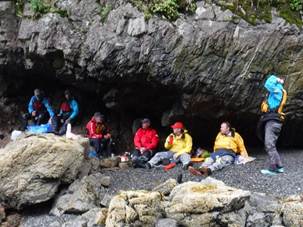 water about 50 minutes early, all eager to start
paddling. We headed south across to Surprise cove for
elevenses. Surprise Cove is a maintained campsite, very
picturesque with good facilities and very sheltered. From here we
crossed Cochrane Bay to Culross Island. We
had lunch on a small pebbly beach in the rain but managed to find shelter under
a small cave with an overhanging rock. From here we had great
views north all the way up Port Wells Passage to the massive glaciers at its
head (Harvard and Yale to the right and Barry’s and Cox glaciers to the left).
water about 50 minutes early, all eager to start
paddling. We headed south across to Surprise cove for
elevenses. Surprise Cove is a maintained campsite, very
picturesque with good facilities and very sheltered. From here we
crossed Cochrane Bay to Culross Island. We
had lunch on a small pebbly beach in the rain but managed to find shelter under
a small cave with an overhanging rock. From here we had great
views north all the way up Port Wells Passage to the massive glaciers at its
head (Harvard and Yale to the right and Barry’s and Cox glaciers to the left).
We paddled
across the entrance to Culross Passage and around the
northern tip of Culross Island where we spotted a
couple of fishing boats putting out their circular nets to scoop up the
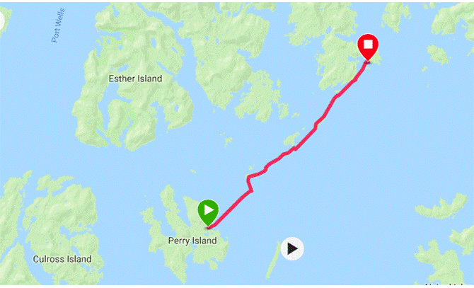
migrating salmon. We headed off across the sound towards Perry
Island where the map indicated that a good beach could be found for
camping. When we got there, we could only find a very small
area above the expected hightide mark. We cooked up a very late
afternoon tea and although it had been a very long day thought we had enough
day left to make it around the tip of Perry 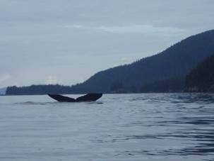 Island to a circular cove and idyllic campsite with plenty of
space.
Island to a circular cove and idyllic campsite with plenty of
space.
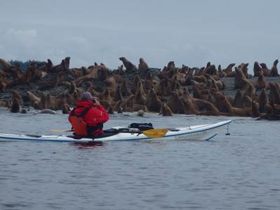
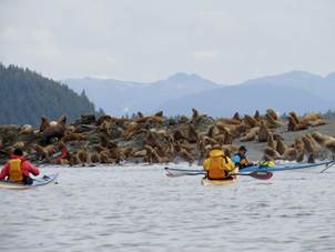
The rock slabs on the NE corner of Perry Island had 100s of Stella Sealions
basking in the afternoon sun during our last trip but we were a little
disappointed to find that the colony was not there this
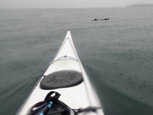
time. We did spot two or three sea lions in the water and they
followed us for a few miles from a distance. However, they
were soon forgotten when Mike noticed a water spout just off
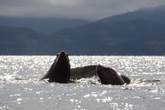
shore. Then another, and the chase was on. We 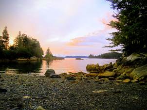 paddled to where we thought the Humpback Whales were going to surface
again. Some of us got close enough to see the whales
surface and even saw a few tail flukes as they dived to feed in the deep water
along the cliffs. This delayed our progress along the shore
line somewhat, but we never got closer than 75 metres. However, it was
certainly the highlight of the day.
paddled to where we thought the Humpback Whales were going to surface
again. Some of us got close enough to see the whales
surface and even saw a few tail flukes as they dived to feed in the deep water
along the cliffs. This delayed our progress along the shore
line somewhat, but we never got closer than 75 metres. However, it was
certainly the highlight of the day.
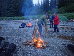
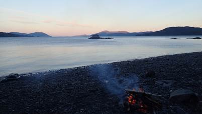
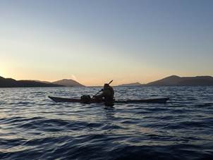
As the sun
began to set we headed around the corner into our cove. Boats
were carried up the beach, tarp and tents deftly erected and our petrol stoves
roaring away with hot brews and evening meals.
Mark Pawley More
Photos………. Audio
Report……..
 18th August (Saturday) – Perry
Island to Olsen Island
18th August (Saturday) – Perry
Island to Olsen Island
Despite the long
length of the first full day, the team was up and ready to go by the normal 9am
start.
After
ensuring that each team had restocked with water, it was time for team brief.
Under grey skies the plan was outlined, a 7km crossing to the Dutch Group of Islands
for lunch and then via some abandoned oil tanks to Axel Lind island (13km)
where we would scout for a campsite. But we might head on a little further if
appropriate. Everyone was ok with the plan, but there were a few requests for a
repeat viewing of the whale - let's see what we could do.
Heading off
as a tight group it was great to hear that everyone chatting that they had
recovered from the day before. Just as we were settling into paddling rhythm
there was an excited cry of "Whale!". We eagerly looked in the
direction pointed, and lo and behold there was the distinctive spout, and
noise, of a whale. Alas it was too far away in the wrong direction to make
paddling over worthwhile, but at least it was a request met and another tick in
the wildlife box.
|
Steller Sea Lion
Type: Mammal Diet: Carnivore Average life span in the wild: 18 (males); 30 (females) Size: 7.75 to 9.25 ft (2.4 to 2.8 m) Weight: 1.2 tons (1.1 metric tons) Group name: Raft (in water); colony (on land) Relative:Size relative to a 6-ft (2-m) man
Steller Sea Lion Range
|
Steller Sea Lion Eumetopias jubatus
Females begin to reproduce at about five years of age and typically have one pup per year. Sea lion mothers care for their young and recognize them by a keen sense of smell. Females slip into the sea to hunt and return to their young with the day's catch—identifying their own offspring by touch and scent. These animals are social and also gather at various times throughout the year when mating and breeding are not taking place. Even in crowds, the big bulls are unmistakable—they are three times larger than females. Most Steller sea lion populations declined markedly in the 1980s and 1990s, even though the animals are protected. Scientists are unsure what factor or combination of factors is responsible for the decline. |
 Steller sea lion breeding is one of
nature's great mass spectacles. When these giants thunder ashore, their
favoured beaches, called rookeries, disappear under their numbers. Young pups
are sometimes crushed by the throng, unheeded by powerful males with only a
single purpose in mind. Bulls (males) must establish and hold a beach
territory
Steller sea lion breeding is one of
nature's great mass spectacles. When these giants thunder ashore, their
favoured beaches, called rookeries, disappear under their numbers. Young pups
are sometimes crushed by the throng, unheeded by powerful males with only a
single purpose in mind. Bulls (males) must establish and hold a beach
territory
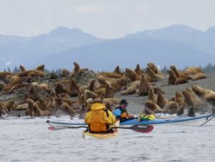 With
spirits high, and the weather conducive to paddling, we headed on towards the
Dutch Group. Despite the solitude of the location, at all
times we could hear these barks and howls travelling across the sea. The
only answer could be sea lions, and it appeared as if the noise was coming
from a group of skerries just off our planned route. In my opinion a sea lion
colony outweighs historic ruins of oil tanks, so we decided to have 11's on the
Dutch Group and then head to the skerries instead.
With
spirits high, and the weather conducive to paddling, we headed on towards the
Dutch Group. Despite the solitude of the location, at all
times we could hear these barks and howls travelling across the sea. The
only answer could be sea lions, and it appeared as if the noise was coming
from a group of skerries just off our planned route. In my opinion a sea lion
colony outweighs historic ruins of oil tanks, so we decided to have 11's on the
Dutch Group and then head to the skerries instead.
With the prospect of a wildlife
encounter the group sped up as we headed towards the ever-increasing noise of
the colony. A distinctive smell was also ever increasing - Sea lions stink!
Regrouping just before the colony, it was obvious that we were massively
outnumbered. Cameras at the ready, we quietly paddled in - some more bravely
than others. As we neared, but still some distance out, the sea lions decided
that they wanted to us to stay away, and the slumbering group became a seething
mass of muscle, teeth and barks as they raced into the sea. Recognising that
this was their environment we paddled back out - some with rather more vigour
than others! Did I mention their big teeth?
Giving the skerries a wide birth so as to give the sea lions some space, you could see the
alpha bulls like the generals of old, commanding the troops from their high
spots. Given their physical size, and size of their teeth, I was glad that the
bulls were still simply observing and ordering from on high.
With the weather closing in we had a
quick lunch on Axel Lind island. The plan had been to possibly stay here for
the night, however the weather report suggested a storm was coming in, and it
was decided to paddle on into the less exposed Olsen Island in Unakwik Inlet.
The miles passed easily as we crossed
over to Olsen Island, marvelling at the varied fauna and epiphytic mosses that
were draped over the tree branches. All too soon we arrived at Olsen Island
where it was time to play the daily game - How high is tonight’s tide???But
nothing to worry about, this was a great spot that provided a brilliant spot to
stay.
Another fabulous day on the sea. With
good friends and good times.
|
|
|
|
Mike Alter More
Photos………. Audio
Report……..
19th August
(Sunday) – Olsen Island Storm Bound
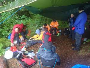
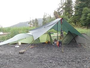
With a storm due in, we were given a day
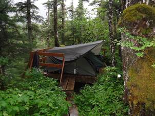
off! So, some of us had a bit of a lie in and a slow start to the day. Tarp
(x3) city was erected in the trees in anticipation of the rain!!
Over late breakfast in the city, the
group discussed the merits of equipment that had been brought on the trip and
the interesting food choices of the group. Main topics included the variety of
electronic devices that people had with them, camp chairs, jars/tins and fresh
veg! There was even a dual language gold leaf hardback book!
Whilst most were passing the time of
day with food sorting, reading, or snoozing, the rain began to fall about lunch
time. Nikki became the Chief Acquisition Technician for Collection of H2O
(C.A.T.C.H.) This job entailed sourcing the rain water that
was falling by using the tarps and strategically placed pans!!
Shortly before the rain had started
half of the group (Keith S, Keith P, Roger, Ian, Mark & Andy) decided to
stretch their legs and headed off for a ‘short’ walk. This walk turned into a
circumnavigation of the island (more details in separate
report!!). 5 hours later the intrepid team returned with tales of
coasteering, cliffs of no return, crossing of ravines using vine tight ropes,
battling through the jungle and triffids!
Each time the epic journey was recounted it became more and more extreme, oh and also a lot longer! And by bedtime the journey time was
12 hours! The only casualty in this extreme epic (other than a lot of wet
clothing!!) was the sad loss of the “bear bell” which will be missed by all
(especially Keith P).
And finally, the statistic that this
was the start of the rain that failed to stop for the next 56 hours!!!
|
|
|
|
Ruth Edwards More
Photos………. Audio
Report…….. Walk
Around the island Audio Report…….
20th August
(Monday) – Olsen Island to Island Halfway up Unakwik
Inlet
 After a very wet day of not doing much (well
for those who opted out of the excursion), everybody was camp crazy, so we
decided to move on. The day started really as it meant to go on -
grey, overcast and wet. The tents were wet, the kit was wet, it was
wet - many of us considering what we'll be changing for the next
trip. Nevertheless, we were on the water for the now routine time of
9am. So, all afloat, we made for our one and only crossing for the
day.
After a very wet day of not doing much (well
for those who opted out of the excursion), everybody was camp crazy, so we
decided to move on. The day started really as it meant to go on -
grey, overcast and wet. The tents were wet, the kit was wet, it was
wet - many of us considering what we'll be changing for the next
trip. Nevertheless, we were on the water for the now routine time of
9am. So, all afloat, we made for our one and only crossing for the
day.
Getting to the end of the island took
significantly less time than the excursion the day before - just
saying. There was thick fog and visibility was low, so compass
bearing decided, we grouped up in a fat diamond and started the crossing,
keeping an eye out for any boats taking an inshore route and avoiding the worst
of the fog out in the sound. Land came into view, and all was good.
As we continued up the shoreline, the
landscape always takes on a spooky theme with such conditions, with low lying
cloud, fog and the mountains being dark silhouettes that take on a sinister
hue.
Weaving around some islands and small
inlets, the map clearly indicated that there was a way to pass through, so off
we headed between the islands towards our passage way. Low and
behold, the map lied (well, maybe a white lie), and we were presented with some
shallows. Now to a Sea Kayaker, this was an epic
problem. The decision to get out of one’s boat for a
"portage" is just not something one should consider, fortunately to
those canoeists in the group, this wasn't so much a portage as a wade, and that's
over dramatising it. So out we got and
quickly floated the boats over the shallows and hopped back
in. Unfortunately, this was still too much for Andy and Chris, so
they took the 1km detour and paddled around, joining us a "few
minutes" later.
And then came wildlife
central. Noticing a cabin, we decided to paddle over and
investigate. Approaching, somebody noticed a bear (I believe this
was bear number 2) and then all bets were off, and the group went bear chasing,
completely missing the fact that every sea predator in the sound was staring at
us for invading their space. Sea otters, seals, sea lions, bears,
birds, the lot. They most definitely weren't happy that we might be
there to steal their salmon, although most likely they were just annoyed that
we'd upset the damn sea lions - who started to grow in number and make it very
clear we weren't welcome. So a good laugh
:-).
Through the mudflats and then we continued onwards to come across our camp site
for the night, which we named Misery Cove. A small island just about
high enough to camp above the tide (albeit it was close) with a convenient area
to eat, and a grass area should we have to retreat to higher ground.
|
|
|
|
Martin Aldridge More
Photos………. Audio
Report……..
 21st August (Tuesday) – Island
Halfway up Unakwik Inlet to Meares Bay and return “Return
to Misery Cove”
21st August (Tuesday) – Island
Halfway up Unakwik Inlet to Meares Bay and return “Return
to Misery Cove”
We woke up to find it was still
raining. We took down our tents and loaded up our kayaks in the rain and then
set off for Mears Glacier.
It was a cold and wet paddle with
plenty of waterfalls to be seen, including one particularly big one which a few
people wanted to play in. Personally, I was so cold and wet, I was sure that
any swim would be certain death!
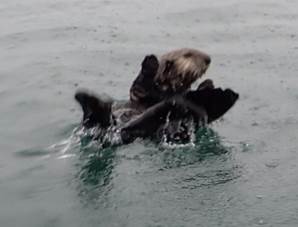
We were not disappointed by the sea
otters, who were still floating around all over the place, despite the
rain 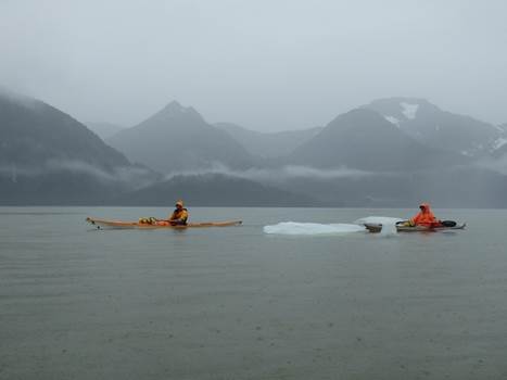 and the cold.
As we got closer to the glacier, grey seals were also becoming more common (at
least they have blubber to deal with the cold!).
and the cold.
As we got closer to the glacier, grey seals were also becoming more common (at
least they have blubber to deal with the cold!).
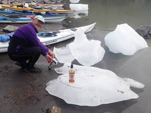
We also encountered our first
icebergs... or were they bergy bits?
When we stopped for elevenses, we were
all cold, wet through and, to be honest, miserable. Keith recommended that it
may not be a good idea for us to continue to the glacier today because it was
only going to get colder as we got closer to the glacier. We all agreed to
turn back and return to our previous night's camp.
As we came around the island back to
our beach, we were greeted by a deer on the beach.
As we reinforced our man-made camp
platforms against the anticipated higher tide and re-pitched our wet tents in
the rain, we decided to name this cove 'Misery Cove'.
Finally, around 4pm that afternoon,
and after 50 hours of non-stop rain, the rain stopped, and the clouds cleared
just enough for us to glimpse the surrounding snow-capped mountain tops. We
went to bed that night hoping it would stay dry into the next day.
|
|
|
|
Nikki Aldridge More
Photos………. Audio
Report……..
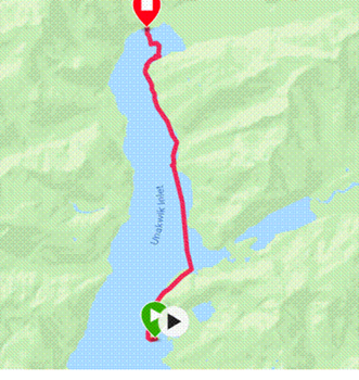 22nd August (Wednesday) – Island
Halfway up Unakwik Inlet to Meares Glacier
22nd August (Wednesday) – Island
Halfway up Unakwik Inlet to Meares Glacier
Waking up in a wet tent after a night
of more heavy rain and waves that came close to our camp spots it was relief to
realise it had actually stopped raining. The plan was
to be on the water by 9 as usual. The thought of a brighter day and sunshine
later made packing away wet gear slightly more bearable.
Being leader for the day was made
easier by the fact that we were repeating the previous days paddle from unnamed
island partway up Unakwik Inlet to an unnamed spot
for elevenses before heading onto Meares Glacier.
Setting off with less cloud meant that
this time views of glaciers on mountain tops appeared briefly between the
clouds. Views of mountain tops were rare indeed on this trip. As we paddled
towards ‘elevenses beach’ Chris commented it’s like Coniston on steroids, as
the water was glassy and still and lake like in appearance for a while.
After an elevenses stop that was
noticeably warmer than the previous day; though the change in air temperature
was still noticeable we set off ‘around the corner’ to Meares Glacier.
|
Some Glacier Facts (source https://alaska.guide/Glacier/Meares-Glacier) Location: 61 ° 14' 23" N, 147 ° 25' 3" W Region: Valdez-Cordova (CA) Nearest City: Valdez Length: 15 mi (24.14 km) Elevation: 4528 ft (1380.13 m) Tributary to: Unakwik Inlet |
|
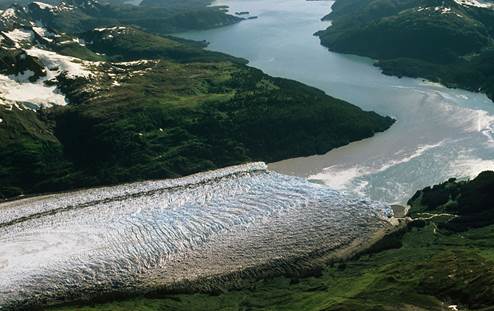
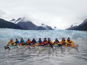
Meares
Glacier is the only advancing glacier in Prince William Sound. Located in the
Chugach Mountains between Aspero Peak and Mount
Michelson. It was named in 1909 by U.S Grant and D.F Higgins, US Geological
survey for Captain John Meares 1756 -1809, British Naval officer, explorer and
trader.
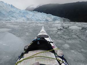
 As we paddled around the corner, the amount of ice in the water
increased, ‘icebergs’ but not really. Here is a definition of
icebergs https://oceanservice.noaa.gov/facts/iceberg.html what
we were seeing were mostly bergy bits and growlers
As we paddled around the corner, the amount of ice in the water
increased, ‘icebergs’ but not really. Here is a definition of
icebergs https://oceanservice.noaa.gov/facts/iceberg.html what
we were seeing were mostly bergy bits and growlers
Following
Keith’s clear instructions not to paddle too close to the glacier due to the risks
associated with calving, which increases at high water, there appeared to be a
crazy race straight to the glacier. The size simply misleads the eye, and what
looks to be close is still a safe distance away. The seals however hadn’t heard
Keith’s warnings as they reclined on the ice flow at the base of the glacier.
The signs of the advance of the glacier could be seen where trees had been
pushed over along the shoreline. The thunderous booms as ice fell away from the
face of the glacier were a reminder of the power of nature.
 After taking many photos, including the ‘must have’ of paddlers in front
of the glacier shot, we made our way to the opposite side of the inlet and our
campsite, right by the Glacier but protected by a rock outcrop from wave surges
caused by larger chunks of ice falling off the glacier. Not long after landing
the shout “watch the boats” was heard after a louder boom gave warning of a
wave heading our way.
After taking many photos, including the ‘must have’ of paddlers in front
of the glacier shot, we made our way to the opposite side of the inlet and our
campsite, right by the Glacier but protected by a rock outcrop from wave surges
caused by larger chunks of ice falling off the glacier. Not long after landing
the shout “watch the boats” was heard after a louder boom gave warning of a
wave heading our way.
After
unpacking in the sunshine (yes sunshine – a miracle it seemed) the beach was
soon covered in kit drying and the tents up on higher ground were drying off
nicely; the tarp went unused for a change. Apparently swimming with ‘icebergs’
is a must do thing – so Nikki and Mark got changed and divided right in. Mark
even got on some ice to do what was described as a ‘mermaid’ pose. I didn’t
know mermaids reclined on ice – I thought it was seals. The water was reported
to be refreshing and not as cold as expected -I took their word for it!
As the
paddling part of the day had finished mid-afternoon there was time for some
exploring and after a short scramble up from the beach a spot was found for
glacier watching. Literally sitting watching and waiting for ice to fall of the
glacier face.
Warm and
relaxed it was time for the evening meal and this meant dahl and rice for
Chris, Mark, Roger and me. After a rubbish fire (started
controversially by Keith, and not Ian ‘one match’ Bell), we drifted off to our
tents for a dry night’s sleep listening to the thunderous booms from the glacier
and the sound of waves hitting the beach. A wonderful dry day.
|
|
|
|
Frankie
Annan More
Photos………. Audio
Report……..
23rd August
(Thursday) – Meares Glacier to Olsen Cove
 We had a long paddle ahead of us, so
when I heard Keith 1 telling Keith 2 (through my slumber at 6.30am) “get the
tent down, it's going to rain soon”, I was up and out like a shot.
We had a long paddle ahead of us, so
when I heard Keith 1 telling Keith 2 (through my slumber at 6.30am) “get the
tent down, it's going to rain soon”, I was up and out like a shot.
It was
exactly what we all didn't want to hear after the sunny reprieve of the
previous day, but we knew it was coming and the last thing we wanted was to
miss the honour of packing away dry tents for the first time that week. Pulling
on my totally dry paddling gear was a joy and the tent was down double quick.
We all got busy packing the boats and having breakfast in a massive effort to
be on the water before the rain started!
Keith 1 was
first on the water (not unusual) and disappeared around the corner in the
direction of Meares Glacier and we were 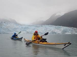 not far behind him, all wanting to grab a few more photos and say goodbye
to that awesome spectacle. I found it mesmerising and could have stayed there
for ages, but of course the rain had started, and people wanted to start
paddling because they were getting cold.
not far behind him, all wanting to grab a few more photos and say goodbye
to that awesome spectacle. I found it mesmerising and could have stayed there
for ages, but of course the rain had started, and people wanted to start
paddling because they were getting cold.
It was my
day to lead so I started getting everyone together to tell them what they
already knew – “we're going THAT way”! Shamefully, I didn't have a map as I
wasn't aware we'd each have to lead one day, so I borrowed one from a friend
and tried to get my head around the whole 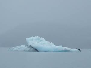 navigation idea that I had previously been ignoring, knowing I was in
very capable hands.
navigation idea that I had previously been ignoring, knowing I was in
very capable hands.
Thankfully
we were just following the coast of Unakwik Inlet to
Olsen Cove, where we hoped to find a 5-star camp site for the night. The
weather was grey, murky and obscuring the view. All the wildlife had decided to
take the day off so there was little to distract from the greyness, wetness and
dullness.
Long, wet
paddling days like this are physically hard going and some people had very
uncomfortable boats, leaky boats, leaky spray decks and leaky clothing. Of
course, the other very real challenge on such a long trip is psychological. You
spend all day, every day with the same people, take breaks under a tarp
together, cook under a tarp together and camp in crowded areas trying to stay
above the high-tide level. In normal life we have much more space, privacy and
comfort. The biggest challenge can be to stay happy and optimistic when
conditions are less than ideal.
That said,
there were a few gripes throughout the day about fairly
unimportant things and I tried not to take any of it too seriously. I
felt that everyone was a bit glum after the high of the glacier and the
beautiful weather the previous day. Apart from that, the day was very
uneventful and what Stevie Wonder would call a necessary day. Thankfully the
rain eased-off in the afternoon and actually stopped
to let us pitch our tents and cook on the beach.
|
|
|
|
Chris Preston More
Photos………. Audio
Report……..
24th
August (Friday) – Olsen Cove to Oyster farm via Cascade Falls (Eaglet Bay)

After our long, wet
paddle from Meares glacier out of Unakwik
inlet it was great to wake up to a nice dry morning. By
now the decamp operation had become pretty slick and
in no time at all breakfast had been consumed, our first bear of the day had
made an appearance, kayaks were packed, and we were on the water before 9am.
Chris took
the first leg out of Olsen bay and as we exited the cove a golden eagle flew
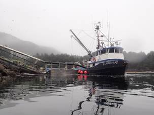
overhead toward Olsen island. We passed a fishing vessel
transferring their catch as we headed towards the headland on a southerly
course. Nicky took the lead as we turned south east towards Kiniklik accompanied (or I should say chased) by a number of sea lions.
 We had a brief stop at the small Kiniklik inlet
marked with a church symbol on the map as Keith thought there might be some
historic ruins on the site. A little investigation at home revealed
that there was indeed a native Alaskan settlement there some time
ago. Kiniklik is an Eskimo name and was
one of the 2 oldest native villages in Prince William Sound. The
native Alaskans (Chenega) were particularly hard hit
by influenza and tuberculosis brought by white settlers and the villages were
all but abandoned by 1925, most relocating to Cordova, although a small family
fish plant was operated for several years afterward by the Chief and his
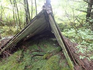
family. Unfortunately, we found no sign of the village, only a small US
geological survey marker and an old bivouac, probably used by
hunters. We only searched for a short while, but it appears the
forest had reclaimed the land and we could have been only meters away from it and
not known it due to the density of the foliage.
We had a brief stop at the small Kiniklik inlet
marked with a church symbol on the map as Keith thought there might be some
historic ruins on the site. A little investigation at home revealed
that there was indeed a native Alaskan settlement there some time
ago. Kiniklik is an Eskimo name and was
one of the 2 oldest native villages in Prince William Sound. The
native Alaskans (Chenega) were particularly hard hit
by influenza and tuberculosis brought by white settlers and the villages were
all but abandoned by 1925, most relocating to Cordova, although a small family
fish plant was operated for several years afterward by the Chief and his
family. Unfortunately, we found no sign of the village, only a small US
geological survey marker and an old bivouac, probably used by
hunters. We only searched for a short while, but it appears the
forest had reclaimed the land and we could have been only meters away from it and
not known it due to the density of the foliage.
We continued
our paddle towards Point Pellow, with our sealion escort and Andy safely
surrounded by fellow paddlers. As we turned the point we also saw
Harbour seals and sea otters. We then turned into Eaglek Bay on our way to Cascade Bay. We took a fairly direct line towards the northern headland of Schoppe Bay where we stopped for
elevenses. After a brew and a peanut butter wrap (there, I
said it, but don’t ask me to talk about these again!) we headed
directly toward Cascade Bay.
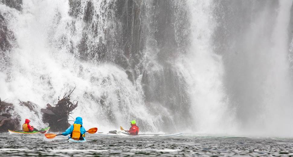
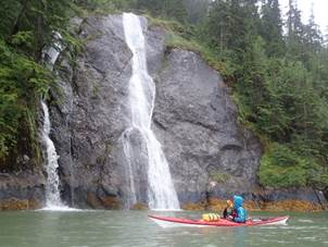
We had the
bay to ourselves as we had at most of the locations on our trip. As
we got closer we could hear the roar of the waterfall and as we turned the
final corner we were not disappointed. Cascade falls is truly
spectacular and is the largest waterfall in Prince William Sound. It
drops 171 feet and descends from a series of lakes that are fed by the Eaglek glacier. Keith, Ian, Ruth, Mike and Nicky
were positively salivating at the white water and all of them were keen to get
closer while the rest of the crew stayed clear in one of the eddies either
side, not wishing to invite a capsize. Ian Bell got the prize for
the closest approach from what I could see in the left-hand eddy and got a
thorough soaking.
As we
existed Cascade Bay in drizzle we stopped for lunch on the right-hand headland
where we saw a Belted kingfisher patrolling the coastal
forest. After lunch we headed for our final
destination across Eaglek Bay to very secluded
cove close to the Oyster mariculture area on the
peninsula marked by Ragged Point. It was in this sheltered cove that
our second black bear of the day made a brief appearance before disappearing
into the forest. Our camp area was just above the beach but probably
vulnerable on the highest of tides. Keith assured everyone that we
should be ok and then added that the others in the group might want to put a
watch on throughout the night; but as we were pitched on the highest point we’d
get plenty of warming. The sun set on a lovely evening as we
gathered round our pathetic attempt at a fire using the wood that was soaked
from the previous day’s rain. After a great day on the water, with
the food safely stashed in triple wrapped bags, dry bags and under a tarp maybe
20m away we turned in for the night safe from the bears and rising tide-we
hoped!! Total Distance covered 30.37km
|
|
|
|
Keith
Peek More
Photos………. Audio
Report……..
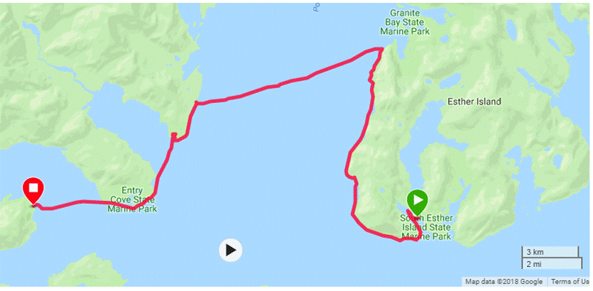
25th
August (Saturday) – Eaglet Bay to Esther Island
We had a
good start to the day with a relatively dry breakfast and pack up having, in
the end, been well above the tide line (despite the concerns of some on the
previous night). This is a campsite I would certainly use again.
|
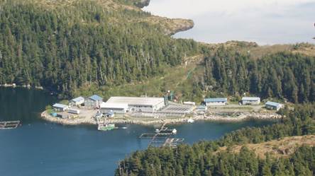
WALLY NOERENBERG HATCHERY The Wally Noerenberg Hatchery (WNH) is the second PWSAC-owned hatchery located in Lake Bay on the southern end of Esther Island in Prince William Sound, approximately 20 miles east of Whittier. The hatchery was built in 1985 with monies borrowed from the Alaska Fisheries Enhancement Revolving Loan Fund. WNH is currently permitted for 148 million pink, 165 million chum, 4 million coho, and 4 million Chinook salmon eggs annually. Sockeye salmon were also cultured at WNH in the past and was transferred to the Main Bay Hatchery in 1990.
Klint Hischke, WNH Hatchery Manager leads a permanent, year-round staff of eight along with a seasonal staff of 12 during the summer months. Klint has worked with PWSAC (Remote Programs, CCH and WNH) since 2013. He received his B.S. in Water Resource-Fisheries with a minor in Aquaculture from University of Wisconsin, Stevens Point. All the Hatchery Managers enjoy giving tours, showing off their hatcheries and the fish, so please stop by if you are in the area. All the hatcheries can be contacted on VHF 16. This marine park is located on the southern end of Esther Island, including Lake and Quillian Bays. Lake Bay houses one of the world's largest fish hatcheries. You can also carefully navigate to the head of the bay for an anchorage. A hike along the eastern edge of the lagoon and through a low, forested pass brings you to Esther Lake. The land is too wet and uneven for camping.
The
Wally H. Noerenberg Fish Hatchery is owned and
operated by the Prince William Sound Aquaculture Corporation (PWSAC). PWSAC is
a private, non-profit corporation operating under a special permit with
Alaska State Parks. Fresh water can be obtained from the floating dock near
the hatchery. Mooring buoys in front of the hatchery may be used if
available.
|
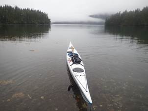
We left
Eaglet bay just before 9:00am with a flexible plan as to our final
destination for the day. The weather forecast for that day was fine, but
the following day was looking wet and windy. That was going to influence the
decision as to where and when we camped that night.
The first
part of the route was basically hand railing the coast to Ragged Point and on
to Squaw Bay, before a short crossing to East flank island and then over to
Esther Island. We would then hand-rail the coast to the inlet, which
is where the fishery and sea plane base are located. We intended to make the
decision as to whether we camped on East Flank or continue to a better location
to weather the expected storm.
Having left
the campsite bay, we had some good mountain views between the broken clouds at
times. We then passed the current site of the oyster farm.
This is just a load of mooring buoys with chains on which they grow the
oysters.
We were
accompanied by the odd sea lion but made good time and were on course to land
at East Flank dead on 11:00 for elevenses. Just as we were about to leave the right-hand
coast, a bear was spotted feeding at a stream outlet. This gave the good
photographers with big cameras an excellent opportunity for some good shots.
They got really close with some stealth paddling and were fortunate to be down
wind. This I think set the bear count to 7. After about a quarter hour the bear
moved on and so did we. We landed at the north of East Flank island for a break
and while we were resting we were entertained by a couple of feeding sea lions.
Yet another photo opportunity.
From here we
crossed to Esther Island and followed the coast. This section of the journey
was relatively uneventful, but we could hear the sea lion colony out on Egg
rock and saw some boat traffic in the main shipping lane. The tour
boats headed out to see the sea lion colony.
We
eventually made Esther Island for a late lunch and made our first contact with
humans from outside of our group during this trip. As we entered the inlet at
Esther Island we spotted a couple of other sea kayakers. Keith
engaged them in conversation about their trip while assessing the landing and
camping area, which was located in a side bay just
around the corner from the fishery.
They turned
out to be a couple of local paddlers setting out to cross over to Valdez and
were intending to take up to four weeks. They moved their boats up and we all
landed on the small beach area and climbed up the ladder to the lower platform
and had lunch while we talked with them. They then left, so we decided then
that this should be our base for the night and the next day as we would likely
be storm bound. The only real other option being at least another 3 hours of
paddling. Camping platforms where bagged and the camp set up.
Once sorted
Frankie took a wander up to the top of the campsite boardwalk and had a close
encounter with a bear, which did not seem to be bothered by our presence.
Others went exploring to the waterfall and took photos while it was not
raining.
Just as most of us where about to call it a night and where heading to our
tents, Mark and Rodger came back from a walk they had been on to the fishery
(Wally Noerenberg Hatchery – see opposite). They said
they had seen at least another 8 bears. With this exciting news a group of us
set of with them to see. We did this with caution, taking bear spray etc in
cases they were right about the large group of bears. After the walk
around the island the previous week we choose to stay on established paths and
not to detour. From the top of the camping area there was an established board
walk path to the fishery. Once there we too were able to spend time
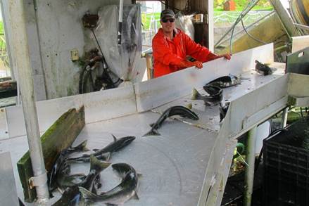
watching 6 to 8 black bears fishing along with sea lions that had jumped past
the fishery boom and were just feasting on the salmon trying to swim upstream
past the rapids to the lake. We watched salmon try (and in most cases fail) to
climb the waterfall and the bears crossing over from the wood to the river
totally ignoring our presence.
Eventually
we headed back to bed as dusk fell.
|
|
|
|
Ian Bell More
Photos………. Audio
Report……..
26th
August (Sunday) – Esther Island Storm Bound
Genesis of the Church of Hydrology
(AKA Storm bound on Esther Island)
I woke slowly, with the dawning
realisation that the water that should be on the outside of my tent was in fact
on the inside of my tent. While I had slept, trillions of water
molecules had passed unhindered through my groundsheet and were now making
themselves comfy in my sleeping bag. I assessed my situation and
deduced that my fetid body was encased in a festering pile of damp goose down
held together by sheets of soggy nylon. It was not the best of
feelings. It was at this instant that I was struck by a blinding realisation,
an epiphany – suddenly it all became clear. The only way that I was
ever to find peace in this world of wetness and ever prevalent damp was to
embrace it! The rain that had been our constant companion over the
last few days was not a foe but a friend. Moisture was good, and
wetness divine. All praise to H2O! Halleluiah! The
Church of Hydrology had been born.
I rushed out of my deliciously damp
tent to convert the others. The first person I met was Frankie. She
had just returned from a walk in the rain, and she had chanced upon a wet black
bear on the muddy path. She showed me a photo of the wet bear, in
the rain, and I then welcomed her to the faith and christened her ‘Frankie
Mistress of Moisture’. All the others were down  by the shore,
where they were wickedly trying to keep the nourishing drizzle from touching
their bodies by standing beneath a tarp. I quickly ordained them:
by the shore,
where they were wickedly trying to keep the nourishing drizzle from touching
their bodies by standing beneath a tarp. I quickly ordained them:
o Keith S - ‘Deacon
Damp’
o Keith P - ‘Vicar of
Drizzly’
o Martin ‘Priest
Precipitation’
o Ruth ‘Pope Puddle’
o Mark ‘Archdeacon
Drips’
o Ian ‘Father Fetid’
o Chris ‘Curate Cats
& Dogs’
o Mike ‘Rector Rain’
o Nicky ‘Chaplain
Clammy’
o Roger ‘Squire
Soggy’.
It was shortly afterwards that a
drenched bear walked through our wet camp and climbed a dripping wet
tree. Some of our party approached the bear, in the rain, to take
photos. However, a wet bear so close to our moisture laden camp was
not a good idea, so we frightened it away by banging some billies together (while
it rained). We deduced that the wet bear had been attracted by the
smell of food being prepared and coffee being brewed, so we decided to cook on
the beach, below the high-water mark, so that the food aroma and any morsels of
dropped pasta would be washed away by the wet water as the tide
advanced. It occurred to me that the wet bear in the camp was a
divine intervention, as it forced everyone out of the Devil’s Shelter (tarp)
out into the God-given showers and delightful drizzle.
That night the wind dropped, but it
kept raining – glory, glory be!
Reverend Wet (AKA Andy Garland)
|
|
|
|
Andy Garland More
Photos………. Audio
Report……..
27th
August (Monday) – Esther Island to Decision Point
The day started off with an overcast sky
in a shade of grey that I hadn't seen before, I felt it was an optimistic grey,
heralding light winds from somewhere.
Everybody got onto the water at their
own pace and paddled down to see the fish hatchery complex from the seaward
side. There was a boom around a small bay to try and stop the Stella Sea Lions
getting to the salmon When looking down
over this watery enclosure the night before we could see that a few Stella sea
lions had somehow managed to get over the barrage and judging from the white turbulence
in the otherwise calm waters that morning, they were enjoying their continued
salmon frenzy. The black bears were also still on the shore, picking off
the salmon trying to get upstream with ease (note to myself, never be
reincarnated as a salmon!!).
I was appointed leader for that day’s
paddle, the plan was to paddle from our location on the southern tip of Esther
Island to the campsite at Ziegler Cove Marine Park on the mainland. We would
head up the western coast of Esther island before making the 8km crossing. I
nominated a fellow paddler to lead us out of the cove to some shouts of
surprise from other members; this paddler had previously expressed alarm with
paddling around the Stella sea lions, whom you could describe as the brainless
thugs of the sea lion world, there were a number in the bay, waiting for us. In
fairness to both the secondary leader and the Stella's, each got on with their
job without hindering the other.
 Hugging
the coast, we made our way northwards without incident. The skies cleared at times, giving us good
views of the rarely seen mountains on this trip. A good lookout was kept for
any whale spouts or activity, but sadly today there was none. We stopped for
elevenses near the makeshift camping area then leisurely continued northwards.
There was no evidence to be seen of the cabin marked on the map. However, we
didn't land to search inland. Shortly before our dinner stop near granite bay
there was a signal from Mark, he had spotted some fresh water otters on
the shore. They hung around long enough for all of us to catch a glimpse of
them, a father mother and two cubs, much smaller than the sea otters, but just
as timid and shy.
Hugging
the coast, we made our way northwards without incident. The skies cleared at times, giving us good
views of the rarely seen mountains on this trip. A good lookout was kept for
any whale spouts or activity, but sadly today there was none. We stopped for
elevenses near the makeshift camping area then leisurely continued northwards.
There was no evidence to be seen of the cabin marked on the map. However, we
didn't land to search inland. Shortly before our dinner stop near granite bay
there was a signal from Mark, he had spotted some fresh water otters on
the shore. They hung around long enough for all of us to catch a glimpse of
them, a father mother and two cubs, much smaller than the sea otters, but just
as timid and shy.
Following dinner stop we set course
approximately SSW to hit the mainland around the area of pirate cove. Unfortunately, the visibility had reduced by
now, we couldn't see where we were heading, relying on sound compass work which
was delivered by mike alto and a hand-held Silva compass. Half way across, there
was a shout that a large dorsal fin had been spotted heading towards us, this
was quickly identified as a male killer whale, with eager shouts of excitement
from most of the group, and an even louder gasp of "oh gawd" from the
secondary leader earlier in the day.
Whilst they had come to terms with a nibble from a Stella sea lion,
there was still some work to do on the outcome of na
Orca`s nibble. During the crossing there were no other sightings of any other
whales, and no tell-tale bubbles forming on the otherwise calm waters, a sign
of something passing deep beneath observed on earlier crossings where there was
whale activity.
After about 1 1/2
hours we made landfall, near a distinguished tower of rock in the sea, and after
a short breather we made our way to the Ziegler cove state marine park camping
area, hoping to find a bear box to put our food in and other signs of
habitation. Alas, they were elusive despite our landing and making a quick
search.
Keith took the opportunity to check
the weather forecast; it indicated high winds the following day which would
prevent us from going on the water. He felt concerned that if the weather front
didn't move through as planned, we may be left with a difficult final day`s
paddle up Passage Canal, which already had a reputation of high winds blowing
against you as default. Following a short discussion, it was agreed we should
continue onto the decision point campsite that we had used on our first night
of expedition, despite it prolonging our paddling day into a 40km journey.
There was the promise of a day off on the following day, a comfortable campsite
and... a toilet, there were no complaints.
Ian took the lead, safely delivering
us to the campsite where there was thankfully only one established tent. After
emptying boats, pitching tents etc. we had food and packed the food cache under
a groundsheet to detract bears. Keith reportedly slept next to the cache, to
see the Aurora Borealis, we all knew he wanted the final picture of Mr black
bear.
|
|
|
|
Roger
Morgan More
Photos………. Audio
Report……..
28th
August (Tuesday) – Decision Point Storm Bound
The weather forecast has promised wind, and in the middle of night it definitely arrived. Getting up to check that the kit left
hanging hopefully to dry hadn’t blown away I realised it wasn’t raining! And
the kit was dry. Waking closer to morning and crawling out of the tent for a
stroll down the beach, not only was it not raining but the sky was blue with
hardly a cloud in sight. It was still pretty windy
though. So now we knew that partly sunny = cloudy and horrible all day
(Monday’s forecast) and partly cloudy meant sunny all-day Tuesdays forecast!
The realisation that the sun was
shining filtered through the campsite and suddenly everyone was scrambling to
hang out all the wet kit to dry. Martin was over excited by the prospect of
going home with a bag of dry stuff which is much
pleasanter (and lighter) than a bag of wet manky clothes. Never have
I seen so many items of underclothing spread out on a beach! The ‘Keith`s’ had
beaten us to it and were on the beach enjoying breakfast in the sunshine. An
impressive bit of delegation followed as Keith S remained in place, and his
cap, sleeping bag and other items arrived at his side along with cups of
coffee.
 Elsewhere
on the beach swimmers were to be seen, this time Ian and Mike followed Nikki
into the water – apparently further away from the ice the water is colder?!?
Elsewhere
on the beach swimmers were to be seen, this time Ian and Mike followed Nikki
into the water – apparently further away from the ice the water is colder?!?
The forecast confirmed what we knew,
the wind was too strong to go anywhere, certainly some of the gusts felt like
they’d carry you away, but they also guaranteed dry kit. A sunny stormbound day
felt like a rare treat – well let’s face it sunshine was a rare treat this
trip. Much lazing and some socialising with the local occupant of the campsite
followed, hard to believe only a short paddle to Whittier remained of the trip.
 Throughout
the trip entertainment highlights have been provided by the wildlife and
Mr Grumpy. In fact, at some points the antics of sea otters and the rants of Mr
Grumpy were the only things that kept the spirts up. Number 57 on the list of
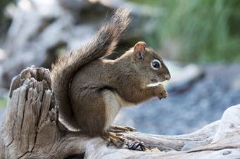
life’s most annoying things is porridge apparently. Breakfast became elevenses
and then lunch and the campsite wildlife, a ground squirrel, came out to
discover if we had any food.
Throughout
the trip entertainment highlights have been provided by the wildlife and
Mr Grumpy. In fact, at some points the antics of sea otters and the rants of Mr
Grumpy were the only things that kept the spirts up. Number 57 on the list of
life’s most annoying things is porridge apparently. Breakfast became elevenses
and then lunch and the campsite wildlife, a ground squirrel, came out to
discover if we had any food.
As the sun moved we swapped beaches –
decision point happily had 2 beaches facing opposite directions. Keith decided it
was time to record the events of the trip. Much muttering and moaning followed,
but recordings were made - can’t
remember what I said, and you can bet its completely different to this write
up!
Conversation invariably turned to how
much food was left-over, and some food swapping occurred to gift Keith S with a
packet of cheesy broccoli.
As evening approached another couple
of paddlers arrived. Mark and Roger went to welcome them and after a last
evening meal and rubbish fire folks drifted to the tents to prepare for 7am on
the water for the final push to Whittier. Looking at the clear sky Keith S
decided to sleep out in his bivvy bag – just in case
the night sky decided to put on a show ………
|
|
|
|
Frankie
Annan More
Photos………. Audio
Report……..
 29th August (Wednesday) – Decision
Point to Whittier
29th August (Wednesday) – Decision
Point to Whittier
We were up early this morning as the
wind overnight was dying off, allowing us to paddle back up Passage Canal to
our finish at Whittier. Stoves were purring on the beach next to our
kayaks which had been moved down ready for packing. Tents and kit
were deftly ferried down to the low tide mark and everyone ate breakfast,
packed their boats and got ready for paddling at the nominated time of
7:00am. Sweet!
We left our friends at Decision Point (3 local paddlers who had arrived the
night before) and paddled off around the corner in a tight
group. The sun was just rising in the east and gave a red tinge to
everything.
We paddled round the light at Decision
Point in close formation, eager to get to town and that long promised “fish and
chips”.
We crossed Squirrel Bay and on across Shotgun Bay (so called because of violent
blasts of winds that blow over the gap and down into the bay from the
west). After a short rest and the earliest of elevenses
we struck out against the wind towards Whittier, all around us in the clear air
we were surrounded by 13 different glaciers. This reminded us
of what Alaska and Prince William Sound is normally like.
As we approach the dock in Whittier
and civilisation and the first houses we spotted a black bear on the
shore. We watched for a little while along with a group of tourists
while he foraged for food along the shore line. We hugged the shore
keeping out of the very strong winds that normally blow down over Portage
Glacier and into the beach where we started 14 days earlier.
We quickly emptied the kayaks and put
all of Levi`s gear into piles ready for collection. He arrived right
on schedule at 11:00am. Once all loaded we headed for the “Swiftwater
Seafood Café” for a well-earned lunch. Our food and
drinks arrived very swiftly, and we made a call to head for the 1pm
tunnel. Well the toffee shop was still closed. We made it
with a few minutes to spare. Levi dropped us at our Airport
Motel. Later that afternoon most headed for REI (USA outdoor
gear store) and to explore Anchorage. Mark booked us in
to Gwennie’s Old Alaska Restaurant,
for the evening meal. Great finish to a very good, if a little
damp trip.
|
|
|
|
Keith
S More
Photos………. Audio
Report……..
Advice
for future trips:
1/ Food available from Fred Mayers from 6:30am / Seyers Mall
24hrs or Sainsbury`s on route.
2/ Getting to Whittier is relatively
easy (train, hire car or shuttle bus). We used Levi Hogan this
time. ($500 for the whole group plus Gas, tolls and tips)
3/ UK style sea kayaks available for
hire from Levi Hogan (http://www.turnagainkayak.com/)
(including delivery, top of the range paddles, BA, Flares and Pepper Spray etc)
4/ Need bug head nets in worst areas.
(Although late August is the best time to go rather than July.)
5/ Large lightweight tarp is very
useful to cook under and for shelter from the rain.
6/ All stoves should be of the same
fuel in case one has a mechanical problem. Such a long expedition means that
you take only enough fuel for yourselves.
7/ Tents should be capable of pitching
on rounded pebbles on the beach immediately above the tide line. Do not expect
to use pegs in the conventional way but they can be buried sideways with the
guy clove-hitched onto the middle. (similar to a
dead-man or snow stake). They should be 3+ season tents and be pretty waterproof. In very heavy rain a spare
tarp can be hung over them to shield them from torrential rain.
8/ Paul Twardock`s
book “Kayaking and Camping in Prince William Sound” A Kayaker's
Paradise is an excellent reference. National Geographic publish a
topographical, waterproof map of the west of the sound (Sheet 761)
9/ Keep bear safe! All food needs to
be sealed x 3 (2 zip-locked bags + 1 dry bag) and stored overnight away from
the sleeping area (50m). Processed foods are far easier to keep bear safe (soup
and pasta etc) and are easier to prepare. Tooth paste, and wash kits
kept with foods – not in tents. Hand flares are probably better than pepper
spray as defence against marauding bears. It is impossible to hang all your
food for a two-week expedition, so a bear cache is used covered with a tarp and
pots etc hung on the outside to try and alert you if it is raided.
10/ Neoprene boots with over trousers
are ideal for keeping your feet dry and launching boats on the gravel beaches.
(Wellington Boots would do a similar job but may not be as comfortable)
11/ $12
toll on tunnel to Whittier / Lazy Otter for charter boat drop-off or to pay for
parking by the small beach under passenger ferry ramp. Launch fees
for the beach is $3 per person. The tunnel into Whittier is at
half-past the hour and out of Whittier on the hour. (Except when a
train is going through it)
![]()
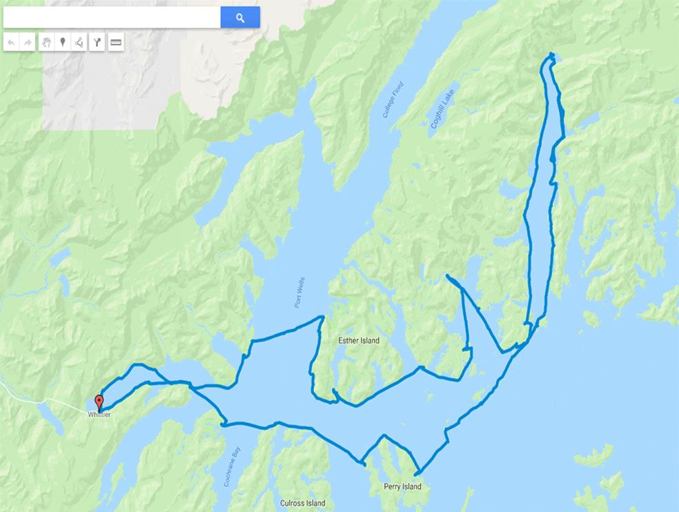
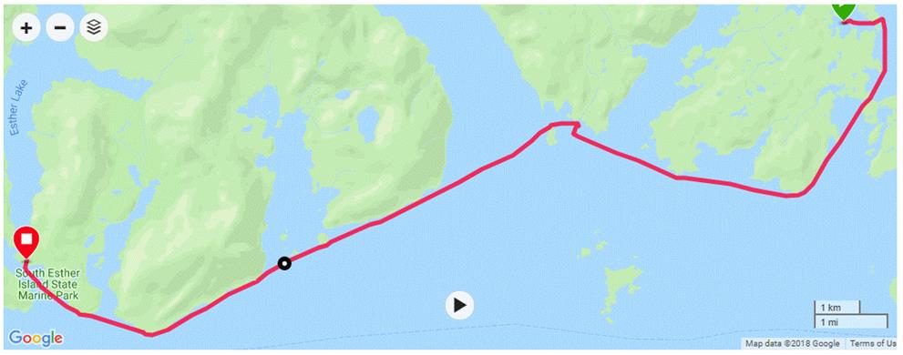
In summary though (based on boat gpx tracking and not map):
- Total : 290km
- 16th : 17.5km
- 17th : 42.5km
- 18th : 28km
- 19th : 0km (storm day)
- 20th : 22km
- 21st : 18.5km
- 22nd : 15.5km
- 23rd : 31km (fault with the data as battery died :-( - but near as damn it)
- 24th : 32km
- 25th : 25km
- 26th : 0km (storm day)
- 27th : 41km
- 28th : 0km (storm day)
- 29th : 14.5km