|
|
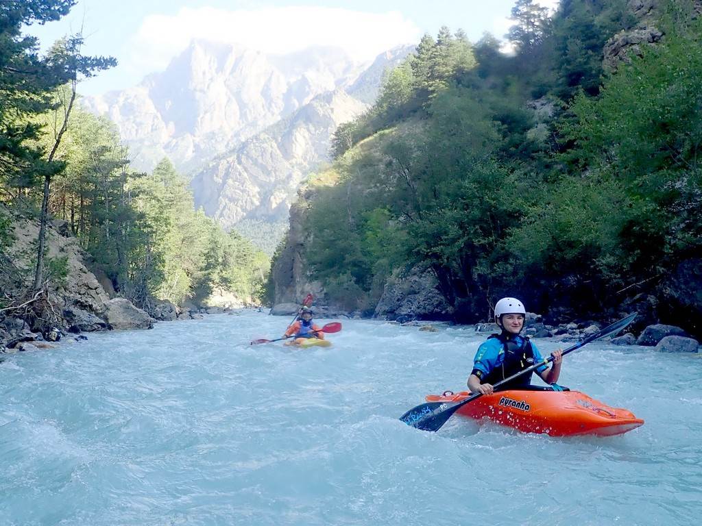
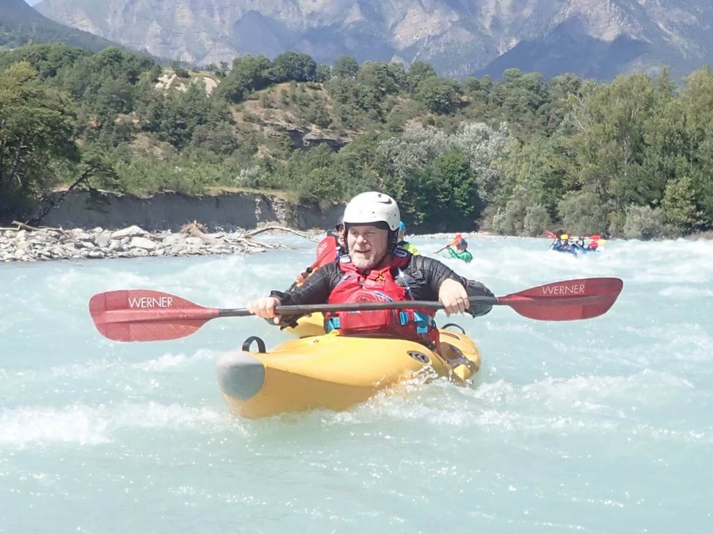
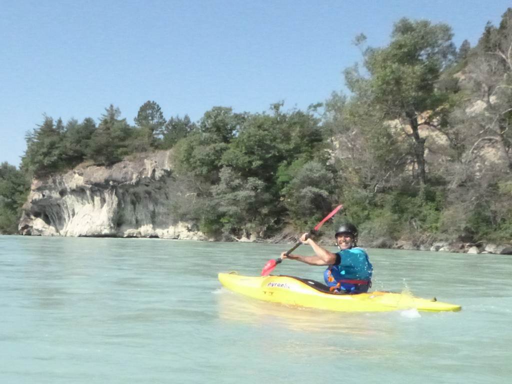
2024 LCC Alpine Paddling Holiday |
||
|
News
items or reports on club activities should be sent to website@liverpoolcanoeclub.co.uk |
|||

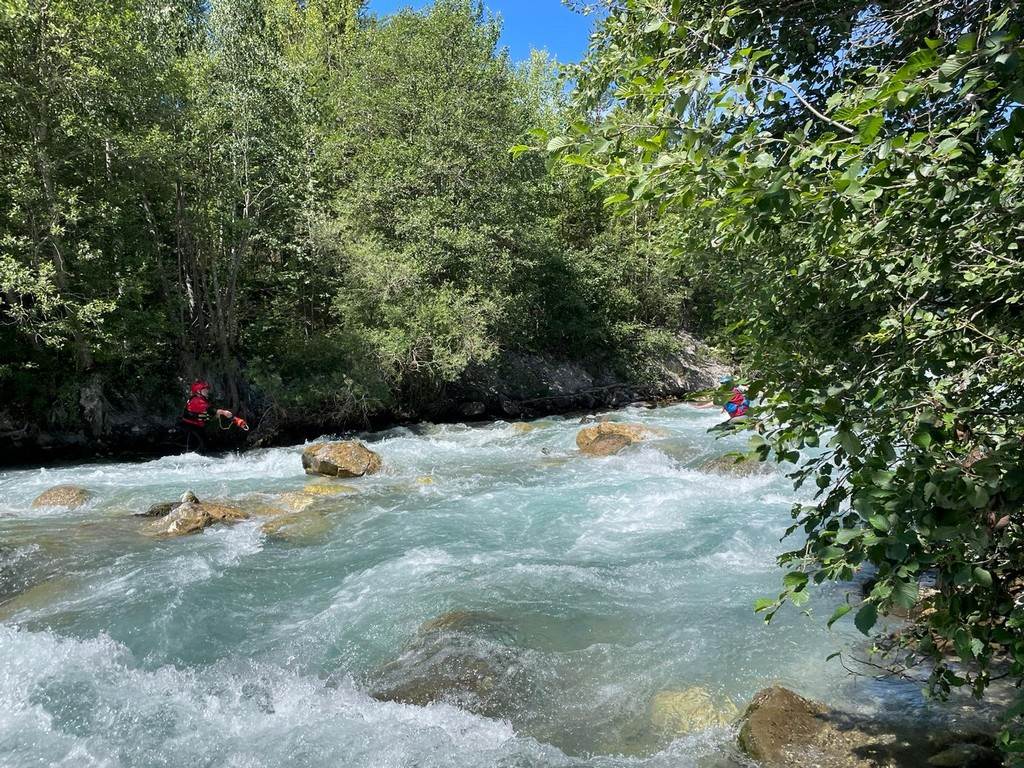
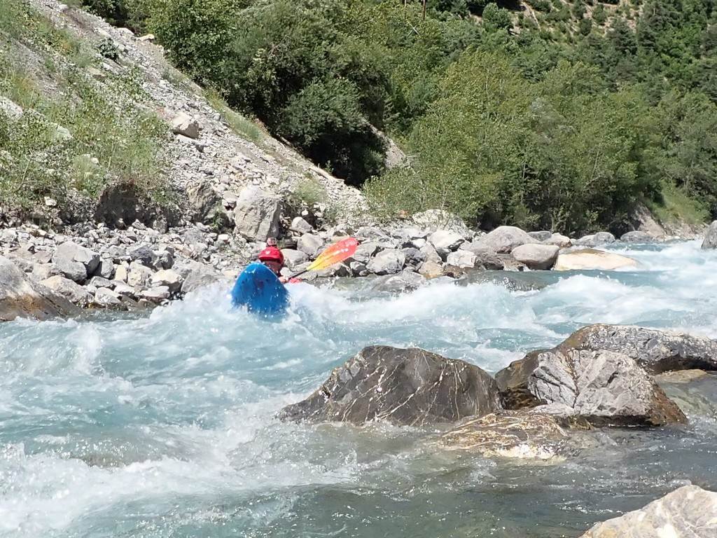
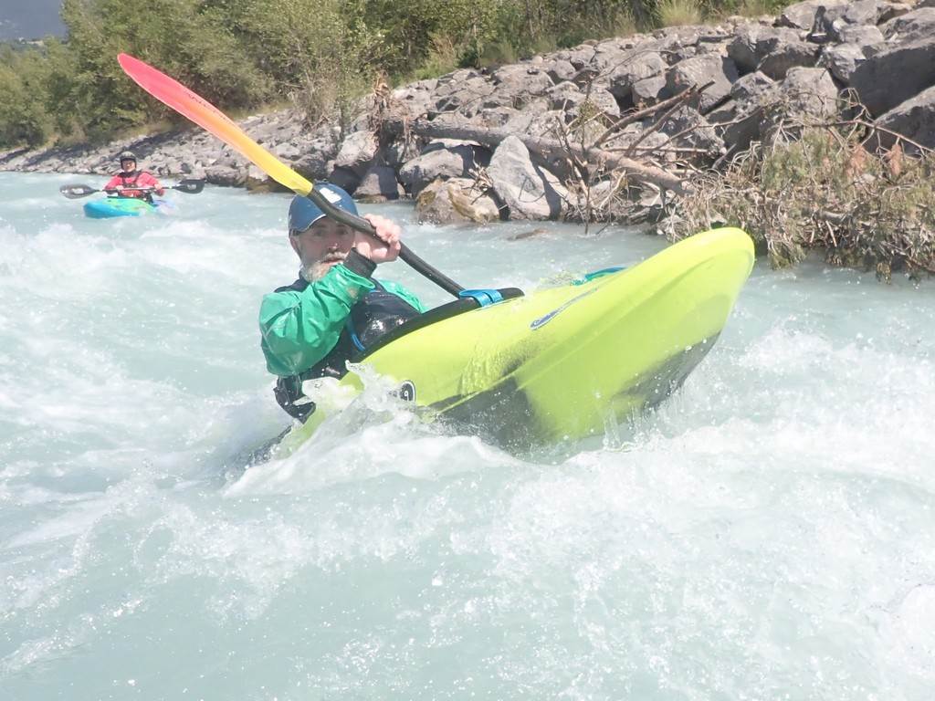
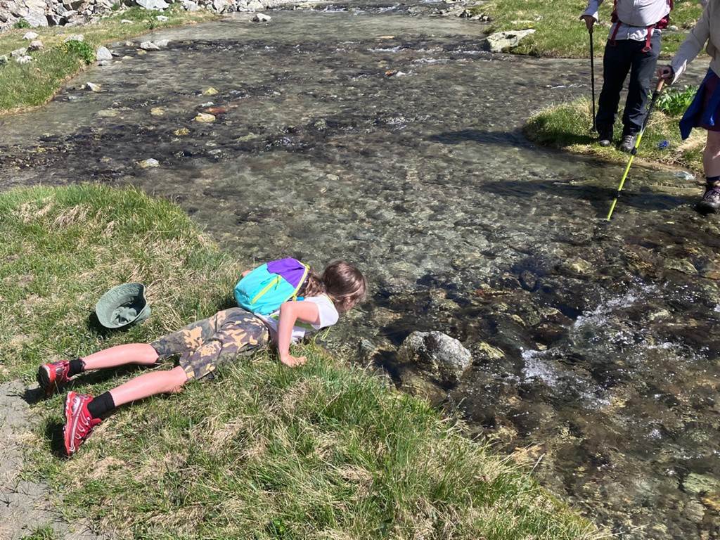
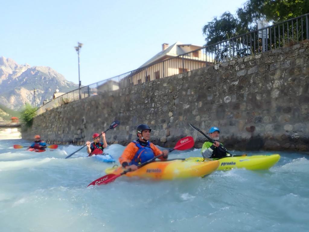
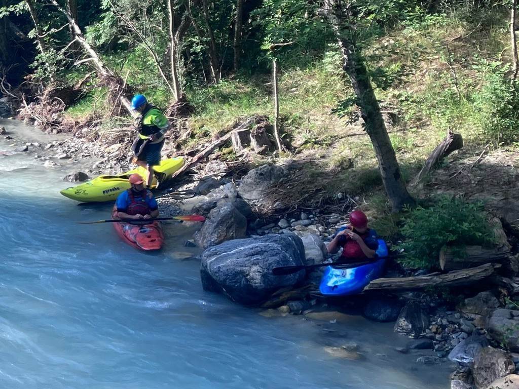
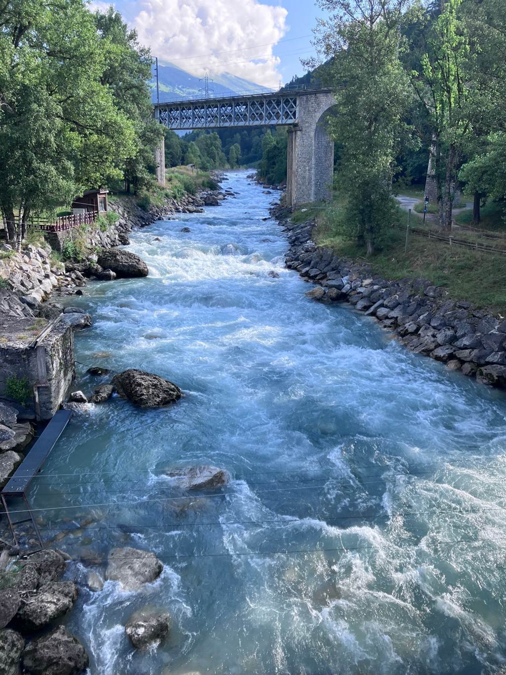
This year was to be a
three-campsite, trip with paddlers dropping in and out at different times. We started at Isle de Serre White Water
Centre, just outside Lyon, which breaks up the outbound journey. We then moved on to l'Argentière
la Bessée to camp next to the Durance River. There is a lake and White Water course next
door. At the end of the first week,
some of the group headed home to return to work while others stayed on to
paddle the surrounding valleys. We then
moved up to Bourg St Maurice and camped at the Isere campsite to paddle the
river Isere and its tributaries. The
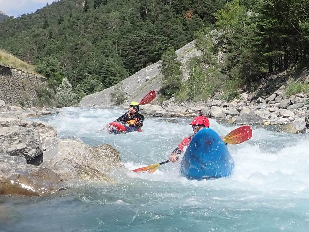
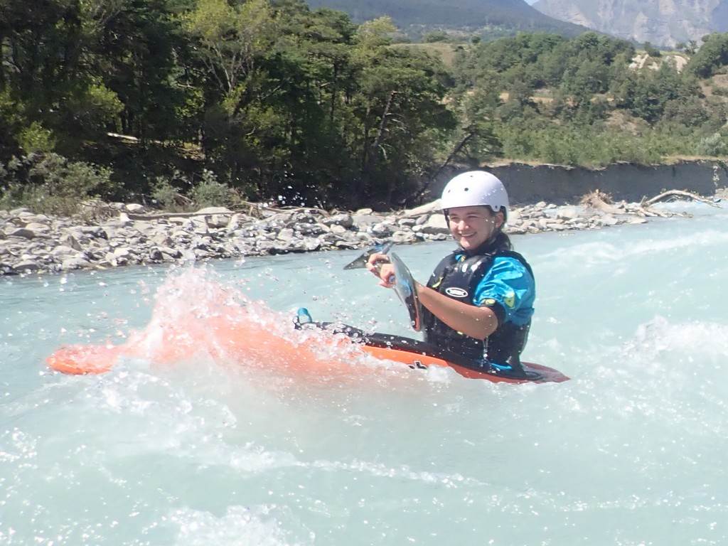
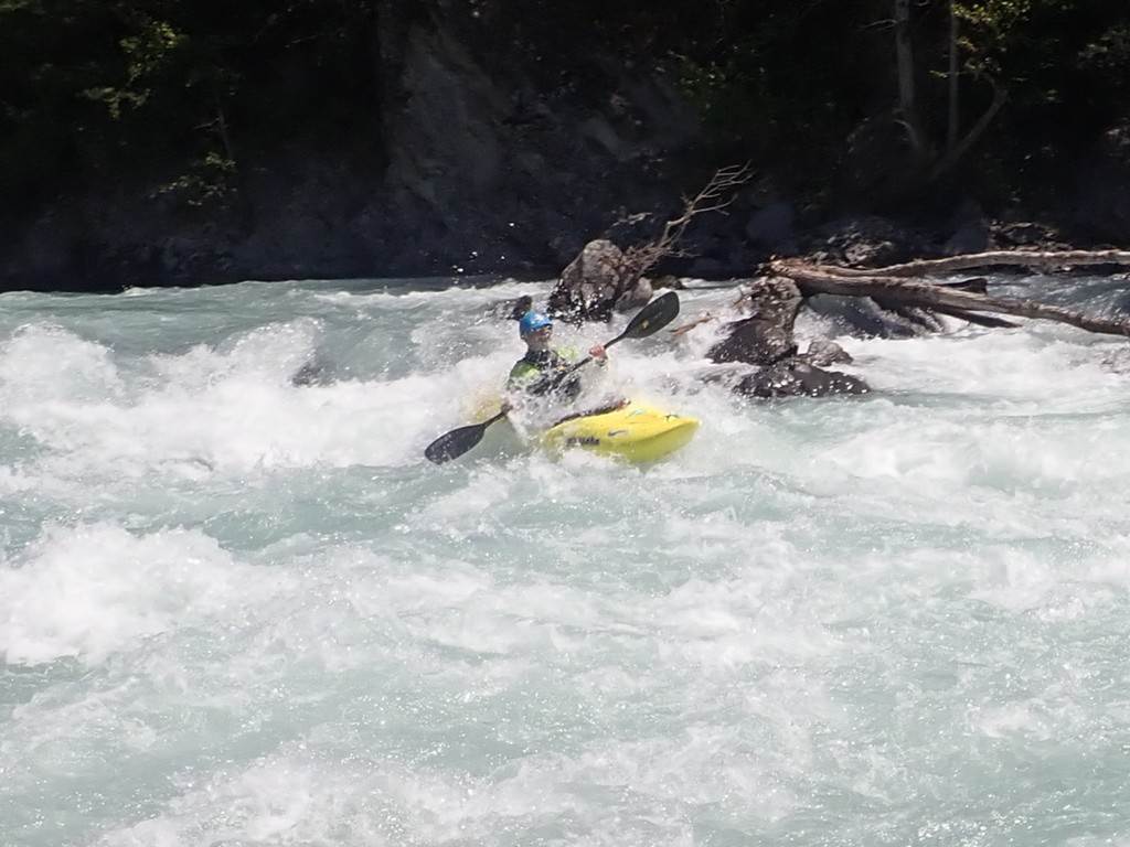
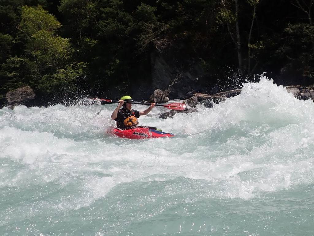
trip is a holiday with late starts and sunny conditions. The paddling is from easy grade 2 to harder
grade 4+ and you can choose which paddles you join in on. Ideal for families with plenty of additional
activities to try.
Stuart T, Roy Mc, Keith S,
Sarah G, Fiona B, Mike F, Cameron F,
John C, Kirk W, Mark B, Marianne B. Sue
and Colin L, Steve M.
The annual Alps Holiday has been running every year since 2008.
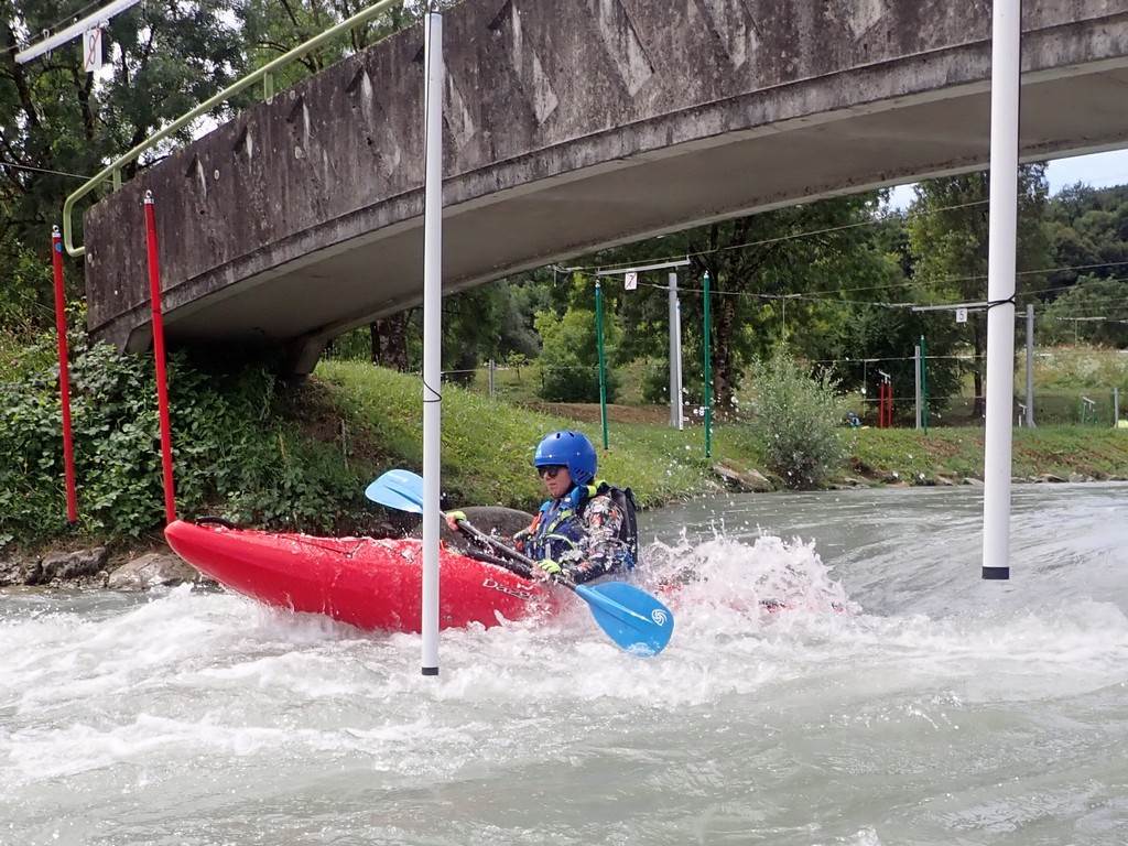
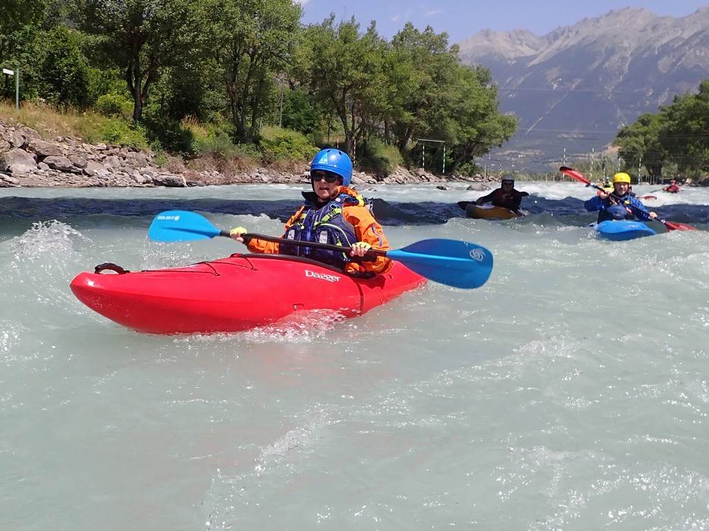
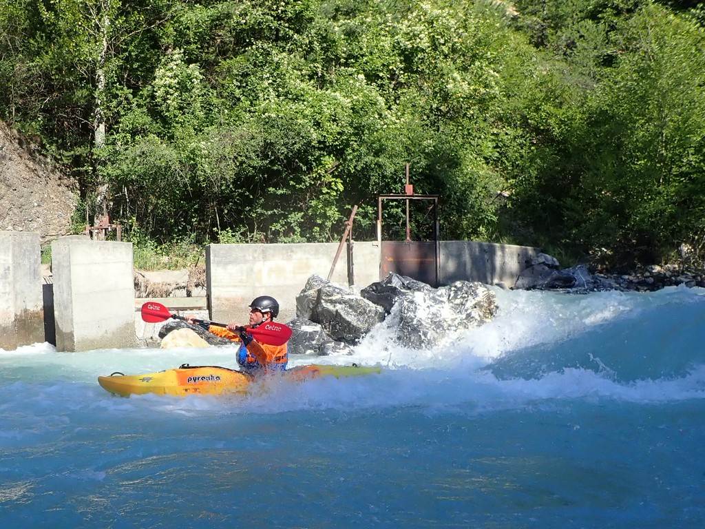
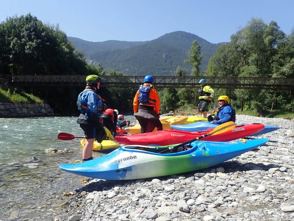
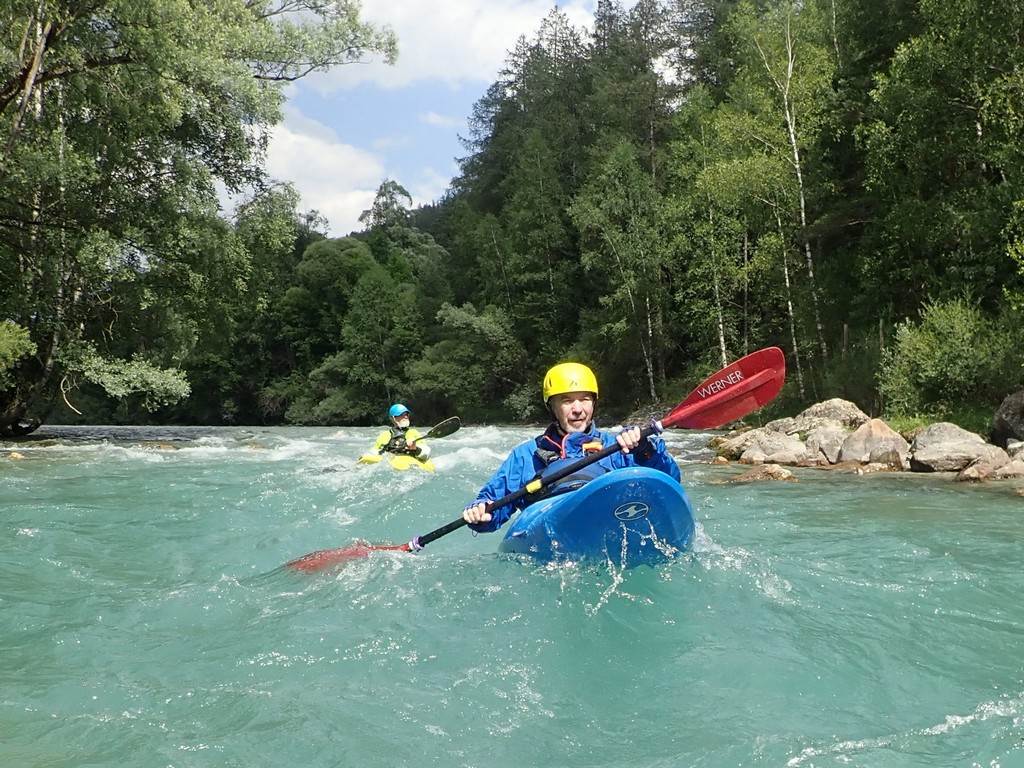
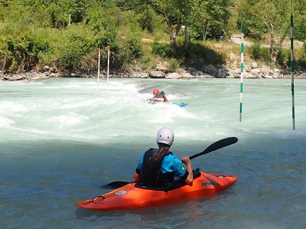
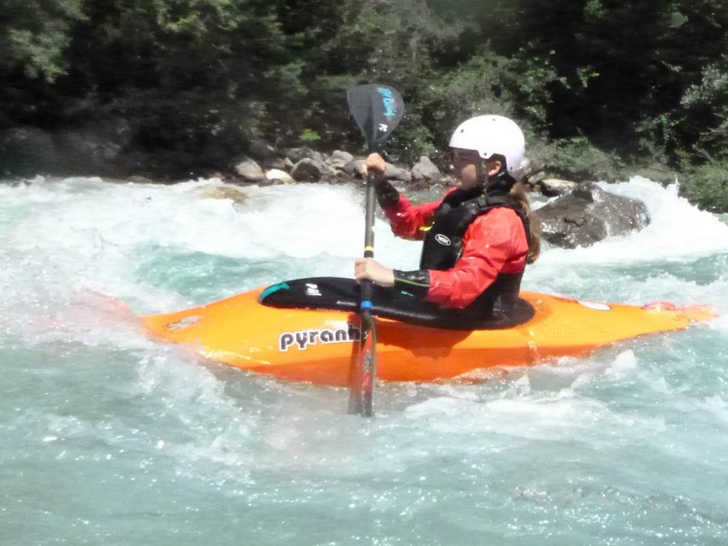
Day 01 Saturday: Espace Eau Vive de
l'Isle de la Serre by Keith
We arrived at L`Isle de la Serre White Water early afternoon and set up
on the campsite which provided excellent camping, showers, a café and several
restaurants in the nearby town. This year we were able to negotiate again the
ex-army tent complete with two fridges and a stove as a base.
The advanced crew had had a
few runs the previous day after their journey out. We decided to follow suit and we all enjoyed
a few runs in the late afternoon. This
course is man made but very natural looking with
rounded boulders and play waves and good eddies for all.
Later we enjoyed food and
drink at our army base but were rudely awoken at 3 in the morning by one of the
largest cracks of lightning we had ever heard.
The lightning and sound happened at the same time and it fell like it
was only metres above our heads.
Click
or tap for more photos………
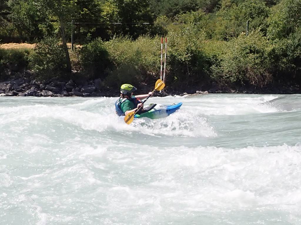
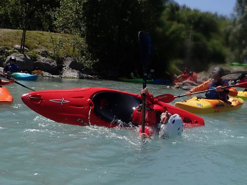
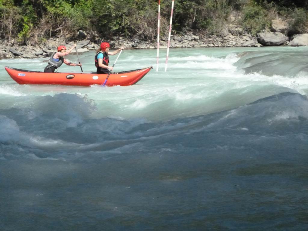
Day 02 Sunday: Espace Eau Vive de l'Isle de la Serre by Colin L
On our first visit to La Serre and Eau Vive we were greeted with a thunderous storm at 3 am but
better the rain then than during our day. A leisurely start the
next morning with a brief walk around the course and a "oh my God"
look at the top end we put in at the beginner’s bit where the water flowed just
as fast but with fewer obstacles. We familiarised ourselves with
the flow by ferry gliding across several times and jumping in and out of
eddies. Great fun and even managed to dodge all the teenagers who were clearly
not phased by the fast flow or the boulders.
We slowly moved down a bit more of the course gaining
more awareness and dare I say confidence eventually travelling through and out
into the Rhone. Keith's guidance and encouragement assured safe passage
and it was a happy day! After another run from the beginners' end Keith
suggested it would be great fun to swim the course; you know, starfish-like
with feet in front to bounce off boulders should we encounter them! He
calmly showed the way and while we all dropped into the water, Sue felt
immediately out of her depth... metaphorically as well as literally! All
safely exited but was it fun? Don't ask Sue!
After lunch and another play at the beginner's end,
Sue and I decided to go and watch the others in the upper course. All
looked cool, calm and collected as they travelled around big rocks and played
behind them. We then watched in horror as Keith grabbed my boat to
bring it up to the top put in! This could only mean one thing! With
reassurance and advice to "just flow through, no playing... you'll be
fine!" I reluctantly followed. Two successful runs were completed
and only a couple of scary wobbles! Yup, that was good! Beer
now! Col
Click or tap for more photos………
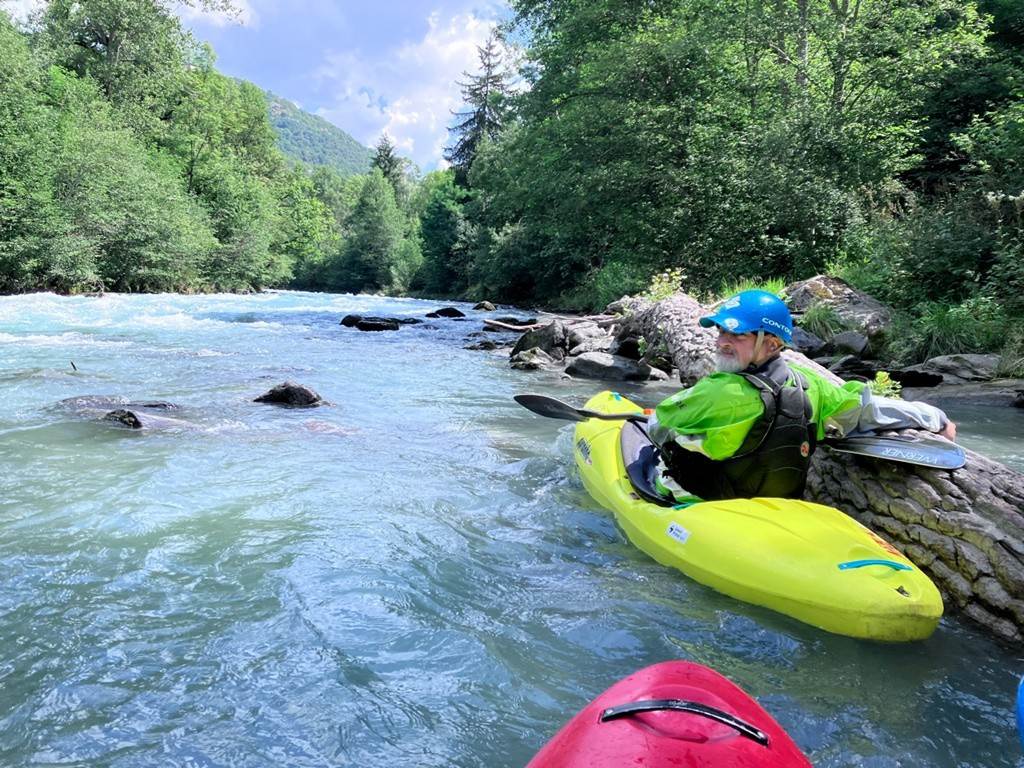
Day 03 Monday: The Veneon Valley access road was closed by Kirk
Williams
Our moving
day got off to a bright start thanks to my red wine overindulgence the previous
evening. After some slightly disorganised packing, we set off on the
journey from l'Isle de la Serre
(near Lyon) to L'Argentière-la-Bessée.
Our plans
for a cheeky paddle on the Veneon were scuppered by
road closures following the earlier flooding in the area. We had to console
ourselves with some restorative McDonalds on the way.
Arrived
safely at our old familiar campsite in L'Argentière-la-Bessée and pitched up in plenty of time to fit in another
burger and a few local beers at the on-site bar. Hopefully, my self-discipline
holds out for an earlier night!
"You
Shall Not Pass!"
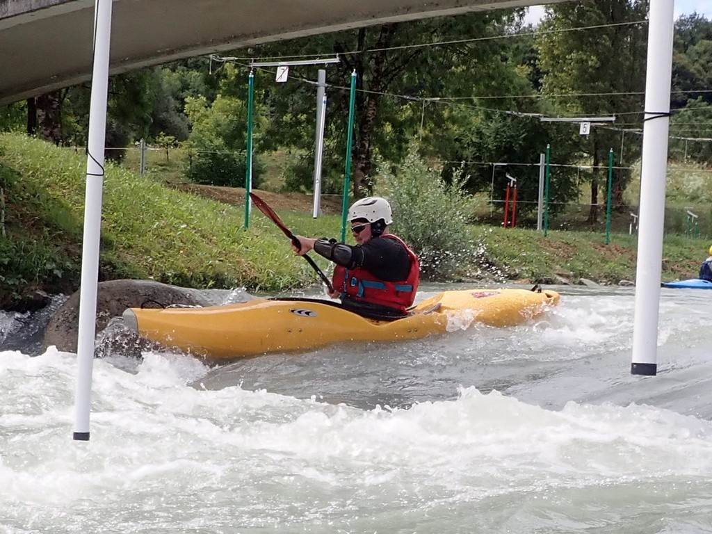
Day 04 Tuesday: Camping Le Ecrins slalom
site to St Clements, Slalom site, Middle Durance River by Roy M
The drivers did the shuttle
at 9 am and at 10 am everyone was ready for the trip on the side of the river.
There were 13 LCC paddlers in total, and a couple of us carried up and ran the
slalom course which was unusually high for the time of year. The course has
also changed considerably since the floods earlier this year. We
completed the course with no issues and met the other 11 paddlers at the beach
at the end of the top site and headed in one big group down to St Clement.

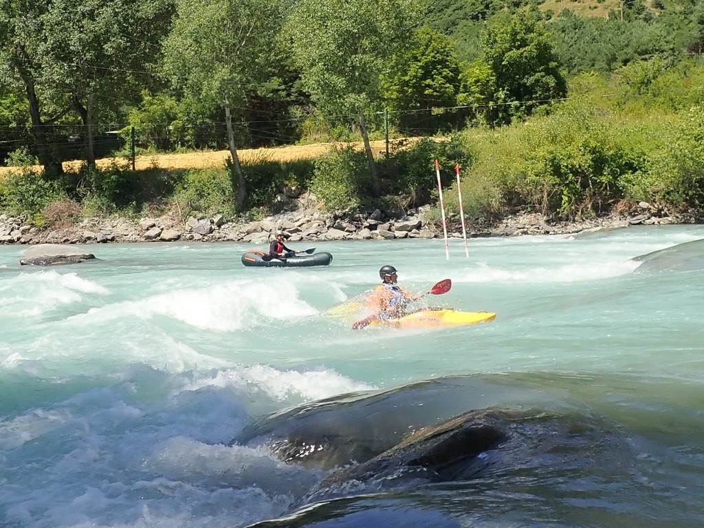
The high river levels
continued downstream and we made good progress down the river. As always, the
scenery was spectacular and the weather was beautiful. Sue and Colin on their first time down the
river did particularly well to negotiate the rapids that like the upper section
has changed after the floods.
When we reached the St
Clement slalom site we realised that the drops on this section had changed too,
the best surf wave is now the second drop, it’s changed from a hole to a green
wave which was great to surf in the firecracker.

On the first run, the wave
was chocka with a group of Germans paddlers, so we went for lunch and then when
we got back on Sarah, Keith, Stu and me had the wave to ourselves for around 30
minutes.
Great day had by all.
Click
or tap for more photos………
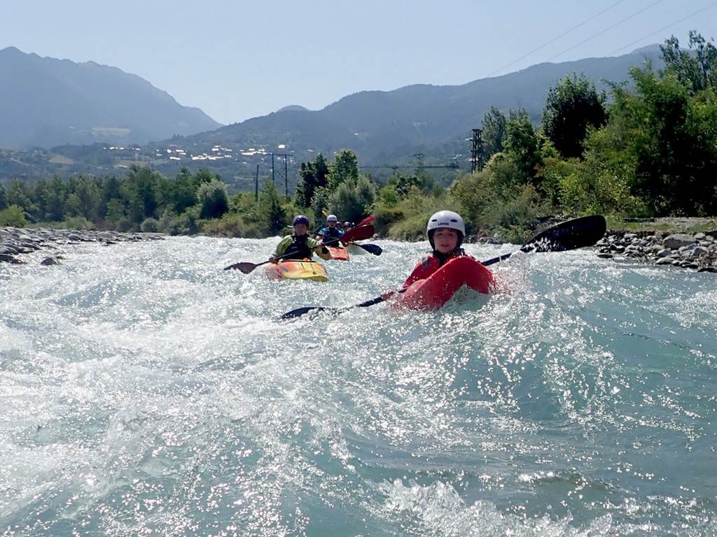
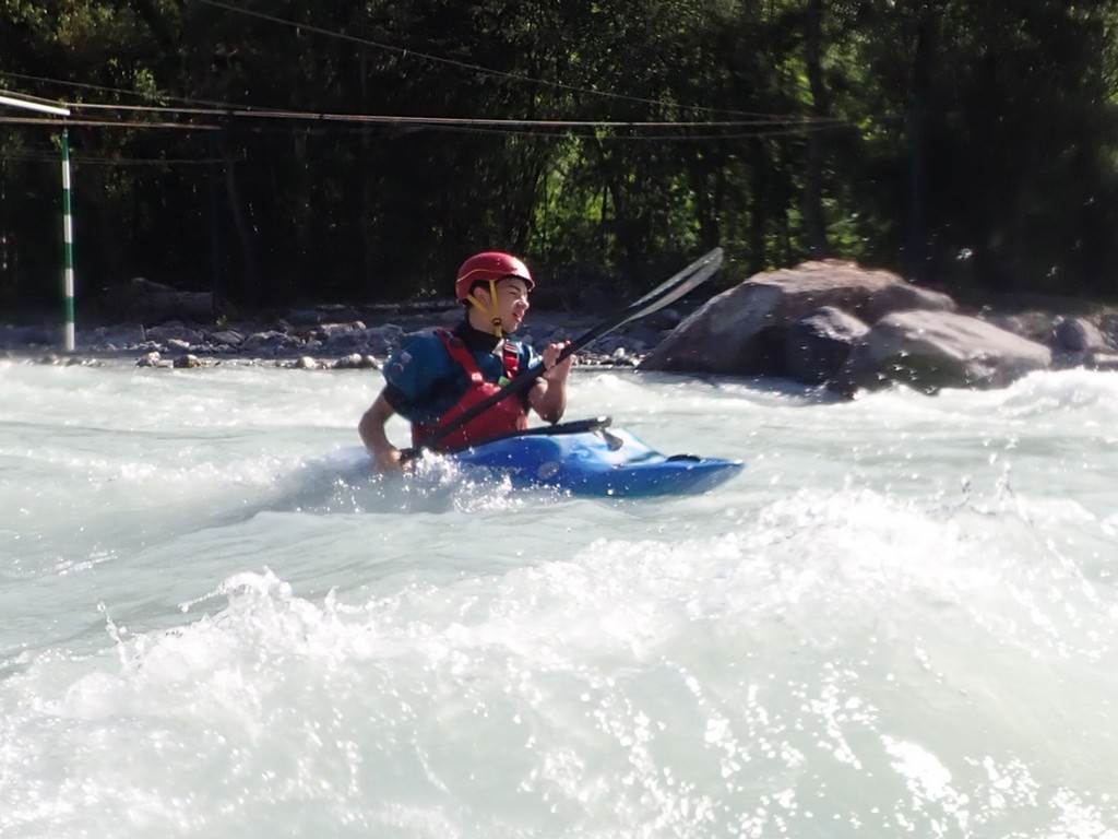
Day 05 Wednesday: Upper Guisane by Stuart T
It had been decided the previous evening that
Roy would take charge and decide today's paddle. Within an instant, it was announced to be the
Upper Guisane.
The water levels this year are still higher than we have been used to
following the recent floods.
We departed the campsite and split into two
groups, one heading to the upper get-in of Le Casset, and the other to a lower
get-in. When we arrived at Le Casset, we
noticed that all of the parking areas had been recently re-laid owing to the
floods. Earlier in the week, on the way
from the last campsite, Keith and I stopped to inspect the crux of the
run. We saw that the force of the water
had now run through a complete island and created a new channel, giving groups
very few options to stop.
We split up into two groups and discussed the
nature of the river and at this level, it may be read and run. Roy led and
successfully navigated the many tree hazards and the boulders hidden by the
cold, milky-coloured water. We started
the trip being extremely cautious, giving the paddler in front plenty of room
should they become stuck on a boulder.
Eddie's were few and far between as we navigated and focussed on
ensuring we knew the position of all of the group.
We stopped at a new large island about 40 meters
above the crux of the trip S bends. Setting off in pairs, Roy leading into S
bends, this is a boulder garden rapid, we bounced down and stopped on either
side of the river to give protection to the following paddlers.
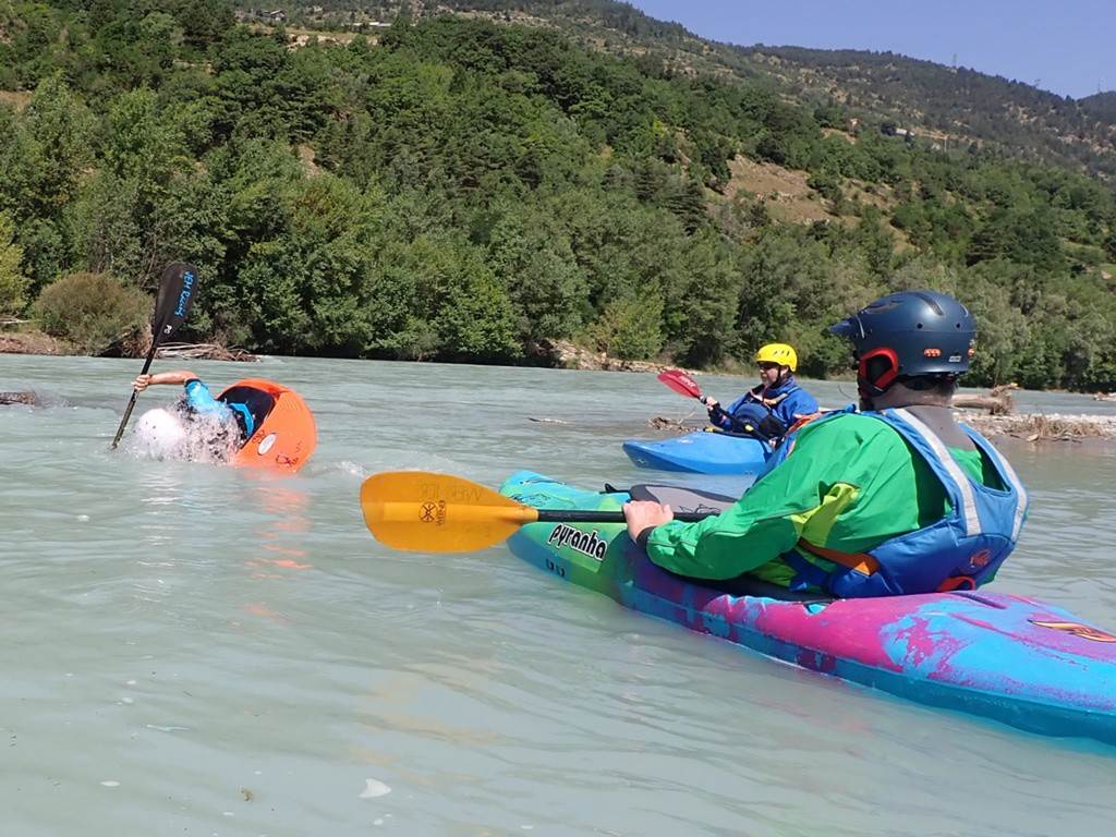
One of the following pairs, unfortunately, got
pinned and had to climb onto a boulder in the centre of the flow. Sarah and Ste
led the rescue, Sarah throwing a perfect hit with the throw line, resulting in
a very thankful paddler. We re-organised
the groups and headed on down to meet the second group at the lower get-in.
We now split into three teams, owing to the
increased numbers and enjoyed the pretty, grade 2 run through the flower-laden
bridges.

Click
or tap for more photos………
Day 06 Thursday morning 25th
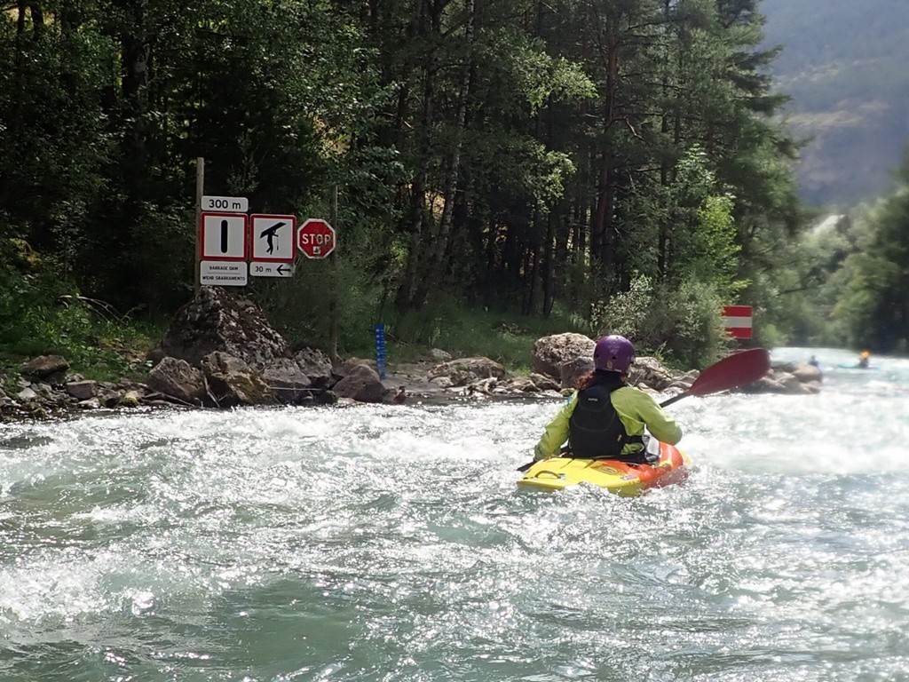
July: Lower Guil by Sue Lowndes
Lower Guil down to St
Clement's - "the most beautiful and tranquil river out here".
Although only our third day on the rivers from l'Argentière
la Bessée, the days are already blurring, and the
obstacles and challenges are locked into a deep recession of my brain! I
misinterpreted the word ' tranquil ' to mean the water would be flatter but
oops that was a mistake! Lots of bounce and confused and bubbly water but
today was a dry day! No wet exits for me although poor Colin did come out
and in the process banged his middle toe which is now a lovely shade of blue
and black with the suggestion that it is quite possibly broken.
In very brief moments, I did manage
to catch some of the beautiful scenery and the most awesome waterfall, so in
many respects yes it was a spectacularly tranquil paddle. The sun
continued to shine with 30° plus heat and the wind wasn't quite as forceful so
made for one less thing to concentrate on. The waters here are
beautiful (and wonderfully cold). The slalom course on entering St
Clements looked big and terrifying but I followed my expert guide and survived
it! A fabulous session on the Durance.
Off at St Clements and in the
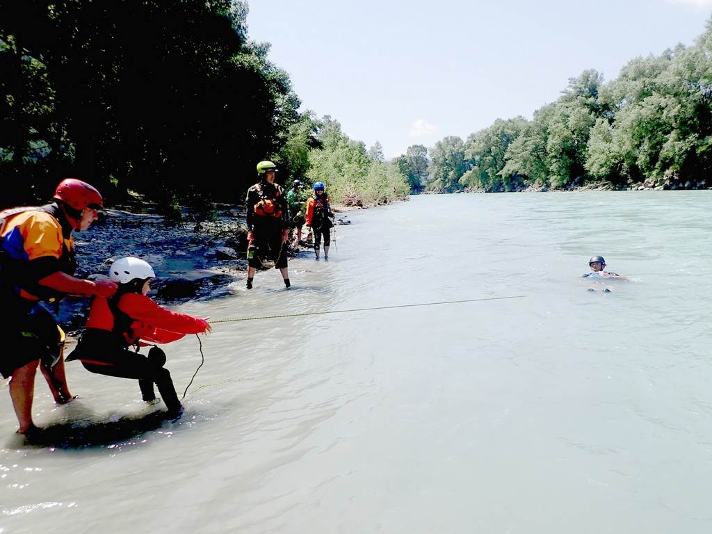
lovely bay still had time to practice throw lines out to rescue swimmers.
Everyone had a go at throwing out and being rescued; some loved it more than
others (the swimming that is) and it was all we could do to keep Clara from
constantly volunteering to be rescued... she's a fish really. Oh,
and huge apologies to Roy for my throw. Hope your nose is okay!
Lunch, coffee and beer!
Prefect!
Click
or tap for more photos………
Day 06 Thursday afternoon 25th
July: Middle Guil by Stuart Toulson
A smaller
group of 5 paddlers now headed up the Guil Valley to paddle the middle section.
The Guil is a 32-mile-long river, that drains into the Durance. The
section we planned to paddle today was from the road tunnel down to Maison du
Roy, which is grade 4. We quickly
dropped one vehicle at the bottom and then arrived at the get-on by the road
tunnel. We met a small group of Dutch
paddlers and helped them rope their boats down into the gorge.
Once
everyone was seated in their boats, we paddled down in order, assessing each
obstacle as we reached it. The closed in
gorge adding to the isolation and feeling of excitement, stopping every few
minutes to catch our breath as we found a suitable eddy.
Towards the
end of the section, one of the team went offline and capsized into an overhung
rock. They tried to roll but we're tight against the rock. As we watched from our separate eddies they
resurfaced and then managed to get to the bank. As Keith had led, he chased the paddle and
boat, managing to throw the paddle to the bank then recover the boat. We followed down but didn't see any sign of
the paddle, this was later collected by a local friendly raft guide, who phoned
us to say he had it. (It pays to label
all of your kit with your name phone number and email address)
After we had
safely left the river, we packed all of the equipment onto the vehicles and
prepared to return to camp.
However just
as Steve was driving off he had a rear tyre blow out. This was quickly changed for the spare, and
we drove back down the mountain and back to camp.
Click or tap for more photos………
Day 07 Friday morning 26th
July: Gyronde by Richard and Poppy Clews
It
was an early 9 am get-in for 8 keen paddlers running the grade 3+ section that
finishes back at the campsite.
The
water was fast, and I was a little tense as I'd swam on this section last
time I was here.
Not
many eddies meant a quick run-down today. We split into 2 groups with Keith and
Stuart leading me and Poppy down. Poppy was untroubled by the pace of the
current and had smiles on her face all the way down. My face was probably more
of grimace, but we all made it down happily.

A
weir drop was fun, but we were surprised that the eddy after it, which
initially looked welcoming, wanted to pull us back towards the weir. A few
strong paddle strokes got us out of trouble, and we were away again.
Next
came the confluence with the Durance and soon after all the hydro station water
gets put back in to nearly double the flow.
We all enjoyed the fast run down through the
Click
or tap for more photos………
Day 07 Friday morning 26th
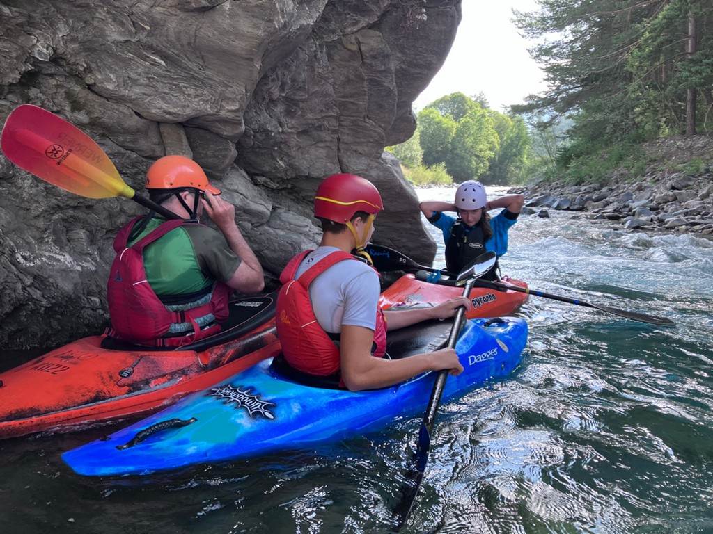
July: Lower Guil to St Clement`s by Clara Clews
At
the start I was quite nervous but when we got on the river it was very fun. We did
it the day before, but this time we got on part-way down and missed some of the
larger waves which was good as I was scared the day before. I enjoyed doing it
again.

Whilst
we were paddling the scenery was beautiful, we were completely surrounded by
hills and mountains and peaks that stuck out of the clouds.
The
day before we went through the confused water and that was quite scary (where
two rivers meet). But this time Keith showed me how to go around it and pick
another line.
When
we got to the eddy, I did a roll and then made everyone else do one. This was
where I got off but everyone else went down the slalom course. When I got out,
I sat on the rocks with Keith's camera and took some good videos and pictures
of people going down and surfing the second wave.
I
enjoyed this paddle very much.
Click
or tap for more photos………
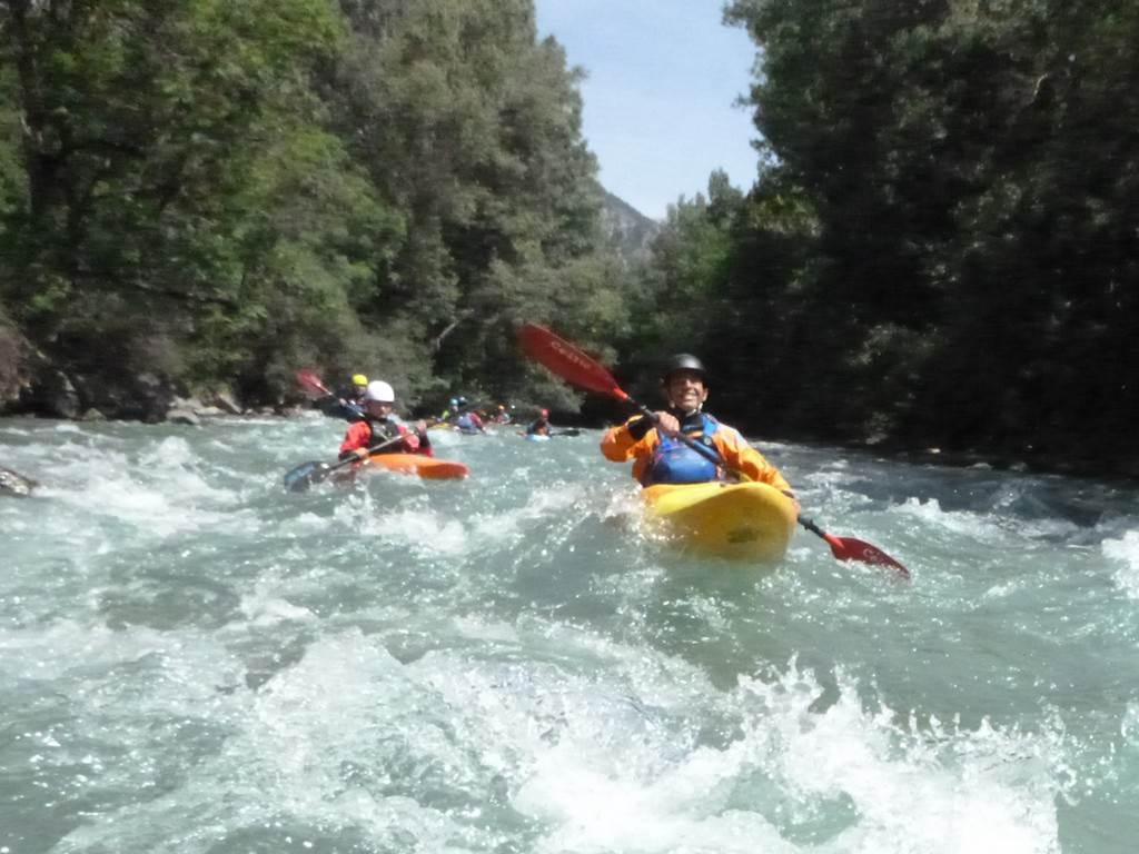
Day 07 Friday afternoon 26th
July: Lower Durance by Nick Coughlin
Friday afternoon and it was decided we would paddle
the Lower Durance or “Sunshine Run.”
After a slightly delayed start nearly the whole group
of paddlers set off down the wide, fast flowing river from St Clement.
We paddled through lots of big bouncy wave trains
putting large smiles on everyone’s faces.
Like all the rivers we have paddled this year features
on the Durance have changed so in some ways it’s like a new river. New islands
need to be navigated around and trees to be avoided. At one point it looked as
though a forest had been uprooted and dumped on the bank.
Eventually, we rounded a bend and eddied out to
prepare for the famous Rab wave. There are two channels into the Rab and we
took our usual river left line but the rafters all seemed to be going river
right. We all got in an eddy and waited while Keith went down the usual left of
centre close to the rocky left bank route. From my viewpoint he seemed to be
getting bounced around a bit more than usual. Unfortunately, he survived, got
out and put up his paddle to signal for the next paddler to set off, all the while
signalling furiously to go to the right. Some paddlers seemed to be able to get
right easier than others with Cookie saying Poppy and Colin had the best line.
Dom was the penultimate paddler and whilst starting
well right the river swept him left and over a rock on the edge. From my
position, I couldn’t see what happened, but he was on the bank when I got
down. Unfortunately, it was the wrong
bank. After a bit of gesticulating and shouting Dom was told to go up near the
wave and jump in to try and swim across. He managed to get to the centre of the
river where he was thrown a line by two excellent throws from Cookie and Roy.
They managed to pendulum him into the bank where his boat had been sitting. We
could all see that the previous day's throw line practice at St Clement's was
now being put to good use.
We got in our boats and headed down to Embrun without
too much drama, even though the Embrun wave was different (larger with more
volume in the river) and did manage to unseat one paddler.
There were enough vehicles at the bottom to get
everybody and their boats back to camp for a well-earned barbecue.
Click or tap for more photos………
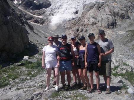
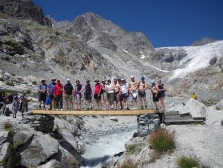
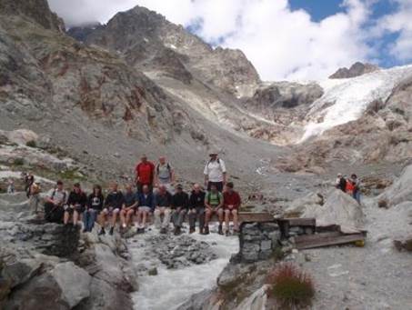
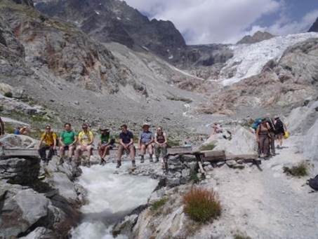
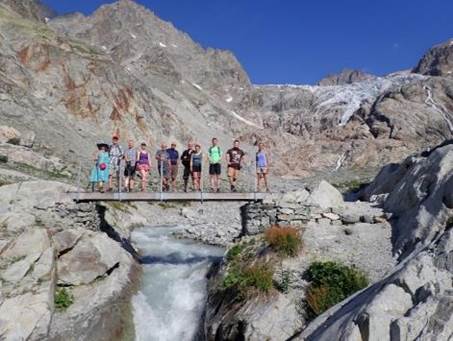
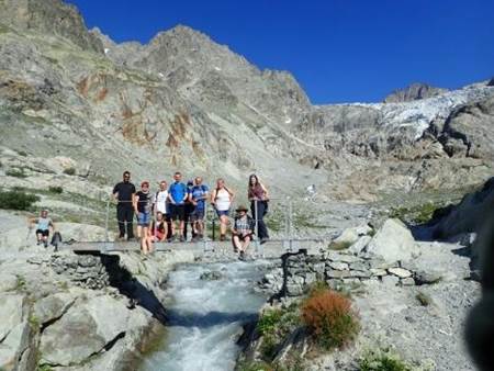
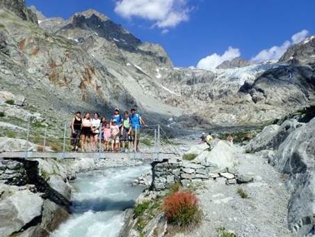
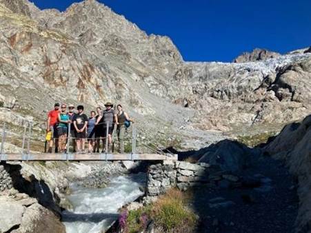
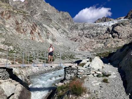
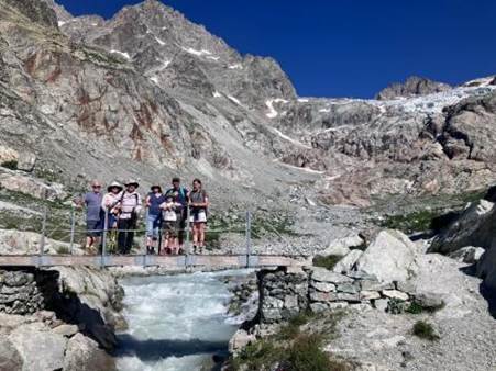
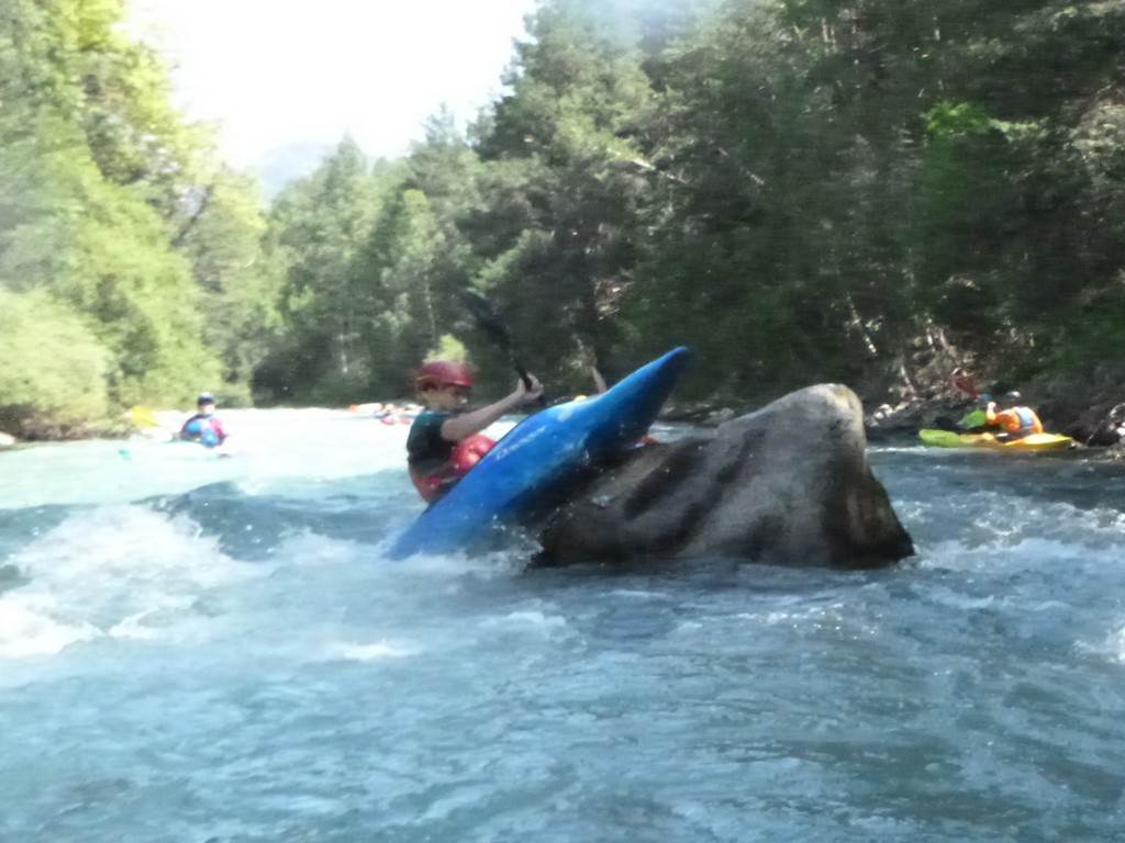
Day 08 Saturday 27th July:
Glacier Blanc by John Cooke
Saturday was an
early start for the group that was going to trek up to Glacier Blanc, the idea
being you avoid the heat later on. We
set off as a group of 8 and as the winding twisty paths started climbing Poppy
was stretching out in the lead. There
was a lot more water this year coming over the waterfalls and in the streams
coming from the mountains than the last time I was here.
By the time we got
to the bridge for the obligatory club photo Rich and Amy decided to call it a
day so that left 6 of us to carry on. The paths get harder and steeper
and in places, you need to use the wires bolted into the rock as support.
We eventually
reached the 2nd refuge after a slight detour as Keith went the wrong way
meaning we had to cross a small stream, Clara loved it, Poppy complained, and I
got my new nubuck leather Dm's wet 😳.
After a drink and
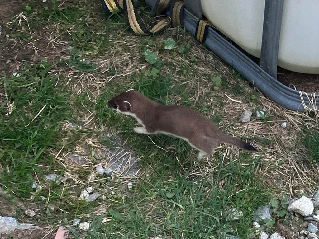
some food, it was time to come back down which is always quicker. We spotted a
group of Stoat-type babies playing at the back of the refuge, but I never saw a
Marmot all day. We had a drink at the bottom at the cafe then headed for
home. The round time on the trek was 6 hours. I clocked 26700 steps so Clara's
little legs must have done well over 30k.
Great day out with
spectacular views.
John, Keith, Rich,
Amy, Poppy, Clara, Colin and Sue.

Click or tap for more photos………
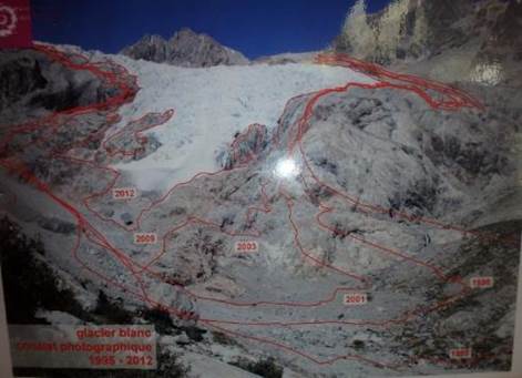
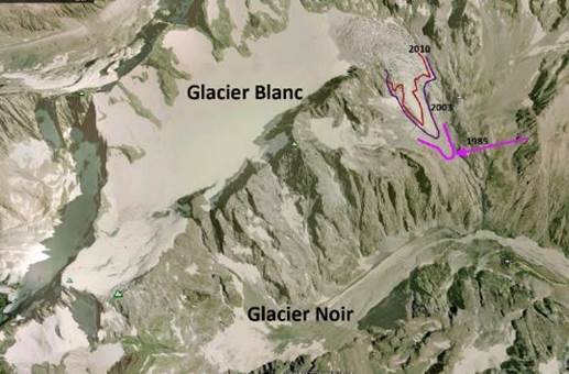
Glacier Blanc
(like 90% of the worlds glaciers) has been retreating (Shrinking) over the last
100 years due mainly to global warming.
Glacier Blanc is on the east side of Barre Des
Ecrins the southernmost of the 4000 m peaks in the Alps. It is the largest
glacier on the peak. The glacier began a sustained retreat after 1870, that
ceased in 1895-1900 , 1915-1920, 1935-1940 and 1980-1990 (Cossart et al, 2006).
The glacier has shrunk by 5-10% of the total glacier volume during 1981-2005 (Rabatel et al, 2008).
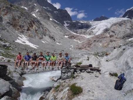
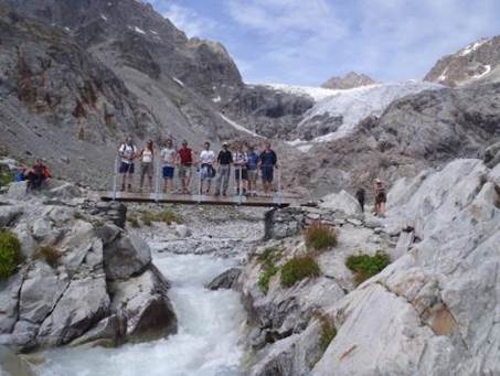
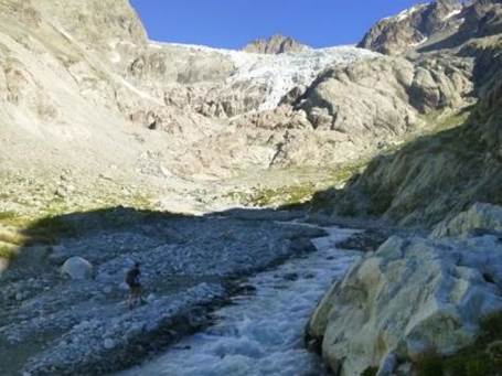
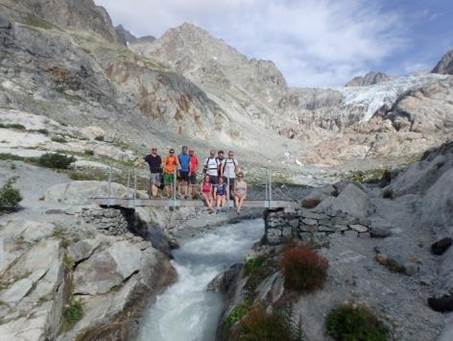
The series of images below are used to examine the retreat
over the last 14 years of Glacier Blanc with LCC trips to the region. The first
image is from 2008 and shows the glacier very low down and almost level
with the bridge. By 2023 it has
retreated right up the valley and is now along way
above the refuge at 2550m.
|
|
|
|
|
|
|
|
|
|
|
|
|
|
|
|
|
|
|
|
|
2020 |
|
|
|
|
|
|
Day 08 Saturday 27th July:
Summer Luge by Sarah Gille
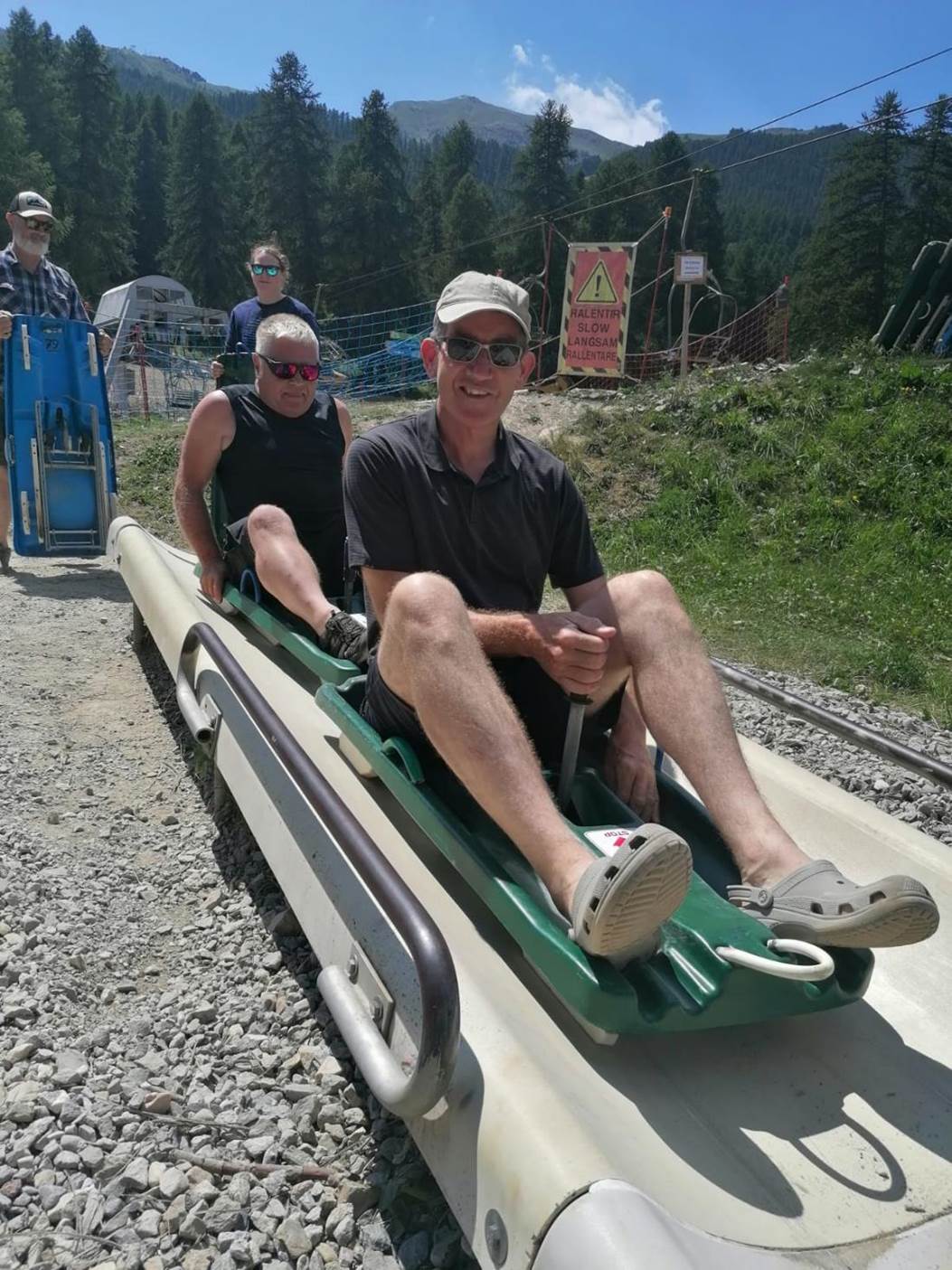
It was forecast to be 30 degrees centigrade today. A group of 8 had set off to walk the glacier
while we decided to take in the summer luge in the nearby ski resort of Puy St
Vincent. https://www.puysaintvincent.com/en
Please see the TicTok video of our afternoon. https://vm.tiktok.com/ZGeWCbkkY/
Click
or tap for more photos………
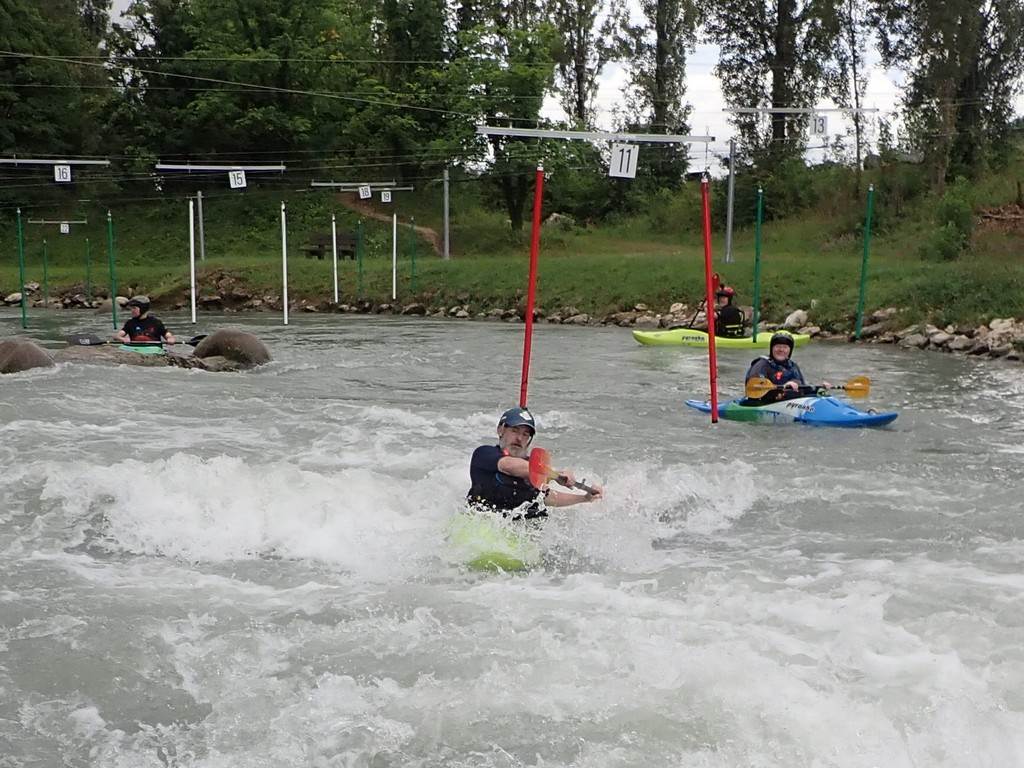
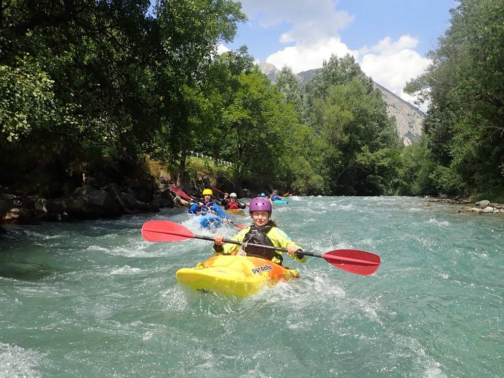
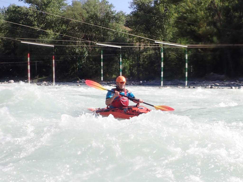
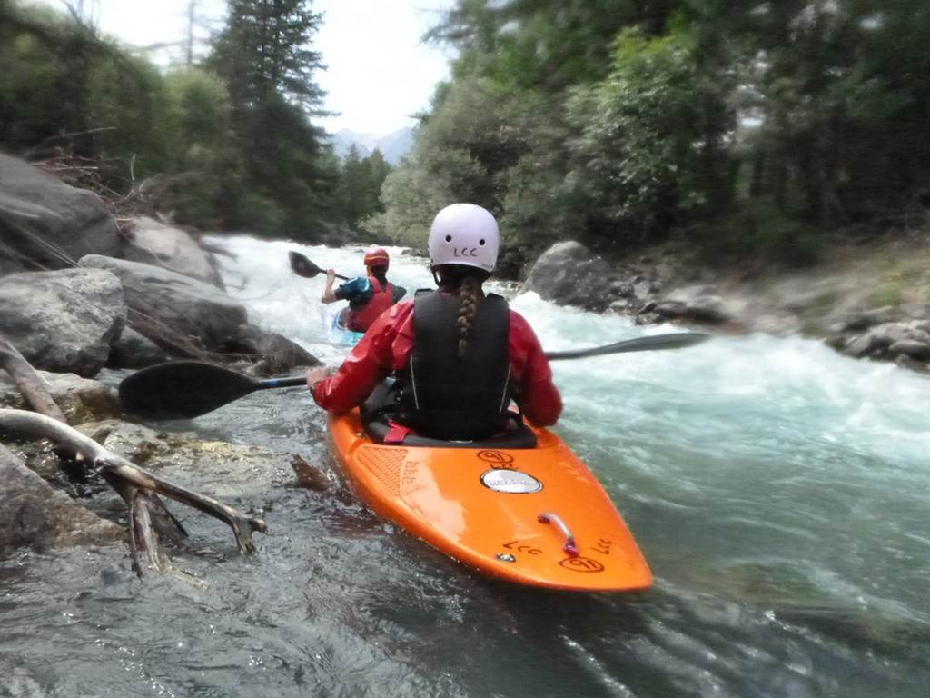
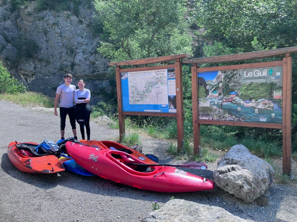
Day 09 Sunday morning 28th July: Lower Guil to St Clement`s
A group of us headed back down the valley to Clara`s favourite river,
the Lower Guil. After shuttling a car
to the get out at St Clements white water centre we carried the boats down to
the footbridge and small beach. The
clear waters from the dam above proved a good level again and we soon got on
and were speeding down river.
There were a few large wave trains and sweeping bends to deal with
before we passed under the main road bridge.
Here we paddled down to the confluence with the Middle Durance River and
the contrast in colours between our clear waters and the white clay-laden
glacial river was clearly marked with a strong eddy line. Sue took the main
line this time and was swept wide but had the confidence to break out into the
calmer waters on the river left.
After negotiating our way through numerous islands and pebble bars in
the now highly braided stream we soon reach the road bridge and 200m slalom
course at St Clements. We were all
instructed to roll by Clara who went first.
The group then paddled down through the stoppers and waves to the main
bridge. This was to be the first of a
three (4) river day.
Click
or tap for more photos………
Day 09 Sunday afternoon 28th
July: Upper Durance by Amy
After the morning paddle, we headed up to the upper Durance leaving a
shuttle car at the get-out near the tunnel above Prelles
Barrage (Dam). We were soon on the water
and paddled down the torrent and took a look at Roy's “new river” (La Cerveyrette) which joined soon after the start. There seemed plenty of water so maybe next
year!
This section had plenty of water and was an enjoyable paddle giving some
paddlers a flip or two. The large
standing waves and interesting woodland gave pleasant paddling. It was not long before we met up above the
main rapids. There is a large eddy on
the river left of a green rail bridge where we could see down the first 200m of
grade 3-. We paddled down before
regrouping to paddle the last section which finished at the old get-out
("The Smelly Bridge"). The broken sewer here has long been fixed and the
water is now very clean.
This next section is continuous breakouts behind conveniently placed
boulders right then left. Some counted
19 or 20 consecutive breakouts and were extremely pumped and in need of a few
minute's breather. With in a kilometre,
we came across the signs for the get out on river left. This is as soon as you reach the small lake
which forms the barrage. We used a
throw line to help with getting the kayaks up the steep path to the waiting
cars.
Click
or tap for more photos………
Day 10 Monday morning 29th
July: Gyronde
With an early morning start, we headed up the valley for the first of
three paddles today. We parked at the
campsite on the Gyronde for an early morning paddle
back to the campsite. The river was
running fast and cold but the floods earlier in the year had changed the
channel in several places and if anything had moved a lot of boulders making a
clearer channel.
After a km or so we entered the gorge.
There was a layer of mist above the cool water as the sun had not yet
reached the valley floor. We paddled as
one group in the fast grade 3+ water making a few eddies that we found. After another km we came across the broken
weir which was shot in the middle heading slightly left to miss the large
boulders below.
After the gorge section, we headed into the town of L'Argentière-la-Bessée. Here the Gyronde joins the Durance and flows down to the
campsite. Just upstream of the campsite
the hydroelectric runoff rejoins the main river doubling its flow. We had an enjoyable paddle down through the
slalom course.
Click
or tap for more photos………
Day 10 Monday morning 29th
July: Lower Guil to St Clement`s
After returning to the campsite for a late breakfast we headed up to
Clara`s River again to paddle down to the usual get out at St Clements. This is a beautiful river with very clean
water that flows from the Snowmelt from snowmelt from high in the Queyras Regional Natural Park.
The grade 2 river runs down and joins the larger Durance where the two
contrasting water colours meet. The
undercut limestone outcrop is on the river right but most prefer to paddle the
middle channel and avoid any chance of a pin.
The river then flows down through many large gravel islands and multiple
braided channels.
Just above the slalom course paddlers are encouraged to practise their
rolling by an enthusiastic Clara. This
often proves to be an ideal warm-up as the three large “surf” waves often catch
out the unwary.
Click
or tap for more photos………
Day 10 Monday afternoon 29th
July: Lower Durance “The Sunshine Run” by Amy
After some lunch, we set off from the beach, the river running fast with
big wave trains to follow down.
It didn't feel like long until I hit a big wave and was under! I was
pleased to reach the riverbank holding both paddle and kayak, which I was able
to empty and get back in.
Keith pointed out that I seemed to be paddling as if it was a Sunday
morning at the docks, when I realised I had to really paddle. We continued,
bouncing along more wave trains.
The scenery was stunning, the air hot, dry and windy. We stopped in an
eddy to think about the Rab Wave. Knowing the strength of the water here,
having practised swimming down it 4 years ago, I decided that it wasn't the day
for me to paddle down it. So, I walked down to the bottom of the wave, whilst
everyone else paddled on. By the time I got there, they had all effectively
come down the wave and Cameron was walking back up the road to squeeze his long
legs into my kayak and run the wave again.
The more proficient in the group stopped to play in waves and surf,
choosing different paths down the river.
Using stronger paddle strokes, I tried to follow Keith. Being warned
that someone had capsized the other day on the next big wave, I knew I had to
go right to avoid it. But before I knew it, I was in the wave, which wasn't
letting me out, so I paddled and paddled, but capsized again. This time, a
longer swim, but still held onto my kayak and paddle. Nick helped me to the
bank where Keith had my boat and we were off again for the final short
stretch.
Thank you to everyone on this paddle, it was challenging, but great fun!
Click
or tap for more photos………
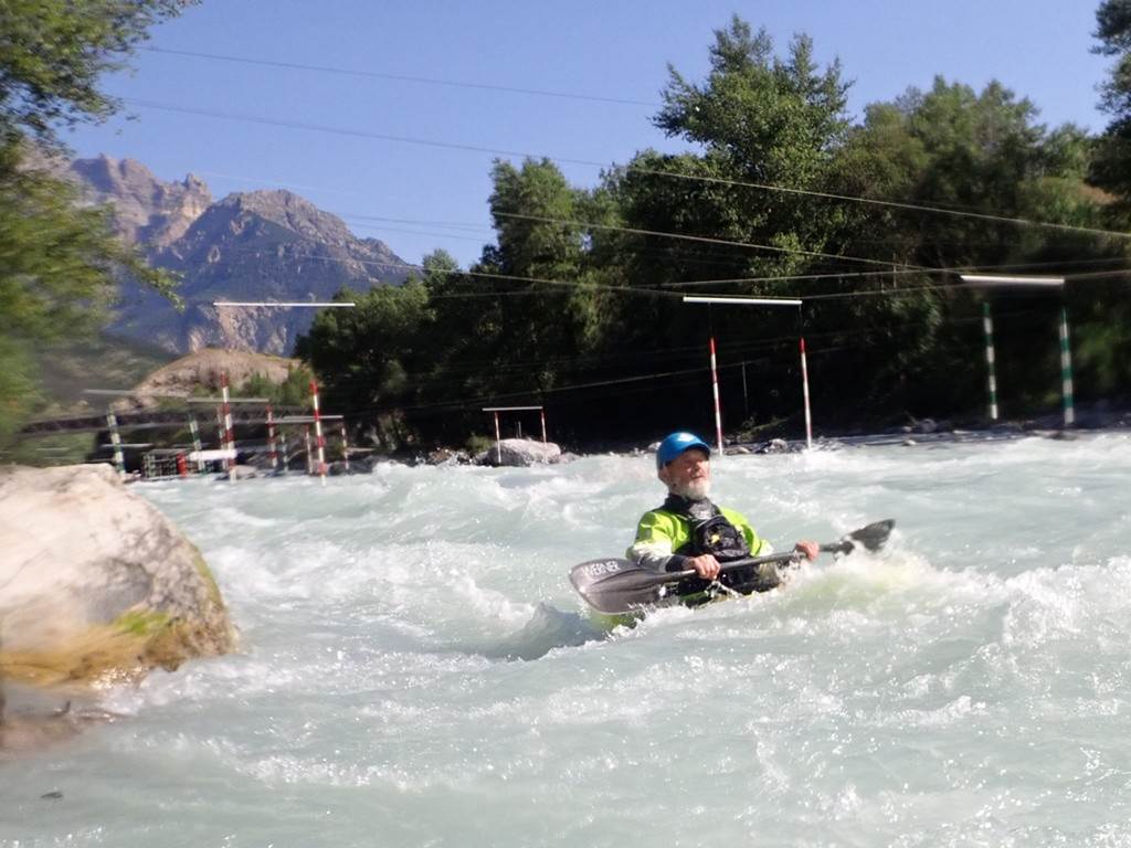
Day 11 Tuesday morning 30th
July: Lower Guil to St Clement`s by Clara Clews
The Lower Guil was still running at a good level, so we headed off to
Clara`s favourite river. We carried
down to the river under the footbridge and set off as one group. The clear water produces some excellent
waves and is set within a beautiful valley below the Mont-Dauphin fort on the
cliffs above.
Before long we joined the main river and sped past the cliff that looked
like a wave. It is white and made from
limestone.
Once at the slalom course, we performed a few practice rolls in the eddy
above and then ran down through the play waves.
Richard stayed to surf a while before paddling down to join us. This is probably the friendliest piece of
grade 3 water in the area and many paddlers come here to train, play and test
themselves before venturing out to try more committing rivers.
We fetched the cars and loaded up in the car park at the rafting centre
as we were heading up for two more rivers on the upper sections of the rivers
in the afternoon.

Click
or tap for more photos………
Day 11 Tuesday afternoon 30th
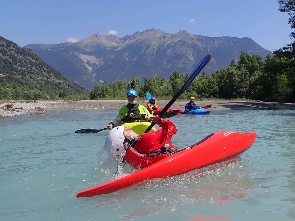
July: Upper Durance by Mark Benson
The Upper Durance offers a varied, mainly grade II run, to keep our
mixed experience group entertained all the way down. Our second visit of 2024
found the river at a slightly lower level but still with a good flow.

Putting on again from the lay-by opposite the Briançon commercial
centre, we progressed through the numerous small rapids on the way to the most
significant of the run, grade III-, a little over halfway to the Prelles Barrage.
Everyone managed to follow the river to good effect, manoeuvring around
or over the several large boulders that form this drop. From here, the approach
to Prelles begins with a natural slalom course of
mid-stream boulders and lots of eddies.
We took the opportunity for play and some useful practice, before
drifting down to the nearby get-out.
Click
or tap for more photos………
Day 11 Tuesday afternoon 30th July:
Upper Guisanne
The third river of
the day was only for those with enough energy left and a little bit of nerve to
paddle the grade 4, “S-bends” rapid, unsighted.
It had given the team a little bit of bother in the previous week. We did stop on the way up to scout it but as
it is run daily by the rafts any trees or debris are likely to be cleared by
the local guides.
We paddled the top
section as a four enjoying the bouncy waves through the town of Le Monêtier-les-Bains. As the valley opened up and gravel beds
appeared we knew we were approaching S-Bends rapid. This had been changed by
the recent floods but consisted of a 100m boulder field with an S-turn at the
bottom and then some awkward ledges and boulders before the rapids ease a
little before the bridge of Les Guibertes.
We all managed the
rapid, this was Poppy`s first grade 4 and she paddled it well. After catching our breath, we continued on
over the two tricky weirs. The afternoon
melt water was now adding to the rivers volume and we were enjoying ourselves.
The final few km's
through the picturesque towns, all competing with each other to have the most
flowers on the bridges was relaxed and fun.
We took out at the usual rafting centre in Serre Chevalier and then
headed into Briançon for an ice cream and a little shopping.
Click or tap for more photos………
Day 12 Wednesday morning 31st
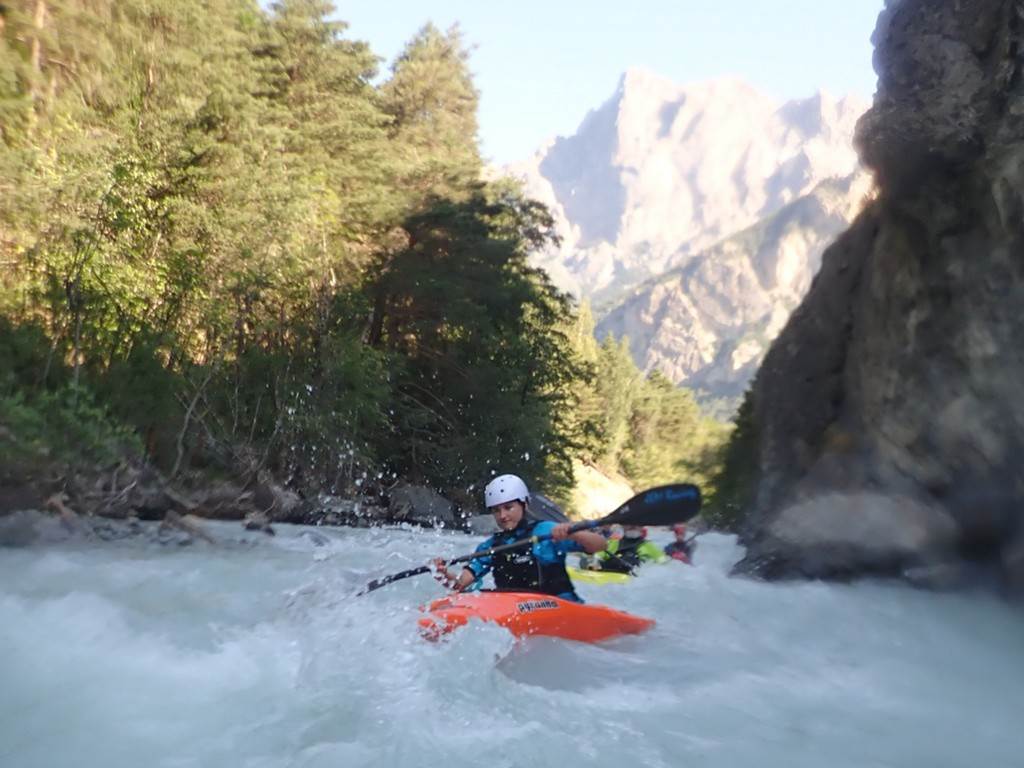
July: Château-Queyras by Cameron Fletcher
This morning, 4 of
us set out from the campsite early to run Château-Queyras,
a run around 40 minutes away from the campsite. It was a narrow run, only 2m
wide in places, which ran through the bottom of a gorge, with vertical cliffs
on both sides.
It was described
as being like 'flushed down a toilet and spat out the other side.' We started
strong, all staying upright and together before one of us went over and lost a
paddle, closely followed by a second. 1 swim later, we all got 'spat out' the
other end and concluded that the description was fairly apt.
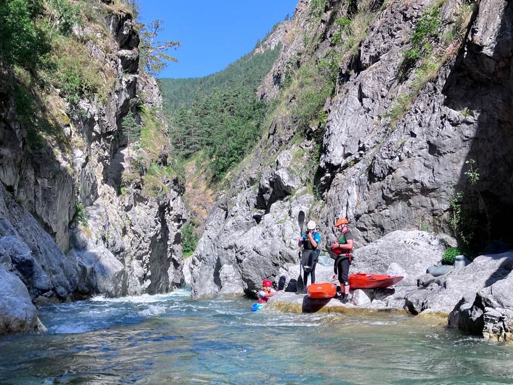
Click or tap for more photos………
Day 12 Wednesday morning 31st
July: Middle Guil by Cameron Fletcher
Soon after the
first run, the same 4 drove downstream to the middle Guil, a continuous grade 4
section, stretching over 6km and containing various drops, rocks and holes. We
had a relatively smooth run, with no major dramas on the way down, and had a
well-earned and much-needed rest at the get-out.

Click or tap for more photos………
Day 12 Wednesday morning 31st
July: Lower Guil to St Clement`s by Clara Clews
Click or tap for more photos………
Day 12 Wednesday afternoon 31st
July: Lower Durance
During the lunch break at the rafting centre, two vehicles were dropped
at the municipal raft get-out at Embrun.
Our 4th section of river today was to be a big one. 19 km of
grade 3, “big and bouncy” water.
One or two paddlers opted to go to the lake at La Roche-de-Rame and play
on the inflatable course there.
The river quickly sped the group along and the wave trains became
progressively larger. This was the third
time most of us had paddled this section so we just enjoyed the bouncy water. Once we came across Rabioux,
the grade 3+ play wave and local test piece we all took the rafting line down
the right hand side of the island. Mike
managed a wave-wheel over the main wave and those watching from the café were
suitably impressed with our paddling.
After a little while paddling in the tail, we allowed the river to sweep
us downstream. The warm air and
refreshing water enabled all to play to their heart's content. The rapids are all too numerous to mention
but we all sought out the most exciting line.
People`s paddling was now confident and it was to be the last day for
some who were heading home the next day.
We loaded up at the end and drove back for cars at the top and then went
back to the campsite around 5:50 pm.
Click
or tap for more photos………
Later that night most of us headed into Briançon to try to find a
restaurant. After looking around the
streets for only a few minutes we found the perfect place for the diverse
group, the Panorama Café that overlooks the town from the Remparts de Briançon.
(France does not normally cater well for vegans and Vegetarians.)

As the sun was setting, we indulged in the usual stroll down to the
Roman Pack Horse Bridge that spans the Briançon Gorge. A great finish to a fab
two weeks for those that were not joining us in Bourg-Saint-Maurice.
Click
or tap for more photos………
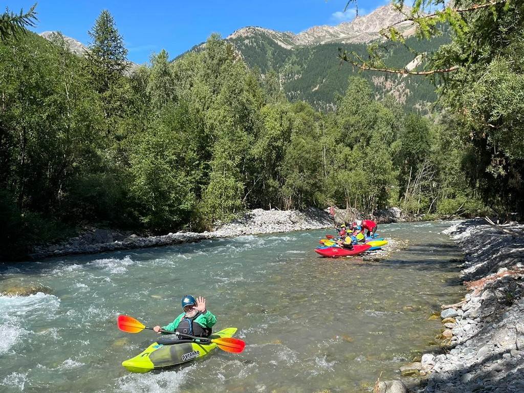
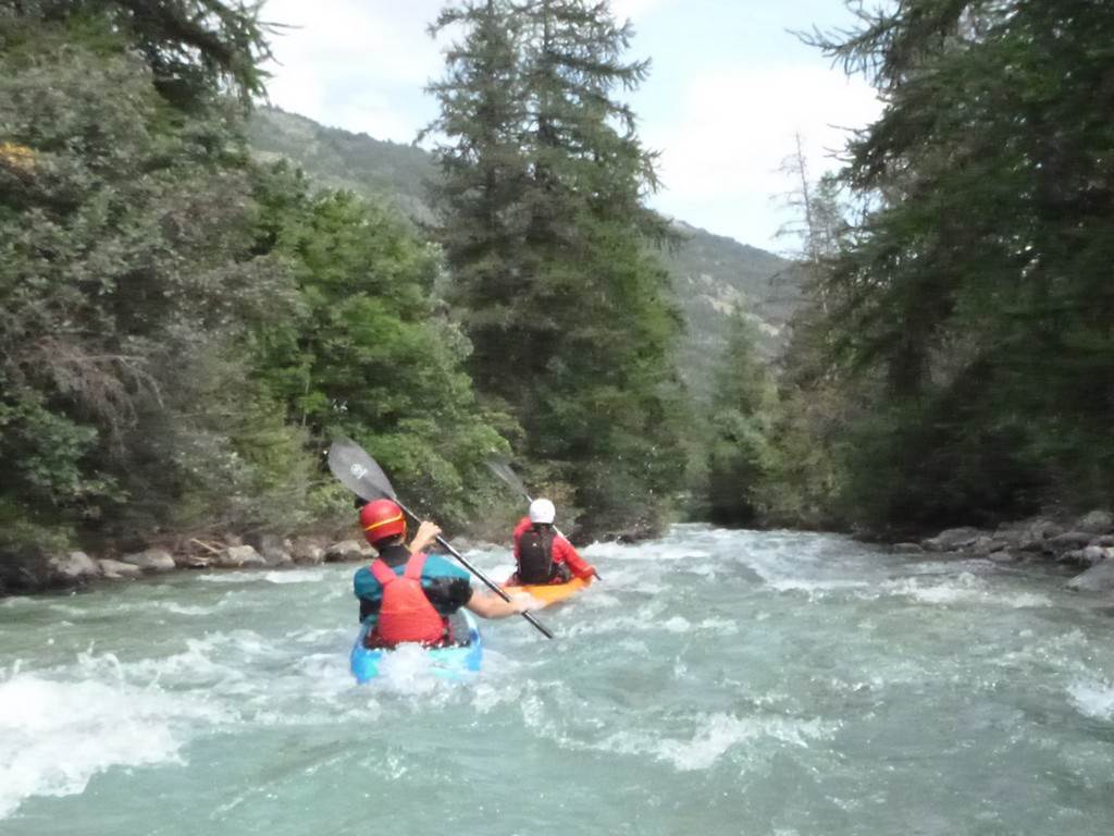
Day 13 Thursday 1st August:
The Gyronde and the campsite move to the Isere by
Nick C
Five intrepid LCC paddlers decided to have a final run of the Gyronde before we left l'Argentière
la Bessée. We had a relatively early start and there was
still a trace of mist rising off the river.
This part of the Gyronde is fairly narrow and
fast flowing so we went down as a group of five. You can tell it isn't too
tricky because Mike and Cameron were in their little boats and we all managed
to get back down to the Durance and the campsite and start to break camp.
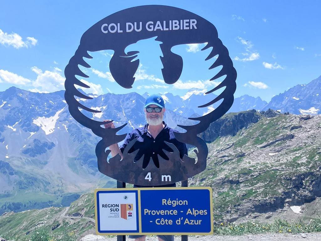
We set off for the Isere on Thursday at about mid-day. Keith and I
decided to take a scenic route which involved a couple of stops for coffee and
a trip over the Col du Galibier. If I didn't already
have a lot of respect for the cyclists in the Tour de France I do now. The Col
du G is miles of relentless climbing and lots of the graffiti from the tour was
still painted on the road. The views from the top are spectacular and lots of
cyclists were up there having photos taken in front of the sign.
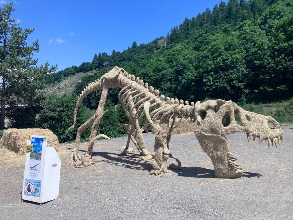
A little further on we stopped at Valloire to
look at some prize-winning straw sculptures, one of which featured little men
in Kayaks paddling under a giant neolithic fish.
We got to the Isere in the late afternoon and were pleased to find Millsey there waiting for us to arrive. We tried to book
into the campsite restaurant that night but got elbowed out and had to eat in
the pleasant local town of Bourg St Maurice.
We did manage to book into the restaurant the following night but that's
another story.............
Click
or tap for more photos………
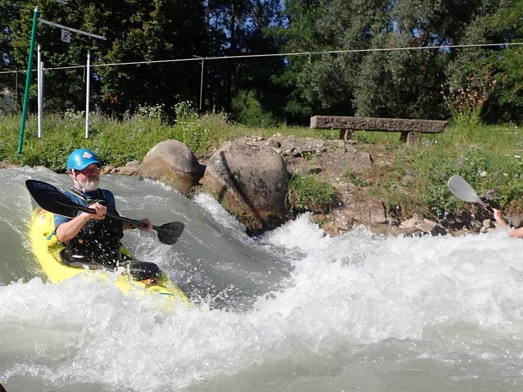
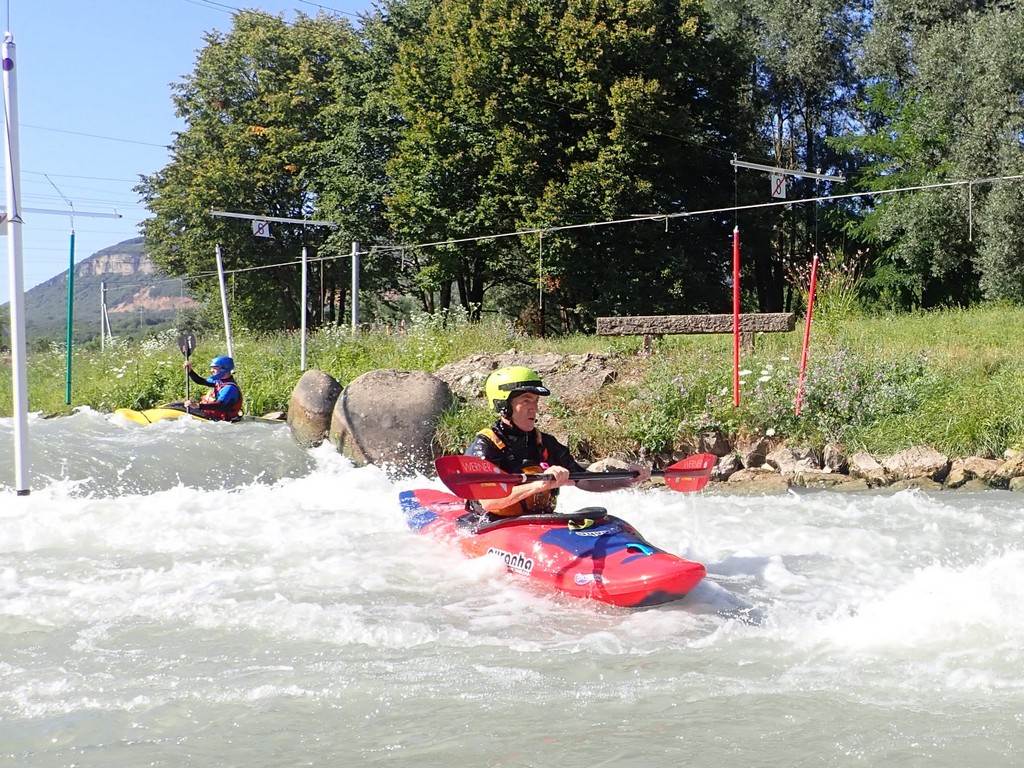
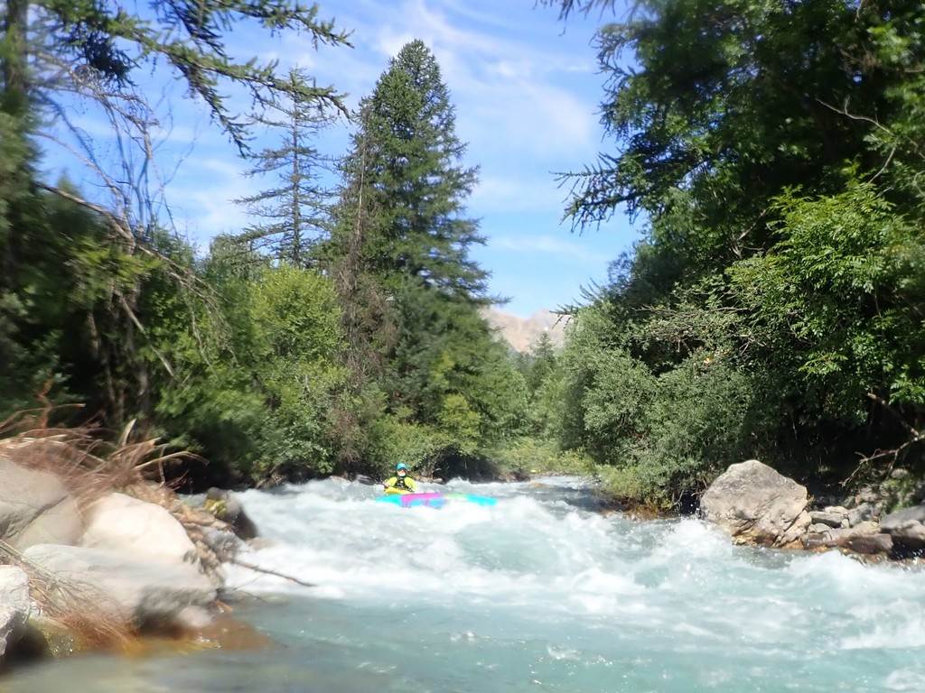
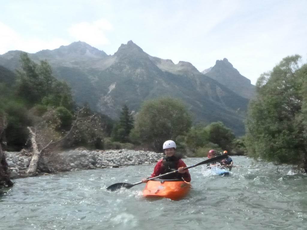
Day 14 Friday 2nd August: The
Isere by Mike Fletcher
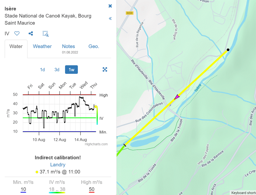
Well, there was water in the river and it was supposed to be 30 Cumecs. After shuttling the car and van to the bottom, 3 of
us put in near the barrage for a run of the top section where would meet up
with the other 3 paddlers at raft get-on at the bottom of the Isere Slalom
course.
The river is very “heavy” with large pour-overs and big boulders. We had
very little warm-up, and the course certainly got my pulse running. We
collected in serval distinct eddy`s to regroup and catch our breath. The river finally eased once we were under
the road bridge.
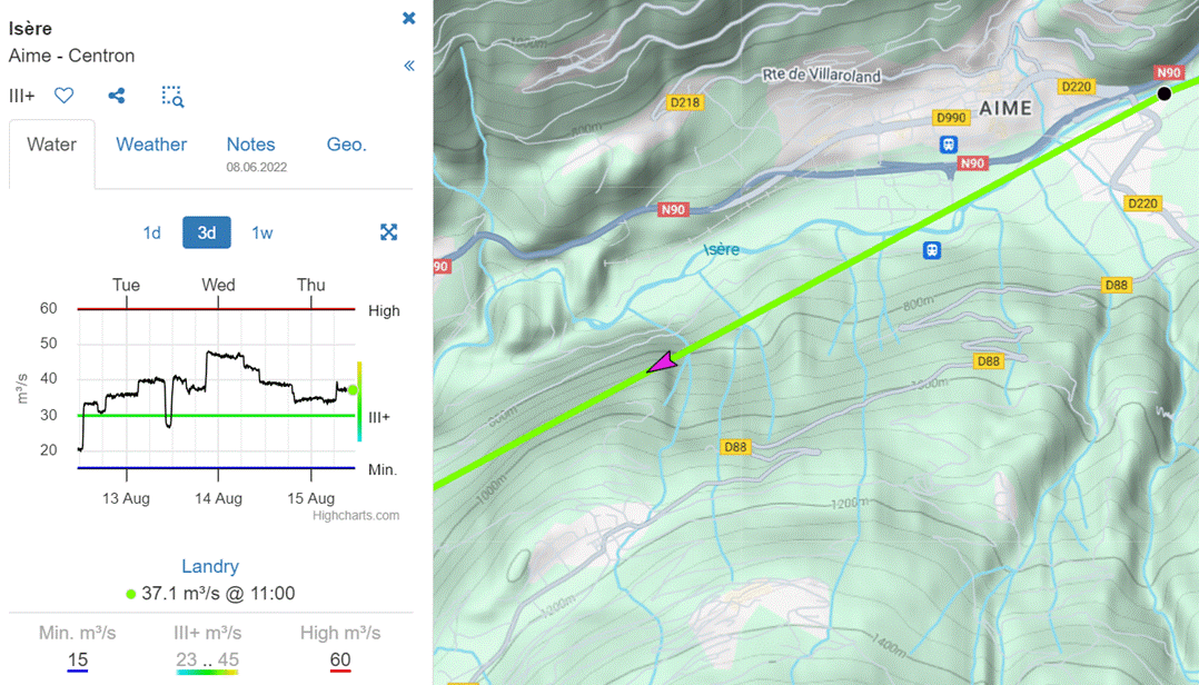
The Slalom section at 31 Cumecs
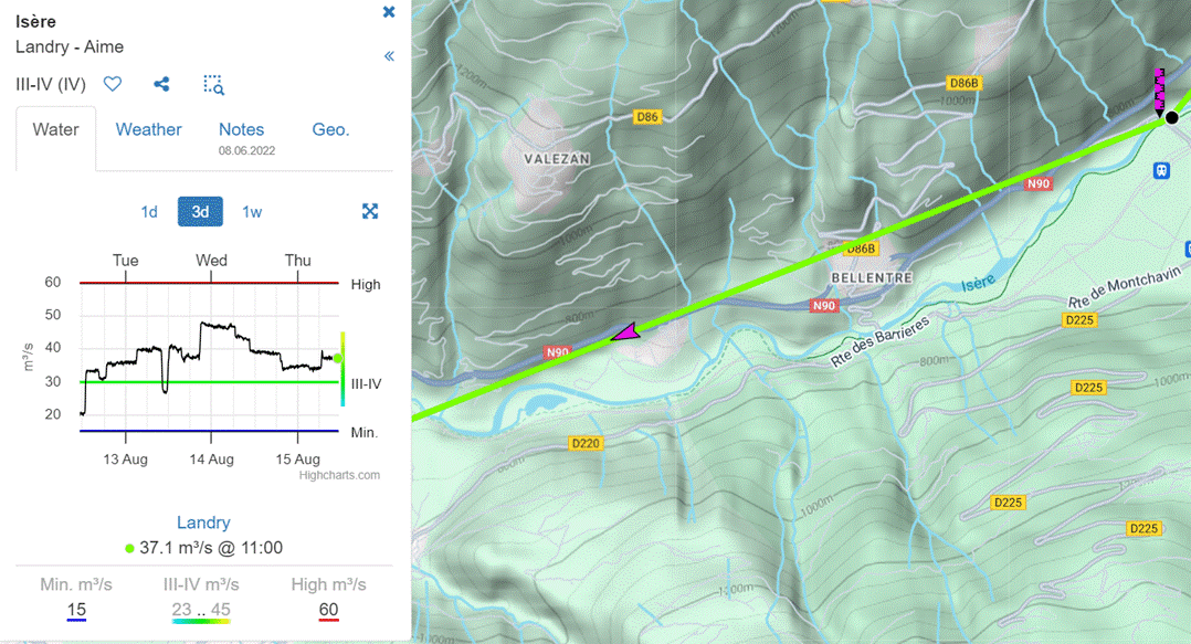
We all then headed off downstream on the section to Landry. This is grade 3- but with big water. The valleys here are wooded and mature
unlike the dryer banks and vegetation of the Ecrin Mountains, where we were the
week before. This section of the river
is very much like the lower Tryweryn but with 3 times as much volume.
There are several sections here to run at grades 2-3 with numerous
access points, Landry, Bellentre, Base de Loisirs des Versants d'Aime (with
swimming lake). From here on down the river paddles as a great grade 4,
continuous section known as the Aime Rapids. This is a fantastic section which
finishes with a fabulous, narrow gorge with all the water passing smoothly
through the narrow walls.
Below here is “a sting in the tail” according to Steve Mills. He was not wrong as several large rapids lead
down to the N90 road bridge. This
signals the rafting base at Centron which was our
get-out. We paddled it on 31 Cumecs but later in the
day, the water was reduced to 21 Cumecs (Cubic Metres
per second) which would have made it much easier. See below for river maps and flow levels.
The campsite at the white water centre and slalom course – 5 Euros a
night – electricity available. (High-quality showers and toilets) restaurant
and bar on site. Swimming lake and warm-up pool on the opposite bank.
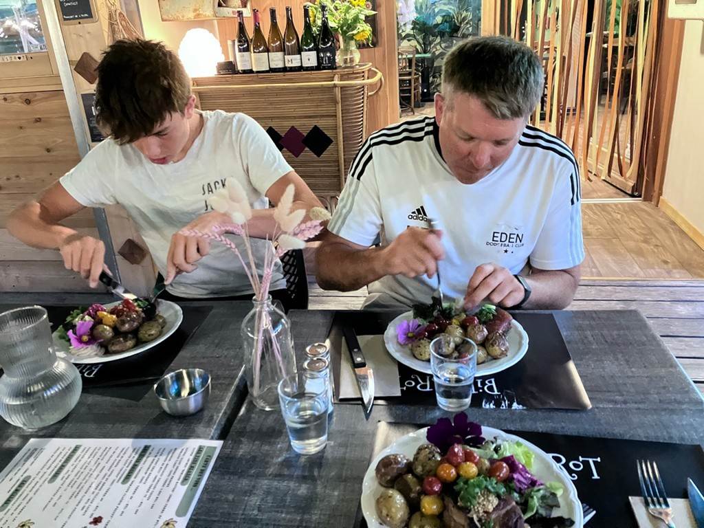
Oh, we did finally eat at the Bistro restaurant on the second night –
Mike and Cameron above opting for the belly pork rather than the lasagne (cold
with edible flowers).
Click
or tap for more photos………
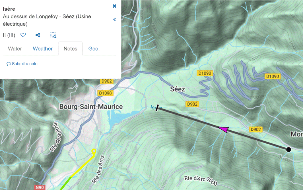
There are lots of river sections in which to paddle.
Isère Au
dessus de Longefoy - Séez
(Usine électrique) Grade 2
(3)
Isère Stade
National de Canoë Kayak, Bourg Saint Maurice
Grade 4+
Isère Bourg-St.Maurice – Landry grade 2-3

Isère Landry
– Aime Grade 3-4 (4)
Isère Aime
– Centron Grade 3+
Day 15 Friday 3rd August: The Journey
Home
Many of us had wandered home at various
stages. Some chose to explore little
villages staying overnight at hotels and hostels to break up the journey. Others drove home overnight, sharing the
driving and grabbing sleep where they could.
The French motorway laybys allow overnight stays and have facilities,
unlike UK service stations that often only allow breaks of 2 hours!
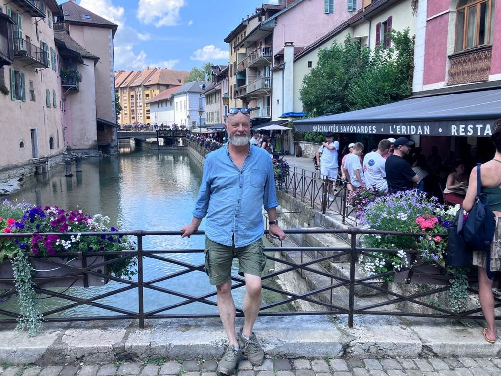
Nick and I went
via Annecy, a beautiful French town with a great lake with accessible lake
shores with fabulous views of the mountains all around. We then headed for our overnight train and
were back in Widnes before breakfast.
Click or tap for more photos of the trip home………
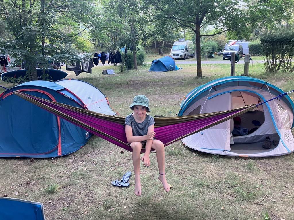
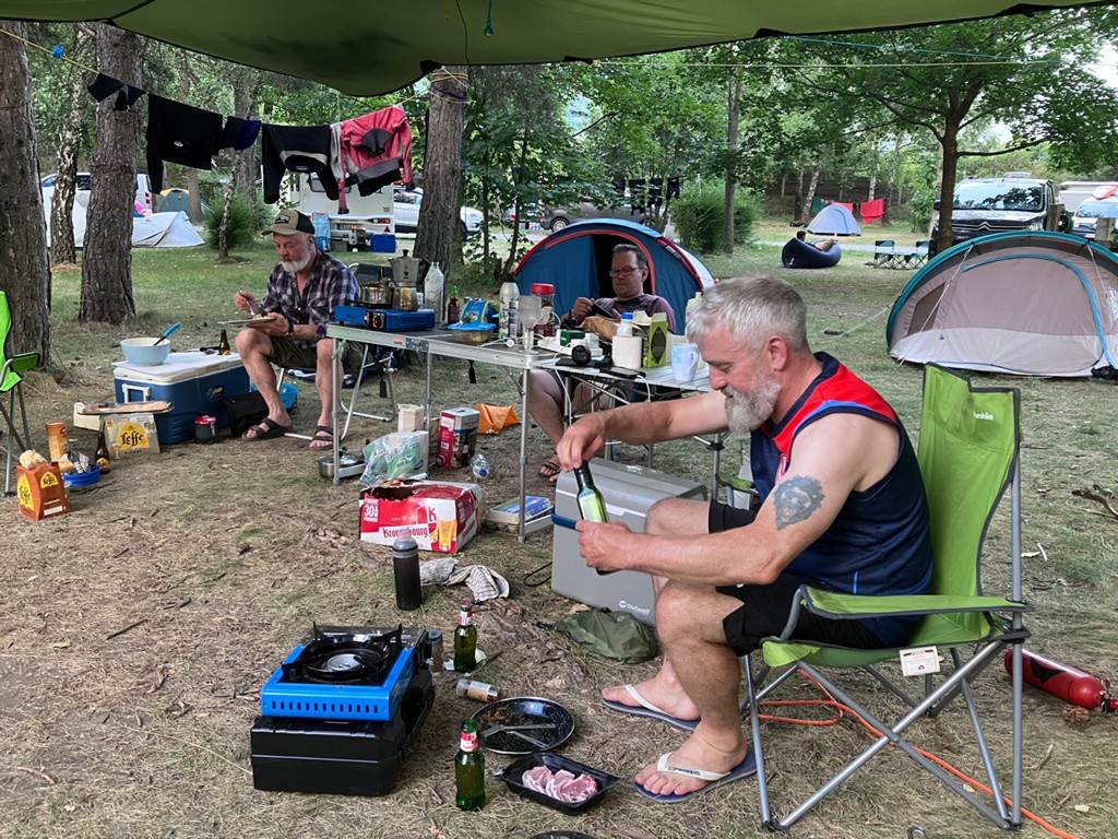
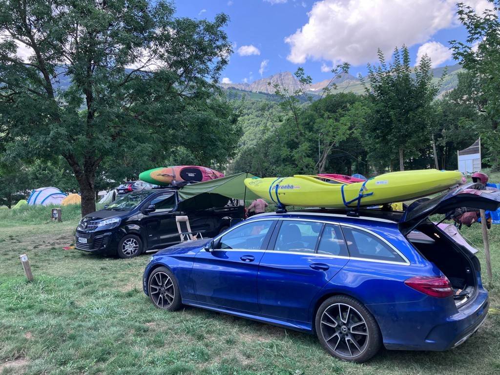
General photos of trip and campsites……
We intend to return in 2025 with two weeks.
Week 1 based in l'Argentière la Bessée (Saturday 19th to 26th July)
and then the second week will probably be based at the campsite in Bourg St
Maurice (Saturday 26th July to 2nd August). Full details will be circulated in January
2025.
Click or tap here
to read the full trip report from this years trip……