|
|
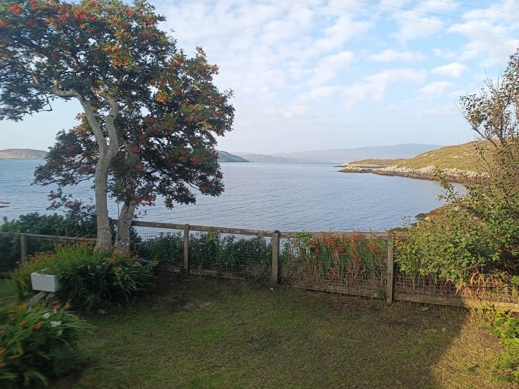
2024 Outer Hebrides -
Fuzzy Water |
|
|
News items or reports
on club activities should be sent to website@liverpoolcanoeclub.co.uk |
||

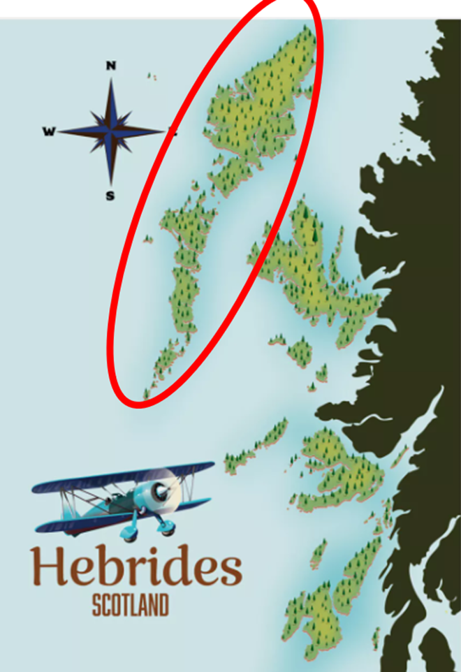
The 2024
plan was to travel to the Outer Hebrides and remain flexible with either
shorter trips or extended camping trips.
These would all be dependent on the prevailing weather forecast. This approach had proved very useful during
the previous year's trip to the West Coast of Ireland and would enable us to
Island hop from South to North.
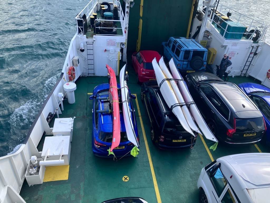
10 club
members signed up for the trip in February and the transport was sorted (4
cars) and then the ferries were booked.
We opted to go from Oban to Castle
Bay ferry paddle a bit on Barra and then journey north taking the Ardmhor Barra
to Eriskay ferry. We then intended
to spend the rest of the week on South Uist and Benbecula before taking the Berneray
to Leverburgh. The second week would
be spent exploring Harris and Lewis before taking the Tarbet to Uig
ferry back to Skye and journey home from there. We were glad we had the ferries booked as the
mainland ferries were all fully booked.
We were able to change the times and dates of the inter-island ones by
travelling very early in the morning.
Day 01 Friday 16th Aug Travel to Oban “Team Mercedes head North”
Part one of
day one of the Outer Hebrides trip for me was a drive up to Formby from the
Chilterns to join team Mercedes for the drive to Oban to rendezvous with the
rest of the group to catch the ferry to Barra.
Arriving
just past midday the boats and gear were soon loaded and after an amazing
omelette for lunch made by our leader, Team Mercedes (Keith, Frankie and
Debbie) set off. The M6 presented the first challenge but local knowledge and a
diversionary route through Preston dealt with that. The further north we
travelled the more glorious the scenery became and after a couple of stops
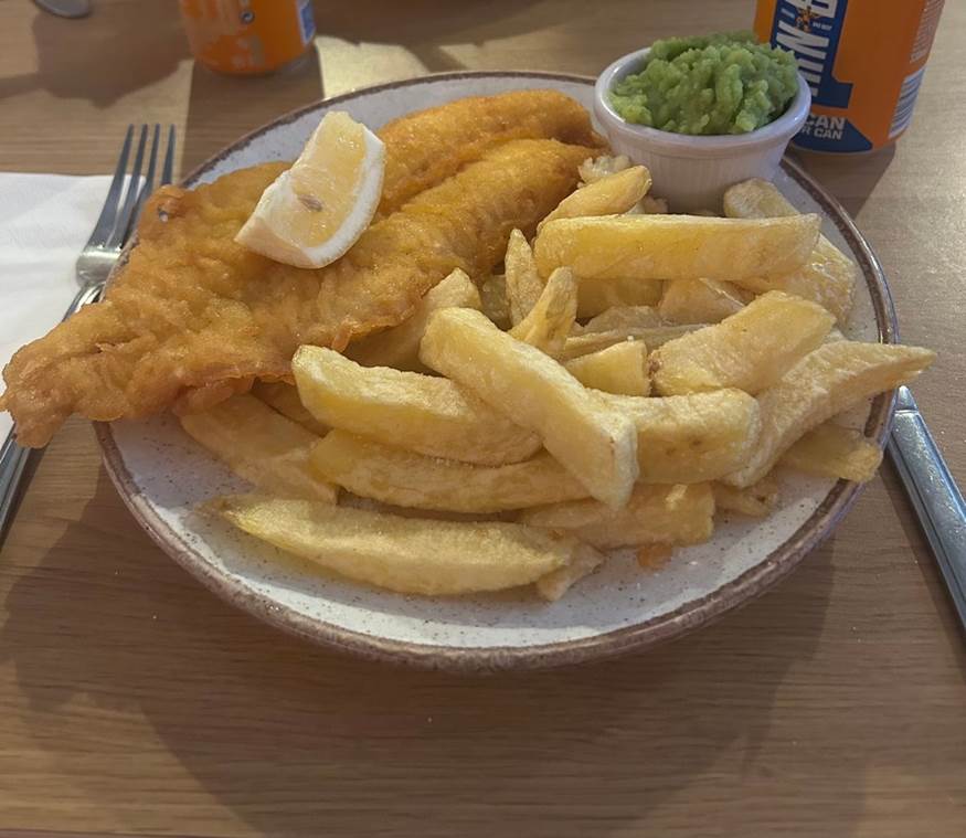
along the way, we hit Glasgow around teatime so obviously the thing to do was
stop for fish and chips at Simeones. Fish, chips and mushy peas (no gravy or
curry sauce for me thank you very much) and a can of Irn Bru. The holiday had
definitely started.
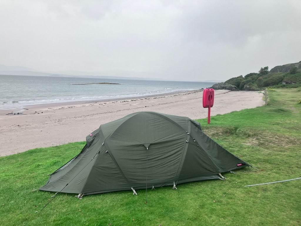
Fully fuelled
for the final leg of the drive we eventually got to our wild camping spot about
10.45 pm just as the rain started and the wind picked up. Tents were quickly
erected and crawled into for our first night's wild camp of the trip.
Click
or tap for more photos of the trip…..
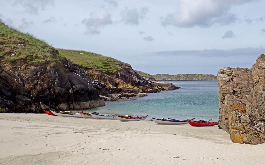
Day 02 Saturday 17th Aug Ferry to
Barra and “@croft183”
The forecast
was not looking promising for the sunny golden sands of the west coast but at
least the ferries were not cancelled.
We all met up in Oban and stocked up in Tesco`s and discussed the plans
in the cafe. The ferry was full and we
were very glad that we had booked, as many others were all scrabbling for any
standby places. It was great to head
out through the Sound of Mull and we reminisced about the 2022
Scotland trip around Mull and tried to spot the 5 star beaches and key
places along the way.
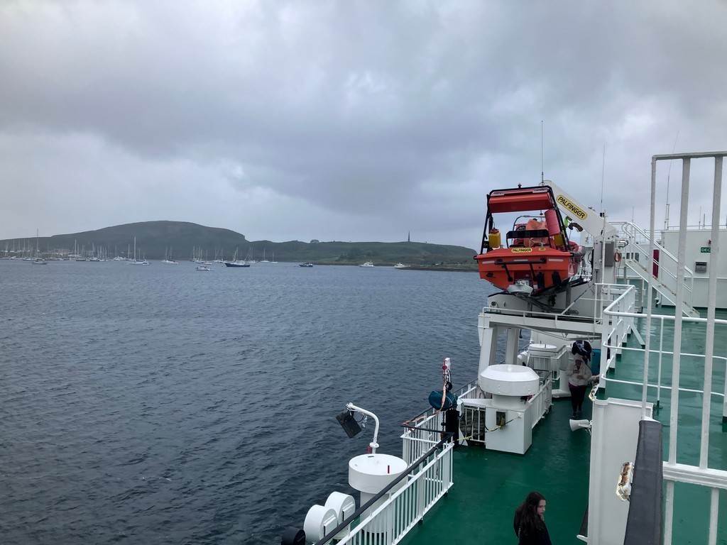
After 4 or
so hours we drew into Castlebay and were soon unloaded and driving on the “A”
roads on the island (these were single-track roads with regular passing
places). The plan was to drive onto
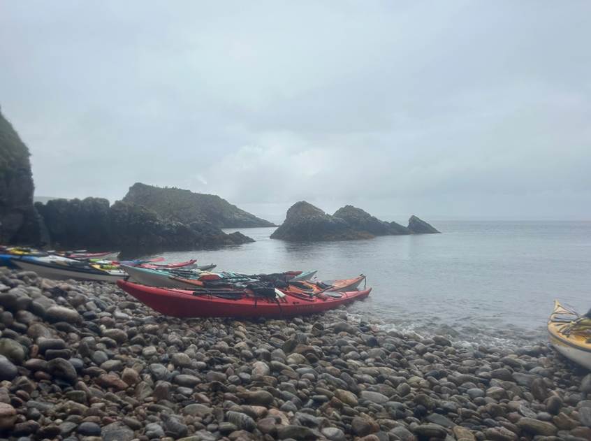
Vatersay and check out the camping opportunities and beaches. While there was camping on the peninsular,
the forecast was for strong winds and being a large group of 10 with 9 tents to
pitch other options were sought.
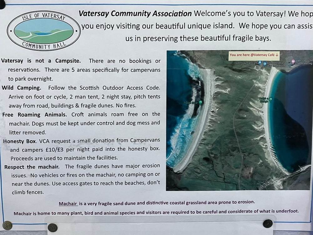
We checked
out the campsite options and after a quick phone call we opted for a sheltered
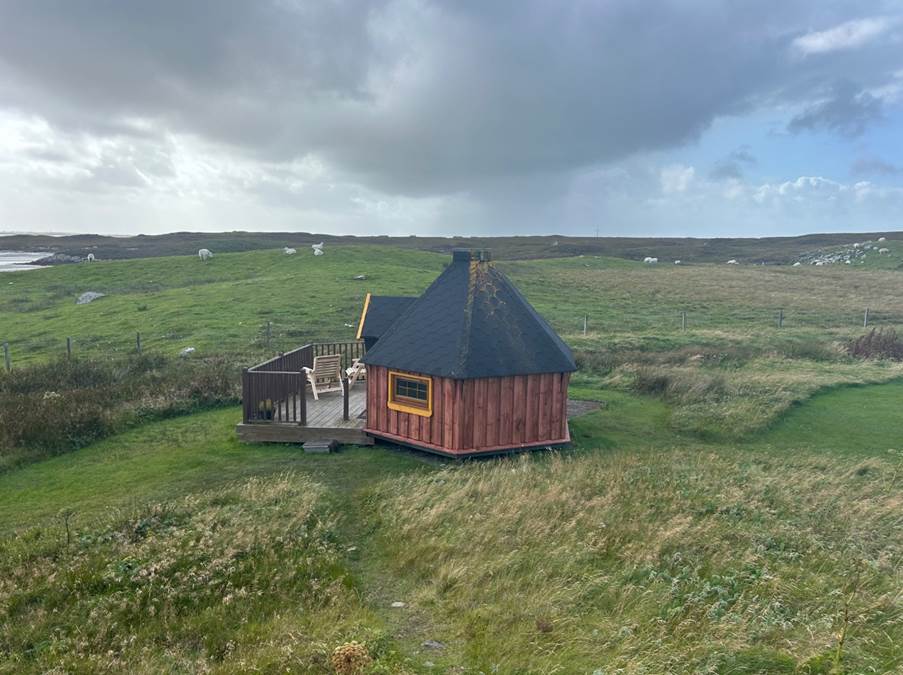
site on the East of Barra, Barra Holidays @croft183. This proved ideal and had the use of two
kitchens and well-appointed showers and facilities.
It was now 6
pm but we wanted to take a walk along the beaches on either side of the
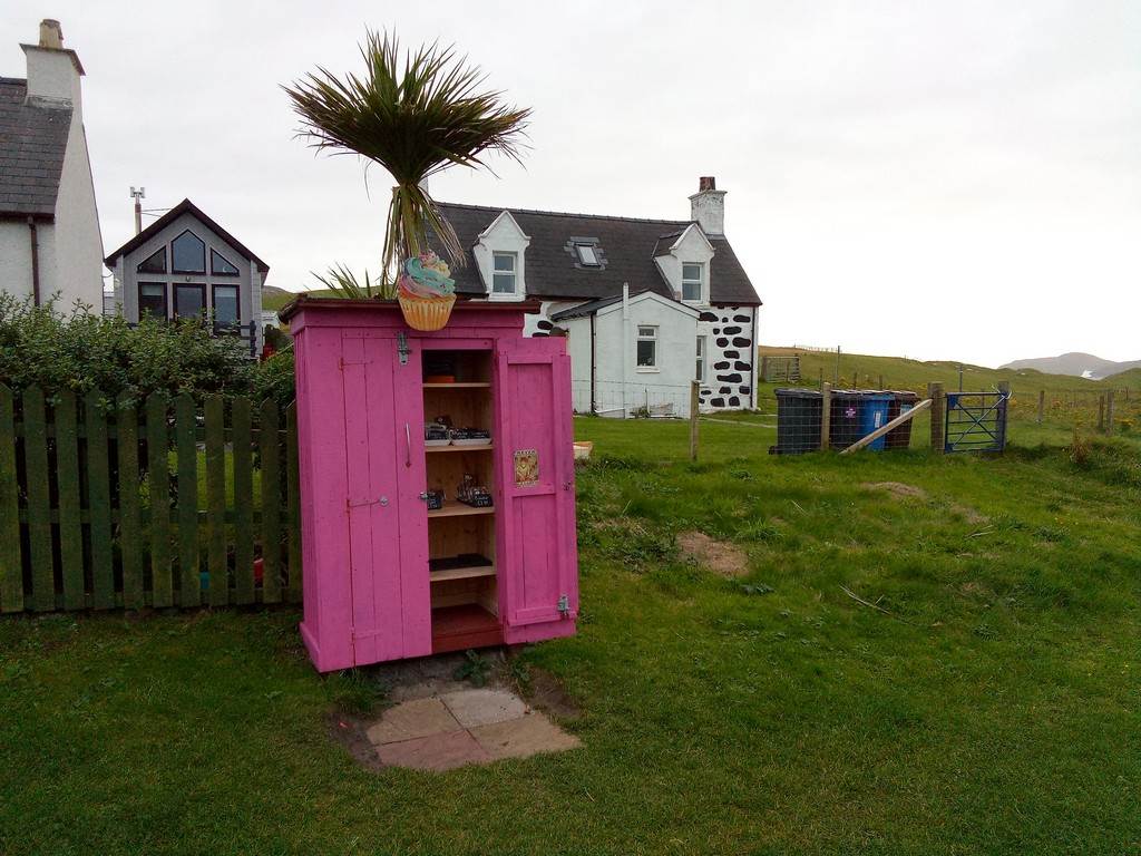
peninsular and visit the only shop on Vatersay, “Piece of Cake Honesty
Box”. The small hamlet reminded me of
the post-war prefabs and a definite step back in time to the 1960`s.
After
observing the impressive surf on the West Coast we returned to the cars and
drove the short distance to our home for the next few nights at @croft183.
Click
or tap for more photos of the trip…..
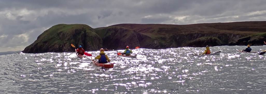
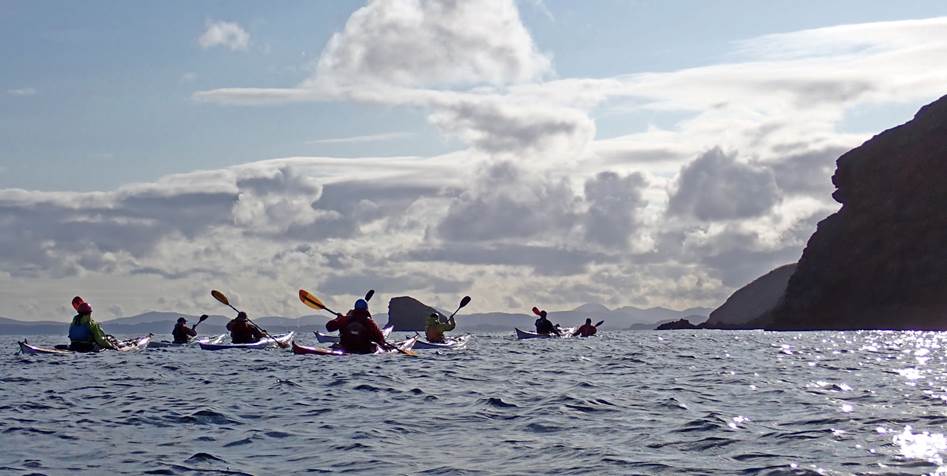
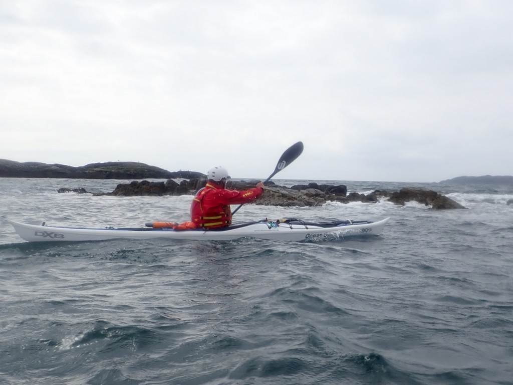
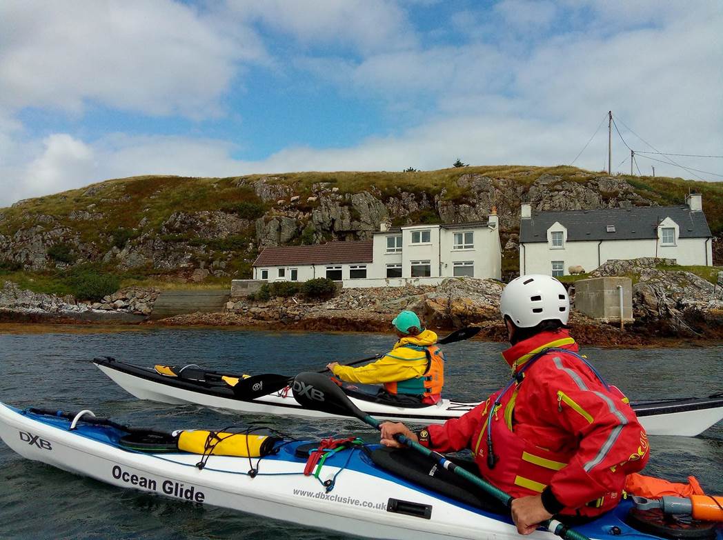
Day 03 Sunday 18th Aug - North Bay by Andrew Bond - An Introduction to the Wind
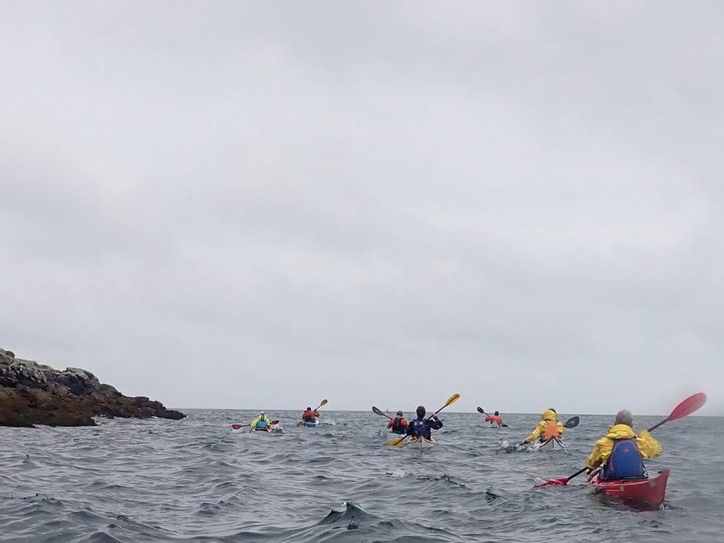
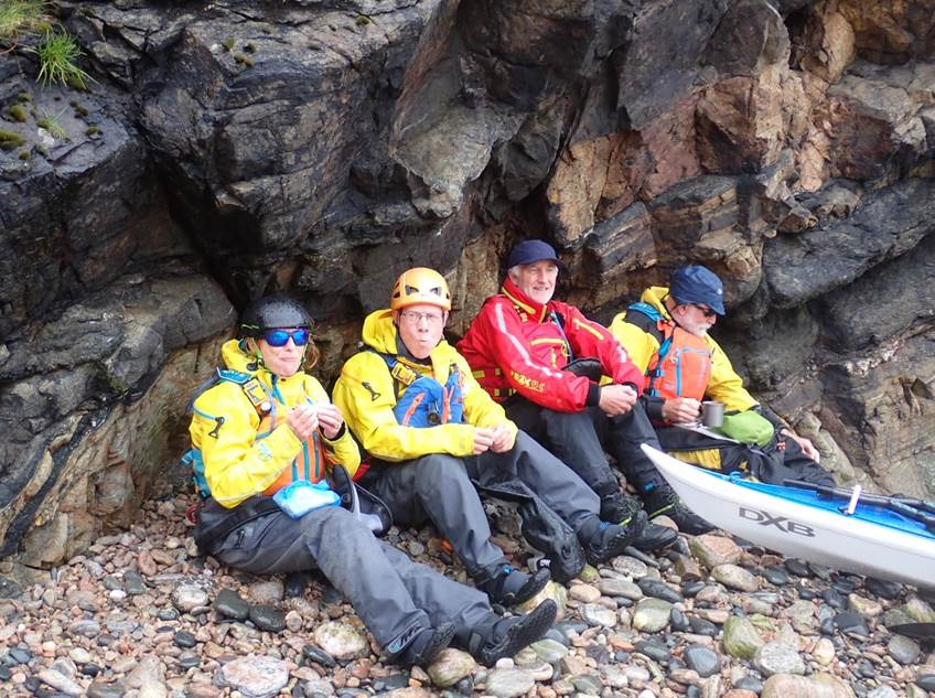
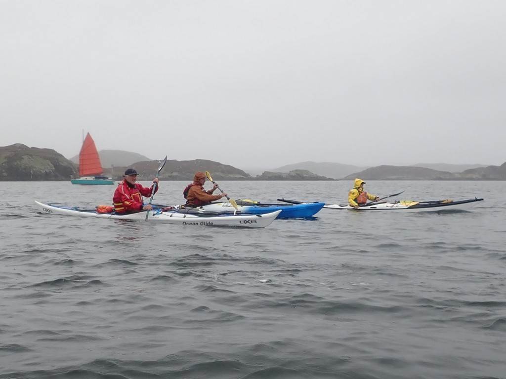
Paddlers:
Dave, Chris, Frankie, Catriona, Debbie, Keith, Alistair, Gary, Christine and
Andy
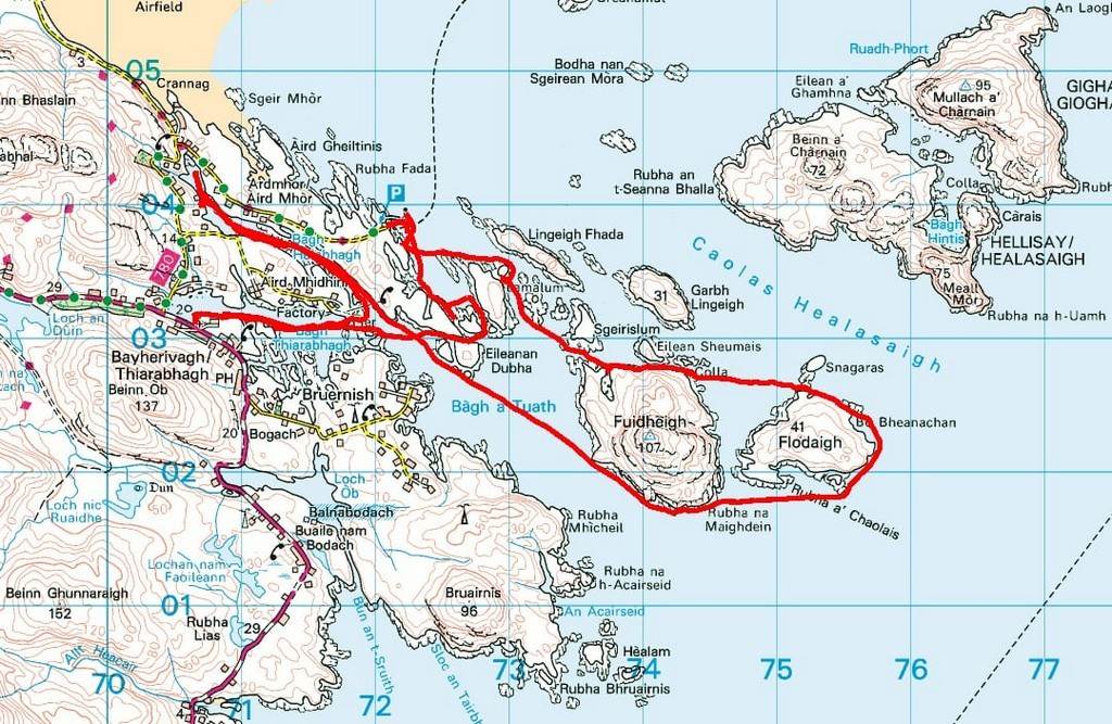
Eschewing
the comforts of our campsite at Balnabodach on the east coast of Barra, we
headed en masse to North Bay to explore some of the coastline and islands on
the northeast side of the island. This meant we would, in theory, escape the
worst of the strong prevailing westerly winds and have a relatively sheltered
trip. The launch spot was a convenient slipway, close to the local church. It
was Sunday morning and arriving churchgoers looked on with interest as we
prepared to set off.
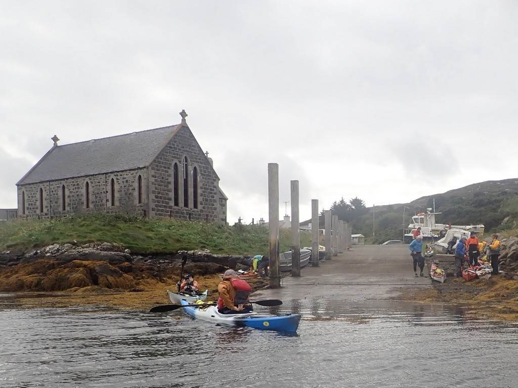
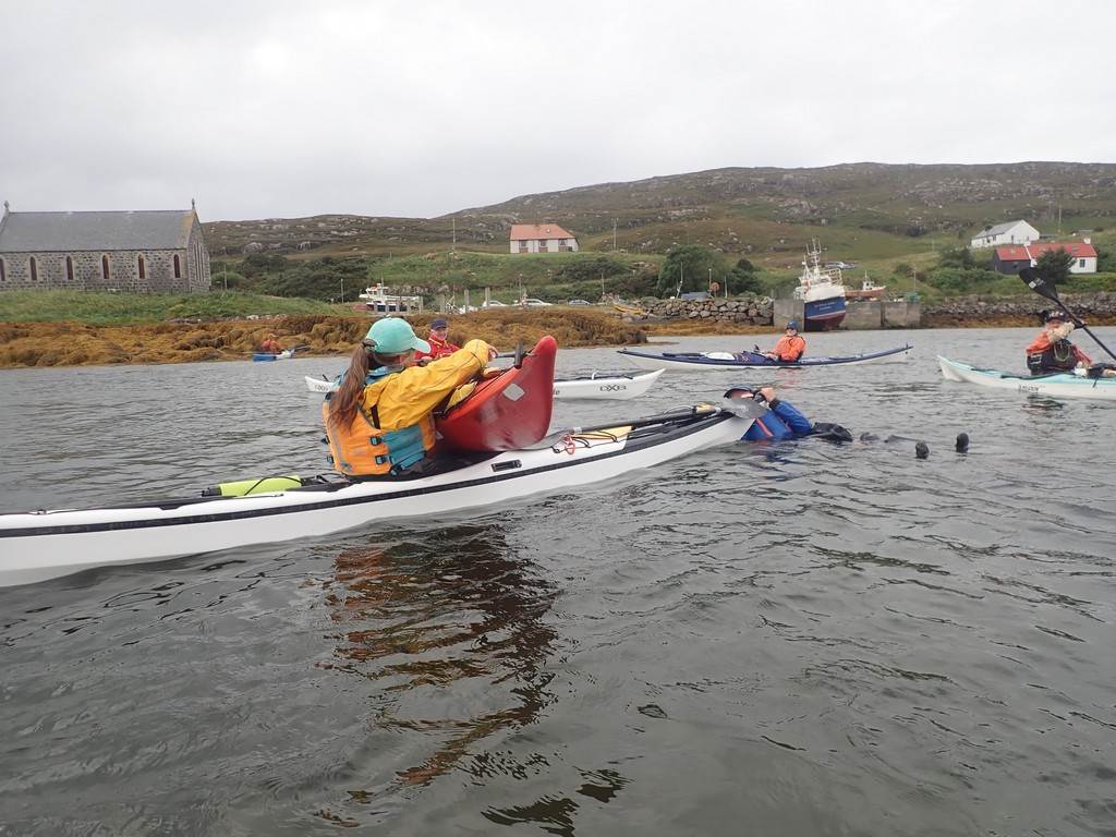
On launching
I decided, unwisely, to go through one or two warm-up exercises. A gust of wind
caught my paddle blade and the next minute I was floundering in the water, to
the complete bemusement of onlookers. Momentarily. I was unable to compute what
had happened, but Christine quickly restored order and had me efficiently back
in my kayak. Having established my paddling credentials, we could set off.
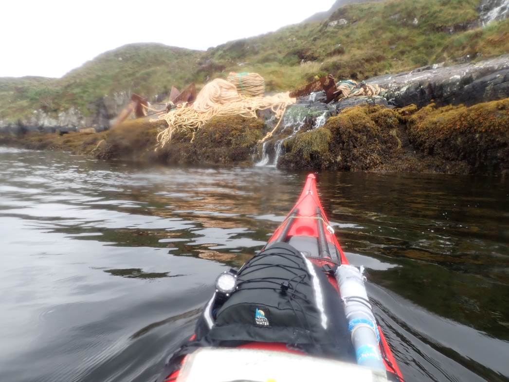
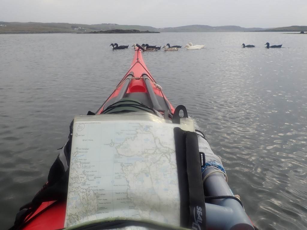
We headed
east out of North Bay passing some of the accumulated debris and infrastructure
of the local fishing industry. The kind of fishing fleet which had flourished
here and elsewhere in the Hebrides consisted predominantly of small
family-owned boats. Fishery resources were subjected to escalating pressure in
the 20th century from east coast vessels and European fishing fleets so that by
1980 the coastal waters had little left but shellfish. Sadly, the decline in
West Coast communities is largely due to the depleted fishing resources, which
impacts local income and employment. Farming of salmon on an industrial scale
does, however, appear to be flourishing.
Turning back
to the northwest we explored nearby Bagh Thuileabhagh which allowed us an
elevenses break, a memorable landing in thick mud (and for me, the opportunity
for dry clothes) before we set off again. The route Chris had proposed took us
eastwards around the small islands of Fuidleigh and Flodaigh and gave us the
first taste of a following sea, which some found a bit unnerving. We rounded
the more exposed headland of Fuidleigh and encountered a stretch of bouncy
water, then took a direct line due east before rounding Flodaigh and entering
more sheltered waters.
We then
threaded our way through a group of small islands back towards Barra mainland
into an increasing headwind, sheltering briefly on the sheltered east side of
Lamalum, and decided that the ferry slipway at Ardmhor would offer the best
lunch spot. We had a pleasant sheltered lunch in the sun, admiring at close
quarters one of the inter-island ferries which had arrived at the same time.
After lunch we threaded our way through a couple of small islands back into
North Bay. All that then remained was a determined paddle into a strong
headwind, back to our launch spot and the cars.
Our
'introductory' paddle had given us a taster of what the Hebrides has to offer.
Stunning scenery with enchanting islands, mountain backdrops and ever-changing
vistas. We had also been exposed to the elements on this first trip but enjoyed
interesting and sometimes challenging paddling conditions.
Andy Bond
Click
or tap for more photos of the trip…..
Day 04 Monday 19th Aug
- Loch Baghasdail and Castle by Frankie Annan
Day 4 began
earlier for some than others. The ferry ride from Barra over to Eriskay was a short
hop over water that maybe in different weather conditions we would have
explored in our boats. On arrival Team Mercedes did a bit of early sightseeing
and went to visit the beaches where the cargo of malt whisky from SS Politician
was washed ashore, inspiring the film Whisky Galore. It was way too early being
only 8 am to actually visit the Politician but we managed a short walk alas no
whisky to be found.
Having done
our sightseeing we set off to drive to the campsite we were planning on basing
ourselves at/find the rest of the group/go and look at options for paddling if
the weather improved. A WhatsApp message from Gary’s car directed us to a hotel
where the early birds had stopped for breakfast. It would have been rude not to
join in, though by the time we arrived, breakfast options were somewhat
limited. Egg, bacon and beans it was then. For the ladies, the highlight of the
hotel was without doubt the silver glittery toilets in the ladies. A more
out-of-character set of facilities it would have been hard to imagine.
There
followed a lively discussion about going paddling or not, eventually it was
decided to head to the campsite and get sorted in the most sheltered spot we
could find for the approaching storm/ tail end of hurricane Ernesto before
going for a late afternoon bimble on the water (maybe). One of the definite
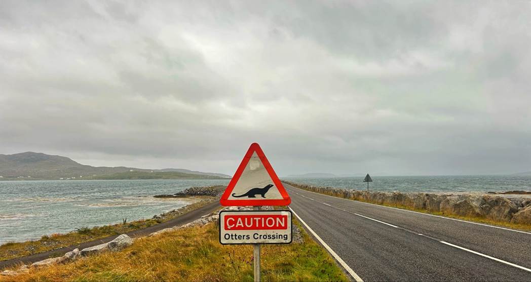
highlights of the drive across the Islands (Eriskay, South Uist, Benbecula and
North Uist) was all the otter crossing warning signs. No otters were spotted
crossing - how good would that have been!
The Moorcroft
campsite was a wonderful find. Ian and Catriona the owners were so lovely and
welcoming and the facilities were some of the best, if not the best I have ever
enjoyed whilst camping. So tents up, and having mostly taken over the campers
kitchen, along with our new friend Dag, (a young Frenchman who had set out from
his home in southern France to see how far north he could cycle before it was
time for him to travel home in the autumn).
Keith started work on persuading us we really
should get out on the water whenever there was a weather window. He promised it
would be sheltered and it wouldn’t rain. So muttering and moaning we dragged
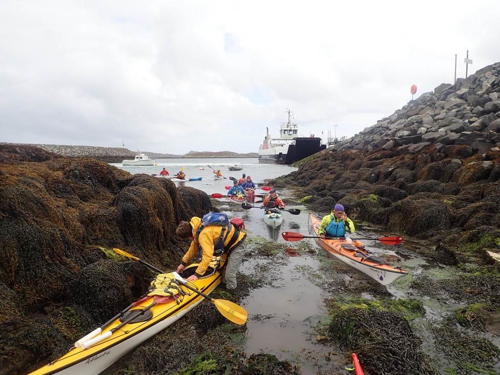
ourselves out and met up on the designated slipway to paddle in Loch
Baghasdail. I have to be honest and say I can’t recall too much, I was in my
boat, I paddled, I definitely looked for rocks to hop or garden and swell
bouncing off corners to play in. I can’t say if I found it. We saw the remains
of the castle, and even stopped for afternoon elevenses - this is LCC and it is
in the rules that you have elevenses on the water.
I think
there was a debate about whether the elevenses spot was a overnight camp option
and how midgy it might be (there are some good things about lots of wind -
midges what midges). We then headed back to the start point around an island,
was there any fuzzy water - I don’t think so but there could have been.
Back at the
slipway boats were sorted and back to the campsite to sit out the weather in
the very well provisioned campers kitchen keeping an eye on the weather
forecast and hoping for another weather window to appear before heading for the
tents.
Click
or tap for more photographs……….
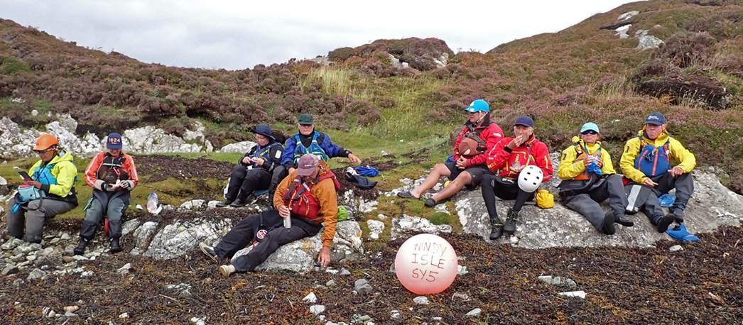
Day 05 Tuesday 20th
Aug - Stormbound
Following a morning rendezvous in the
kitchen, the word was that there was a plan to look for a paddle later. It was
windy but not wet so some of us set off for a walk from the campsite to seek
out some of the stone circles marked on the map. Catriona, Frankie, Debbie and
Keith set off on the walk. 3 of us dressed in waterproofs and walking
boots/shoes/wellies and one of us in shorts and Crocs. Only 3 of us actually
went further than the start of the footpath across the road from the campsite.
Mindful of the need to be back, to
potentially go paddling at 3.30pm, we headed off along the marked footpath
towards Locheport and the stone circles. There were some rather boggy parts of
this section of the West Highland Way. There may have been some welly envy from
some corners. As we walked past small bodies of water with white caps on the
wind waves there was doubt and scepticism about any of us getting in our boats
later. The sun was mostly shining and after a few discussions about our pace,
were we really going that slowly or had we set out later than we thought? It
turned out to be the latter, we made it to the first burial mounds and a view
of the Loch that unbeknownst to us at that point we would have lots of fun on
fuzzy water a few days later.
After exploring the burial mounds and
pondering over the map we decided not to carry onto to the stone circle as we
were not sure we would be back in time to not go paddling. Retracing our steps
we came across first Gary and then Chris, who both had set out on the walk,
although they had taken slightly different routes to both each other and us.
The wind picked up and the rain began just as we made it back to base for lunch
and a discussion about the paddling or not.
“So the plan is to
look at a paddle late today say leave here at 3.30 pm and look at getting in
here: https://maps.app.goo.gl/XjedefYP8xHvzxqQ7?g_st=com.google.maps.preview.copy”
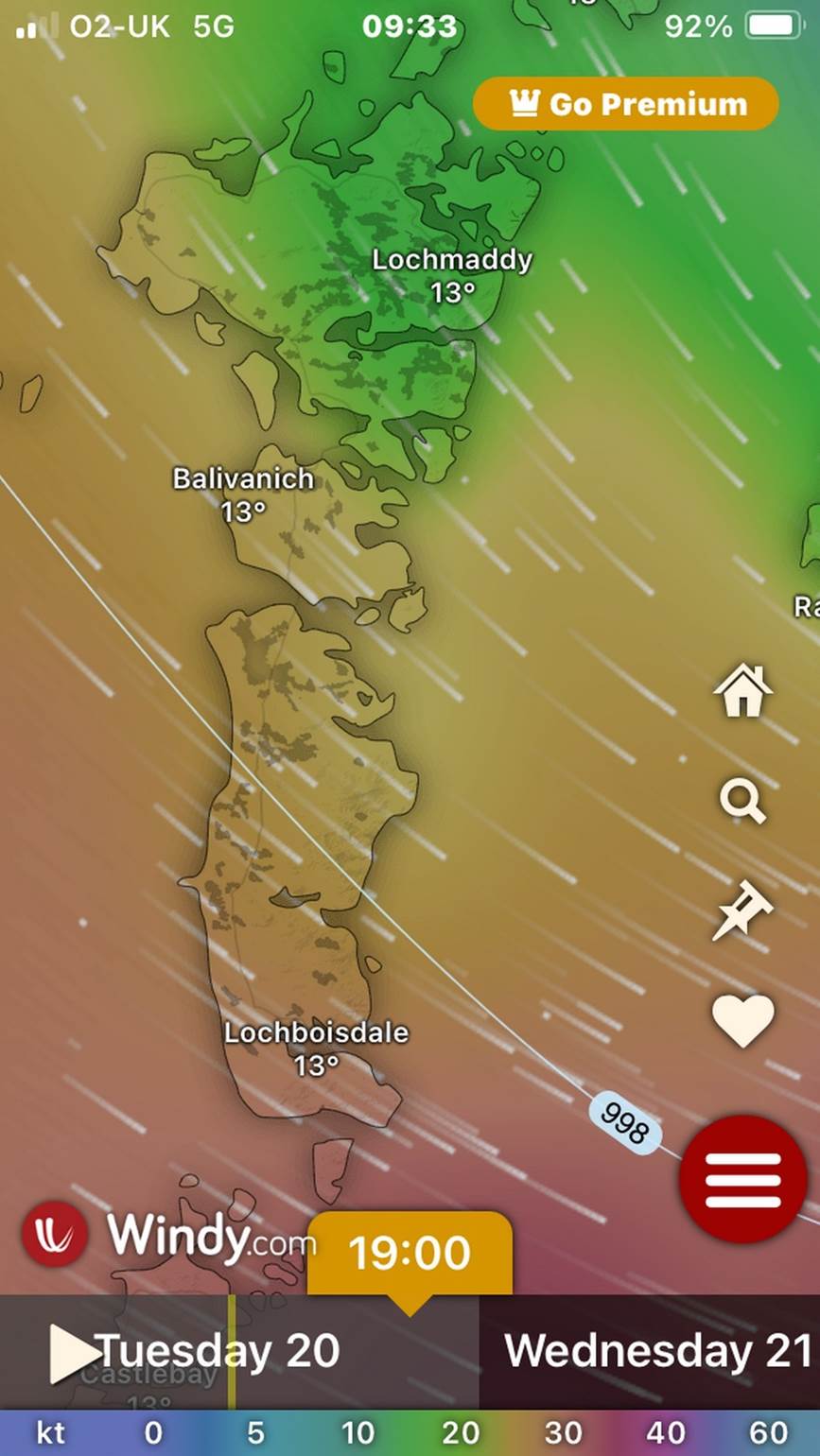
In the end, we decided paddling was
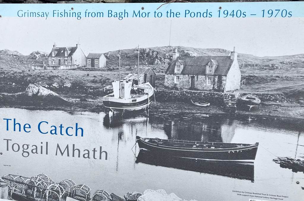
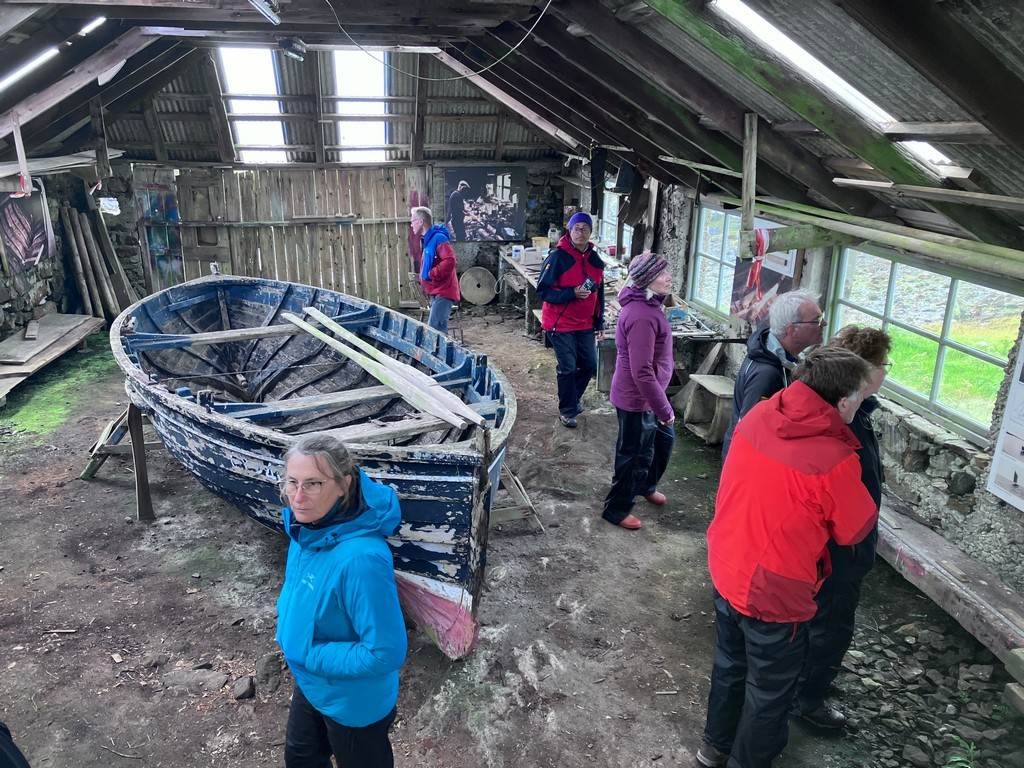
off and we left a car or two and went for a drive to look at the Harbour at
Grimsay and the boat museum. It proved to be very sheltered and if we all had
boats, we may have got on the water for a quick paddle for an hour or two
before dark.
However, we enjoyed the two museums
and found a possible good get-in for a paddle when the storm finally passed
through. The restaurant at the Harbour was just shutting as we arrived and
Debbie was more than a little disappointed, as she had visited there a few
years before.
Click or tap here for more photos……
Day 06 Wednesday 21st Aug - Day 05 Tuesday - Stormbound still!
It was all
going so well, we hunkered down in the storm-force winds, when a shout for help
from Dave followed a tent pole snapping. With all several pairs of hands
helping out the tent was dropped and further damage avoided, and Dave prepared
to spend the night in his van.
Then snap
went one of the poles in my tent and after managing to collapse it to avoid
further damage. A quick call was made to
Iain (campsite owner) to see if there was any space in the bunkhouse. It was full but were offered one of the
camping huts as it was free. It was a no-brainer.
By now it
was wet, windy and miserable - so after a few trips to what we christened the
“hobbit hut”. Dave and I moved in for 2
nights of storm-bound comfort. A heater, fairy lights, a microwave and a
kettle. What is not to love about that? There was a moment or two of worry
about our comrades when the wind actually shook the hut but that soon passed
with a glass of whisky.
We had been
watching the weather for several days and overnight the tail end of hurricane
Ernesto swept past the islands. Most of
the camper vans and tents had moved on from the campsite to find more sheltered
positions leaving us hunkering down behind the bunkhouse. We had a drying room and bothy-style
kitchen.
It was a day
of stories, quiet reading and waiting around which often happens on extended
expeditions.
Click
or tap for more photos…..

Day 07 Thursday 22nd
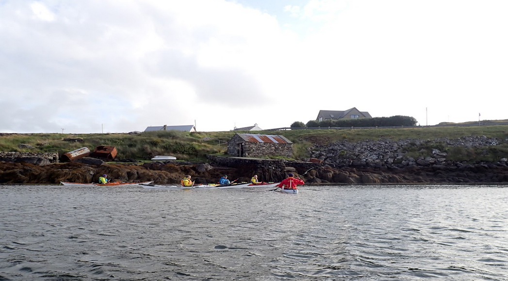
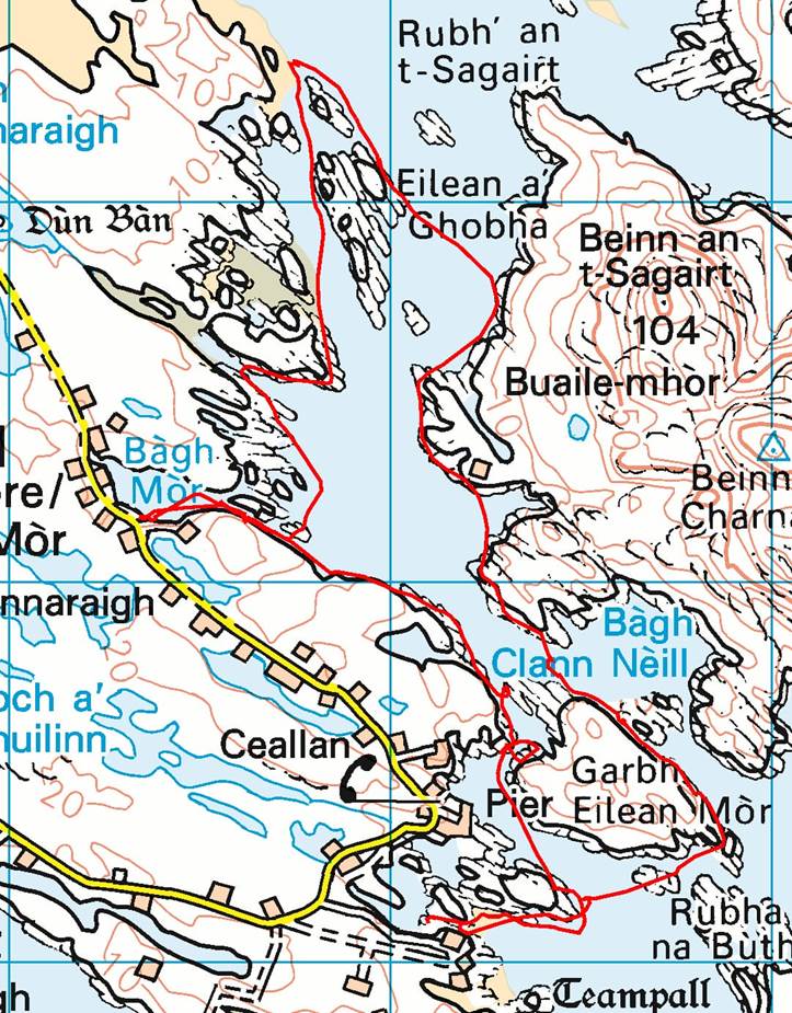
Aug - Grimsay Harbour and Ronay by Catriona Hare
Surprise. surprise another windy day,
which required careful planning to identify a safe paddling time and location
This time the weather window was late afternoon and we returned to Grimsay
where we had been on a tour of boat museums a couple of days earlier. We
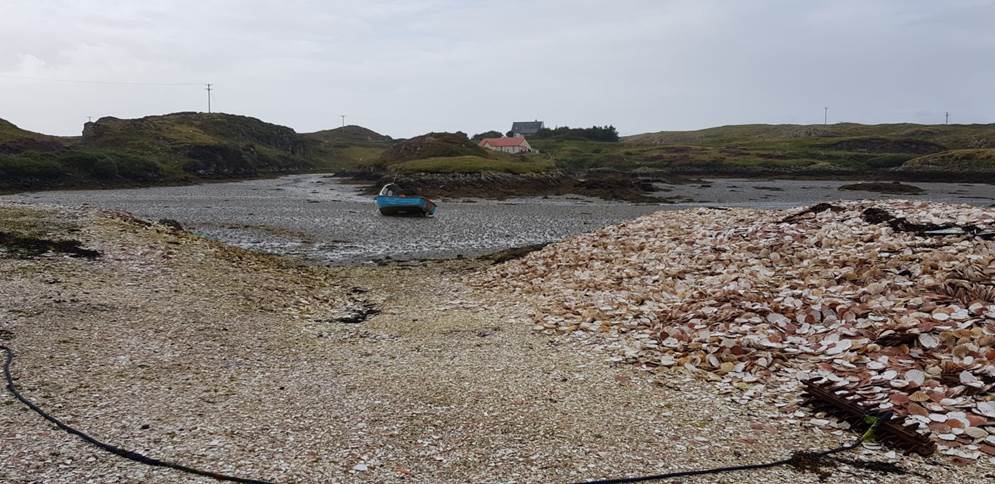
started from a scallop processing plant, where their shell disposal was forming
a raised beach.
Not far from the start we encountered
our first tidal stream of the week, and we had fun breaking in and out of the
flow between Grimsay and Garbh Eilean, before turning the corner and heading
through the narrow entrance to the natural harbour at Bagh Mor.
In the shelter of the bay, you could see
why this area had been used as a harbour and had an historic pier.
On the way in we had lots of tide
assistance. The way out was much harder and the intelligent people listened to
the instructions about eddy hopping to take rests and avoid the worst of the
tide, some people used lots of energy and just paddled. They were given the
challenge of going river paddling, to improve
their ability to read water, ☹️. Luckily, there were tide races to practice in later in the week, which
I am sure met this challenge.
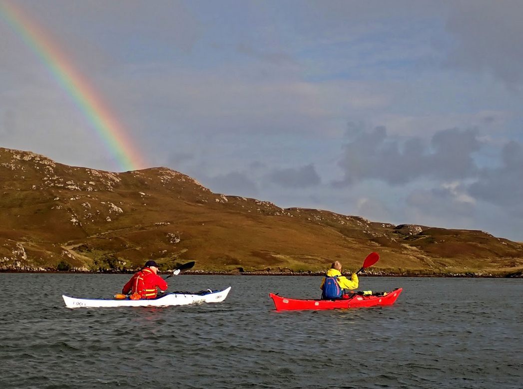
Once we had escaped the harbour we
paddled round the small island of Eilean A Ghobha and crossed over to bigger island
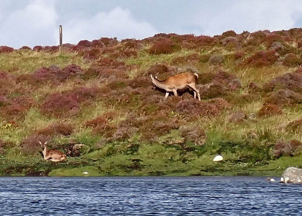
of Ronay and travelled down its west coast for about 2km .Here we saw lots of
red deer, identified potential camping spots (for a return trip in better
weather?) and were treated to beautiful
early evening light and a rainbow.
We decided to go round the opposite
side of Garbn Eilean on the way back to avoid a potential slog back through the
fist tide race. The paddle up the east coast of the island was lovely and
sheltered but once we rounded the corner and headed back towards the launch
point we were paddling into our umpteenth strong headwind of the week. However,
this paddle was less than a Km and we were soon back at the launch point, where
the high tide meant we had a much shorter boat carry than we had on the way
out.

Click or tap for more photos……
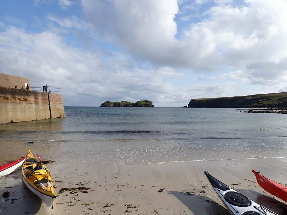
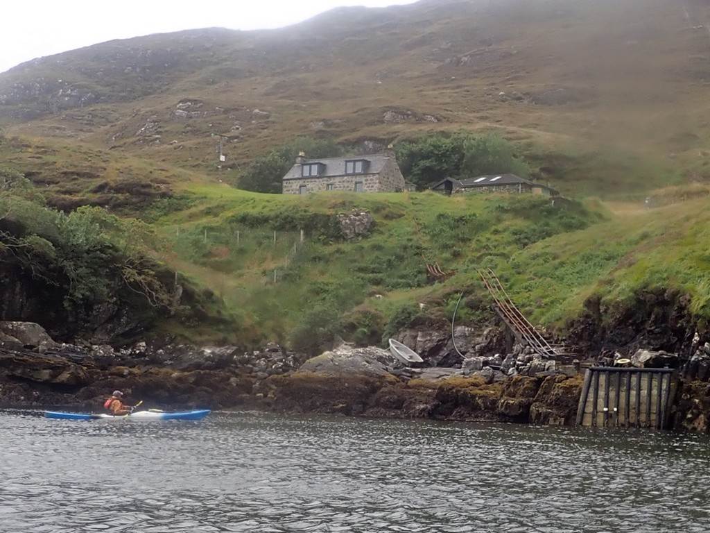
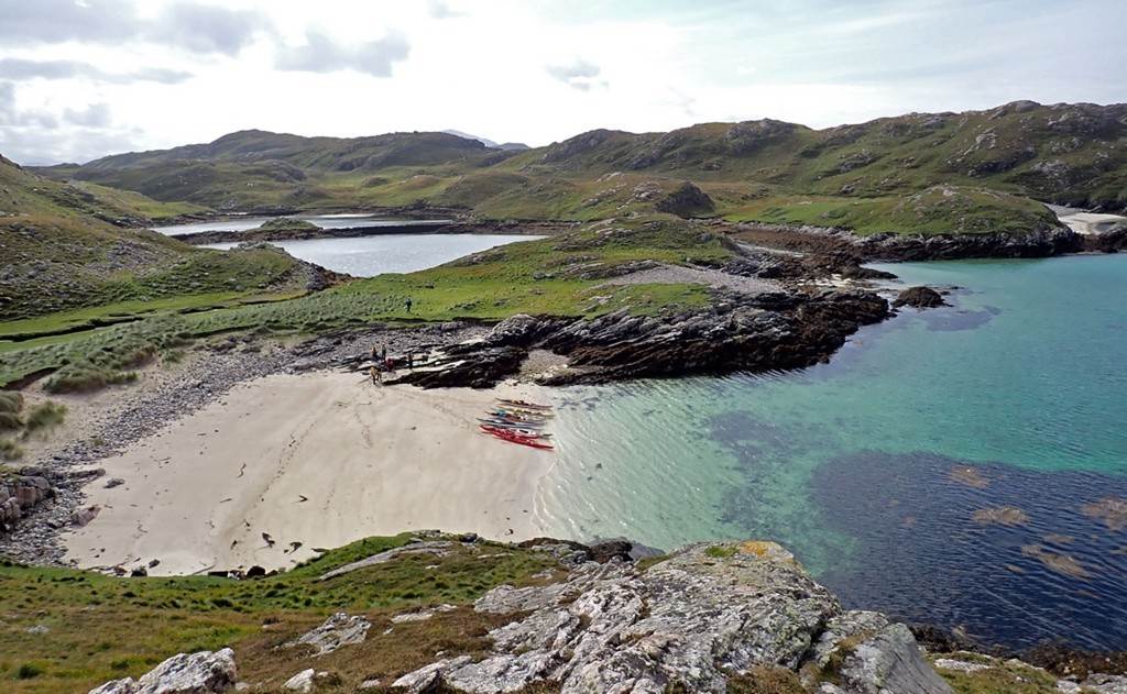
Day 08 Friday 23rd Aug - Loch Eupoirt by Dave Brown
We found a
nice get-in-point close to the water at a place called Saighinis this was or is
a small fishing cove used by 1 -2 boats with lobster pots on the side as we
dodged these to take off the sea kayaks from the cars and van or was that just
me !!!!.
Loch Eupoirt Get-in: https://maps.app.goo.gl/7NPpssYDW2xTqeqR9?g_st=com.google.maps.preview.copy
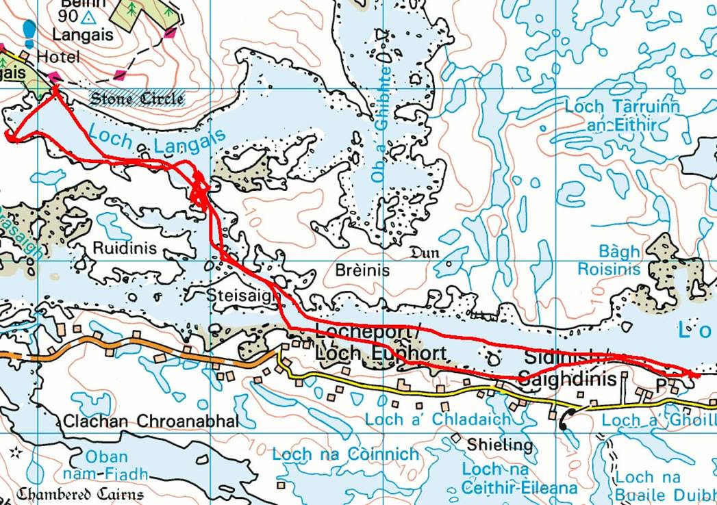
Paddling day
4 23 Aug 11km
Once we were
on the water all was good and started paddling you could see people starting to
relax once in their boats as we paddled along looking at the rocks for Otters
and other moving things, we came upon a very big stone house with lots of glass
all around, it just looked out of place but I would have moved in at a moment’s
notice.
We passed a
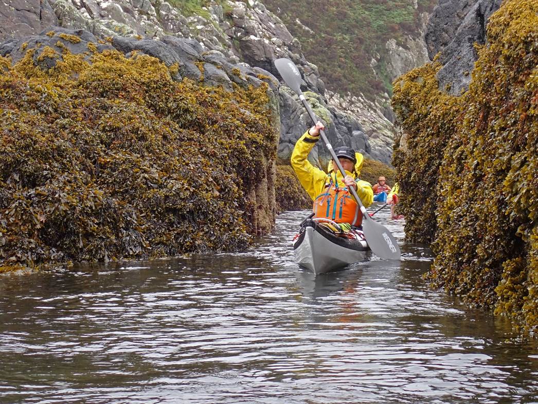
small Island of Steisaign, then came to a narrow gap of about 50 meters wide
looking at this more closely, eddy’s were on both sides great break-out
practice and ferry gliding.
After we all
broke out on the left, we had a chat and decided to have a play - lots of
fun was had at this point crossing the flow from both sides and then we all
paddled back up the side eddy just to go back down through the swirly bits and
big boils in the lower part of the eddy.
After this,
we headed down to Loch Langais looking for 11’s or even Lunch !!!,, At the end
of the Loch, we had a big debate on where to go, the beach or old boat house.
The boathouse gave us more options.
After lunch
we all headed up to the Stones Circle, which was called Pobull Fhinn. This translates to “Finns people”, (got that
off the website so must be true). There
were some stones still standing and some having a lie down - I don’t
blame them after all that time!
After our
walk back down the hill we all got into our boats and had a great paddle back
with the tide and a bit of wind.
Click
or tap for more photos…..
Day 09 Saturday 24th Aug - Meavaig South – “Otterly”
Fabulous by Debbie Hughes
Time to move on from the campsite and
take the 9.30 ferry across the Sound of Harris from Berneray to Leverburgh
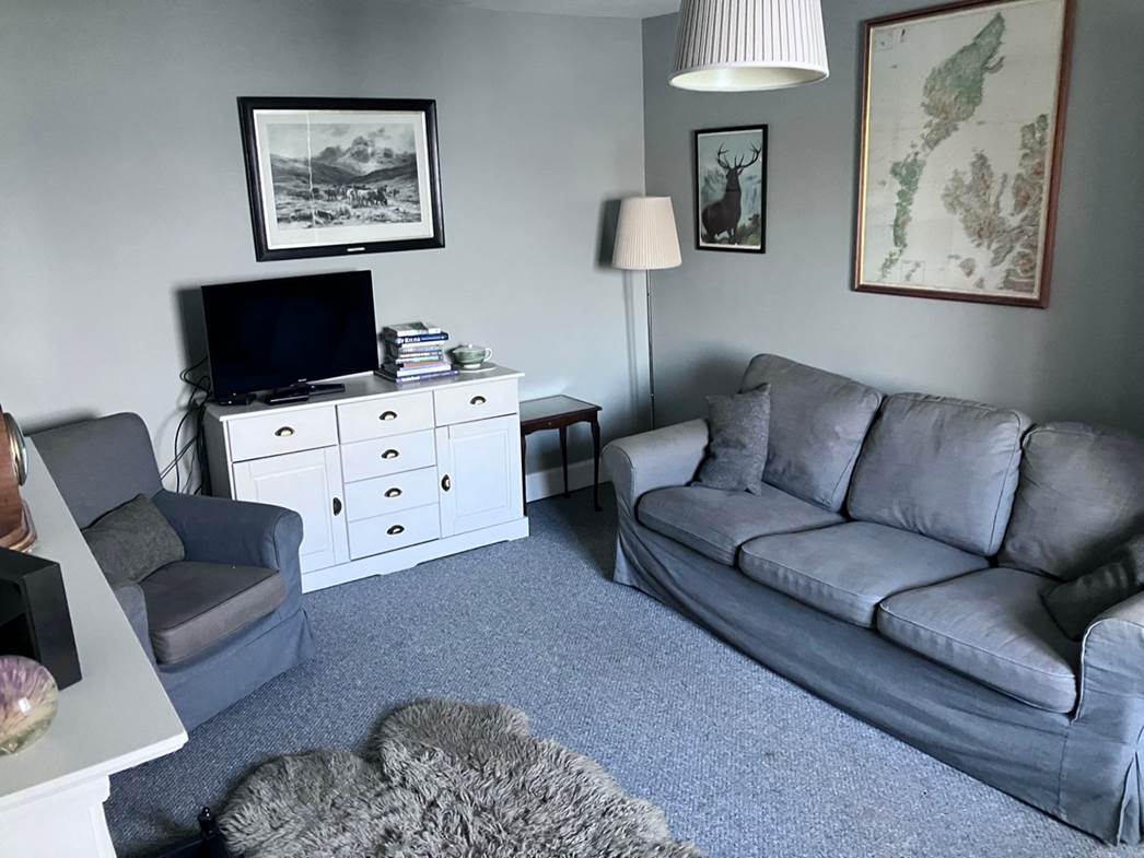
where we had a quick stock up at the shop and a coffee stop. Then on up to Tarbert in North Harris where,
joy of joys, Keith had found us a cottage for the week as the forecast was
still not promising pleasant camping/paddling weather. As the cottage wasn’t
available until 4.00 p.m. we had plenty of time to spend on the drive up there,
stopping off to watch the surf crashing in on the beautiful sandy beaches on
the west coast. It had a view of the famous Losgaintir beach from the
road.
We arrived at Tarbert still with ages
to go before we could move into our new lodgings. Frankie, our sewing guru, had
discovered there was a Harris tweed museum not far from the village so we did a
detour down “The Golden Road”. This was
apparently named as a reference to its colossal construction cost, these 21
miles of single-track tarmac snake their way up the east side of South Harris
through, at times, a lunar-like landscape composed more of rock than grass.
But…. we had only gone about 3 miles
when a slipway appeared on the left at Miabhaig and we were going
paddling! This idea was not
enthusiastically received by some of the party and eventually only some of us
kitted up and got on the water and set off in the wind and rain.

The plan was to sneak round the edges
of Loch Ceann Dibig and back….We got as far as Aire Druirecleit point and the
wind picked up so the return trip was hard work getting back to the top of the
loch. We were having a breather up against the low cliffs at the head of the
loch when an otter was spotted on a small rocky reef only about ten metres
away. He/she/they proceeded to entertain
us for at least five minutes, diving for food and doing typical ottery stuff,
crunching crispy crabs while lying on its back in the water, diving down again
and again and coming well out of the water on returning to the surface. It seemed oblivious to us being there and got
steadily nearer to us providing an excellent photo opportunity.

Eventually, otter decided it was time
to go… relying on Keith for pics - I didn’t take a camera. It was a real treat
to watch and made up for the otherwise soggy, windy paddle. and we returned to
the slipway.
Well past 4.00 by now, we went in
search of paradise…..some of the others had already arrived at the cottage.
which was down a very steep hill, right next to the sea. Great for checking on the sea state. And….Aly
had already lit the fire! Definitely a change from the traditional two-week sea
kayak trip but along the lines of any port in a storm. A warm house with showers, drying facilities,
comfy rooms and a games room to boot saved us from what could have been a cold
wet second week.
Hotly contested table football, darts
and pool (very silly pool - our version) were a bonus. Brilliant decision.
Click or tap for more photos……
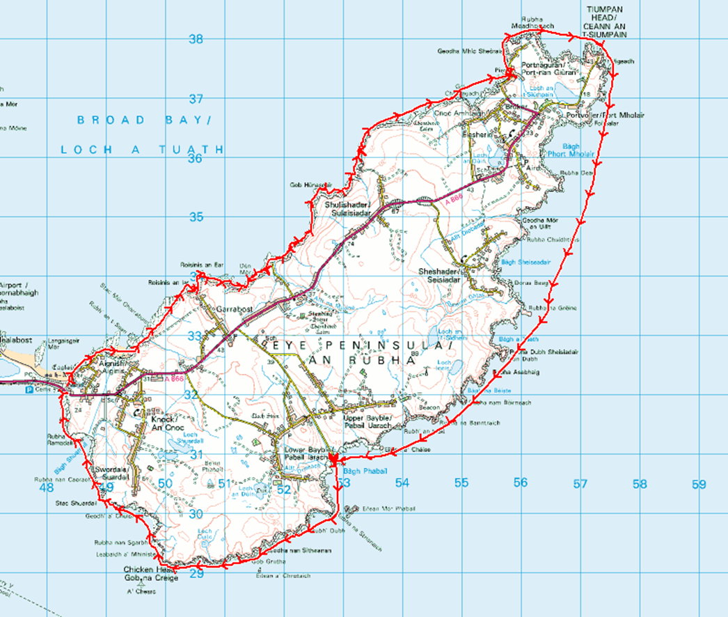
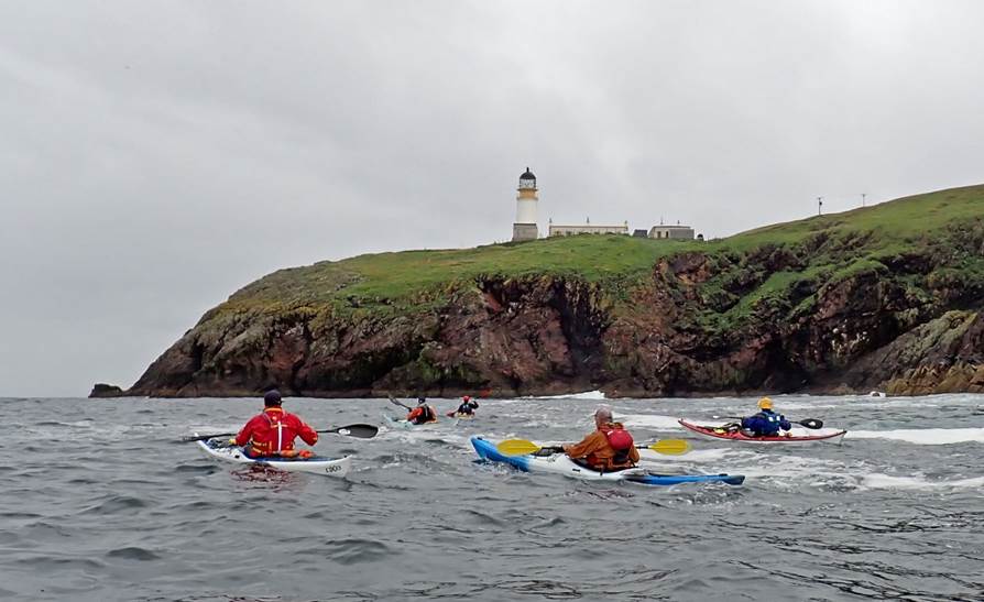
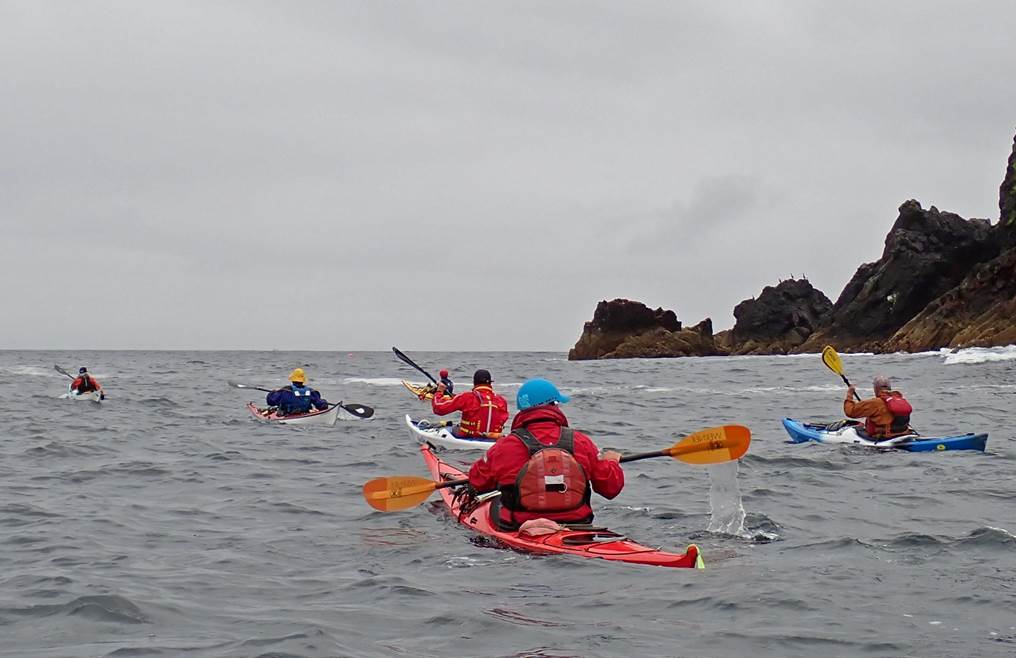
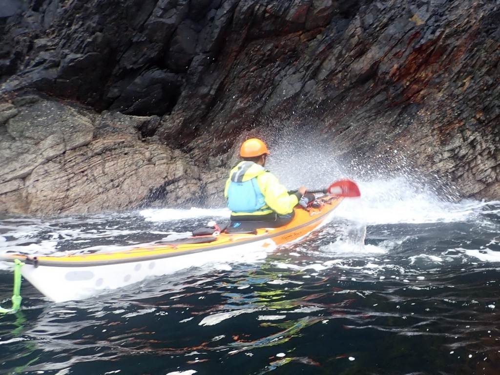
Day 10 Sunday 25th Aug - Eye Peninsula by Chris Bolton
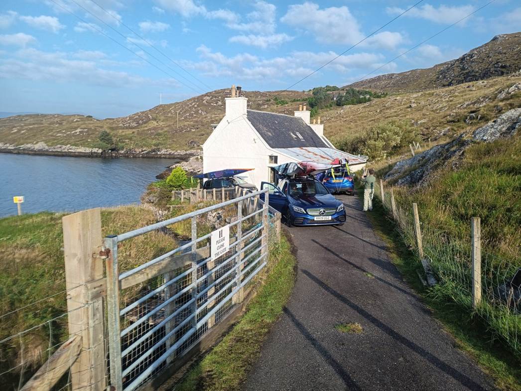
We arrived
and settled in to the house called Tighnamara the evening before. Being
established on Harris, Keith asked for ideas about where to paddle. We all had
a think and suggested trips on Harris, which he listened to and then suggested
his own ‘off the wall’ idea that we should go to Lewis and paddle round the Eye
Peninsula, off Stornoway. Lewis and Harris are actually the same island, but it
was a 1:15hr drive to get there. Fortunately, the main road from Tarbert to
Stornoway is two way, a change from the single track roads with passing places
that we’d become used to.
The forecast was comparatively good (comparatively
being the key word!) with SW winds dropping a bit mid-afternoon and veering W.
The tidal stream in the Minch, the channel between the Western Isles and Skye,
would be flowing North until 3-4pm. The original plan was to go anticlockwise
round the peninsula, starting off with wind and tide behind us, then returning
down the western side, where there’s no tide. There were two possible problems
with that: if there was still a southerly swell in the Minch, the outward leg
would be downwind in the swell. The more experienced paddlers might enjoy the
surfing, but for those unaccustomed to it, there’s a risk of losing control and
getting sideways to a wave. The second problem was that if the wind
strengthened again, from the West, the return leg would be exposed.
So we started from the West side of the isthmus, and
went clockwise. Keith alarmed us by going down a road that was signed to a
church – on a Sunday in a staunchly Free Church area – and we feared we might
end up in a church car park surrounded by disapproving locals. However, the
church was roofless historic ruin, last used for worship in 1829, and the
locals who passed while we unloaded were friendly. The cars were then put in
the car park.
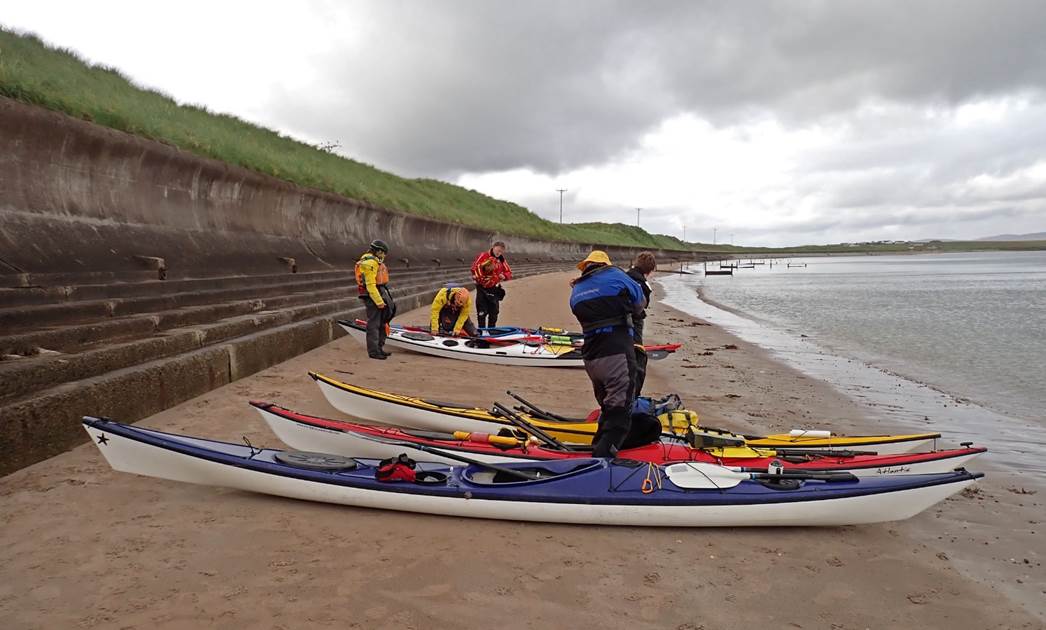
At 11:15 we launched onto calm water from a sandy
beach. That in itself was a first for this holiday!
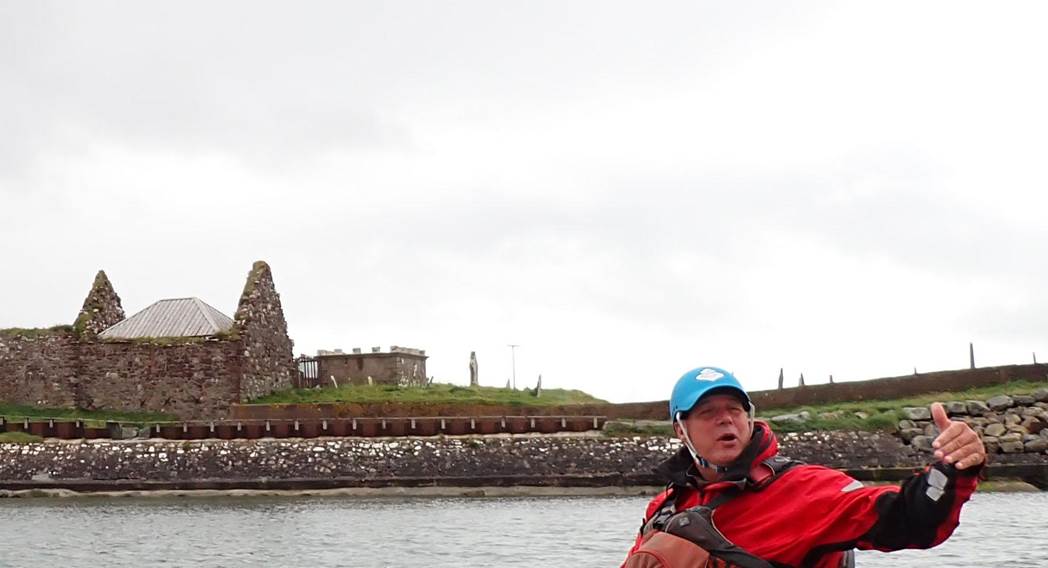
St Columba’s Church
The cliffs were made from conglomerate rock, which is
not something to be expected on a coast famous for rough seas and old, hard
rocks. Although it looked fragile, it was surprisingly solid, and even had
caves.
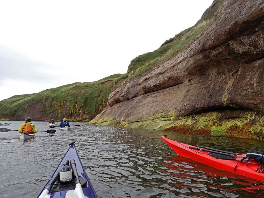
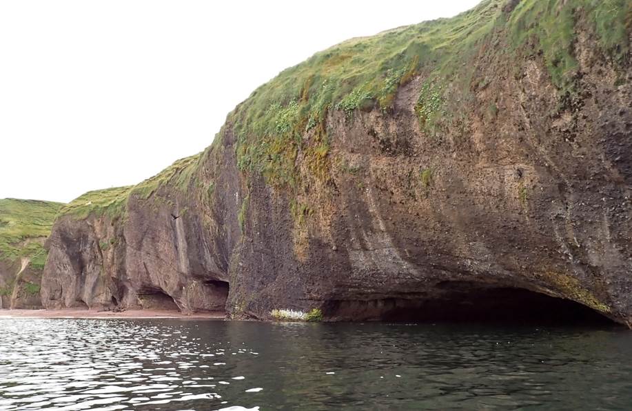
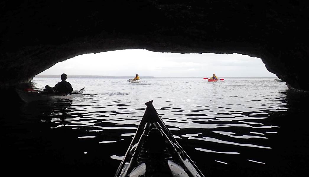
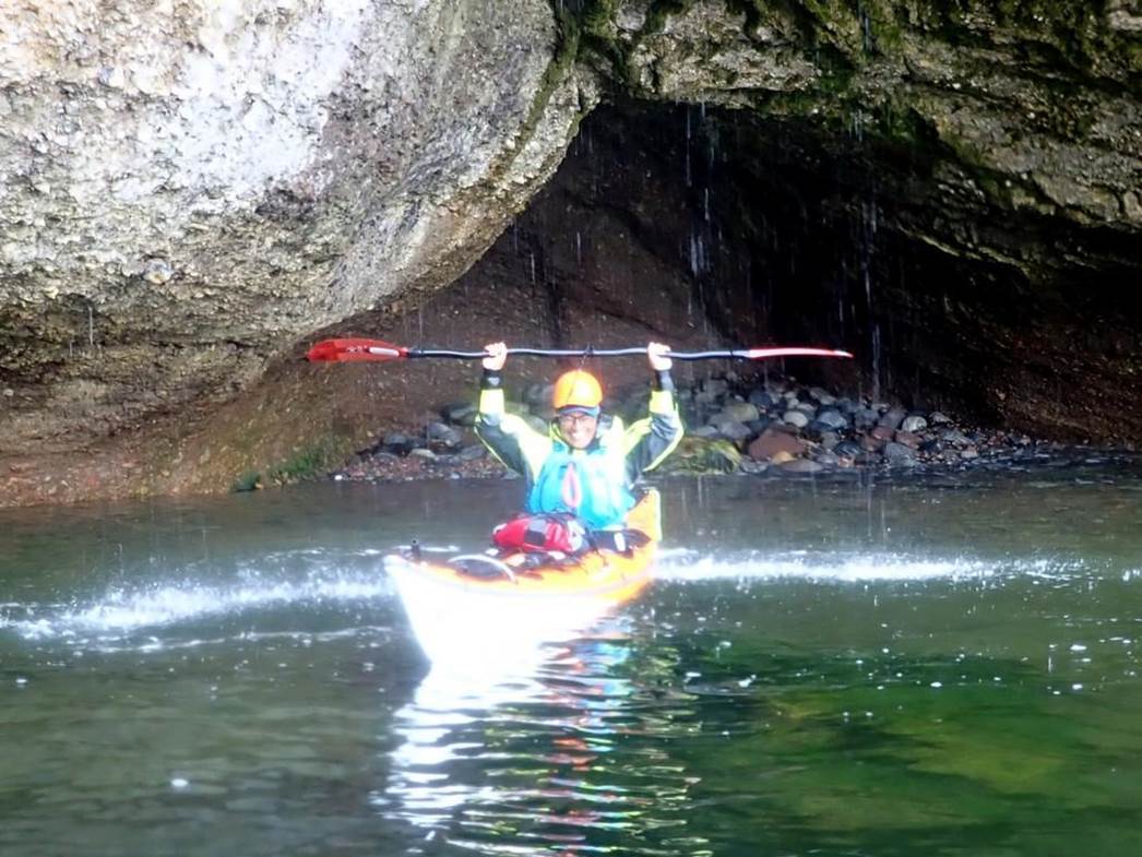
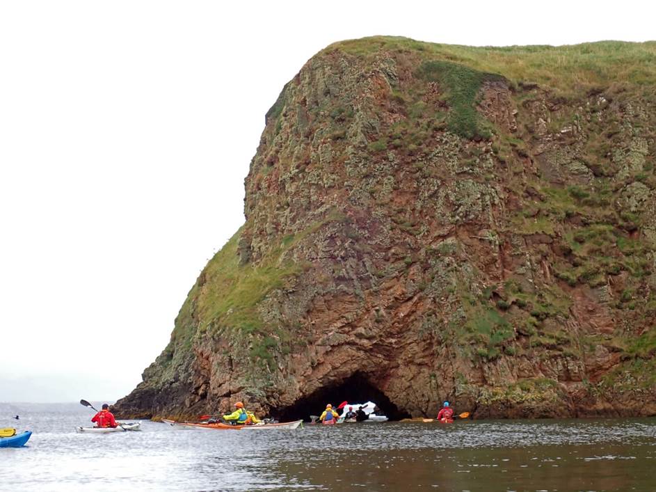
Well, kayakers, calm water and caves can only have one
outcome, and progress along the coast was slow as we explored every available
nook and cranny. There were also a few waterfalls, one of which was usable as a
shower.
Slow progress wasn’t a concern, as we didn’t want to
reach the northern end of the peninsula much before 3pm, as until then the tide
would still be running strongly against us on the return leg. A light drizzle
fell, but we didn’t really notice it while paddling. The rock type having
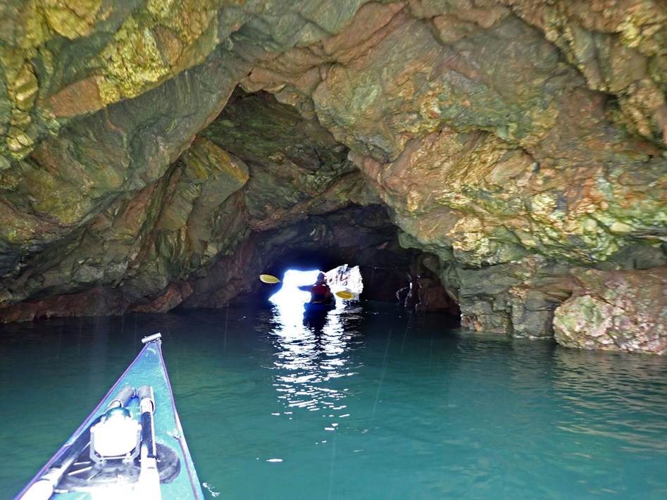
changed to the more expected gneiss (nice!), we found a short through cave, and
many photos were taken.
Shortly after that, at about 12:35, having paddled
about 5km in 2:20hrs, we stopped on a pebble beach for elevenses (aka first
lunch) suitable equipped with a small overhang for shelter.
Continuing on at a faster pace, although finding more
caves, another 5km brought us with sight of the pier at Portnanguran, the next
target for elevenses.
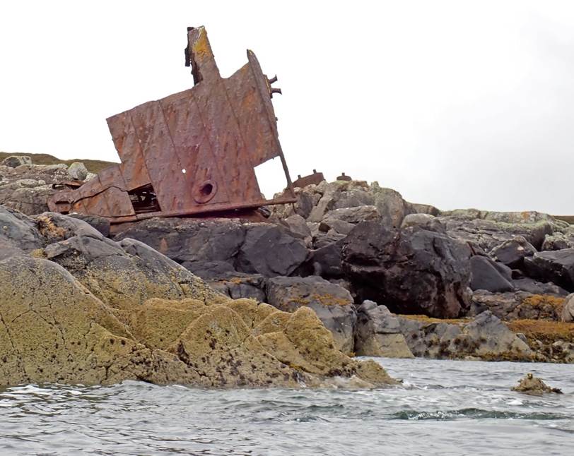
Just before that, we could see the bow of a wrecked
steel ship, high on the rocks. Launched in 1915 as
the steam trawler Miletus, she was taken over as a minesweeper by the Admiralty
in WW2 and renamed HMS Lowther. Returned to her previous owner and based in
Fleetwood. Renamed Wyre Law, she was wrecked in a storm in October 1952 with 13
crew onboard.
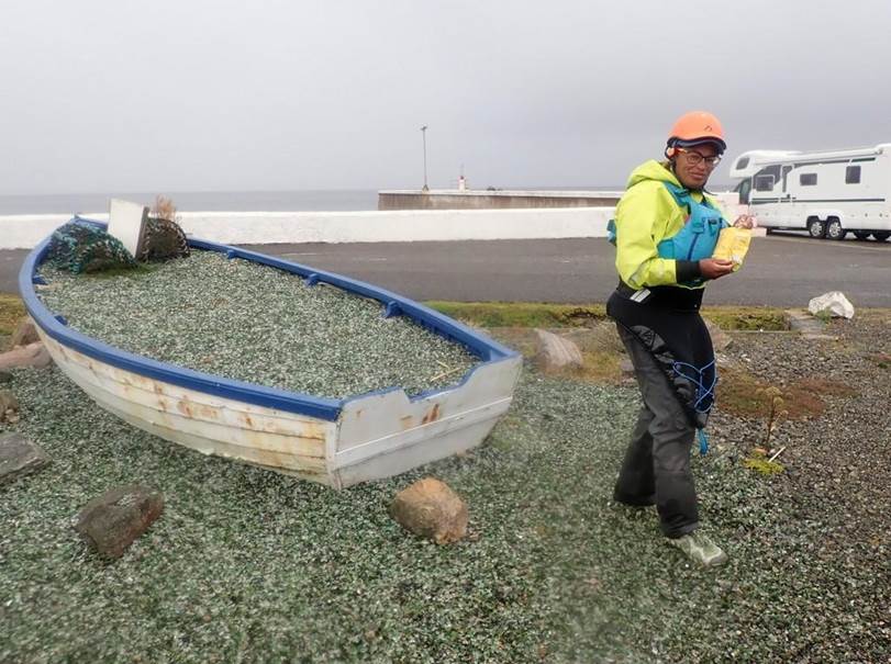
The pier turned out to have a sandy
beach on the far side, and just inshore of it was a picnic area with benches
and a small boat surrounded by a mock sea made from green and white broken
glass.
Unfortunately there was no toilet block,
and some adventurous scrambling over boulders was necessary to find secluded
spots.
We left Portnanguran just after 3pm,
having paddled only 12.5km of the expected 30+km necessary to get round the
peninsula to our cars. We were, however, only 1km from the northernmost point,
and 3km from Tiumpan Head, where its lighthouse marked the end of the
peninsula.
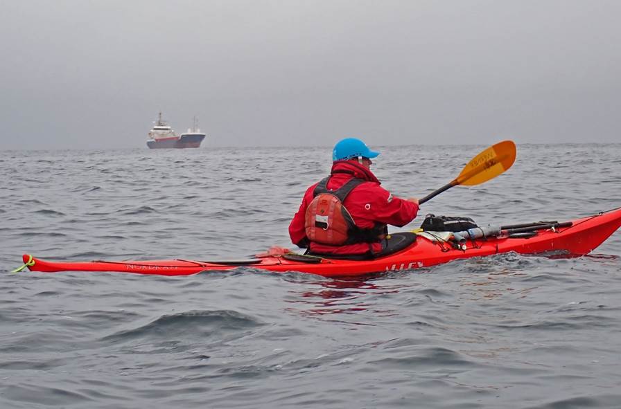
A small ship waited in the mist a mile
or so to the North, possibly waiting for a pilot to enter Stornoway or to
transit the Minch.
It being her Birthday, Debbie led us
round the headland, which was slightly choppy with the swell diffracting round
and then being reflected from the cliff.
Once round, the swell settled down, and
the slight steepening of the waves suggested that the tide was now running
South, against the swell. None of the team had any difficulty with the swell,
and we paddled happily along in the improving weather, keeping well offshore to
avoid the breakers and stay in the tide, which was now pushing speed up to a
welcome 7km/hr. In the distance, the shapes of mountains arose out of the sea.
We thought they might be on Barra, but a look at the chart later showed that they
were actually Skye.
After only an hour and half, we’d left Tiumpan Head
10km behind us, and we headed into the bay at Bayble, hoping that the pier
shown on the map would provide the same kind of sandy beach as the one at
Portnanguran. It didn’t disappoint, being very similar, although without the
picnic area. We stood around the boats on the sand and Frankie produced a
magnificent cake for Debbie’s birthday, slices of which were shared around.
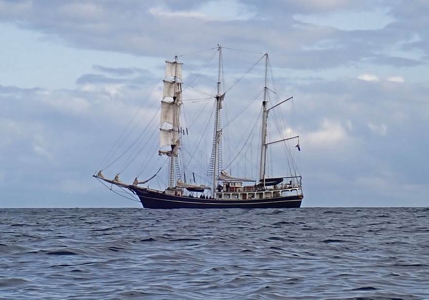
We left at 5:25pm, passing inshore of Eilean Beag
Phabail (Little Bayble Island) and keeping as close to the cliffs as we dared,
to get some shelter from the strengthening West wind. A few miles offshore was
the Dutch sail training ship Thalassa (tallshipthalassa.nl).
This part of the island was well supplied with caves
and natural arches, but the swell made exploration tricky. Had we followed the
original plan and started on this coast, we would still have been unable to
explore them, and the conglomerate caves on the west side would have been
exposed to a building sea by the time we reached them.
By the time we rounded Chicken Head, shortly after
6pm, passing between it and Chicken Rock with its marker and South Cardinal
buoy, the wind was up to F5 gusting F6 and right ahead. Keeping close in to get
some benefit from the friction of the wind against the cliffs, we fought our
way along the remaining 4km to the small beach and carried the boats up to the
road at 7pm.
With the prospect of a 1:15hr drive back to the house,
we were hopeful for finding a fish and chip shop, but such things are not
allowed on the Sabbath. Keith found a Chinese takeaway that sold chips, which
were apparently excellent (we found the same place but settled for some
mediocre Chinese food, not having spotted the chips) while the other found a
curry house and ate in.
Altogether a great paddle, 32.8km being by some margin
the longest of the trip, and a fitting celebration for Debbie.
Click or tap for more photos……
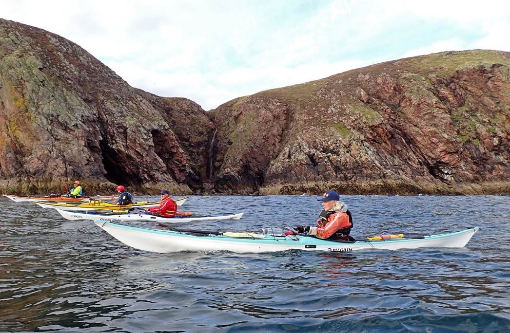
Day 11 Monday 26th Aug -
Scalpay by Alistair Ball
The weather wasn’t as miserable as it
had been and was different from most days as it didn’t require a long drive to
get to the launch site, we only had to drive a few miles from our superior
lodgings, the idea of “wild camping” from our boats had been binned a few days
earlier, as the weather itself was too wild for such endeavours.
When unloading our boats on the
concrete slipway, Keith had a mishap, stubbing his foot on a protruding steel
spike, after which a health and safety directive was issued to the unwary and
from memory, that was the only injury sustained that particular day.
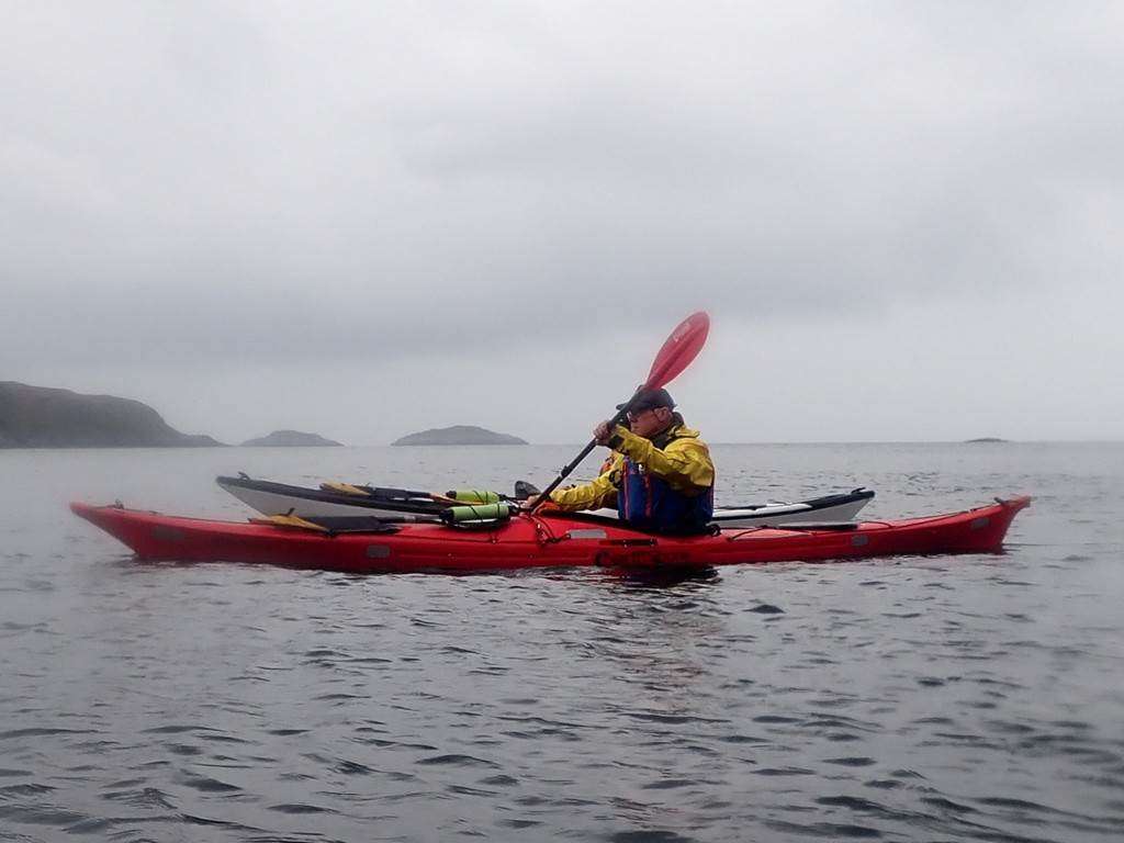
Once all launched, we mustered in
flotilla formation, our first objective was to creep along the shoreline
against the tide under the rather simple but elegant road bridge which spanned
the gap to the Island of Scalpay. Having cleared the bridge we then had to
ferry glide our way across the flow to reach the still water on the coast of
Scalpay.
![]()
The manoeuvre was carried out without
incident and we all continued on hugging the coast until we were out of the
tide. Off to our left was the aptly named inlet of “An Acairsaid a Tuath” (?
exactly) in which lies the main settlement on the island.
We pressed on across some open water
to gain the shelter of a string of smaller islands, where I was given the task
of finding a sandy beach for the first elevenses. Having failed miserably
to find such an elusive haul out, we ended up heading south, leap-frogging from
island to island to gain the lee from the rougher seas rolling in from the
west. Eventually, we got to a point where a decision had to be made, whether or
not to continue with our plan to circumnavigate Scalpay. In the end the decision
was made to bottle out of the exposed paddle along a rocky shoreline and start
the journey back via the inlet of An Acairsaid a Deas (getting the hang of it
now).
One or two of the group took the
opportunity to play in some surf that had developed by a reef off to our left,
while the rest of us headed for a spot to have a rather delayed break.
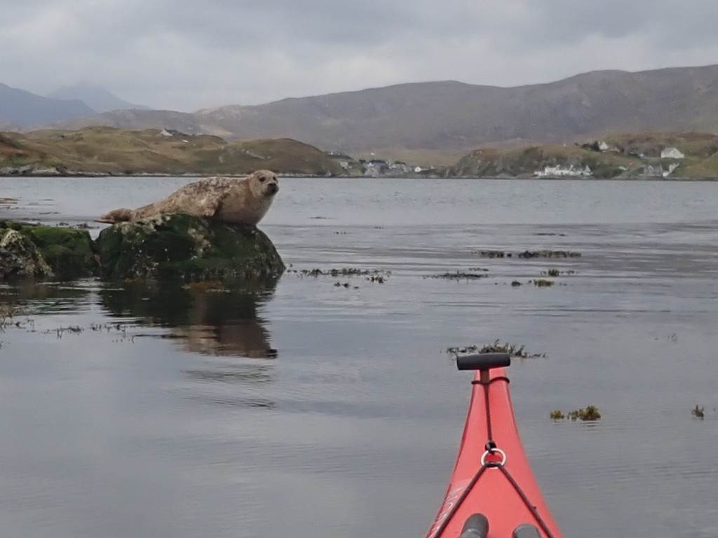
I think this was the occasion when we
quietly drifted through a sea of seals as we were being blown along by the wind
into the shelter of the bay, by which time, it was lunch and I noted that my
plastic kayak seemed to sail quite well with the wind behind!
After lunch we slowly made our way
north along the bay to the south side of the village with the pretty shoreline
houses, (see the attached photo) keeping close to the shore to complete a loop
of the inlet. After that, it was simply a case of paddling along the coastline
until we rounded the north-westerly tip of the island to take refuge in the
earlier-mentioned inlet, which led to the main port and even a small marina on
the island. We took the opportunity to haul out, this time next to the marina
and cafe and as I had already made sandwiches for the trip, I sadly didn’t get
the chance to sample the pies that the cafe would have inevitably sold.
I mentioned the marina because the following
day I met a couple from New Zealand in the local brewery bar, who had sailed
their yacht around the world, only to moor up in Scalpay, 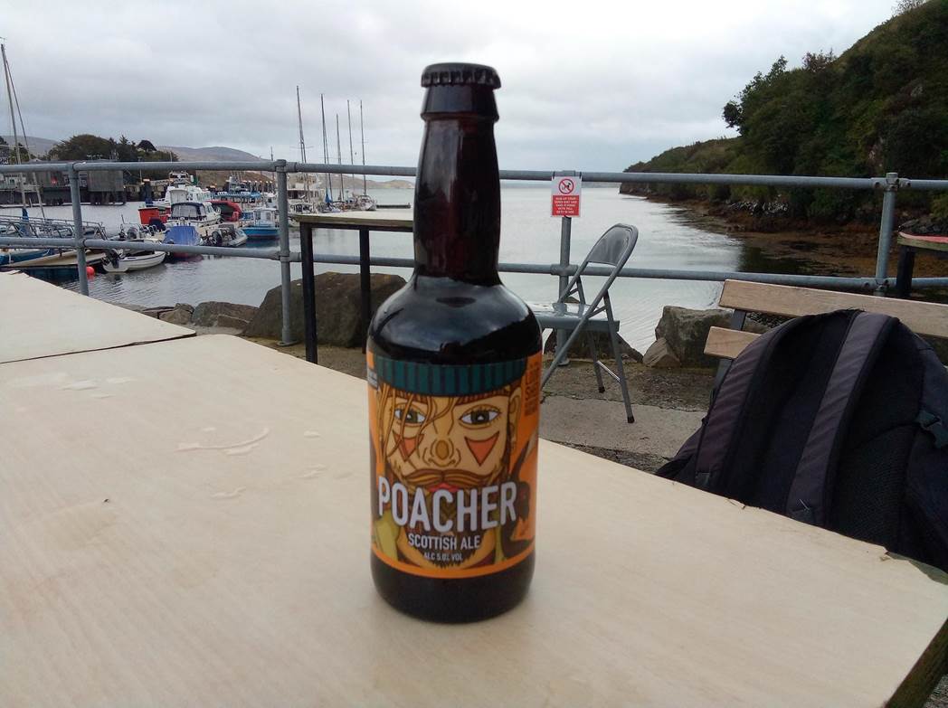
Apparently, they arrived just after
we left for home, so as a tribute to them, I’ve included a photo of the great
ale that we were drinking whilst telling salty tales.
Having finished off the last of our
grub we left the shelter of the harbour and hugged the northeast coast of
Scalpay to once again ferry glide across the tide to gain the safety of the
opposite bank. Then under the bridge and back to the ramp from where we
launched. Following that we had the usual faff of reloading the boats etc and
there ended our very enjoyable foray to Scalpay.
 .
.
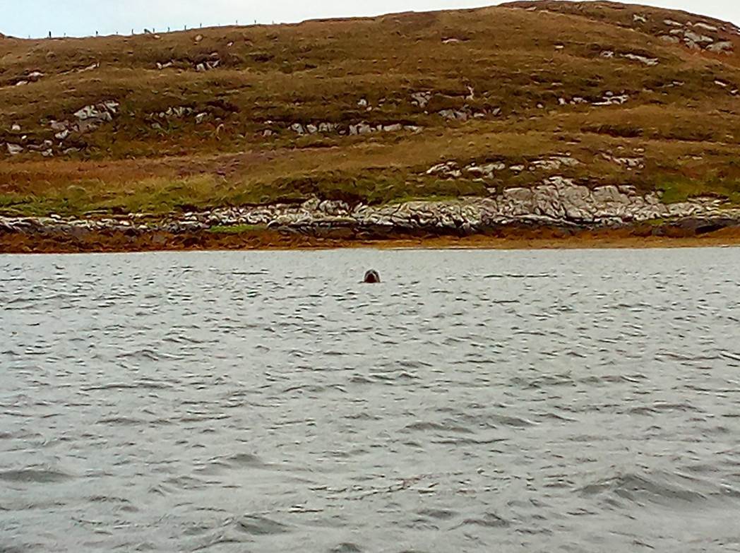
One of many seals, I think this chap
followed us for some time. The next photo is of Dave and Christine as we passed
along the shore.
Click or tap for more photos……
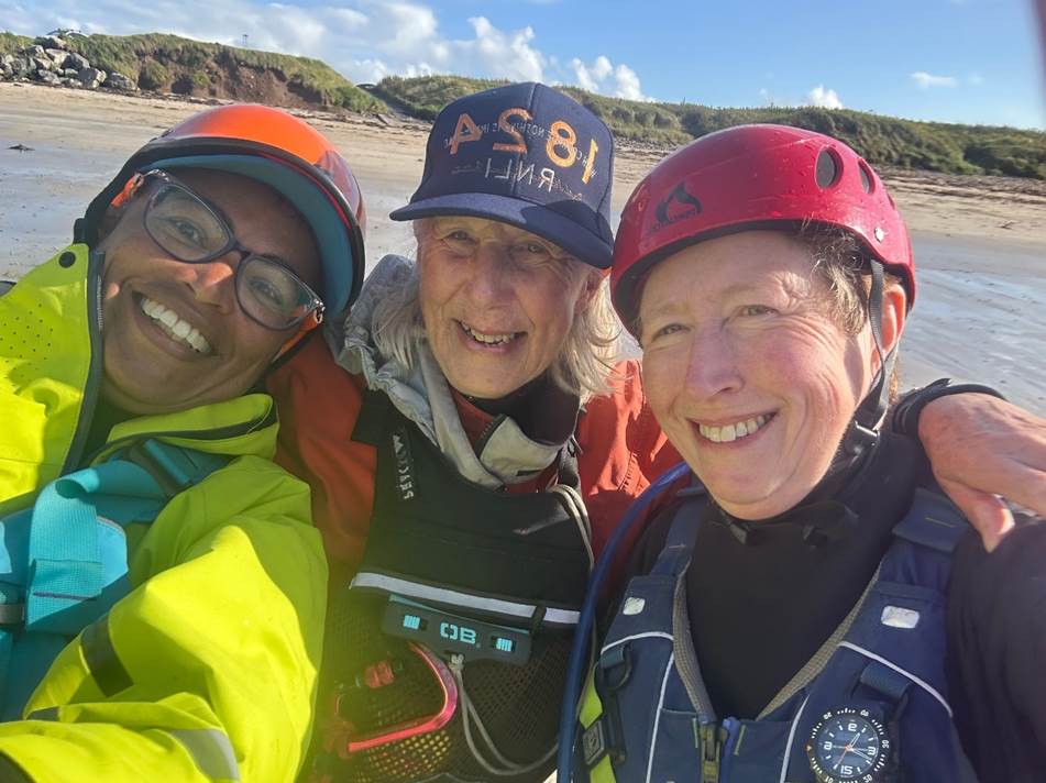
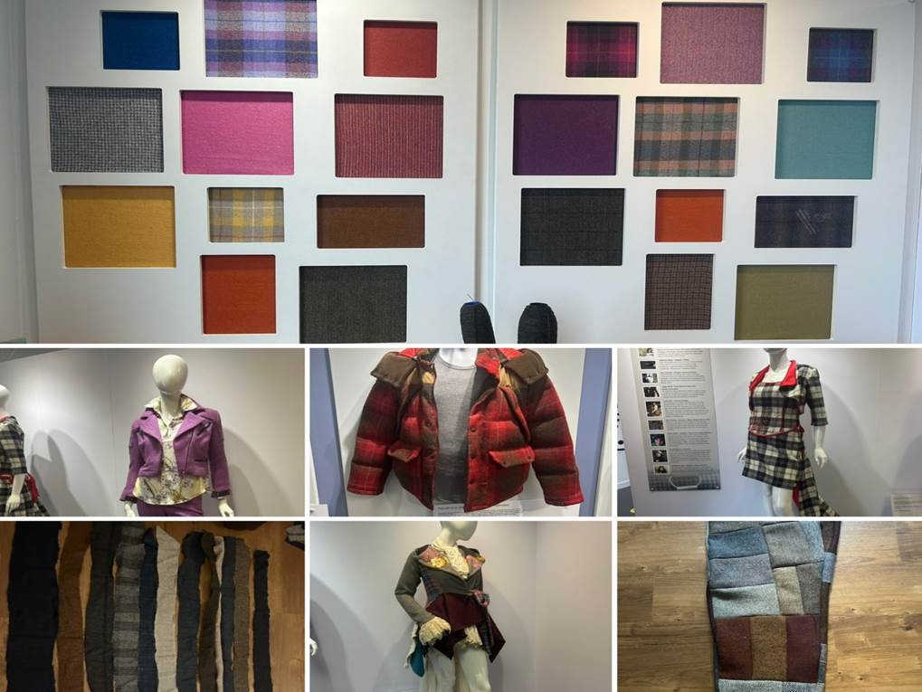
Day 11 27 August - Stormbound
Paddlers
Keith S, Frankie A, Debbie H (Team Mercedes) Catriona H and Gary B
Another day
when the weather was just too much weather to get out on the water. Team
Mercedes became Team Mercedes plus with some transfers in from Gary’s car for a
day of alternate activities starting with a trip to the Harris Tweed
exhibition.
When you are
a sea kayaker who sews then really a must-visit venue. Harris Tweed is an
amazing fabric steeped in the history of the islands and is one of the most
desirable wool fabrics in the world. The process of making the tweed is
fascinating and the palette of colours from the dyed-in-the-wool process is
stunning. So, wandering around the exhibition and learning more about the
processes of warping, weaving, finishing and stamping was a true pleasure for
me. Possibly less so for Keith, Gary, Debbie and Catriona. High quality wool is
also rather expensive, so I made do with bags of remnants. A sustainable
solution that is now well on the way to becoming a crazy pair of Harris Tweed
trousers.
We left the
exhibition and travelled the rest of the golden road to visit a brewery for
those in search of further beer supplies for personal consumption and gifts.
The brewery boasted a very nice restaurant so that was lunch sorted alongside a
couple of flights for the beer seekers, to choose their favourites.
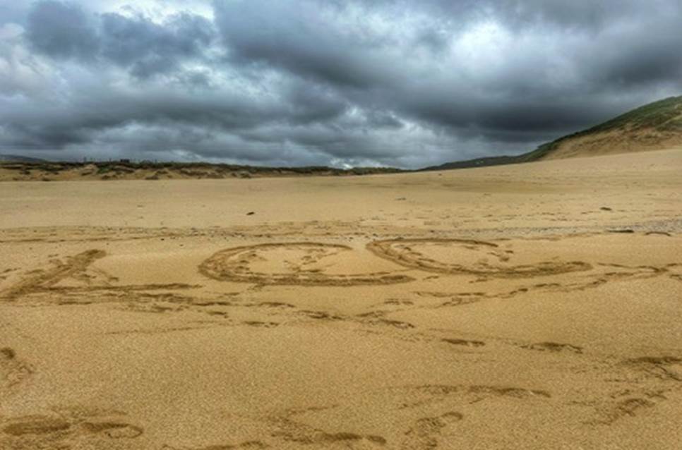
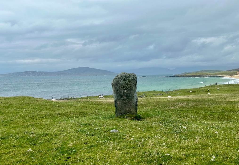
A visit to
the Scarista standing stone and a walk along golden sands was the perfect post
prandial activity. Sanderlings were a point of interest and much googling for
identification, orange wellies meant that Debbie was the only person who could
claim a Tuesday paddle in the sea.
Returning to
the car all footwear was examined closely for sand and sheep poo before being
allowed to enter the vehicle to return to the cottage to find out what our
fellow expedition paddlers holidaymakers had been up to.
Click
or tap for more photos……
Day 13 Wednesday 28th Aug - Loch Eireasort from Crosbost by Gary Bunting
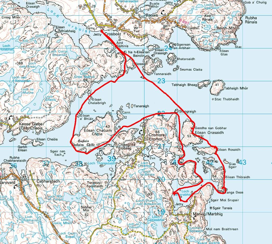
After a
storm bound day we were eager to get out. As the forecast was for Southerlies
strengthening in the afternoon / evening the sheltered mouth of east facing
Loch Eireasort was chosen. So at 9am we
set out to drive to Crosbost, and were launching by 10:30 from the jetty next
to the Lochs Free Church of Scotland.
We paddled
out across the small Loch Liurboist and around the headland between the islets
of Riosaigh and Tanaraidh into Loch Eireasort. Then across the loch and around
to the east (outside) of a series of
islets: Eilean Orasaidh, Rosaidh and Thoraid. This section faces out into the
Minch with a benign but noticeable swell and good views of the cliffs further
south. Turning west around Tanga Deas, north-west and then south-west around a
headland we entered the well-sheltered Loch Mharabhig. Passing a boat yard’s
floating pier and a working jetty at the head of the loch, we eventually found
a suitable ‘elevenses’ stop (at 12:30).
Refreshed,
we set out back on the north / west side of
Loch Mharabhig, round some skerries and through a narrow passage behind
Eilean Orasaidh. Up until this point, after the break, Frankie had been closely
followed by an inquisitive seal which now abandoned her. Another half kilometre
north and then west back into Loch Eireasort.
Then
following the southern shore, passing the small bay at Cromore and through the
channel to the south of Eilean Chaluim Chille with its ruined church (not
visible from the sea) and visible 3 giant balanced boulders (see https://www.walkhighlands.co.uk/outer-hebrides/eilean-chalium-chille.shtml).
Luckily we
paddled over the causeway to the island as it wasn’t low tide.
At the end
of the channel it was decided to head back to the cars going across the loch,
tight in around the headland, back into and across Loch Liurboist and so back
to the launching jetty. By 15:30 we were off the water after another enjoyable
and sociable paddle in stunning scenery.
Click
or tap for more photos……
Day 14 Thursday 29th Aug - Loch Siophort by
Keith Steer
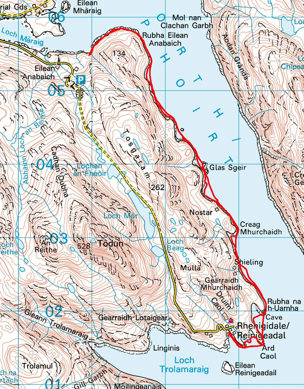
We opted for an early start at 8:00am
to try and avoid the stronger winds forecast later that day. We drove over the top of the mountains of Haris
heading for Loch Siophort. The first get-in
at Lochedge Lodge was now fenced off as new building works were due to start. Plan B was to head for the slipway observed
on Google Earth at Eilean-Anabuich. This
was a busy fish farm operation and there was nowhere to park, let alone unload
and launch.
Plan C it was, to head to the youth Hostel
at Rhenigidale. This was the end of the
road (and long-distance footpath over the hills from our cottage). Despite the rain, the small beach made for
an ideal launching place, and we were soon unloaded and sorted on the stoney
beach. There were a few large and square
looking caves at the entrance to the Loch.
We paddled out into the Minch and then rounded the corner into Loch
Siophort. This was a steep-sided Loch not dissimilar to a Norwegian Fjord.

We spotted an Eagle high above us as
we paddled up the left-hand side of the Loch keeping a watchful eye on the
weather, just in case the strong winds arrived sooner than predicted.
At a small island just before a fish
farm, we spotted an otter. He quickly
dived around to the other side of the rocky island. After paddling past the seemingly quiet fish
farm, we turned west into Loch Mharaig we encountered the gusty headwinds, and it
was clear that we were not going to venture much further. We hauled out on a relatively sheltered beach
and had elevenses. It was still raining.
We retraced our steps and paddled
back into the Fjord. We took a little
time to investigate some of the old anchors used to fix the cages of the fish
farm.
There was a house with what looked
like rails down to a dock. There was no
road and was the site of a few minutes of discussion on what they were and
how they worked. We paddled back around
the corner to Rhenigidale. Time to head
back to the comfort of our holiday cottage.
The drive back was as exciting as the drive there.
Click or tap for more photos…..
Day 15 Friday 30th Aug
- Atlantic sun, sand, and swell by Christine Bond
The last paddle of the Outer Hebrides
trip…. The wind had been forecast to
drop, the sun was forecast to shine and a good trip to the Atlantic West coast
was the plan. Unfortunately, the wind
had not quite read the weather forecast from the previous day so it was a
little windier than we would have liked for Plan A. Plan A had been to circumnavigate Great
Bernara. Due to the wind, we kept to the
shelter of the islands on the west coast of Bernera instead.
We set off for our first white sand
beach. Something the west coast is known
for. To reach our first elevenses stop we accomplished two open crossings first
to Fuaigh Mor, where we headed up the North East coastline before heading for
another crossing to Bharsargh, through a channel to the west side of the
island, then crossing to our furthest island Pabaigh Mor. This is where it got
interesting !!! As we started to reach the north part of the island we were
less protected from the Atlantic swells.
How big 2/3/4 metres ….. they
were probably about 2 metres but felt much bigger with the following sea and
the multi-wave tops. There was a small rock, Bogha Dubh, in our path, where the
waves were crashing, and which Chris navigated us around. We weren’t in the swell too long, but long
enough for some of us before heading left to a narrow channel between Pabaigh
Mor and Pabaigh Beag. The gold at the
end of the rainbow was a beautiful turquoise cove, Caolas Phabaigh Beag free
from any Atlantic swell. Time for a
lunch stop on the beautiful beach, shared only with the sheep which still roam
the once inhabited land, and taking in the view.
Over lunch, the discussion
started on how to get back. Chris went
on a mini-expedition to see if it was easier to paddle from the other entrance
to the bay. No, so the options were: Paddle the way we came in (6 nervous paddlers
!!): or to portage our boats first paddling into a small loch off the lagoon
followed by a small boat carry on grass then down a very rocky beach to
re-launch our boats south of the challenging sea conditions and through a
beautiful and large natural arch.
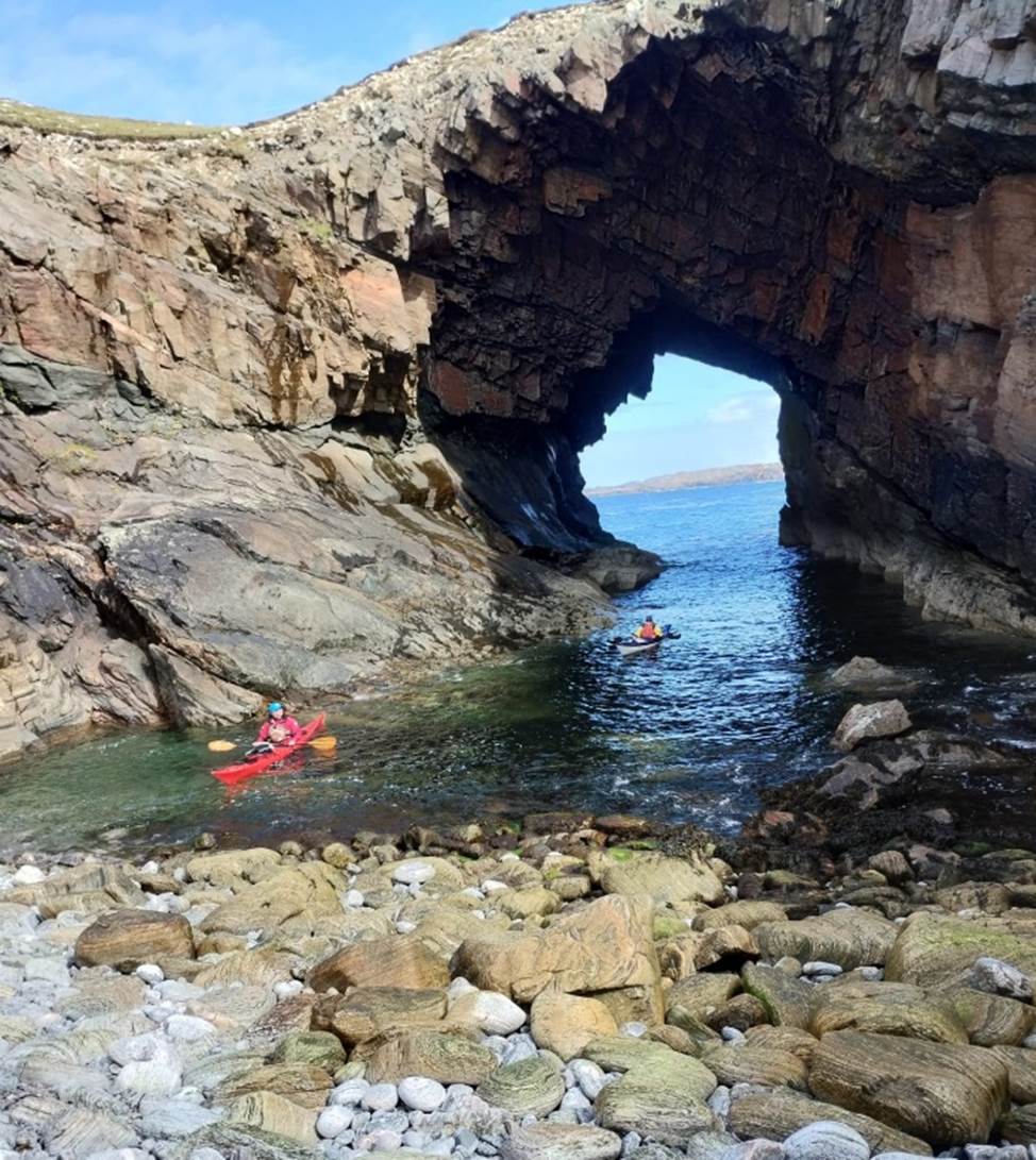
Photo – Debbie Hughes
Two paddlers (Keith and Chris) opted
for the sea paddle to the portage, while the remaining six all helped each
other with our boats. As we came out of
the Arch and around the corner we found a blow hole in action. So, a quick stop to investigate before
continuing back down the coast.
We crossed back to Bharsargh then
headed to the left of the beautiful long white sandy beach Traigh na Beirigh,
far too busy with a few people walking and a camp site at the far end. We stopped for afternoon tea in a little cove
just around the headland at Rhubha Sheotharaid. One small mishap as we landed
with one (unnamed) paddler, getting ready to disembark from their boat, seemed
to disembark earlier than expected much to everyone else’s amusement.
Especially due to the excess air in the dry suit meaning feet couldn’t find the
ground only float. The paddler needed
two people to help, one to rescue the kayak and the other to help rescue the
swimmer.
After afternoon tea we headed back to
base first crossing to Fuaigh Beag, then to Cliatassaigh, Linngeam, Eilean nam
Feannag then passing a few points on the mainland of Lewis before spotting our
landing stage under the road bridge. A team photo opportunity with the bridge
over the Atlantic in the background.
Back on dry land time to change, and
load boats before a little history and culture trip before returning back to
base. We drove in convoy to the Calanais
Standing stones an ancient centre of power.
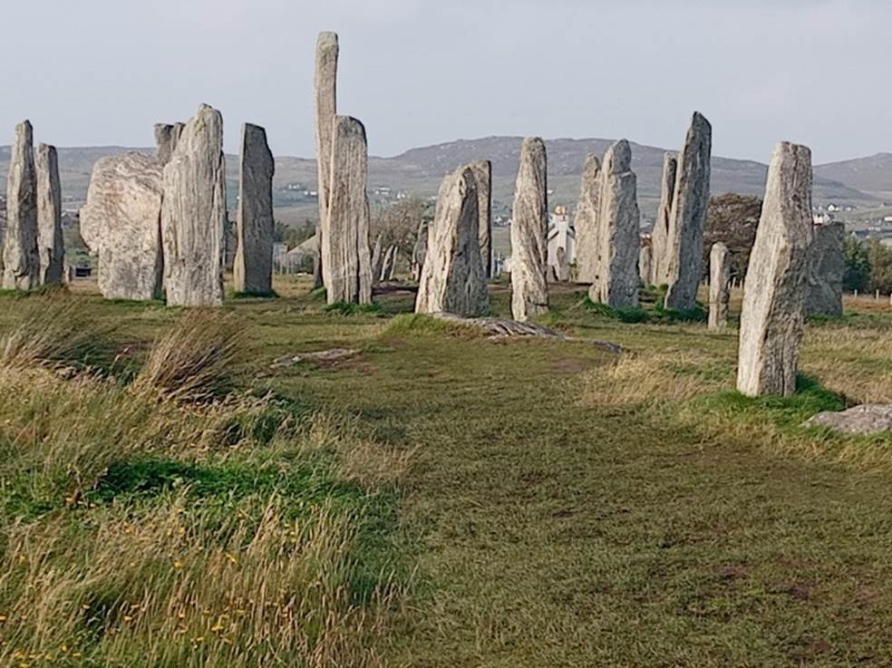
A little education and walk amongst
such an amazing wonder. What a way to finish our trip, in the sun overlooking
the Atlantic coast.
Christine Bond
Click or tap for more photos…..
Day 16 Saturday 31st Aug - The Ferry to Uig and home
It was time
to pack the cars and leave our cottage, Tigh-na-Mara, which had been our home
for a week while on Harris.
We headed
down to the port town of Tarbet. More
tweed shops and coffee overlooking the harbour).
At midday,
we boarded the ferry to Uig on the Isle of Sky. The crossing was calm and we enjoyed coast and
island watching as we drew closer to the Isle of Sky. Some were even checking out future trips.
As we
returned to the cars we said our goodbyes and reflected briefly on the paddling
we had been able to do, in spite of the weather. The drive down through Scotland was pleasant
and relatively straightforward and yes we did take advantage of the obligatory
stop at Morrisons in Fort Bill.
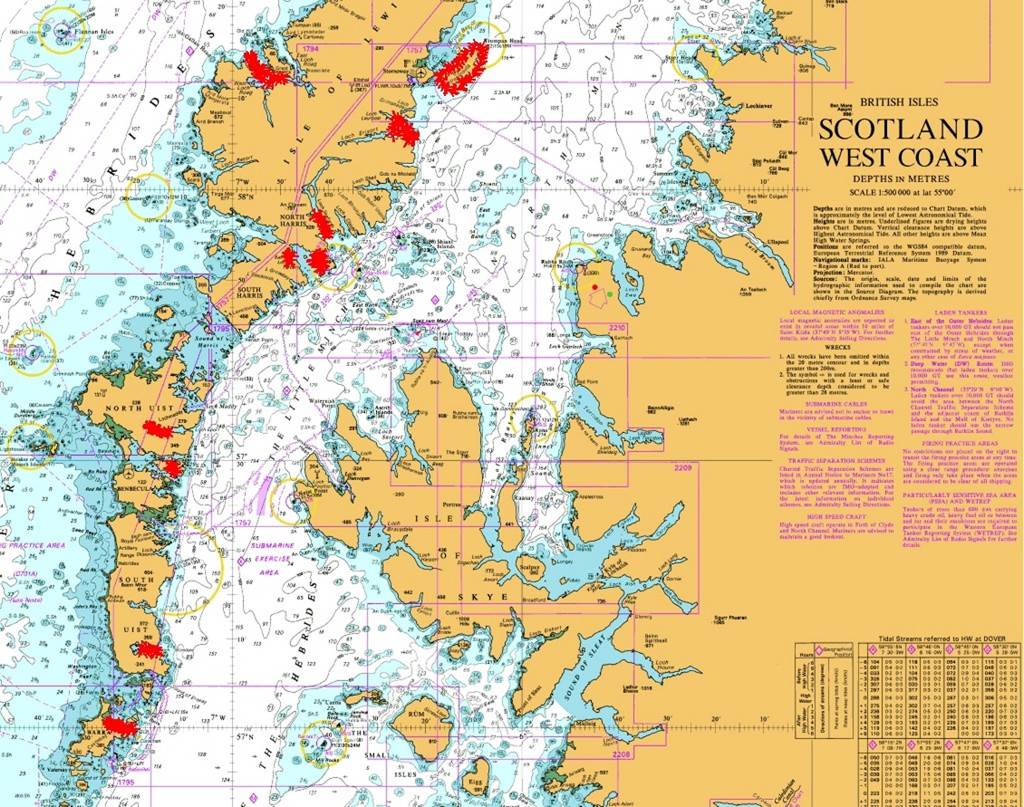
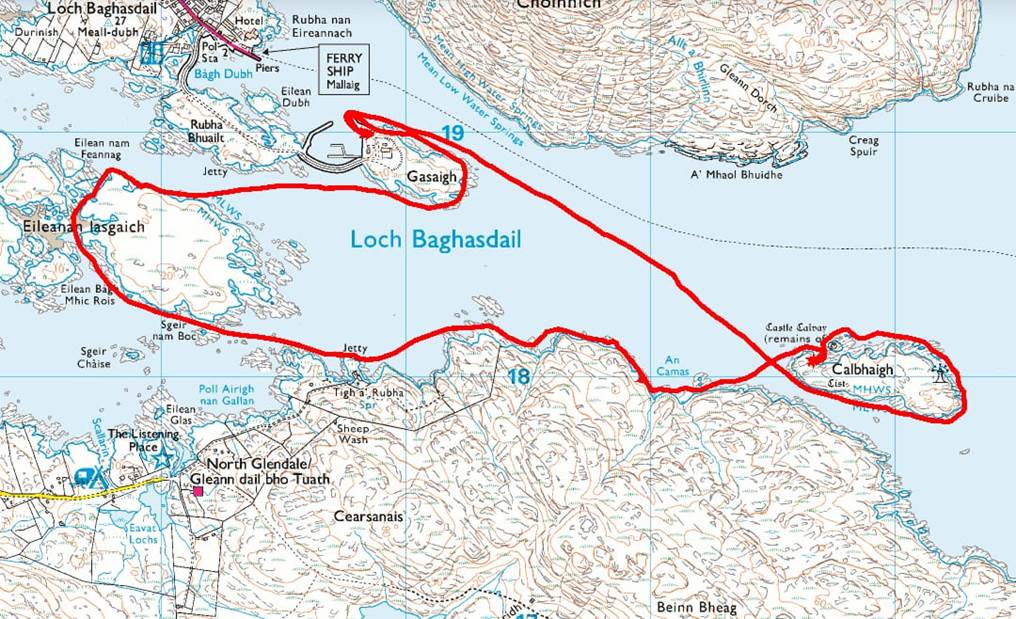
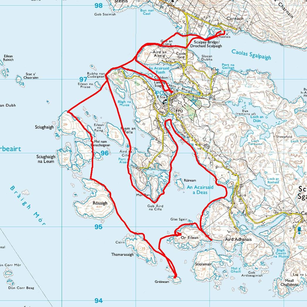
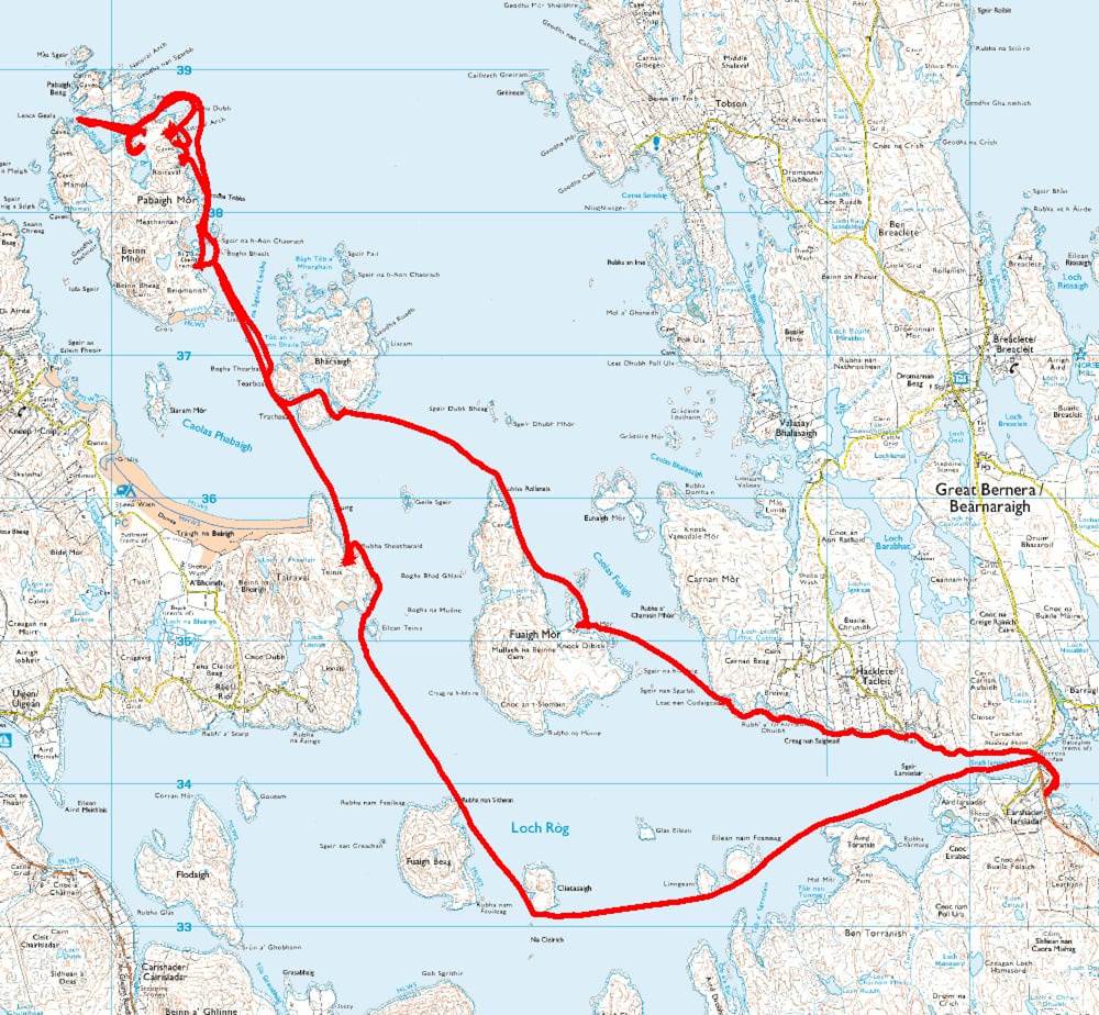
Many thanks to
Chris for the chart below which shows the location of the the paddles undertaken.
Click
or tap for all the photos from the trip…….