River Tweed, 29 April to 1 May 2023 by Chris Bolton
Paddlers Keith Steer (Co-ordinator), Ian Bell, Nikki Aldridge, Graham Rowe, Gareth L Jones, David Smith, Zoë Maynard, Chris Bolton.


I’ve been keen to get more involved in club ‘expedition’ type trips, so I signed up for the Tweed descent. The Tweed is an interesting river that I’d paddled once before, 12 years ago, but every trip is different as a result of water level and weather. The plan was to arrive in Peebles by Friday night, meeting a 9am ready to paddle at 10am on Saturday. Being retired, I was able to drive up on Friday afternoon, so when Zoë emailed that she had taken the day off and was planning to drive up in her Fiat Panda I offered her a lift. I booked camping at the Glentress Forest Lodges 2 miles downstream of Peebles, and vaguely wondered why it was so well booked up that we were only able to get a pitch in the overspill field. Our drive up was uneventful and benefited from some excellent fish and chips in Moffat. The campsite at Glentress (£10 each) sloped more than the wild camps on the river, but there were toilets.
Two days before the trip I happened across a discussion on an mtb website, where people were concerned about finding anywhere to park in Peebles during the Tweeldlove bike festival, that weekend, which explained why the campsite was busy. After some research Keith pulled the start time forward to 9am, meeting at 8am, in the hope of getting boats unloaded before the car park was jammed; we also scoped out an alternative at Cardrona a few miles downstream.
Saturday 29 April
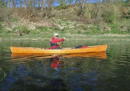
Ian, David and Nikki had driven up in Ian’s van after work, with a trailer for the boats, and van or tent camped in the car park at Peebles, Keith and Graham arrived at something like 1:30am and Gareth was in his van. At 8am the car park was not quite too full to get unloaded so boats were taken to the water and packed. Vehicles were parked in nearby streets and after waiting until 9am for the public toilets to open as per the sign on the door (they remained closed) we set off down the river at 9:10am. The level at Peebles was 0.28m, which is about as low as I’d want to paddle it, and there were a few scrapes on the shallower bits.


It was overcast and distinctly chilly (6ºC) but the wind was light and we made good progress despite the low water, averaging abut 7km/hr. There were many shingle rapids, requiring careful choice of line if you didn’t want to run out of water, but nothing hazardous.
The half dozen anglers we saw were friendly, and we followed their requests to pass behind them or on the opposite side of the river. Graham, as an angler himself, was a good source of advice if we were unsure how to avoid upsetting their sport.


The river continued in much the same way, with a few islands to decide which side to run and some interesting bridges.
Occasional light showers put in an appearance. Lunch was at 1:30, just below Thornilee. After lunch the rain came on a bit more steadily, with hoods and in some cases gloves appearing.


Fairnilee, the first significant rapid, was reached at 3:15pm and was a straightforward chute going right, then a turn left on flat water and a curving ramp back right. We spotted fire engines parked at the bridge above, and looking downstream we could see 8 or 9 fire and rescue people on the bank at the exit from the rapid, and one in the water. This seemed a rather unnecessary precaution, as none of us had any difficulty with the rapid!


We continued on, passing the Boleside river level station (0.44m)  and about an hour later passed under the road bridge into Galashiels, stopping briefly (on the water) just after the confluence with Gala Water. We had covered over 36km and some were beginning to tire, but Keith assured us that it was only another 5.5km to the good campsite they had used on the previous trip. This was true, but omitted the large weir and associated portage which we encountered on the way. Melrose Cauld (local word for weir) has the biggest drop on the river, and consists of slope of large and angular boulders.

It’s paddleable at substantially higher river levels, but was a 200m portage at today’s level. I’d done the portage on my previous trip, and having a new canoe trolley (from KCS) that I hoped would cope with awkward paths, I’d brought it to test with a loaded boat. Once I’d strapped it on properly, it was marginally quicker than unloading luggage and carrying, but maybe no less effort.
The camp was on a semi-island opposite a huge red clay cliff by the village of Newstead (out of sight of all buildings). In flood, it would become a true island. The landowner had been busy planting trees, either in an attempt to prevent it being eroded by future floods, or because grants were available for using the land for forestry, and it wasn’t useful for growing anything else. Tents were pitched and hot drinks and food prepared. It was too cold to stand about and most had had little sleep the night before, so it was an early night. Day 1, 42km.

Sunday 30 April
Day 2 started with a target ‘on the water’ of 9am, and as before we were moving downstream at 10 minutes past. The first sight was the dramatic ‘3 bridges’ just before the Leader Water confluence. 
It was disappointing that despite the tributaries adding more water, the river channel became proportionately wider, so the rapids remained shallow. As we approached St Boswells, Nikki was able to tell us, from her 1:25000 map, that we were passing a donkey sanctuary – it was, unfortunately, at the top of a 30m cliff, so we didn’t see the donkeys. The river is very scenic, and the weather was much warmer than the day before, so it was a pleasant paddle.


At 10:45 we arrived at Merton Cauld. This is a concrete weir with a single deep chute. At higher levels, the main concrete structure can be lined down or even paddled, but it was 30cm out of the water. The main chute was easier than it looked, the trick being to hit the breaking wave slowly enough to avoid shipping too much water.


Five of us shot it, with Graham making an immediate portage; his cedar strip boat boat has limited freeboard so would swamp easily, but is light and he brought less luggage than anyone else, so portaging was quick. Keith paddled down the two remaining boats to save unpacking them and portaging.

We eddied out below to empty the splashes. David landed on a small gravel island and was assured that there was no need for him to join the rest of us on the main bank – but we then decided that, while ashore, we could take elevenses, leaving him stranded and snacking alone.

7.5km later we reached Rutherford Cauld. This was a straightforward chute, shot on sight by everybody (apparently it was somewhat more difficult on the previous trip, with somebody jumping out of their canoe part way down!).
There was some debate about exactly where we should stop for lunch, but since the river was flowing, the downstream option won. Boats were neatly moored at some fishing steps, and a convenient bench was found. There were a huge number of sheep when we arrived (nobody risked counting them as we were still a bit short of sleep) but they all ran off.


Next were the infamous Makerstoun rapids.
The final section is Gr 3 and the narrows at the bottom has seen a number of incidents. The Upper rapid is not serious and we all shot it. There’s a very straight line on the left, but at that level it requires accurate paddling, and the wider but shallowed right hand side is a safer bet for a group.
It’s a further kilometre of flat water to the upper part of the main rapid. This is steeper and rockier, and was run on the left of the chute with a recommendation to “just follow the water”. The grade 3 section follows shortly after.

Graham portaged down the rocks at the left bank, and found it awkward. The rapid is narrow and twisty at this level (think Serpent’s Tail with bends) and requires quick reactions.
Four of us shot it without problems, and one shot it with a couple of sideways moments and finished going backwards, but upright.


Our two most experienced paddlers then paddled down the boats of the last two. It turns out that heavy polythene boats don’t turn as well as lighter Royalex ones, and each in turn found themselves pinned diagonally across the gap (yellow line). Fortunately, they managed to stay upright and we had a rescuer in the right place to drag them backward enough to get their bows into the gap, and all was well.
Between the various rapids and caulds, the river continues on its spectacular path, but there’s not much new to say about it, so the next excitement was Kelso Cauld.

This didn’t look promising. It’s a concrete wall with several small chutes, all of which had a vertical drop on entry of exit. Keith, however, spotted a tiny channel between two walls, not much wider than a boat, with just enough water to lubricate the bottom of the boat, and we all followed safely down (except Graham, who wisely portaged. His boat will need a new coat of varnish even without that).


All the weirs are different, and there were several that wouldn’t even be noticed at higher levels, such as one near Sprouston. River level at Sprouston was 0.5m.

The next was Banff Mill, with a sloping face across the rightmost 80%, and a channel down the left side with three steps. Keith ran a line diagonally from the left end of the main weir, while the rest of us ran the steps. Zoë was pleased to lead the way down at least two of these.
By Carham, we’d covered 38km for the day and there were mutterings of tiredness. We stopped on a gravel bank for ‘elevenses’ (some people can’t count to seventeen) and decided that we’d camp at the next feasible spot, although that would mean an early start on the final day. A gravel island at the mouth of the Lithtillum Burn filled the bill; a bit rocky, but flat.


Unfortunately, after we’d been on the island an hour, we found a scrape nest with 3 eggs. It was too late to avoid disturbing the parents, although it may have been abandoned before we arrived. We think they were oystercatchers, but while there were some around they had not reacted when we landed; normally, they will object very noisily if anyone approaches a nest.

Keith informed us that we’d need to be on the water for 7am next morning if we wanted to have any hope of finishing the trip (and as it turned out he was not wrong!) and there was a chilly breeze, so we went to bed quite early. Day 2, 41.5km.
Monday 1 May

 Day 3 dawned clear, calm and sunny. Some cloud, possibly rain, and wind was forecast for later in the day, but the forecast wind was behind us. Most but not all were on the water at 7am and we finally moved off at 7:28, paddling gently downriver in the sunshine.

Although the river level felt low and the gradient was slowing, we were still averaging 7km/hr.
Gareth had booked a taxi back to Peebles for the vehicles for sometime in the afternoon, exact time to to be confirmed depending on progress. Another small weir marked the start of a huge loop in the river as we approached Coldstream.

The last of the main weirs was just after the bridge in Coldstream and we were unsure about it. The main crest, when we reached it, was totally dry and the whole river cut right behind the rightmost bridge pier and curved left into a boily runout. It was straightforward to shoot and there were no dramas.

The confluence of the Till was marked by gravel islands. Clearly the Till floods more often to bring gravel into the Tweed than the Tweed floods to wash it downstream. On the opposite bank is a steep sandstone cliff, with an obvious nest site. Graham was fortunate to spot the peregrine the nest belongs to, as well as an osprey on the next reach. The early start meant elevenses were at 9:45, on a gravel bank just before Norham.


River level at Norham was 1.26m. This was where the weather started to deteriorate, with cirrus cloud and developing Northerly or North-easterly wind. This was not the wind we had hoped for, and the shape of the valley meant it was blowing from directly ahead at F5 gusting F6.
As we passed Horncliffe, it was a struggle to make progress, and we stopped to rearrange paddlers and gear into 4 tandems each towing a boat full of gear.
The river was now wide and deep, we were in the tidal section and it was approaching high tide, so we had less current to assist us against the strong wind. On the long straight before the A1 bridge there are small huts at regular intervals, with what appears to be a bunker next to each. I’d been told on a previous trip that there were WW2 defences, and repeated this as fact, but it didn’t seem to quite fit, we couldn’t see what armament would have been used. I’ve now found out they are fishing shiels (see http://www.mouthofthetweed.co.uk/shielnetcoble.html) from the days of commercial salmon netting. The fishermen lived in the huts waiting for the run to start, then launched their coble and shot the net. The bunker was to store the catch, underground to keep them cool and with a secure door necessitated by the value of the catch.

Just before the A1 bridge we met some local sea kayakers going upstream, who confirmed that, further downstream, the tide had turned. We regrouped and discussed where to land in Berwick and where and when to ask for the taxi pickup. There was only 2.5km to go, so we allowed an hour. We reached sheltered water under the railway bridge and paddled gently to finish between the two road bridges at 2pm. Day 3, 33km.
There’s now a locked flood defence gate at the top of the slipway so all the boats and gear have to be lifted onto the sea wall. The taxi arrived after only 5 minutes and the drivers hastily embarked for Peebles, since it’s over 1.5hrs each way. We were on our way home by 6pm. It had been a hard paddle and I anticipated a few coffee stops on the way home, as well as realising that a piece of Zoë’s excellent shortbread was all I’d eaten since 10am. My satnav sent me on a diversion down a single track road somewhere near Jedburgh, and I cursed it, but Ian later said they had been redirected by police so there must have been a road closure. After dropping Zoë in Southport I reached home just before midnight.
This was a great trip on a great river, even though more water would have been appreciated. We were all there for the paddling, and some had other objectives too. Keith was on holiday (well deserved, given his job), Graham was on a journey, David was keen to learn as much possible. Zoë wanted to see what she could achieve on her first solo canoe camping trip, I was keen to paddle with old and new friends and revisit the river. We all did well and finished the trip with no injuries or swims. Thanks to all for your company and to Keith for his well balanced leadership.
by Chris Bolton
Photos are by me, Nikki and Keith