Search
2026 Menorca – Day 5 Cala des Talaier to Cala de Biniparratx 09 04 2026
LCC Menorca 2026 – Day 5 – 9 April 2026
Cala des Talaier to Cala de Biniparratx by Chris B
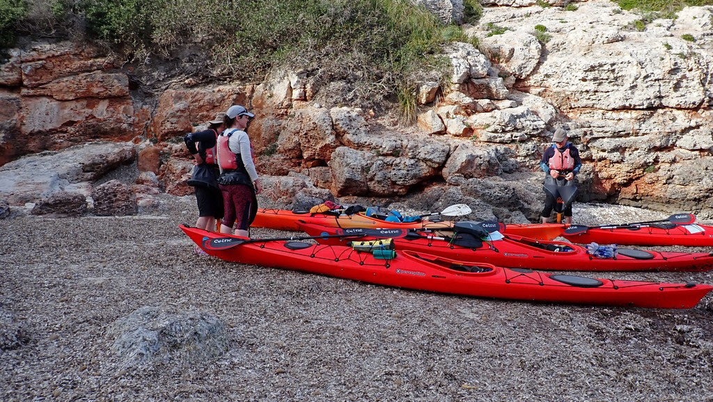
We woke to a heavy dew overnight, with several tents suffering from condensation inside. Ali’s watch reverted to displaying UK time overnight, so his 7 am alarm went off at 8 am local time. Despite having less time to prepare, he managed to be on the water for the scheduled 9 am start.
The previous day, we’d knocked 41km off the remaining distance but still had about 70km to paddle to complete the circumnavigation, and two consecutive 40km days might be too much. Today and tomorrow should be good paddling days, but the weather for the day after was as yet unclear. The further we went today, however, the lower the risk that we’d run out of time and have to ask for a pick up from Menorca en Kayak. That in turn might restrict our choice of overnight stop tomorrow, as a pick up would have to be from a beach with road access. There was also uncertainty about whether the wind would drop for Tuesday, so that if we stayed with the boats on a sheltered beach somewhere, we could paddle then. The alternative would be to return the boats on Saturday and find somewhere to stay. So the plan for today was to avoid too many stops and too many caves, but have a good break for lunch on a sunny beach where wet overnight gear could be dried.
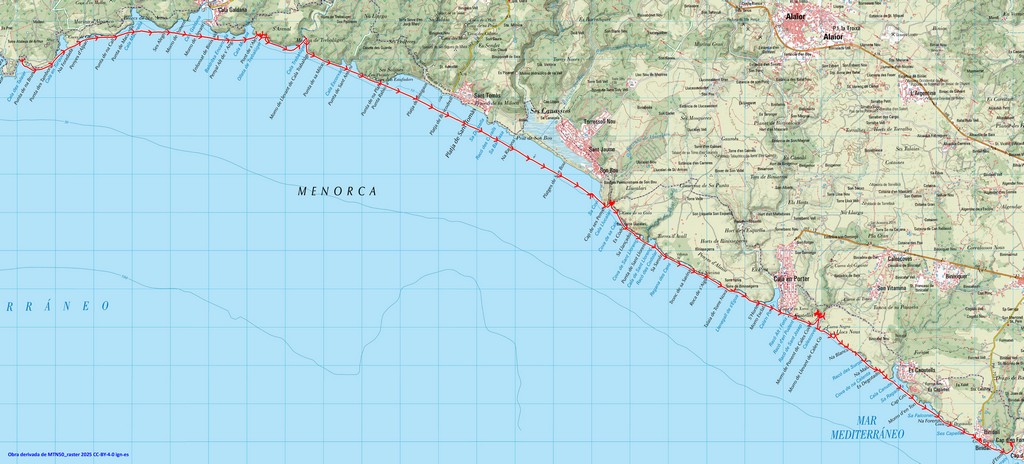
The day was hazy with just a light wind, and we cruised along the coast, following the cliffs but cutting across Cala Turqueta, Cala Macarella and Cala Galdena, the last with a village.
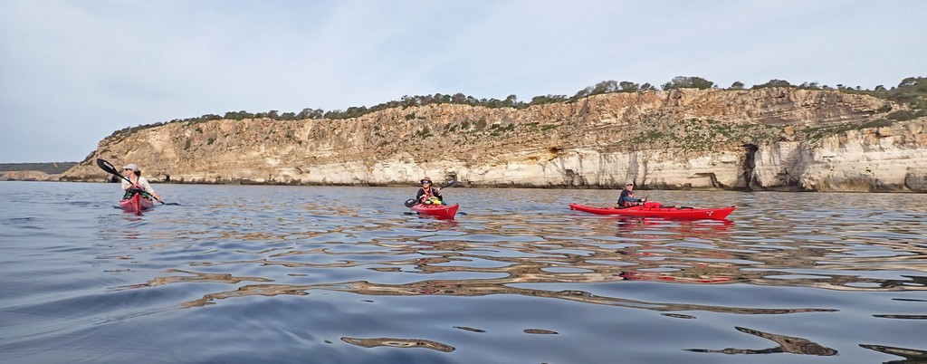
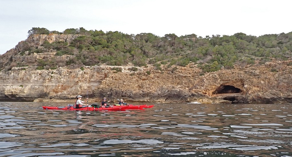
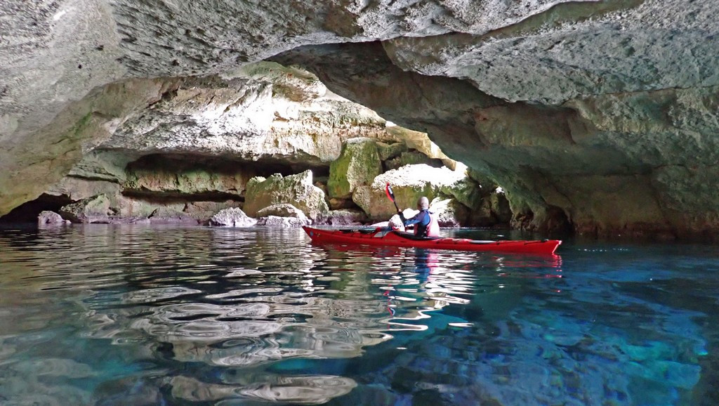
This brought us to Pont de s’Aleix – shown on the map from Menorca en Kayak as having a cave and an arch (the clue to the arch is in the name), so it was worth taking some time out for it. The cave went in quite a long way, with a substantial chamber, but the most impressive feature was a blue glow from underwater on one side. The opening that let in this glow turned out to extend above water level, which was just big enough to paddle through, emerging from a point where it wasn’t obvious that there was a cave.
Shortly afterwards, we found the huge arch, actually more of a large tunnel (about Wallasey tunnel-sized), rectangular in shape and reminiscent of the Lancaster Canal culvert under the M6.
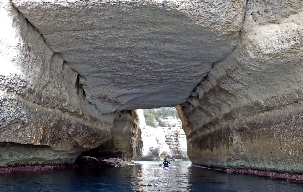
Another cave followed on the far side of the arch.
Caves on the South coast are mostly in sandstone and don’t have stalactites and stalagmites, unlike those on the North coast, which are in limestone. Menorca has very complex geology – see https://geologiamenorca.org/Contingut.aspx?IdPub=8348
It was here we saw other paddlers for the first time, as a SOT came through with a family of three, all paddling.
We stopped after 9km for elevenses at Cala Trebalúger. A large group of walkers were crossing the beach and then climbed up onto the rocks on the right. A river flows out at the side of the beach, creating ‘sinking sand’ for those who landed here. Ali was looking for a bin, but there wasn’t one.
There were several buoys off the beach, marked “Keep 50m away”, but they looked like moorings, so maybe that was just a warning to yachts not to anchor too close. A tourist boat, towing a dinghy, came into the bay shortly before we left, but didn’t pick up a mooring and left after 5 min. The beach is remote by Menorcan standards, with a 1.5-hour walk from the nearest car park, so people possibly get there by sea.
2km after Cala Trebalúger, we reached a long straight section of coast past Sant Tomàs to Son Bou. This was 6.5km without much interest except a small offlying island/rock, so we stayed offshore. At Son Bou, there were two big blocks of holiday apartments with rooms angled to the sea view. These must have housed as many visitors as the previous population of the town, making a huge change to the local economy. Keith noted many developments since the previous LCC trip in 2024, as the island is becoming more tourist-focused. Noting that the planned lunch stop in Cala Llucalari was surrounded by hills, Keith stopped before we lost line of sight to the phone mast to get a weather forecast. The windy weather was continuing to slip back. Originally forecast for Friday to Sunday, it was now Saturday to Monday or perhaps later.
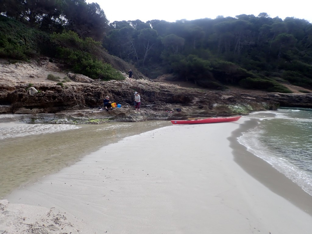
Cala Llucalari was a stony beach with some seaweed on it, but space was found to lay out sleeping bags, etc. The cliff faces revealed caves modified for habitation. As with most beaches there was a naked man. To Ali’s disappointment, there were no bins.
Having paddled two 9km sections in the morning, the plan was now for two 7km sections, finishing at the first of two possible camping beaches. If that wasn’t suitable, there was another 4km later.
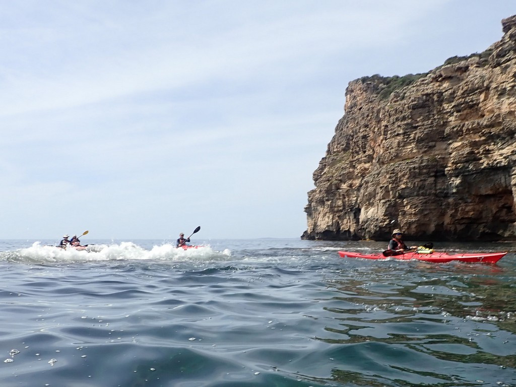
By now, the haze had dispersed, and it was warm and sunny. Breaking waves on some small reefs gave Keith an opportunity to explain that it was best to pass these on the down-wave side. While there might be a greater chance of being hit by a breaker, it would wash you into safe water. While passing the other side, the breaker could push you onto the rock.
We passed across Cala en Porter as it looked built up and busy.
On the cliff on the far side was a series of ramps cut into the rock, with white painted walls, joining up caves in the rock. This was Cova d’en Xoroi, see https://www.covadenxoroi.com/en
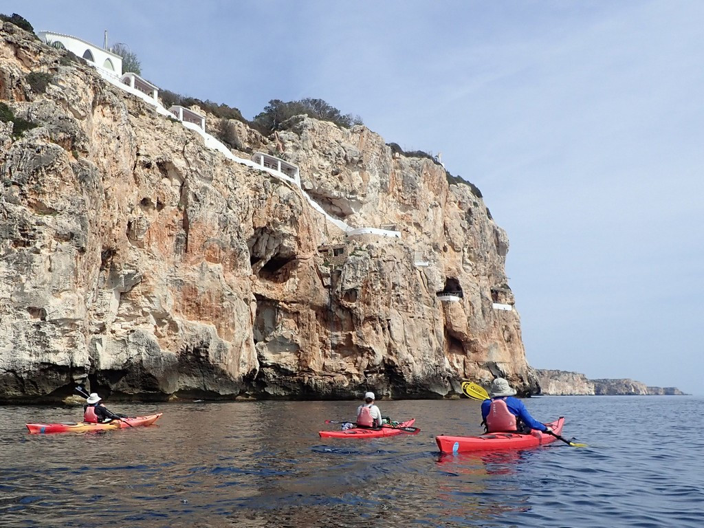
A local legend describes how a pirate was washed ashore and lived in one of the caves, followed some years later by the disappearance of a young woman, later found to be living in the cave with the pirate and their three children. The caves are now a bar with a cocktail lounge and live music, making a feature of the spectacular sunsets. Kayakers bivying on the beach can, of course, see the sunset free of charge.
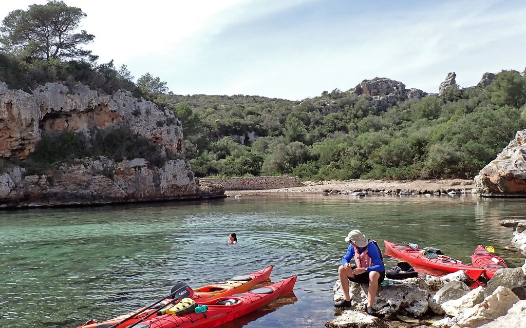
Shortly after that, we reached Calescoves, described online and in the LCC 2014 report as beautiful. Access to the sand was blocked by a deep layer of rotting weed, so we landed on rocks and moored the boats, leaving them afloat. Keith was unimpressed and landed on different rocks. A Dutch yacht was anchored, and a swimmer from it passed up and down the cove, inspiring Rachel to swim too.
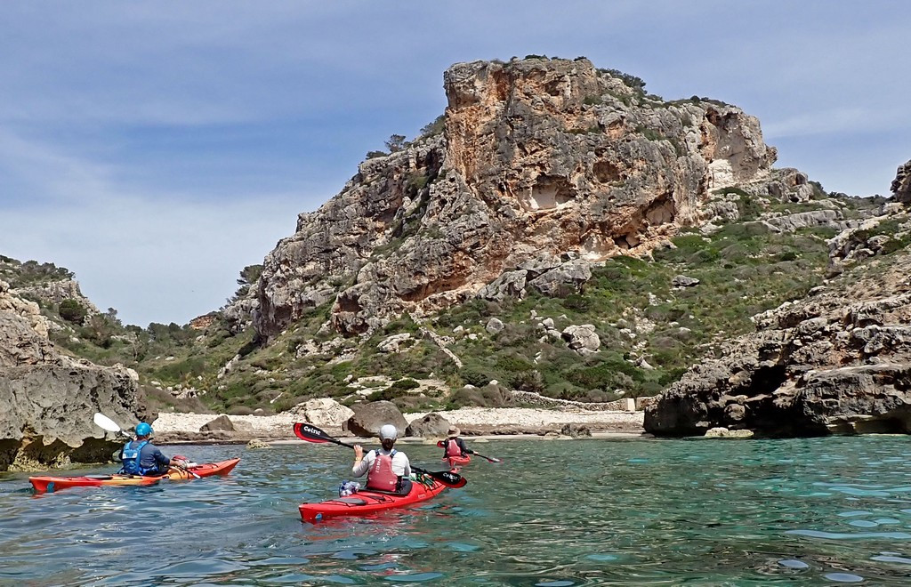
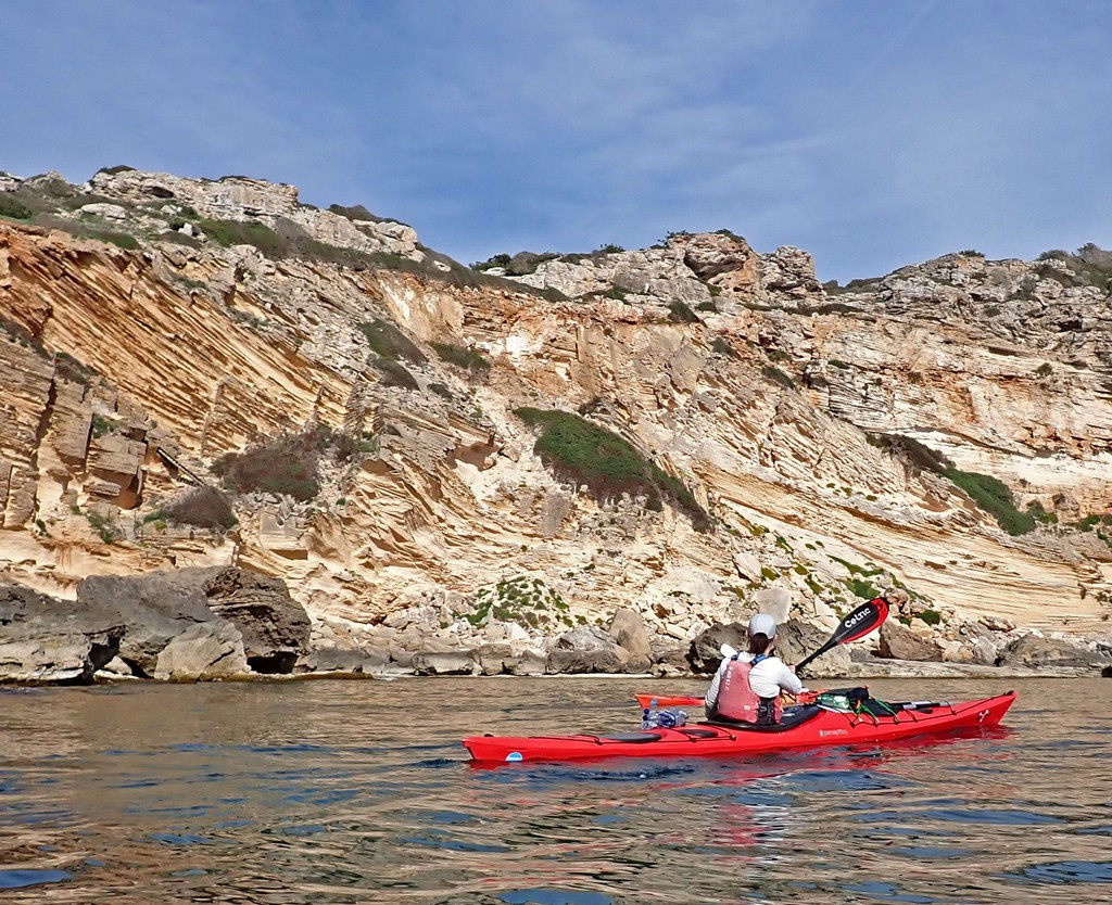
Moving on, we passed impressive rock strata at Racó de Suros (Racó translates from Catalan as a “corner” which in this coastal context seems to be a bay, but with cliffs rather than Cala which implies a beach) Not visible in the photo but there’s even a set of steps all the way down the cliff – maybe for emergency escape for fishermen caught by weather (like those in Abraham’s Bosom near Holyhead).
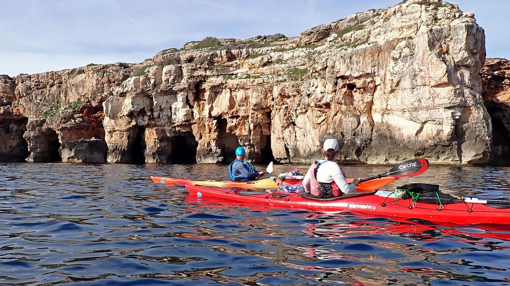
We had now reached the section of coast famous for its caves, but had to restrain ourselves. We had been warned by Menorca en Kayak that the first cave after Calescoves was sometimes closed to avoid disturbing bats, but the notice requiring this wasn’t currently in place, so we could enter if we were quiet. We were unsure which was the first cave, as most face SE due to the direction of rock weakness, so they are easy to miss when travelling East. The first cave we went in had a dark area at the back, and there was a quiet twittering noise. Keith assured us there could be no bats as there was no smell of guano. There had been shags flying around the cave entrance, and the noise may have been chicks on a nest.
We entered some quite deep caves, but had to move on in case Friday turned out to be the last day we could paddle. As they face SE, we were usually past them before they were obvious. This was perhaps fortunate. We saw one very tall cave with a stalactite in the roof like the sword of Damocles. Although the rock in this part of the coast looked like the sandstone further west, the sand grains are calcareous, like limestone, so they can form stalactites.
We reached Cala Biniparratx at 6:14 pm, hoping that we could camp, as we’d had a long day, even though it wasn’t 40km. The beach was initially uninviting due to weeds, but once landed, it was reasonable, although in total shade, as it was in a deep gorge. We decided it was good, and hoped it would get the morning sun, although Keith did say we couldn’t possibly stay there as it was too noisy, being almost directly under the runway approach for Mao airport. An odd effect was that the noise of aircraft powering up for take off was reflected from the cliff on the South side of the gorge, and it sounded as if the aircraft was over the sea.
There was a big yellow container at the top of the beach, which Ali hoped, and convinced himself, was a bin (but it wasn’t). There was nobody on the beach, although a young couple walked down after 20 min and went a short way out on the rocks. As with all the locals we met, they were interested in our trip and didn’t seem bothered that we were sleeping on the beach. There was no phone signal, unless you walked 5 minutes up to the main island level. Keith was messaging Menorca en Kayak to get their opinion on the weather and the availability of accommodation once we finished paddling. It was looking likely that the windy period would slip further, allowing at least some paddling on Saturday, but lasting until Tuesday. We went to sleep thinking that tomorrow, Friday, would probably be our last full day of paddling.
The rest of this post has been hidden and is only visible to logged in members. Click here or tap the login tab on the main menu or enquire about membership.